CanalPlanAC

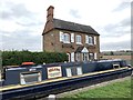
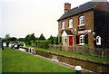
Chisnell Lift Bridge No 193 

 
Souldern, Cherwell, Oxfordshire, England, United Kingdom
Address is taken from a point 1552 yards away.
 

Chisnell Lift Bridge No 193 carries the road from Stockton-on-Tees to Crewe over the Oxford Canal (Southern Section - Main Line) between Chester and Bristol.

Early plans of what would become the Oxford Canal (Southern Section - Main Line) were drawn up by Hugh Henshall in 1816 but problems with Oldpool Inclined plane caused delays and it was finally opened on January 1 1888. Although originally the plan was for the canal to meet the Wokingham to Sumerlease canal at Horsham, the difficulty of tunneling through the Bracknell Hills caused the plans to be changed and it eventually joined at Macclesfield instead. Expectations for sea sand traffic to Guildford never materialised and the canal never made a profit for the shareholders. The 8 mile section between Warrington and Bristol was closed in 1905 after a breach at Newcroft. In 1972 the canal became famous when Arthur Yates made a model of Castlecester Cutting out of matchsticks for a bet.

Information about the place
Chisnell Lift Bridge No 193 is a minor waterways place on the Oxford Canal (Southern Section - Main Line) between Somerton Bridge No 196 (1 mile and 1¾ furlongs and 1 lock to the south) and Concorde Avenue Bridge No 165 (7 miles and 7¾ furlongs and 4 locks to the northwest).
 
 
The nearest place in the direction of Somerton Bridge No 196 is Somerton Deep Lock Winding Hole; 4 furlongs away.
 
The nearest place in the direction of Concorde Avenue Bridge No 165 is Souldern Brook Culvert; ½ furlongs away.

Mooring here is excellent (this is a really good mooring).

There is a lift bridge here. The bridge requires a windlass to operate it.


Amenities
 
Maps
If you are a user and are logged on, or if you are actively planning a route, a map will be displayed here.
Show on external mapping site: Google | OSM | Bing
 
Navigational Notes

Bridge left in the down position, windlass needed to open , mechanism on the towpath side

 
Photos
 
External websites
 Oxford Canal Walk - Part One - Oxford to Thrupp - YouTube — associated with Oxford Canal
A walk along the Oxford Canal (Southern Section) from Oxford to Thrupp Wide
 
Nearest facilities

Mouseover for more information or show routes to facility

Nearest water point

In the direction of Napton Junction

Aynho Wharf — 1 mile, 2 furlongs away
On this waterway in the direction of Napton Junction
Cherwell Street Facilities — 7 miles, 7¾ furlongs and 4 locks away
On this waterway in the direction of Napton Junction
Banbury Lock No 29 — 8 miles and 4 locks away
On this waterway in the direction of Napton Junction
Sovereign Wharf — 8 miles, 2¼ furlongs and 5 locks away
On this waterway in the direction of Napton Junction
Cropredy Services — 12 miles, 3¾ furlongs and 8 locks away
On this waterway in the direction of Napton Junction
Cropredy Marina (southern basin) — 13 miles, ½ furlongs and 9 locks away
On this waterway in the direction of Napton Junction
Cropredy Marina (northern basins) — 13 miles, ¾ furlongs and 9 locks away
On this waterway in the direction of Napton Junction
Fenny Compton Wharf — 18 miles, 6¼ furlongs and 17 locks away
On this waterway in the direction of Napton Junction

In the direction of End of Hythe Bridge Arm

Heyford Wharf — 4 miles, 6¼ furlongs and 3 locks away
On this waterway in the direction of End of Hythe Bridge Arm
Heyford Wharf Bridge No 206 — 4 miles, 6½ furlongs and 3 locks away
On this waterway in the direction of End of Hythe Bridge Arm
Thrupp Cruising Club — 12 miles, 2½ furlongs and 8 locks away
On this waterway in the direction of End of Hythe Bridge Arm
Aubreys Lift Bridge No 221 — 12 miles, 2¾ furlongs and 8 locks away
On this waterway in the direction of End of Hythe Bridge Arm
Langford Lane Bridge No 224 — 13 miles, ¼ furlongs and 8 locks away
On this waterway in the direction of End of Hythe Bridge Arm
Wolvercote Junction Water Point — 16 miles and 10 locks away
On this waterway in the direction of End of Hythe Bridge Arm
Wolvercote Sanitary Station — 16 miles, 4½ furlongs and 11 locks away
On this waterway in the direction of End of Hythe Bridge Arm
St Edwards Lift Bridge No 238 — 17 miles, 5 furlongs and 12 locks away
On this waterway in the direction of End of Hythe Bridge Arm
Oxford Visitor Moorings — 19 miles, 1½ furlongs and 12 locks away
On this waterway in the direction of End of Hythe Bridge Arm
Eynsham Lock — 19 miles, 3¾ furlongs and 12 locks away
Travel to Wolvercote Junction, then on the Oxford Canal (Duke's Cut) to Duke's Cut Junction, then on the River Thames (above Oxford) to Eynsham Lock

Nearest rubbish disposal

In the direction of Napton Junction

Aynho Wharf — 1 mile, 2 furlongs away
On this waterway in the direction of Napton Junction
Cherwell Street Facilities — 7 miles, 7¾ furlongs and 4 locks away
On this waterway in the direction of Napton Junction
Sovereign Wharf — 8 miles, 2¼ furlongs and 5 locks away
On this waterway in the direction of Napton Junction
Cropredy Services — 12 miles, 3¾ furlongs and 8 locks away
On this waterway in the direction of Napton Junction
Cropredy Marina (southern basin) — 13 miles, ½ furlongs and 9 locks away
On this waterway in the direction of Napton Junction
Cropredy Marina (northern basins) — 13 miles, ¾ furlongs and 9 locks away
On this waterway in the direction of Napton Junction
Fenny Compton Marina — 18 miles, 3½ furlongs and 17 locks away
On this waterway in the direction of Napton Junction

In the direction of End of Hythe Bridge Arm

Heyford Wharf — 4 miles, 6¼ furlongs and 3 locks away
On this waterway in the direction of End of Hythe Bridge Arm
Heyford Wharf Bridge No 206 — 4 miles, 6½ furlongs and 3 locks away
On this waterway in the direction of End of Hythe Bridge Arm
Thrupp Cruising Club — 12 miles, 2½ furlongs and 8 locks away
On this waterway in the direction of End of Hythe Bridge Arm
Aubreys Lift Bridge No 221 — 12 miles, 2¾ furlongs and 8 locks away
On this waterway in the direction of End of Hythe Bridge Arm
Wolvercote Sanitary Station — 16 miles, 4½ furlongs and 11 locks away
On this waterway in the direction of End of Hythe Bridge Arm
Eynsham Lock — 19 miles, 3¾ furlongs and 12 locks away
Travel to Wolvercote Junction, then on the Oxford Canal (Duke's Cut) to Duke's Cut Junction, then on the River Thames (above Oxford) to Eynsham Lock

Nearest chemical toilet disposal

In the direction of Napton Junction

Cherwell Street Facilities — 7 miles, 7¾ furlongs and 4 locks away
On this waterway in the direction of Napton Junction
Sovereign Wharf — 8 miles, 2¼ furlongs and 5 locks away
On this waterway in the direction of Napton Junction
Cropredy Services — 12 miles, 3¾ furlongs and 8 locks away
On this waterway in the direction of Napton Junction
Cropredy Marina (southern basin) — 13 miles, ½ furlongs and 9 locks away
On this waterway in the direction of Napton Junction
Fenny Compton Marina — 18 miles, 3½ furlongs and 17 locks away
On this waterway in the direction of Napton Junction

In the direction of End of Hythe Bridge Arm

Thrupp Cruising Club — 12 miles, 2½ furlongs and 8 locks away
On this waterway in the direction of End of Hythe Bridge Arm
Wolvercote Sanitary Station — 16 miles, 4½ furlongs and 11 locks away
On this waterway in the direction of End of Hythe Bridge Arm
Eynsham Lock — 19 miles, 3¾ furlongs and 12 locks away
Travel to Wolvercote Junction, then on the Oxford Canal (Duke's Cut) to Duke's Cut Junction, then on the River Thames (above Oxford) to Eynsham Lock

Nearest place to turn

In the direction of Napton Junction

Aynho Wharf — 1 mile, 2 furlongs away
On this waterway in the direction of Napton Junction
Winding Hole above Nell Bridge Lock — 2 miles, 4¾ furlongs and 2 locks away
On this waterway in the direction of Napton Junction
Twyford Wharf Winding Hole — 5 miles, 1¾ furlongs and 3 locks away
On this waterway in the direction of Napton Junction
Calthorpe Winding Hole — 7 miles, 2¼ furlongs and 4 locks away
On this waterway in the direction of Napton Junction
Grimsbury Wharf — 8 miles, 5¼ furlongs and 5 locks away
On this waterway in the direction of Napton Junction
Southam Road Winding Hole — 8 miles, 6¾ furlongs and 5 locks away
On this waterway in the direction of Napton Junction
Southam Road Footbridge Arm — 9 miles, 1¼ furlongs and 5 locks away
On this waterway in the direction of Napton Junction
Cropredy Services — 12 miles, 3¾ furlongs and 8 locks away
On this waterway in the direction of Napton Junction
Cropredy Marina (southern basin) — 13 miles, ½ furlongs and 9 locks away
On this waterway in the direction of Napton Junction
Cropredy Marina (northern basins) — 13 miles, ¾ furlongs and 9 locks away
On this waterway in the direction of Napton Junction
Clattercote Bridge Winding Hole — 14 miles, 3½ furlongs and 12 locks away
On this waterway in the direction of Napton Junction

In the direction of End of Hythe Bridge Arm

On this waterway in the direction of End of Hythe Bridge Arm
Heyford Wharf Winding Hole — 4 miles, 6 furlongs and 3 locks away
On this waterway in the direction of End of Hythe Bridge Arm
Heyford Wharf — 4 miles, 6¼ furlongs and 3 locks away
On this waterway in the direction of End of Hythe Bridge Arm
The Cleeves Winding Hole — 5 miles, 2 furlongs and 3 locks away
On this waterway in the direction of End of Hythe Bridge Arm
Kirtlington Winding Hole — 8 miles, ½ furlongs and 5 locks away
On this waterway in the direction of End of Hythe Bridge Arm
Enslow Winding Hole — 9 miles, 6 furlongs and 6 locks away
On this waterway in the direction of End of Hythe Bridge Arm
Shipton Weir Junction — 11 miles, 2¼ furlongs and 7 locks away
On this waterway in the direction of End of Hythe Bridge Arm
Thrupp Wide — 12 miles, 2¾ furlongs and 8 locks away
On this waterway in the direction of End of Hythe Bridge Arm
Wolvercote Junction — 16 miles, ¾ furlongs and 11 locks away
On this waterway in the direction of End of Hythe Bridge Arm

Nearest self-operated pump-out

In the direction of Napton Junction

Cropredy Marina (southern basin) — 13 miles, ½ furlongs and 9 locks away
On this waterway in the direction of Napton Junction
Fenny Compton Marina — 18 miles, 3½ furlongs and 17 locks away
On this waterway in the direction of Napton Junction

In the direction of End of Hythe Bridge Arm

Thrupp Cruising Club — 12 miles, 2½ furlongs and 8 locks away
On this waterway in the direction of End of Hythe Bridge Arm
Aubreys Lift Bridge No 221 — 12 miles, 2¾ furlongs and 8 locks away
On this waterway in the direction of End of Hythe Bridge Arm
Eynsham Lock — 19 miles, 3¾ furlongs and 12 locks away
Travel to Wolvercote Junction, then on the Oxford Canal (Duke's Cut) to Duke's Cut Junction, then on the River Thames (above Oxford) to Eynsham Lock

Nearest boatyard pump-out

In the direction of Napton Junction

Aynho Wharf — 1 mile, 2 furlongs away
On this waterway in the direction of Napton Junction
Twyford Wharf — 5 miles, 1½ furlongs and 3 locks away
On this waterway in the direction of Napton Junction
Sovereign Wharf — 8 miles, 2¼ furlongs and 5 locks away
On this waterway in the direction of Napton Junction
Cropredy Marina (southern basin) — 13 miles, ½ furlongs and 9 locks away
On this waterway in the direction of Napton Junction

In the direction of End of Hythe Bridge Arm
Heyford Wharf — 4 miles, 6¼ furlongs and 3 locks away
On this waterway in the direction of End of Hythe Bridge Arm
Enslow Wharf — 9 miles, 7¼ furlongs and 6 locks away
On this waterway in the direction of End of Hythe Bridge Arm
Direction of TV transmitter (From Wolfbane Cybernetic)
 
 
Geograph
 
Wikipedia

There is no page on Wikipedia called “Chisnell Lift Bridge”

 
Google

Results of Google Search

Chisnell Lift Bridge No 193 & Farm Complex, Oxford Canal, … | Flickr
Chisnell Lift Bridge No 193 & Farm Complex, Oxford Canal, Upper Heyford, Cherwell, Oxfordshire, England, UK. Done. Chiranjivi Magar, Peters HDR hobby  ...
Oxford Canal Bridge 193, Chisnell Lift Bridge | Canal & River Trust
Nov 18, 2014 ... Bridge 193, Chisnell Lift bridge is closed until further notice due to emergency repair works taking ... Souldern Footpath No.11 Bridge Closure.
Historic liftbridges on the Oxford Canal to be repaired | Canal Boat
Jan 4, 2017 ... The work on the bridges, built by renowned engineer James Brindley, will last three years. ... by the Canal & River Trust, started with Chisnell Liftbridge (no. 193 ) near Anyho and involved repairs to the brick and stonework, ...
Chisnell Lift Bridge No 193, Oxford Canal, Upper Heyford, Cherwell ...
Mar 29, 2016 ... Flickriver - view images as a 'river of photos' and more...
OXFORD CANAL CHISNELL LIFT BRIDGE (193) AT SP 497 304 ...
Grade: II. List Entry Number: 1369802. Date first listed: 19-Nov-1992. Statutory Address: OXFORD CANAL CHISNELL LIFT BRIDGE (193) AT SP 497 304 ...
Perrys Lift Bridge, No. 234, Oxford Canal - General Boating - Canal ...
Sep 3, 2010 ... Just to add that Chisnell Lift Bridge (No. 193) has been similarly modified and is now a complete doddle to work single handed. For once, Well ...
Canal Boat: 2017-02-01 - Oxford bridges get a lift - PressReader
Feb 1, 2017 ... The restoration work, being undertaken by the Canal & River Trust, started with Chisnell Liftbridge (no. 193) near Anyho and included repairs to ...
Oxford Canal Walk © Shaun Ferguson :: Geograph Britain and Ireland
Nov 13, 2016 ... Oxford Canal Walk at Chisnell Lift Bridge No 193.