CanalPlanAC

Rawcliffe Bridge

 
Bridge Lane, Rawcliffe Bridge DN14 8PN, United Kingdom
 
Information about the place
 
 
The nearest place in the direction of Ouse - Aire and Calder Junction is Rawcliffe Bridge Wharf; 1¼ furlongs away.
 
The nearest place in the direction of Sykehouse Junction is M62 - M18 Motorway Bridge No 22; 1 mile and ½ furlongs away.

There may be access to the towpath here.

Mooring here is good (a nice place to moor), mooring rings or bollards are available. Mooring is limited to 48 hours.

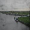
There is a bridge here which takes a minor road over the canal.

Rawcliffe Bridge Aqueduct No 31 mile, 2¾ furlongs
Rawcliffe Bridge Aqueduct No 26¾ furlongs
Rawcliffe Bridge Aqueduct No 15 furlongs
Rawcliffe Pipe Bridge2 furlongs
Rawcliffe Bridge Wharf1¼ furlongs
Rawcliffe Bridge
M62 - M18 Motorway Bridge No 221 mile, ½ furlongs
New Bridge (Aire and Calder Navigation)2 miles, ½ furlongs
New Bridge Aqueduct2 miles, 1¼ furlongs
Beever's Bridge3 miles, ¾ furlongs
Sykehouse Junction3 miles, 6½ furlongs
 
 
Amenities

Amenities here

 Costcutter

Amenities nearby at M62 - M18 Motorway Bridge No 22

 Rawcliffe Station
 
Maps
If you are a user and are logged on, or if you are actively planning a route, a map will be displayed here.
Show on external mapping site: Google | OSM | Bing
 
Additional information

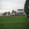
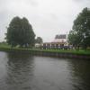
Quiet place to moor with the Black Horse Hotel pub next to the Canal. The pub is closed during the day during weekdays but do meals on Friday, Saturday and Sunday.
Secure your boat quite well as commercial traffic on the canal, which passes quite close to moored boats, even during the night the odd one goes past.
There is a petrol station with a convenience store, if you go over the bridge (walking away from the pub, it is approx 300 metres on the right hand side.

 
Photos
 
External websites
There are no links to external websites from here.
Why not log in and add some (select "External websites" from the menu (sometimes this is under "Edit"))?
 
Nearest facilities

Mouseover for more information or show routes to facility

Nearest water point

In the direction of Castleford Junction

Pollington Visitor Mooring5 miles, 7 furlongs away
On this waterway in the direction of Castleford Junction
Pollington Manor Swing Bridge5 miles, 7½ furlongs away
On this waterway in the direction of Castleford Junction
Bramwith Lock No 149 miles, 4¾ furlongs and 1 lock away
Travel to Sykehouse Junction, then on the Sheffield and South Yorkshire Navigation (New Junction Canal) to Bramwith Junction, then on the Sheffield and South Yorkshire Navigation (Bramwith to Stainforth) to Bramwith Lock No 14
Whitley Lock No 129 miles, 5½ furlongs and 1 lock away
On this waterway in the direction of Castleford Junction
Barnby Dun Lift Bridge10 miles, 3 furlongs and 1 lock away
Travel to Sykehouse Junction, then on the Sheffield and South Yorkshire Navigation (New Junction Canal) to Bramwith Junction, then on the Sheffield and South Yorkshire Navigation (Main Line) to Barnby Dun Lift Bridge
Bramwith Swing Bridge9 miles, 7½ furlongs and 2 locks away
Travel to Sykehouse Junction, then on the Sheffield and South Yorkshire Navigation (New Junction Canal) to Bramwith Junction, then on the Sheffield and South Yorkshire Navigation (Bramwith to Stainforth) to Bramwith Swing Bridge
Long Sandall Lock No 1312 miles, 4½ furlongs and 1 lock away
Travel to Sykehouse Junction, then on the Sheffield and South Yorkshire Navigation (New Junction Canal) to Bramwith Junction, then on the Sheffield and South Yorkshire Navigation (Main Line) to Long Sandall Lock No 13
Bank Dole Lock No 113 miles, 6¾ furlongs and 2 locks away
Travel to Bank Dole Junction, then on the Aire and Calder Navigation (Selby Section) to Bank Dole Lock No 1
Thorne Visitor Moorings14 miles, 2¼ furlongs and 3 locks away
Travel to Sykehouse Junction, then on the Sheffield and South Yorkshire Navigation (New Junction Canal) to Bramwith Junction, then on the Sheffield and South Yorkshire Navigation (Bramwith to Stainforth) to Stainforth Junction, then on the Sheffield and South Yorkshire Navigation (Stainforth and Keadby Canal) to Thorne Visitor Moorings
Ferrybridge Flood Lock No 1115 miles, 1¼ furlongs and 2 locks away
On this waterway in the direction of Castleford Junction
Doncaster Visitor Pontoon Moorings15 miles, 5¾ furlongs and 2 locks away
Travel to Sykehouse Junction, then on the Sheffield and South Yorkshire Navigation (New Junction Canal) to Bramwith Junction, then on the Sheffield and South Yorkshire Navigation (Main Line) to Doncaster Visitor Pontoon Moorings
Ferrybridge Flood Lock Footbridge15 miles, 1¾ furlongs and 3 locks away
On this waterway in the direction of Castleford Junction
Doncaster Town Lock No 1216 miles, ¼ furlongs and 2 locks away
Travel to Sykehouse Junction, then on the Sheffield and South Yorkshire Navigation (New Junction Canal) to Bramwith Junction, then on the Sheffield and South Yorkshire Navigation (Main Line) to Doncaster Town Lock No 12
Beal Bridge16 miles, 1¼ furlongs and 3 locks away
Travel to Bank Dole Junction, then on the Aire and Calder Navigation (Selby Section) to Beal Bridge
Beal Lock No 216 miles, 2½ furlongs and 3 locks away
Travel to Bank Dole Junction, then on the Aire and Calder Navigation (Selby Section) to Beal Lock No 2
Sprotbrough Lock No 1119 miles, 2¼ furlongs and 3 locks away
Travel to Sykehouse Junction, then on the Sheffield and South Yorkshire Navigation (New Junction Canal) to Bramwith Junction, then on the Sheffield and South Yorkshire Navigation (Main Line) to Sprotbrough Lock No 11
Bulholme Lock No 1019 miles, 7¼ furlongs and 3 locks away
On this waterway in the direction of Castleford Junction

In the direction of Ouse - Aire and Calder Junction

Dutch Riverside2 miles, 3 furlongs away
On this waterway in the direction of Ouse - Aire and Calder Junction
Goole Marina2 miles, 4½ furlongs away
On this waterway in the direction of Ouse - Aire and Calder Junction
Selby Basin19 miles, 5½ furlongs and 2 locks away
Travel to Ouse - Aire and Calder Junction, then on the River Ouse : Yorkshire (tidal section - Naburn to Goole) to Selby Junction (River Ouse), then on the Aire and Calder Navigation (Selby Section) to Selby Basin

Nearest rubbish disposal

In the direction of Castleford Junction

Whitley Lock No 129 miles, 5½ furlongs and 1 lock away
On this waterway in the direction of Castleford Junction
Barnby Dun Lift Bridge10 miles, 3 furlongs and 1 lock away
Travel to Sykehouse Junction, then on the Sheffield and South Yorkshire Navigation (New Junction Canal) to Bramwith Junction, then on the Sheffield and South Yorkshire Navigation (Main Line) to Barnby Dun Lift Bridge
Bramwith Swing Bridge9 miles, 7½ furlongs and 2 locks away
Travel to Sykehouse Junction, then on the Sheffield and South Yorkshire Navigation (New Junction Canal) to Bramwith Junction, then on the Sheffield and South Yorkshire Navigation (Bramwith to Stainforth) to Bramwith Swing Bridge
Thorne Visitor Moorings14 miles, 2¼ furlongs and 3 locks away
Travel to Sykehouse Junction, then on the Sheffield and South Yorkshire Navigation (New Junction Canal) to Bramwith Junction, then on the Sheffield and South Yorkshire Navigation (Bramwith to Stainforth) to Stainforth Junction, then on the Sheffield and South Yorkshire Navigation (Stainforth and Keadby Canal) to Thorne Visitor Moorings
Doncaster Visitor Pontoon Moorings15 miles, 5¾ furlongs and 2 locks away
Travel to Sykehouse Junction, then on the Sheffield and South Yorkshire Navigation (New Junction Canal) to Bramwith Junction, then on the Sheffield and South Yorkshire Navigation (Main Line) to Doncaster Visitor Pontoon Moorings

In the direction of Ouse - Aire and Calder Junction

Dutch Riverside2 miles, 3 furlongs away
On this waterway in the direction of Ouse - Aire and Calder Junction
Goole Marina2 miles, 4½ furlongs away
On this waterway in the direction of Ouse - Aire and Calder Junction
Selby Basin19 miles, 5½ furlongs and 2 locks away
Travel to Ouse - Aire and Calder Junction, then on the River Ouse : Yorkshire (tidal section - Naburn to Goole) to Selby Junction (River Ouse), then on the Aire and Calder Navigation (Selby Section) to Selby Basin

Nearest chemical toilet disposal

In the direction of Castleford Junction

Whitley Lock No 129 miles, 5½ furlongs and 1 lock away
On this waterway in the direction of Castleford Junction
Barnby Dun Lift Bridge10 miles, 3 furlongs and 1 lock away
Travel to Sykehouse Junction, then on the Sheffield and South Yorkshire Navigation (New Junction Canal) to Bramwith Junction, then on the Sheffield and South Yorkshire Navigation (Main Line) to Barnby Dun Lift Bridge
Bramwith Swing Bridge9 miles, 7½ furlongs and 2 locks away
Travel to Sykehouse Junction, then on the Sheffield and South Yorkshire Navigation (New Junction Canal) to Bramwith Junction, then on the Sheffield and South Yorkshire Navigation (Bramwith to Stainforth) to Bramwith Swing Bridge
Thorne Visitor Moorings14 miles, 2¼ furlongs and 3 locks away
Travel to Sykehouse Junction, then on the Sheffield and South Yorkshire Navigation (New Junction Canal) to Bramwith Junction, then on the Sheffield and South Yorkshire Navigation (Bramwith to Stainforth) to Stainforth Junction, then on the Sheffield and South Yorkshire Navigation (Stainforth and Keadby Canal) to Thorne Visitor Moorings

In the direction of Ouse - Aire and Calder Junction

Dutch Riverside2 miles, 3 furlongs away
On this waterway in the direction of Ouse - Aire and Calder Junction
Goole Marina2 miles, 4½ furlongs away
On this waterway in the direction of Ouse - Aire and Calder Junction
Selby Basin19 miles, 5½ furlongs and 2 locks away
Travel to Ouse - Aire and Calder Junction, then on the River Ouse : Yorkshire (tidal section - Naburn to Goole) to Selby Junction (River Ouse), then on the Aire and Calder Navigation (Selby Section) to Selby Basin

Nearest place to turn

In the direction of Castleford Junction

Huddle Grounds Winding Hole11 miles, 6¾ furlongs and 2 locks away
Travel to Sykehouse Junction, then on the Sheffield and South Yorkshire Navigation (New Junction Canal) to Bramwith Junction, then on the Sheffield and South Yorkshire Navigation (Bramwith to Stainforth) to Stainforth Junction, then on the Sheffield and South Yorkshire Navigation (Stainforth and Keadby Canal) to Huddle Grounds Winding Hole
Wheatley Hall Road Winding Hole13 miles, 5 furlongs and 2 locks away
Travel to Sykehouse Junction, then on the Sheffield and South Yorkshire Navigation (New Junction Canal) to Bramwith Junction, then on the Sheffield and South Yorkshire Navigation (Main Line) to Wheatley Hall Road Winding Hole
Bank Dole Lock Junction13 miles, 7 furlongs and 3 locks away
Travel to Bank Dole Junction, then on the Aire and Calder Navigation (Selby Section) to Bank Dole Lock Junction
Gas House Bight15 miles, 4¼ furlongs and 2 locks away
Travel to Sykehouse Junction, then on the Sheffield and South Yorkshire Navigation (New Junction Canal) to Bramwith Junction, then on the Sheffield and South Yorkshire Navigation (Main Line) to Gas House Bight
Doncaster Visitor Pontoon Moorings15 miles, 5¾ furlongs and 2 locks away
Travel to Sykehouse Junction, then on the Sheffield and South Yorkshire Navigation (New Junction Canal) to Bramwith Junction, then on the Sheffield and South Yorkshire Navigation (Main Line) to Doncaster Visitor Pontoon Moorings
Beal Lock No 2 Weir Entrance16 miles, 1½ furlongs and 3 locks away
Travel to Bank Dole Junction, then on the Aire and Calder Navigation (Selby Section) to Beal Lock No 2 Weir Entrance
Sprotbrough Lock Weir Exit19 miles, 1¾ furlongs and 3 locks away
Travel to Sykehouse Junction, then on the Sheffield and South Yorkshire Navigation (New Junction Canal) to Bramwith Junction, then on the Sheffield and South Yorkshire Navigation (Main Line) to Sprotbrough Lock Weir Exit
Bulholme Lock Weir Exit19 miles, 7 furlongs and 3 locks away
On this waterway in the direction of Castleford Junction

In the direction of Ouse - Aire and Calder Junction

Viking Marina2 miles, 3¾ furlongs away
On this waterway in the direction of Ouse - Aire and Calder Junction
River Foulness Junction17 miles, 4½ furlongs and 2 locks away
Travel to Ouse - Aire and Calder Junction, then on the River Ouse : Yorkshire (tidal section - Goole to Trent Falls) to Trent Falls, then on the River Humber to Humber - Market Weighton Junction, then on the Market Weighton Canal to River Foulness Junction
Selby Basin19 miles, 5½ furlongs and 2 locks away
Travel to Ouse - Aire and Calder Junction, then on the River Ouse : Yorkshire (tidal section - Naburn to Goole) to Selby Junction (River Ouse), then on the Aire and Calder Navigation (Selby Section) to Selby Basin

Nearest self-operated pump-out

Direction of TV transmitter (From Wolfbane Cybernetic)
 
 
Geograph
 
Wikipedia

Wikipedia has a page about Rawcliffe Bridge

Rawcliffe Bridge is a small hamlet in the East Riding of Yorkshire, England. It is situated approximately 3 miles (4.8 km) south-west of Goole and lies just south of the M62 motorway.

It forms part of the civil parish of Rawcliffe which lies just to the north-west. The hamlet was once served by a station on the Selby to Goole branch line, but this closed along with the line in June 1964.

The Aire and Calder Navigation runs just south of Rawcliffe Bridge. Sugar Mill Ponds lies just to the west and is designated as a Local Nature Reserve and was part funded by lottery money.

Rawcliffe Bridge is home to an ex-RAF hardened communications UNITER bunker which is now owned by a security company, next to this site also is a MoD GPSS fuel depot.

Other Wikipedia pages that might relate to Rawcliffe Bridge
[Croda International] James Dawe in 1925. Crowe bought an abandoned waterworks facility at Rawcliffe Bridge for £7, which would later be used to manufacture the company's first [List of places in Yorkshire] Preston-under-Scar, Primrose Valley, Pudsey, Queensbury Rainton, Ramsgill, Rawcliffe, Rawcliffe Bridge, Ravenfield, Ravenscar, Rawdon, Rawmarsh, Raywell, Redcar, Redmire [Rawcliffe, East Riding of Yorkshire] village of Rawcliffe and the hamlet of Rawcliffe Bridge which lies just to the south-east of the village. According to the 2011 UK census, Rawcliffe parish [Rawcliffe] Rawcliffe may refer to: Rawcliffe, East Riding of Yorkshire location of Rawcliffe railway station Rawcliffe Bridge, East Riding of Yorkshire Rawcliffe [River Don, Yorkshire] Riding of Yorkshire, England. It rises in the Pennines, west of Dunford Bridge, and flows for 70 miles (110 km) eastwards, through the Don Valley, via [Frederick Wood (industrialist)] cosmetics. This new enterprise was named Croda and established at Rawcliffe Bridge, outside Goole, Yorkshire. In 1927 Fred's father, Philip Wood became [River Don Navigation] pedestrian bridge across the river into Forge Island. Bridge Street Bridge (Chantry Bridge) is a single-span metal bridge that carries Bridge Street over [Listed buildings in Upper Rawcliffe-with-Tarnacre] Upper Rawcliffe-with-Tarnacre is a civil parish in the Wyre district of Lancashire, England. It contains nine buildings that are recorded in the National [Humphrey Stafford, 1st Duke of Buckingham] 1981, p. 281. Rawcliffe 1978, p. 21. Harriss 2006, p. 614. Rawcliffe 1978, p. 11. McFarlane 1980, p. 153. Griffiths 1981, p. 358. Rawcliffe 1978, pp. 20–21
 
Google

Results of Google Search

Rawcliffe Bridge - Wikipedia
Rawcliffe Bridge is a small hamlet in the East Riding of Yorkshire, England. It is situated approximately 3 miles (4.8 km) south-west of Goole and lies just south of  ...
Rawcliffe Bridge
At first glance the Hinchliffe's 350-acre farm at Rawcliffe Bridge near Goole in East Yorkshire looks like the efficient, productive arable farm that it is. But when ...
Rawcliffe Bridge Primary School
Welcome to The Federation of Rawcliffe Bridge and Rawcliffe Primary School, where children gain a lifelong love of learning. This website provides you with a ...
Rawcliffe Bridge Primary School - Ofsted
Rawcliffe Bridge Primary School. URN: 117893. Bridge Lane, Rawcliffe Bridge, Goole, DN14 8NH ...
Rawcliffe Bridge Club - Home | Facebook
Rawcliffe Bridge Club, Goole. 264 likes. Rawcliffe Bridge Club is a Social Club and Bar providing events throughout the year, live sports, great ales,...
Rawcliffe Bridge to Doncaster - 4 ways to travel via train, and line 88 ...
The cheapest way to get from Rawcliffe Bridge to Doncaster costs only £4, and the quickest way takes just 24 mins. Find the travel option that best suits you.
East Yorkshire bridge to close for an extra three months - Hull Live
Feb 17, 2020 ... The bridge over the Dutch River at Rawcliffe Bridge has been closed to traffic since June 2019.
United Kingdom | Croda
We were founded in 1925 at Rawcliffe Bridge in Yorkshire, England by an entrepreneur, Mr Crowe, and chemist Mr Dawe to make lanolin from the refining of ...
The Top 10 Things to Do Near Sugar Mill Ponds Rawcliffe Bridge
Things to do near Sugar Mill Ponds Rawcliffe Bridge on TripAdvisor: See 18 reviews and 25 candid ... Bridge Lane, Rawcliffe Bridge, Goole DN14 8NH, England.
London to Rawcliffe Bridge - 8 ways to travel via train, bus, car, and ...
The cheapest way to get from London to Rawcliffe Bridge costs only £16, and the quickest way takes just 3¼ hours. Find the travel option that best suits you.