CanalPlanAC

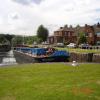
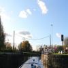
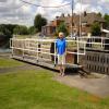
Castleford Flood Lock No 9

 
C&RT key needed to operate this lock
Lock Lane Wildlife Garden, Hunt Street, Wakefield WF10 2LT, United Kingdom
 
Information about the place
 
 
The nearest place in the direction of Bank Dole Junction is Castleford Sanitary Station; ¼ furlongs away.
 
The nearest place in the direction of Castleford Junction is Castleford Junction Footbridge (closed) (Although it's closed to pedestrians it's still a footbridge!!); ¼ furlongs away.

Mooring here is unrated.

This is a lock, the rise of which is not known.


Amenities

Amenities here

 Aldi
 Fish & Chips
 Cashpoint
 Pleasuretime Caravans Ltd
 Kendell Cycles
 Castleford Station

Amenities nearby at Castleford Junction Footbridge (closed)

 Morrisons
 Savile Rd SS
 Total

Amenities nearby at Castleford Sanitary Station

 Ferry Inn
 Glass Blower
 Glass Blower
 SEE ADDRESS
 Wetherspoons
 Burger King
 Fish & Chips
 Boots Chemist
 Barclays
 Cashpoint
 Cashpoint
 Cashpoint
 HSBC
 Halifax
 Lloyds Bank
 Santander
 Yorkshire
 Yorkshire Bank
 
Maps
If you are a user and are logged on, or if you are actively planning a route, a map will be displayed here.
Show on external mapping site: Google | OSM | Bing
 
Additional information

There is visitor mooring and CRT 'facilities' on both sides just beyond the East end of the lock.

 
Navigational Notes

Castleford Lock is beam limiting due to the curvature of the lock chamber, but fine for typical leisure craft. The lock is usually open unless the river is in flood.

 
Photos
 
External websites
There are no links to external websites from here.
Why not log in and add some (select "External websites" from the menu (sometimes this is under "Edit"))?
 
Nearest facilities

Mouseover for more information or show routes to facility

Nearest water point

In the direction of Castleford Junction

Woodnook Lock No 62 miles, 2¼ furlongs and 1 lock away
Travel to Castleford Junction, then on the Aire and Calder Navigation (Wakefield Section) to Woodnook Lock No 6
Fairies Hill Moorings2 miles, 1 furlong and 2 locks away
Travel to Castleford Junction, then on the Aire and Calder Navigation (Wakefield Section) to Fairies Hill Lock Junction, then on the Aire and Calder Navigation (Wakefield Section - Fairies Hill Mooring Arm) to Fairies Hill Moorings
Lemonroyd Lock No 73 miles, 4¼ furlongs and 1 lock away
Travel to Castleford Junction, then on the Aire and Calder Navigation (Main Line - Castleford to Leeds) to Lemonroyd Lock No 7
Lemonroyd Marina3 miles, 5 furlongs and 2 locks away
Travel to Castleford Junction, then on the Aire and Calder Navigation (Main Line - Castleford to Leeds) to Lemonroyd Marina
King's Road Lock No 33 miles, 3¾ furlongs and 2 locks away
Travel to Castleford Junction, then on the Aire and Calder Navigation (Wakefield Section) to King's Road Lock No 3
Woodlesford Lock No 54 miles, 7 furlongs and 2 locks away
Travel to Castleford Junction, then on the Aire and Calder Navigation (Main Line - Castleford to Leeds) to Woodlesford Lock No 5
Fishpond Lock No 45 miles, 5¾ furlongs and 3 locks away
Travel to Castleford Junction, then on the Aire and Calder Navigation (Main Line - Castleford to Leeds) to Fishpond Lock No 4
Stanley Ferry Water Point5 miles, 1 furlong and 4 locks away
Travel to Castleford Junction, then on the Aire and Calder Navigation (Wakefield Section) to Stanley Ferry Water Point
Ramsdens Bridge Sanitary Station5 miles, 1¾ furlongs and 4 locks away
Travel to Castleford Junction, then on the Aire and Calder Navigation (Wakefield Section) to Ramsdens Bridge Sanitary Station
Leeds Sanitary Station9 miles, 3½ furlongs and 5 locks away
Travel to Castleford Junction, then on the Aire and Calder Navigation (Main Line - Castleford to Leeds) to Leeds Sanitary Station
Leeds Dock Visitor Moorings9 miles, 6 furlongs and 6 locks away
Travel to Castleford Junction, then on the Aire and Calder Navigation (Main Line - Castleford to Leeds) to Leeds Dock Entrance, then on the Aire and Calder Navigation (Leeds Dock) to Leeds Dock Visitor Moorings
Broad Cut Low Lock No 310 miles, 5½ furlongs and 7 locks away
Travel to Castleford Junction, then on the Aire and Calder Navigation (Wakefield Section) to Fall Ing Junction, then on the Calder and Hebble Navigation (Main Line) to Broad Cut Low Lock No 3

In the direction of Ouse - Aire and Calder Junction

Castleford Sanitary Station¼ furlongs and 1 lock away
On this waterway in the direction of Ouse - Aire and Calder Junction
Bulholme Lock No 105 furlongs and 1 lock away
On this waterway in the direction of Ouse - Aire and Calder Junction
Ferrybridge Flood Lock Footbridge5 miles, 2¾ furlongs and 2 locks away
On this waterway in the direction of Ouse - Aire and Calder Junction
Ferrybridge Flood Lock No 115 miles, 3 furlongs and 2 locks away
On this waterway in the direction of Ouse - Aire and Calder Junction
Bank Dole Lock No 17 miles, 1¼ furlongs and 3 locks away
Travel to Bank Dole Junction, then on the Aire and Calder Navigation (Selby Section) to Bank Dole Lock No 1
Beal Bridge9 miles, 3¾ furlongs and 4 locks away
Travel to Bank Dole Junction, then on the Aire and Calder Navigation (Selby Section) to Beal Bridge
Beal Lock No 29 miles, 5 furlongs and 4 locks away
Travel to Bank Dole Junction, then on the Aire and Calder Navigation (Selby Section) to Beal Lock No 2
Whitley Lock No 1210 miles, 6¾ furlongs and 3 locks away
On this waterway in the direction of Ouse - Aire and Calder Junction

Nearest rubbish disposal

In the direction of Castleford Junction

Lemonroyd Marina3 miles, 5 furlongs and 2 locks away
Travel to Castleford Junction, then on the Aire and Calder Navigation (Main Line - Castleford to Leeds) to Lemonroyd Marina
Woodlesford Lock No 54 miles, 7 furlongs and 2 locks away
Travel to Castleford Junction, then on the Aire and Calder Navigation (Main Line - Castleford to Leeds) to Woodlesford Lock No 5
Ramsdens Bridge Visitor Moorings5 miles, 1¼ furlongs and 4 locks away
Travel to Castleford Junction, then on the Aire and Calder Navigation (Wakefield Section) to Ramsdens Bridge Visitor Moorings
Leeds Sanitary Station9 miles, 3½ furlongs and 5 locks away
Travel to Castleford Junction, then on the Aire and Calder Navigation (Main Line - Castleford to Leeds) to Leeds Sanitary Station
Leeds Basin10 miles, 2¾ furlongs and 7 locks away
Travel to Castleford Junction, then on the Aire and Calder Navigation (Main Line - Castleford to Leeds) to Leeds Bridge, then on the Leeds and Liverpool Canal (Main Line - Wigan to Leeds) to Leeds Basin
Horbury Basin Residential Moorings & Sanitary Station12 miles, 6 furlongs and 9 locks away
Travel to Castleford Junction, then on the Aire and Calder Navigation (Wakefield Section) to Fall Ing Junction, then on the Calder and Hebble Navigation (Main Line) to Horbury Basin Residential Moorings & Sanitary Station
Shepley Bridge Sanitary Station17 miles, 2½ furlongs and 16 locks away
Travel to Castleford Junction, then on the Aire and Calder Navigation (Wakefield Section) to Fall Ing Junction, then on the Calder and Hebble Navigation (Main Line) to Shepley Bridge Sanitary Station
Dobson Locks Services19 miles, ½ furlongs and 21 locks away
Travel to Castleford Junction, then on the Aire and Calder Navigation (Main Line - Castleford to Leeds) to Leeds Bridge, then on the Leeds and Liverpool Canal (Main Line - Wigan to Leeds) to Dobson Locks Services

In the direction of Ouse - Aire and Calder Junction

Castleford Sanitary Station¼ furlongs and 1 lock away
On this waterway in the direction of Ouse - Aire and Calder Junction
Whitley Lock No 1210 miles, 6¾ furlongs and 3 locks away
On this waterway in the direction of Ouse - Aire and Calder Junction
Selby Basin18 miles, 1¾ furlongs and 6 locks away
Travel to Bank Dole Junction, then on the Aire and Calder Navigation (Selby Section) to Selby Basin

Nearest chemical toilet disposal

In the direction of Castleford Junction

Fairies Hill Moorings2 miles, 1 furlong and 2 locks away
Travel to Castleford Junction, then on the Aire and Calder Navigation (Wakefield Section) to Fairies Hill Lock Junction, then on the Aire and Calder Navigation (Wakefield Section - Fairies Hill Mooring Arm) to Fairies Hill Moorings
Lemonroyd Marina3 miles, 5 furlongs and 2 locks away
Travel to Castleford Junction, then on the Aire and Calder Navigation (Main Line - Castleford to Leeds) to Lemonroyd Marina
Ramsdens Bridge Sanitary Station5 miles, 1¾ furlongs and 4 locks away
Travel to Castleford Junction, then on the Aire and Calder Navigation (Wakefield Section) to Ramsdens Bridge Sanitary Station
Leeds Sanitary Station9 miles, 3½ furlongs and 5 locks away
Travel to Castleford Junction, then on the Aire and Calder Navigation (Main Line - Castleford to Leeds) to Leeds Sanitary Station
Horbury Basin Residential Moorings & Sanitary Station12 miles, 6 furlongs and 9 locks away
Travel to Castleford Junction, then on the Aire and Calder Navigation (Wakefield Section) to Fall Ing Junction, then on the Calder and Hebble Navigation (Main Line) to Horbury Basin Residential Moorings & Sanitary Station
Savile Town Wharf and Basin (Dewsbury)15 miles, 7 furlongs and 12 locks away
Travel to Castleford Junction, then on the Aire and Calder Navigation (Wakefield Section) to Fall Ing Junction, then on the Calder and Hebble Navigation (Main Line) to Dewsbury Arm Junction, then on the Calder and Hebble Navigation (Dewsbury Old Cut) to Savile Town Wharf and Basin (Dewsbury)
Shepley Bridge Sanitary Station17 miles, 2½ furlongs and 16 locks away
Travel to Castleford Junction, then on the Aire and Calder Navigation (Wakefield Section) to Fall Ing Junction, then on the Calder and Hebble Navigation (Main Line) to Shepley Bridge Sanitary Station
Dobson Locks Services19 miles, ½ furlongs and 21 locks away
Travel to Castleford Junction, then on the Aire and Calder Navigation (Main Line - Castleford to Leeds) to Leeds Bridge, then on the Leeds and Liverpool Canal (Main Line - Wigan to Leeds) to Dobson Locks Services

In the direction of Ouse - Aire and Calder Junction

Castleford Sanitary Station¼ furlongs and 1 lock away
On this waterway in the direction of Ouse - Aire and Calder Junction
Whitley Lock No 1210 miles, 6¾ furlongs and 3 locks away
On this waterway in the direction of Ouse - Aire and Calder Junction
Selby Basin18 miles, 1¾ furlongs and 6 locks away
Travel to Bank Dole Junction, then on the Aire and Calder Navigation (Selby Section) to Selby Basin

Nearest place to turn

In the direction of Castleford Junction

Lemonroyd Lock Weir Exit3 miles, 3¼ furlongs and 1 lock away
Travel to Castleford Junction, then on the Aire and Calder Navigation (Main Line - Castleford to Leeds) to Lemonroyd Lock Weir Exit
Fairies Hill Lock Arm2 miles, 4 furlongs and 2 locks away
Travel to Castleford Junction, then on the Aire and Calder Navigation (Wakefield Section) to Fairies Hill Lock Arm
Fleet Lane Arm3 miles, 7¼ furlongs and 2 locks away
Travel to Castleford Junction, then on the Aire and Calder Navigation (Main Line - Castleford to Leeds) to Fleet Lane Arm
Stanley Ferry Marina5 miles, ¼ furlongs and 4 locks away
Travel to Castleford Junction, then on the Aire and Calder Navigation (Wakefield Section) to Stanley Ferry Marina
Junction with River Aire (Old Channel) South8 miles, 1½ furlongs and 4 locks away
Travel to Castleford Junction, then on the Aire and Calder Navigation (Main Line - Castleford to Leeds) to Junction with River Aire (Old Channel) South
Junction with River Aire (Old Channel) North8 miles, 6½ furlongs and 5 locks away
Travel to Castleford Junction, then on the Aire and Calder Navigation (Main Line - Castleford to Leeds) to Junction with River Aire (Old Channel) North
Knostrop Flood Lock Weir Entrance8 miles, 6¾ furlongs and 5 locks away
Travel to Castleford Junction, then on the Aire and Calder Navigation (Main Line - Castleford to Leeds) to Knostrop Flood Lock Weir Entrance
Wakefield Weir Entrance8 miles, ½ furlongs and 6 locks away
Travel to Castleford Junction, then on the Aire and Calder Navigation (Wakefield Section) to Fall Ing Junction, then on the Calder and Hebble Navigation (Main Line) to Wakefield Weir Entrance
Leeds Dock Side Arm9 miles, 5¾ furlongs and 6 locks away
Travel to Castleford Junction, then on the Aire and Calder Navigation (Main Line - Castleford to Leeds) to Leeds Dock Entrance, then on the Aire and Calder Navigation (Leeds Dock) to Leeds Dock Side Arm
River Aire Junction10 miles, 2¼ furlongs and 6 locks away
Travel to Castleford Junction, then on the Aire and Calder Navigation (Main Line - Castleford to Leeds) to Leeds Bridge, then on the Leeds and Liverpool Canal (Main Line - Wigan to Leeds) to River Aire Junction
Leeds Basin10 miles, 2¾ furlongs and 7 locks away
Travel to Castleford Junction, then on the Aire and Calder Navigation (Main Line - Castleford to Leeds) to Leeds Bridge, then on the Leeds and Liverpool Canal (Main Line - Wigan to Leeds) to Leeds Basin
Broad Cut Weir Entrance10 miles, 5 furlongs and 7 locks away
Travel to Castleford Junction, then on the Aire and Calder Navigation (Wakefield Section) to Fall Ing Junction, then on the Calder and Hebble Navigation (Main Line) to Broad Cut Weir Entrance
Waller Bridge Winding Hole10 miles, 7¼ furlongs and 8 locks away
Travel to Castleford Junction, then on the Aire and Calder Navigation (Wakefield Section) to Fall Ing Junction, then on the Calder and Hebble Navigation (Main Line) to Waller Bridge Winding Hole
Horbury Basin Residential Moorings & Sanitary Station12 miles, 6 furlongs and 9 locks away
Travel to Castleford Junction, then on the Aire and Calder Navigation (Wakefield Section) to Fall Ing Junction, then on the Calder and Hebble Navigation (Main Line) to Horbury Basin Residential Moorings & Sanitary Station
Aire Valley Marina (eastern entrance)11 miles, 6 furlongs and 12 locks away
Travel to Castleford Junction, then on the Aire and Calder Navigation (Main Line - Castleford to Leeds) to Leeds Bridge, then on the Leeds and Liverpool Canal (Main Line - Wigan to Leeds) to Aire Valley Marina (eastern entrance)

In the direction of Ouse - Aire and Calder Junction

Bulholme Lock Weir Exit5½ furlongs and 2 locks away
On this waterway in the direction of Ouse - Aire and Calder Junction
Bank Dole Lock Junction7 miles, 1½ furlongs and 4 locks away
Travel to Bank Dole Junction, then on the Aire and Calder Navigation (Selby Section) to Bank Dole Lock Junction
Beal Lock No 2 Weir Entrance9 miles, 4 furlongs and 4 locks away
Travel to Bank Dole Junction, then on the Aire and Calder Navigation (Selby Section) to Beal Lock No 2 Weir Entrance
Haddlesey Junction13 miles, 3½ furlongs and 5 locks away
Travel to Bank Dole Junction, then on the Aire and Calder Navigation (Selby Section) to Haddlesey Junction
Selby Basin18 miles, 1¾ furlongs and 6 locks away
Travel to Bank Dole Junction, then on the Aire and Calder Navigation (Selby Section) to Selby Basin

Nearest self-operated pump-out

Direction of TV transmitter (From Wolfbane Cybernetic)
 
 
Geograph
 
Wikipedia

There is no page on Wikipedia called “Castleford Flood Lock”

Wikipedia pages that might relate to Castleford Flood Lock
[Aire and Calder Navigation] subsidence. In March 1988, the bank near Lemonroyd lock collapsed into St Aidan's opencast mine, which then flooded. A significant factor was the presence of excavations [North Pennine Ring] the left is Castleford Flood Lock, and traffic lights must be observed to prevent a collision with a commercial boat emerging from the lock. The ring turns [River Aire] It then passes through Leeds and on to Swillington and Woodlesford. At Castleford is the confluence of the Aire and Calder; just downstream of the confluence [River Cam] Conservators, Lock Dimensions Archived 7 March 2009 at the Wayback Machine, accessed 25 May 2009 Photographs of the October 2001 Cam floods Archived 12 [St Aidan's] located between Leeds and Castleford in West Yorkshire, England. The land was formerly an opencast coal mining area that was flooded in 1988, after the riverbank [Outer Pennine Ring] Leeds to Castleford is 10 miles (16 km) and there are six locks, although Knostrop Flood Lock normally has both sets of gates open. The first lock on the [Sowerby Bridge] Hebble Navigation and the Rochdale Canal; Tuel Lane Lock on the Rochdale Canal is the deepest lock in the United Kingdom. The canal basin and warehouses [Elland Road] matches at Elland Road. In the 1988 Yorkshire County Cup final, they beat Castleford Tigers 33–12. Due to the redevelopment of their traditional home of Headingley [Retford] Street— ran from Southampton to Derby, Little Chester, Chesterfield, Castleford, Pontefract, to Eboracum, or York: and from it, at Chesterfield, branched [2009 Challenge Cup] after the break, before Castleford scored another of their own. Another try for Halifax was countered with three Castleford tries, one of which was successfully
 
Google

Results of Google Search

Aire and Calder Navigation - Wikipedia
The Aire and Calder Navigation is the canalised section of the Rivers Aire and Calder in West ... Lock sizes were increased several times, as was the depth of water, to enable larger boats to ... The Aire and Calder is a canalisation of the River Calder from Wakefield to Castleford, where it ... Ferrybridge Flood Lock and weir.
Outer Pennine Ring - Wikipedia
Straight ahead leads to Castleford weir, and no boats should enter that section. To the left is a flood lock and the route to Goole. The ring turns to the right, along  ...
65. Narrowboat journey from Leeds to Castleford. St Aidan's ...
Aug 30, 2019 ... St Aidan's Flooded Mine and HUGE Canal Locks. 46,289 views46K views. • Aug 30, 2019.
Bulholme Lock No 9
Bulholme Lock No 9 Bulholme Lock is a minor feature on the Aire and Calder Navigation between Castleford to the weast and Bank dole Junction to the East.
Castleford Lock | Canal & River Trust
Sep 28, 2015 ... The Aire & Calder Navigation is currently closed at Lock No 9 Castleford Junction Lock due to an issue with the Lock operation. The rest of the ...