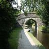
Pen-y-ddol Bridge No 46W
is a minor waterways place
on the Shropshire Union Canal (Llangollen Canal - Main Line) between
Llantisilio - Horseshoe Falls (1 mile and 3 furlongs
to the west) and
Llangollen Basin (48 hour visitor moorings and the limit of navigation.) (1½ furlongs
to the southeast).
The nearest place in the direction of Llantisilio - Horseshoe Falls is Tower Bridge No 47W;
1¾ furlongs
away.
The nearest place in the direction of Llangollen Basin is Llangollen Pavilion;
1 furlong
away.
There may be access to the towpath here.
Mooring here is impossible (it may be physically impossible, forbidden, or allowed only for specific short-term purposes). Except for Kayaks and Horse Drawn Narrowboats this is a non-navigable section of the Canal. You cannot moor here.
There is a bridge here which takes a track over the canal.
Ty Craig Bridge No 48AW | 7¾ furlongs | |
Pentrefelin Aqueduct | 5¾ furlongs | |
Llangollen Motor Museum | 5½ furlongs | |
Pentrefelin Bridge No 48W | 4¾ furlongs | |
Tower Bridge No 47W | 1¾ furlongs | |
Pen-y-ddol Bridge No 46W | ||
Llangollen Pavilion | 1 furlong | |
Llangollen Basin | 1½ furlongs | |
Llangollen Wharf | 2½ furlongs | |
Siambr Bridge No 45W | 2¾ furlongs | |
Llangollen Narrows Section (125m) | 3¾ furlongs |
There are no links to external websites from here.
Why not log in and add some (select "External websites" from the menu (sometimes this is under "Edit"))?
Mouseover for more information or show routes to facility
Nearest water point
In the direction of Hurleston Junction
Llangollen Basin — 1½ furlongs away
On this waterway in the direction of Hurleston Junction
Llangollen Services — 4½ furlongs away
On this waterway in the direction of Hurleston Junction
The Old Wharf — 5 miles, ¼ furlongs away
Travel to Ruabon Branch Junction, then on the Shropshire Union Canal (Llangollen Canal - Ruabon Branch) to The Old Wharf
Trevor Basin — 5 miles, 1¼ furlongs away
Travel to Ruabon Branch Junction, then on the Shropshire Union Canal (Llangollen Canal - Ruabon Branch) to Trevor Basin
Coedfryn Water Point — 5 miles, 3¼ furlongs away
On this waterway in the direction of Hurleston Junction
Chirk Marina — 7 miles, 1¾ furlongs away
On this waterway in the direction of Hurleston Junction
New Marton Water Points — 12 miles, 1½ furlongs away
On this waterway in the direction of Hurleston Junction
Ellesmere Services — 19 miles, ¼ furlongs and 2 locks away
On this waterway in the direction of Hurleston Junction
Blackwater Meadow Marina — 19 miles, 1½ furlongs and 2 locks away
On this waterway in the direction of Hurleston Junction
Weston Arm Services (C&RT) — 16 miles, 2¼ furlongs and 6 locks away
Travel to Frankton Junction, then on the Shropshire Union Canal (Montgomery Canal - connected and navigable) to Weston Arm Junction, then on the Shropshire Union Canal (Weston Branch) to Weston Arm Services (C&RT)Nearest rubbish disposal
In the direction of Hurleston Junction
Llangollen Basin — 1½ furlongs away
On this waterway in the direction of Hurleston Junction
Llangollen Services — 4½ furlongs away
On this waterway in the direction of Hurleston Junction
Ellesmere Services — 19 miles, ¼ furlongs and 2 locks away
On this waterway in the direction of Hurleston Junction
Weston Arm Services (C&RT) — 16 miles, 2¼ furlongs and 6 locks away
Travel to Frankton Junction, then on the Shropshire Union Canal (Montgomery Canal - connected and navigable) to Weston Arm Junction, then on the Shropshire Union Canal (Weston Branch) to Weston Arm Services (C&RT)Nearest chemical toilet disposal
In the direction of Hurleston Junction
Llangollen Services — 4½ furlongs away
On this waterway in the direction of Hurleston Junction
Chirk Marina — 7 miles, 1¾ furlongs away
On this waterway in the direction of Hurleston Junction
Whittington Wharf Narrowboats — 14 miles, 4 furlongs and 2 locks away
On this waterway in the direction of Hurleston Junction
Ellesmere Services — 19 miles, ¼ furlongs and 2 locks away
On this waterway in the direction of Hurleston Junction
Weston Arm Services (C&RT) — 16 miles, 2¼ furlongs and 6 locks away
Travel to Frankton Junction, then on the Shropshire Union Canal (Montgomery Canal - connected and navigable) to Weston Arm Junction, then on the Shropshire Union Canal (Weston Branch) to Weston Arm Services (C&RT)Nearest place to turn
In the direction of Hurleston Junction
Llangollen Basin — 1½ furlongs away
On this waterway in the direction of Hurleston Junction
Bryn Howel Winding Hole — 3 miles, 1¾ furlongs away
On this waterway in the direction of Hurleston Junction
Ruabon Branch Junction — 5 miles, ¼ furlongs away
On this waterway in the direction of Hurleston Junction
Trevor Basin — 5 miles, 1¼ furlongs away
Travel to Ruabon Branch Junction, then on the Shropshire Union Canal (Llangollen Canal - Ruabon Branch) to Trevor Basin
Coedfryn Winding Hole — 5 miles, 4¼ furlongs away
On this waterway in the direction of Hurleston Junction
Chirk Marina — 7 miles, 1¾ furlongs away
On this waterway in the direction of Hurleston Junction
Chirk Golf Course Winding Hole — 7 miles, 4¾ furlongs away
On this waterway in the direction of Hurleston Junction
Chirk Pool — 8 miles, 4¾ furlongs away
On this waterway in the direction of Hurleston Junction
Rhoswiel Bridge Winding Hole — 9 miles, 5½ furlongs away
On this waterway in the direction of Hurleston Junction
Polletts Bridge Winding Hole — 14 miles, 1 furlong and 2 locks away
On this waterway in the direction of Hurleston Junction
Frankton Junction — 15 miles, 5¼ furlongs and 2 locks away
On this waterway in the direction of Hurleston Junction
Sewage Works Winding Hole — 18 miles, 4¼ furlongs and 2 locks away
On this waterway in the direction of Hurleston Junction
Ellesmere Branch Junction — 19 miles, ½ furlongs and 2 locks away
On this waterway in the direction of Hurleston Junction
Ellesmere Town Wharf — 19 miles, 2½ furlongs and 2 locks away
Travel to Ellesmere Branch Junction, then on the Shropshire Union Canal (Llangollen Canal - Ellesmere Branch) to Ellesmere Town Wharf
Weston Arm Junction — 16 miles, 1¼ furlongs and 6 locks away
Travel to Frankton Junction, then on the Shropshire Union Canal (Montgomery Canal - connected and navigable) to Weston Arm Junction
Hawkswood Winding Hole — 17 miles and 7 locks away
Travel to Frankton Junction, then on the Shropshire Union Canal (Montgomery Canal - connected and navigable) to Hawkswood Winding Hole
Queen's Head Winding Hole — 19 miles, 4¼ furlongs and 7 locks away
Travel to Frankton Junction, then on the Shropshire Union Canal (Montgomery Canal - connected and navigable) to Queen's Head Winding HoleNearest boatyard pump-out
In the direction of Hurleston Junction
The Old Wharf — 5 miles, ¼ furlongs away
Travel to Ruabon Branch Junction, then on the Shropshire Union Canal (Llangollen Canal - Ruabon Branch) to The Old Wharf
Chirk Marina — 7 miles, 1¾ furlongs away
On this waterway in the direction of Hurleston Junction
Whittington Wharf Narrowboats — 14 miles, 4 furlongs and 2 locks away
On this waterway in the direction of Hurleston Junction
Blackwater Meadow Marina — 19 miles, 1½ furlongs and 2 locks away
On this waterway in the direction of Hurleston JunctionNo information
CanalPlan has no information on any of the following facilities within range:self-operated pump-out
Direction of TV transmitter (From Wolfbane Cybernetic)
There is no page on Wikipedia called “Pen-y-ddol Bridge No 46W”
Wikipedia pages that might relate to Pen-y-ddol Bridge No 46W
[Aberystwyth]
There is evidence that during the Mesolithic Age the area of Tan-y-Bwlch at the foot of Pen Dinas (Penparcau) was used as a flint knapping floor for hunter-gatherers
[Llangollen Canal]
weighted counterbalance allows the bridge to be opened, and the structure is grade II* listed. Wrenbury lift bridge, No. 20, is automated, with push-button
[Pontrhydfendigaid]
at Strata Florida was positioned to serve the village. The hillfort of Pen y Bannau is 1 km east of the village. The village is home to an annual eisteddfod
[River Teifi]
established in Wales. The river forms the southern boundary of the hamlet of Pen-y-wenallt. Between Cenarth and Cardigan, there is an ancient tradition of
[List of scheduled monuments in Conwy]
CN320: Hafod y Garreg Deserted Rural Settlement coflein NPRN: not yet identified. GAT PRN not yet identified. Cadw SAM: CN304: Ty'n y Ddol Medieval Long
[Ellesmere Canal]
Weston Branch was originally intended to be the main line of the canal. Bridge numbering (which starts at Hurleston Junction) continues down the Llanymynech
[Presbyterian Church of Wales]
(1842), and Aberystwyth, in Ceredigion (1906). It produces a quarterly journal Y Traethodydd and a monthly periodical the Treasury. It is distinguished from
[List of Statutory Instruments of the Welsh Assembly, 2011]
(WSI 2011 No. 1348) Gorchymyn Cefnffordd yr A487 (Tre'r-ddôl a Thre Taliesin, Ceredigion) (Terfynau Cyflymder 30 mya a 40 mya) 2011 (WSI 2011 No. 1394) The
[Henllan, Ceredigion]
Catholic chapel, built by prisoners of war. To the southeast of the village at Pen-ffynnon on the A484 is the West Wales Museum of Childhood, displaying a collection
[Grade II* listed buildings in Denbighshire]
Blaenddol house, Blaen y Ddol Corwen 20 October 1966 SJ0269744506 52°59′21″N 3°27′04″W / 52.98904263911°N 3.4509806474396°W / 52.98904263911; -3.4509806474396
Results of Google Search
At Llangollen between Pen-Y-Ddol Bridge 46W and Tower Bridge 47W ... Type: Navigation Restriction. Reason: 3rd Party Works. Is the towpath closed? No ...
Jul 22, 2020 ... ... 07/08/2020 18:00 inclusive. Type: Advice. Reason: 3rd Party Works. Is the towpath closed? No ... Ends at: Bridge 46W, Pen-Y-Ddol Bridge ...
No need to register, buy now! ... View over the Botley Road bridge into Osney island and the THAMES ... Pen-y-ddol Bridge and one of the horse drawn boats which travel between Llangollen Wharf up the Dee valley towards Llantysilio.