
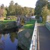
Battye Flood Gates
Cut End Bridge, Kirklees WF14 0EH, United Kingdom
Battye Flood Gates is on the Calder and Hebble Navigation (Main Line).
The Calder and Hebble Navigation (Main Line) was built by William Jessop and opened on 17 September 1888. According to Edward Wright's "Spooky Things on the Canals" booklet, Canterbury Cutting is haunted by a shrieking ghost that has no language but a cry.

Battye Flood Gates
is a minor waterways place
on the Calder and Hebble Navigation (Main Line) between
Mirfield (1 mile and 5¾ furlongs
and 1 lock
to the east) and
Cooper Bridge Junction (Junction of the Huddersfield Broad Canal and the Calder and Hebble Navigation) (5½ furlongs
and 1 lock
to the west).
The nearest place in the direction of Mirfield is Battye Cut End Bridge No 14;
a few yards
away.
The nearest place in the direction of Cooper Bridge Junction is Battye Weir Entrance (Channel leading to the Weir);
¼ furlongs
away.
Mooring here is unrated.
| Battyeford Lock No 12 | 5¼ furlongs | |
| Former Battyeford Ford Graving Dock | 4¾ furlongs | |
South Pennine Boat Club  | 4½ furlongs | |
| Battyeford Cut Bridge No 15 | 4½ furlongs | |
| Battye Cut End Bridge No 14 | a few yards | |
| Battye Flood Gates | ||
| Battye Weir Entrance | ¼ furlongs | |
| Battyeford Hauling Bridge No 14 | ¼ furlongs | |
| Battyeford Pipe Bridge | ¾ furlongs | |
| Battyeford Railway Bridges No 13 | 1 furlong | |
| Cooper Bridge Lock Pipe Bridge | 2½ furlongs | |
Amenities nearby at Battye Cut End Bridge No 14
 White Gate
 Farm Shop
 Bus stop (Coppin Hall Lane)
Bus stop (Far Common Road)
Bus stop (Far Common Road)
Bus stop (Far Common Road)
Bus stop (Far Common Road)
Bus stop (Hollybank School)
Bus stop (Hollybank School)
Bus stop (Huddersfield Rd Coppin Hall Lane)
Bus stop (Huddersfield Rd Coppin Hall Lane)
Bus stop (Huddersfield Rd Leeds Road)
Bus stop (Mirfield Moor)
Bus stop (Mirfield Moor)
Bus stop (Moor Park 25)
Bus stop (Moor Park 25)
Bus stop (Stocks Bank Drive)
Bus stop (Stocks Bank Drive)
Bus stop (Three Nuns Junction)
Bus stop (Coppin Hall Lane)
Bus stop (Coppin Hall Lane)
Bus stop (Far Common Road)
Bus stop (Far Common Road)
Bus stop (Far Common Road)
Bus stop (Far Common Road)
Bus stop (Hollybank School)
Bus stop (Hollybank School)
Bus stop (Huddersfield Rd Coppin Hall Lane)
Bus stop (Huddersfield Rd Coppin Hall Lane)
Bus stop (Huddersfield Rd Leeds Road)
Bus stop (Mirfield Moor)
Bus stop (Mirfield Moor)
Bus stop (Moor Park 25)
Bus stop (Moor Park 25)
Bus stop (Stocks Bank Drive)
Bus stop (Stocks Bank Drive)
Bus stop (Three Nuns Junction)
Amenities nearby at Battye Weir Entrance
Three Nuns Shell Shell Fuel Card Bus stop (Huddersfield Rd Leeds Road)
Bus stop (Three Nuns Junction)
Shell Shell Fuel Card Bus stop (Huddersfield Rd Leeds Road)
Bus stop (Three Nuns Junction)
There are no links to external websites from here.
Why not log in and add some (select "External websites" from the menu (sometimes this is under "Edit"))?
Why not log in and add some (select "External websites" from the menu (sometimes this is under "Edit"))?
Mouseover for more information or show routes to facility
Nearest water point
In the direction of Salterhebble Junction
Brighouse Basin — 2 miles, 7¾ furlongs and 5 locks away
On this waterway in the direction of Salterhebble Junction
Aspley Basin (Huddersfield) — 4 miles, 1½ furlongs and 10 locks away
Travel to Cooper Bridge Junction, then on the Huddersfield Broad Canal to Aspley Basin (Huddersfield)
Salterhebble Sanitary Station — 7 miles, 1¾ furlongs and 14 locks away
On this waterway in the direction of Salterhebble Junction
Salterhebble Junction — 7 miles, 2¼ furlongs and 15 locks away
On this waterway in the direction of Salterhebble Junction
Sowerby Bridge Basin — 9 miles, 4 furlongs and 15 locks away
Travel to Salterhebble Junction, then on the Calder and Hebble Navigation (Main Line) to Sowerby Bridge Basin
Hebden Bridge Services — 14 miles, 7¼ furlongs and 22 locks away
Travel to Salterhebble Junction, then on the Calder and Hebble Navigation (Main Line) to Sowerby Bridge Junction, then on the Rochdale Canal (Main Line) to Hebden Bridge Services
Waterside Lock No 21E — 8 miles, 7 furlongs and 30 locks away
Travel to Cooper Bridge Junction, then on the Huddersfield Broad Canal to Aspley Basin (Huddersfield), then on the Huddersfield Narrow Canal to Waterside Lock No 21E
Slaithwaite Winding Hole — 8 miles, 7¾ furlongs and 31 locks away
Travel to Cooper Bridge Junction, then on the Huddersfield Broad Canal to Aspley Basin (Huddersfield), then on the Huddersfield Narrow Canal to Slaithwaite Winding Hole
Baltimore Marina — 18 miles, 6¾ furlongs and 31 locks away
Travel to Salterhebble Junction, then on the Calder and Hebble Navigation (Main Line) to Sowerby Bridge Junction, then on the Rochdale Canal (Main Line) to Baltimore Marina
Fielden Wharf & Services — 19 miles, 1¾ furlongs and 32 locks away
Travel to Salterhebble Junction, then on the Calder and Hebble Navigation (Main Line) to Sowerby Bridge Junction, then on the Rochdale Canal (Main Line) to Fielden Wharf & Services
Standedge Tunnel (eastern entrance) — 12 miles, 2½ furlongs and 52 locks away
Travel to Cooper Bridge Junction, then on the Huddersfield Broad Canal to Aspley Basin (Huddersfield), then on the Huddersfield Narrow Canal to Standedge Tunnel (eastern entrance)
In the direction of Fall Ing Junction
Shepley Bridge Sanitary Station — 2 miles, 3¼ furlongs and 1 lock away
On this waterway in the direction of Fall Ing Junction
Broad Cut Low Lock No 3 — 9 miles, ¼ furlongs and 9 locks away
On this waterway in the direction of Fall Ing Junction
Ramsdens Bridge Sanitary Station — 14 miles, 4 furlongs and 13 locks away
Travel to Fall Ing Junction, then on the Aire and Calder Navigation (Wakefield Section) to Ramsdens Bridge Sanitary Station
Ramsdens Swing Bridge — 14 miles, 4 furlongs and 13 locks away
Travel to Fall Ing Junction, then on the Aire and Calder Navigation (Wakefield Section) to Ramsdens Swing Bridge
Stanley Ferry Water Point — 14 miles, 4¾ furlongs and 13 locks away
Travel to Fall Ing Junction, then on the Aire and Calder Navigation (Wakefield Section) to Stanley Ferry Water Point
King's Road Lock No 3 — 16 miles, 1¾ furlongs and 14 locks away
Travel to Fall Ing Junction, then on the Aire and Calder Navigation (Wakefield Section) to King's Road Lock No 3
Woodnook Lock No 6 — 17 miles, 3¼ furlongs and 15 locks away
Travel to Fall Ing Junction, then on the Aire and Calder Navigation (Wakefield Section) to Woodnook Lock No 6
Fairies Hill Moorings — 17 miles, 6¾ furlongs and 17 locks away
Travel to Fall Ing Junction, then on the Aire and Calder Navigation (Wakefield Section) to Fairies Hill Lock Junction, then on the Aire and Calder Navigation (Fairies Hill Mooring Arm) to Fairies Hill Moorings
Castleford Sanitary Station — 19 miles, 6 furlongs and 17 locks away
Travel to Fall Ing Junction, then on the Aire and Calder Navigation (Wakefield Section) to Castleford Junction, then on the Aire and Calder Navigation (Main Line - Goole to Castleford) to Castleford Sanitary StationNearest rubbish disposal
In the direction of Salterhebble Junction
Brighouse Lower Basin Visitor Moorings — 2 miles, 7½ furlongs and 4 locks away
On this waterway in the direction of Salterhebble Junction
Aspley Basin (Huddersfield) — 4 miles, 1½ furlongs and 10 locks away
Travel to Cooper Bridge Junction, then on the Huddersfield Broad Canal to Aspley Basin (Huddersfield)
Salterhebble Sanitary Station — 7 miles, 1¾ furlongs and 14 locks away
On this waterway in the direction of Salterhebble Junction
Sowerby Bridge Basin — 9 miles, 4 furlongs and 15 locks away
Travel to Salterhebble Junction, then on the Calder and Hebble Navigation (Main Line) to Sowerby Bridge Basin
Hebden Bridge Services — 14 miles, 7¼ furlongs and 22 locks away
Travel to Salterhebble Junction, then on the Calder and Hebble Navigation (Main Line) to Sowerby Bridge Junction, then on the Rochdale Canal (Main Line) to Hebden Bridge Services
Pickle Lock No 22E — 9 miles, ¼ furlongs and 31 locks away
Travel to Cooper Bridge Junction, then on the Huddersfield Broad Canal to Aspley Basin (Huddersfield), then on the Huddersfield Narrow Canal to Pickle Lock No 22E
Fielden Wharf & Services — 19 miles, 1¾ furlongs and 32 locks away
Travel to Salterhebble Junction, then on the Calder and Hebble Navigation (Main Line) to Sowerby Bridge Junction, then on the Rochdale Canal (Main Line) to Fielden Wharf & Services
Wool Road Visitor Mooring — 17 miles, 4¾ furlongs and 61 locks away
Travel to Cooper Bridge Junction, then on the Huddersfield Broad Canal to Aspley Basin (Huddersfield), then on the Huddersfield Narrow Canal to Wool Road Visitor Mooring
In the direction of Fall Ing Junction
Shepley Bridge Sanitary Station — 2 miles, 3¼ furlongs and 1 lock away
On this waterway in the direction of Fall Ing Junction
Horbury Basin Residential Moorings & Sanitary Station — 6 miles, 7½ furlongs and 8 locks away
On this waterway in the direction of Fall Ing Junction
Ramsdens Swing Bridge — 14 miles, 4 furlongs and 13 locks away
Travel to Fall Ing Junction, then on the Aire and Calder Navigation (Wakefield Section) to Ramsdens Swing Bridge
Ramsdens Bridge Visitor Moorings — 14 miles, 4¼ furlongs and 13 locks away
Travel to Fall Ing Junction, then on the Aire and Calder Navigation (Wakefield Section) to Ramsdens Bridge Visitor Moorings
Castleford Sanitary Station — 19 miles, 6 furlongs and 17 locks away
Travel to Fall Ing Junction, then on the Aire and Calder Navigation (Wakefield Section) to Castleford Junction, then on the Aire and Calder Navigation (Main Line - Goole to Castleford) to Castleford Sanitary StationNearest chemical toilet disposal
In the direction of Salterhebble Junction
Brighouse Basin — 2 miles, 7¾ furlongs and 5 locks away
On this waterway in the direction of Salterhebble Junction
Aspley Basin (Huddersfield) — 4 miles, 1½ furlongs and 10 locks away
Travel to Cooper Bridge Junction, then on the Huddersfield Broad Canal to Aspley Basin (Huddersfield)
Salterhebble Sanitary Station — 7 miles, 1¾ furlongs and 14 locks away
On this waterway in the direction of Salterhebble Junction
Sowerby Bridge Basin — 9 miles, 4 furlongs and 15 locks away
Travel to Salterhebble Junction, then on the Calder and Hebble Navigation (Main Line) to Sowerby Bridge Basin
Hebden Bridge Services — 14 miles, 7¼ furlongs and 22 locks away
Travel to Salterhebble Junction, then on the Calder and Hebble Navigation (Main Line) to Sowerby Bridge Junction, then on the Rochdale Canal (Main Line) to Hebden Bridge Services
Waterside Lock No 21E — 8 miles, 7 furlongs and 30 locks away
Travel to Cooper Bridge Junction, then on the Huddersfield Broad Canal to Aspley Basin (Huddersfield), then on the Huddersfield Narrow Canal to Waterside Lock No 21E
Pickle Lock No 22E — 9 miles, ¼ furlongs and 31 locks away
Travel to Cooper Bridge Junction, then on the Huddersfield Broad Canal to Aspley Basin (Huddersfield), then on the Huddersfield Narrow Canal to Pickle Lock No 22E
Baltimore Marina — 18 miles, 6¾ furlongs and 31 locks away
Travel to Salterhebble Junction, then on the Calder and Hebble Navigation (Main Line) to Sowerby Bridge Junction, then on the Rochdale Canal (Main Line) to Baltimore Marina
Wool Road Visitor Mooring — 17 miles, 4¾ furlongs and 61 locks away
Travel to Cooper Bridge Junction, then on the Huddersfield Broad Canal to Aspley Basin (Huddersfield), then on the Huddersfield Narrow Canal to Wool Road Visitor Mooring
In the direction of Fall Ing Junction
Shepley Bridge Sanitary Station — 2 miles, 3¼ furlongs and 1 lock away
On this waterway in the direction of Fall Ing Junction
Savile Town Wharf and Basin (Dewsbury) — 5 miles, 6¾ furlongs and 5 locks away
Travel to Dewsbury Arm Junction, then on the Calder and Hebble Navigation (Dewsbury Old Cut) to Savile Town Wharf and Basin (Dewsbury)
Horbury Basin Residential Moorings & Sanitary Station — 6 miles, 7½ furlongs and 8 locks away
On this waterway in the direction of Fall Ing Junction
Ramsdens Bridge Sanitary Station — 14 miles, 4 furlongs and 13 locks away
Travel to Fall Ing Junction, then on the Aire and Calder Navigation (Wakefield Section) to Ramsdens Bridge Sanitary Station
Fairies Hill Moorings — 17 miles, 6¾ furlongs and 17 locks away
Travel to Fall Ing Junction, then on the Aire and Calder Navigation (Wakefield Section) to Fairies Hill Lock Junction, then on the Aire and Calder Navigation (Fairies Hill Mooring Arm) to Fairies Hill Moorings
Castleford Sanitary Station — 19 miles, 6 furlongs and 17 locks away
Travel to Fall Ing Junction, then on the Aire and Calder Navigation (Wakefield Section) to Castleford Junction, then on the Aire and Calder Navigation (Main Line - Goole to Castleford) to Castleford Sanitary StationNearest place to turn
In the direction of Salterhebble Junction
Battye Weir Entrance — ¼ furlongs away
On this waterway in the direction of Salterhebble Junction
Cooper Bridge Junction — 5½ furlongs and 1 lock away
On this waterway in the direction of Salterhebble Junction
Deighton Road Bridge Winding Hole — 1 mile, 7¼ furlongs and 5 locks away
Travel to Cooper Bridge Junction, then on the Huddersfield Broad Canal to Deighton Road Bridge Winding Hole
Brighouse Basin — 2 miles, 7¾ furlongs and 5 locks away
On this waterway in the direction of Salterhebble Junction
Ganny Winding Hole — 3 miles, 5¼ furlongs and 6 locks away
On this waterway in the direction of Salterhebble Junction
New Road Winding Hole — 3 miles, 1 furlong and 10 locks away
Travel to Cooper Bridge Junction, then on the Huddersfield Broad Canal to New Road Winding Hole
Anchor Street Winding Hole — 3 miles, 4½ furlongs and 10 locks away
Travel to Cooper Bridge Junction, then on the Huddersfield Broad Canal to Anchor Street Winding Hole
Aspley Basin (Huddersfield) — 4 miles, 1½ furlongs and 10 locks away
Travel to Cooper Bridge Junction, then on the Huddersfield Broad Canal to Aspley Basin (Huddersfield)
University Arm — 4 miles, 2 furlongs and 10 locks away
Travel to Cooper Bridge Junction, then on the Huddersfield Broad Canal to Aspley Basin (Huddersfield), then on the Huddersfield Narrow Canal to University Arm
Salterhebble Wharf — 7 miles, 1¼ furlongs and 13 locks away
On this waterway in the direction of Salterhebble Junction
Salterhebble Bottom Basin Visitor Moorings — 7 miles, 1¼ furlongs and 13 locks away
On this waterway in the direction of Salterhebble Junction
Salterhebble Sanitary Station — 7 miles, 1¾ furlongs and 14 locks away
On this waterway in the direction of Salterhebble Junction
Salterhebble Basin — 7 miles, 6¼ furlongs and 15 locks away
Travel to Salterhebble Junction, then on the Calder and Hebble Navigation (Halifax Branch) to Salterhebble Basin
In the direction of Fall Ing Junction
Shepley Bridge Marina — 2 miles, 3½ furlongs and 1 lock away
On this waterway in the direction of Fall Ing Junction
Dewsbury Arm Junction — 4 miles, 6¾ furlongs and 5 locks away
On this waterway in the direction of Fall Ing Junction
Savile Town Wharf and Basin (Dewsbury) — 5 miles, 6¾ furlongs and 5 locks away
Travel to Dewsbury Arm Junction, then on the Calder and Hebble Navigation (Dewsbury Old Cut) to Savile Town Wharf and Basin (Dewsbury)
Horbury Basin Residential Moorings & Sanitary Station — 6 miles, 7½ furlongs and 8 locks away
On this waterway in the direction of Fall Ing Junction
Waller Bridge Winding Hole — 8 miles, 6½ furlongs and 9 locks away
On this waterway in the direction of Fall Ing Junction
Broad Cut Weir Entrance — 9 miles, ½ furlongs and 10 locks away
On this waterway in the direction of Fall Ing Junction
Wakefield Weir Entrance — 11 miles, 5 furlongs and 11 locks away
On this waterway in the direction of Fall Ing JunctionNearest self-operated pump-out
In the direction of Salterhebble Junction
Hebden Bridge Services — 14 miles, 7¼ furlongs and 22 locks away
Travel to Salterhebble Junction, then on the Calder and Hebble Navigation (Main Line) to Sowerby Bridge Junction, then on the Rochdale Canal (Main Line) to Hebden Bridge Services
Slaithwaite Winding Hole — 8 miles, 7¾ furlongs and 31 locks away
Travel to Cooper Bridge Junction, then on the Huddersfield Broad Canal to Aspley Basin (Huddersfield), then on the Huddersfield Narrow Canal to Slaithwaite Winding Hole
Wool Road Visitor Mooring — 17 miles, 4¾ furlongs and 61 locks away
Travel to Cooper Bridge Junction, then on the Huddersfield Broad Canal to Aspley Basin (Huddersfield), then on the Huddersfield Narrow Canal to Wool Road Visitor Mooring
In the direction of Fall Ing Junction
Ramsdens Bridge Sanitary Station — 14 miles, 4 furlongs and 13 locks away
Travel to Fall Ing Junction, then on the Aire and Calder Navigation (Wakefield Section) to Ramsdens Bridge Sanitary Station
Castleford Sanitary Station — 19 miles, 6 furlongs and 17 locks away
Travel to Fall Ing Junction, then on the Aire and Calder Navigation (Wakefield Section) to Castleford Junction, then on the Aire and Calder Navigation (Main Line - Goole to Castleford) to Castleford Sanitary StationNearest boatyard pump-out
In the direction of Salterhebble Junction
Aspley Basin (Huddersfield) — 4 miles, 1½ furlongs and 10 locks away
Travel to Cooper Bridge Junction, then on the Huddersfield Broad Canal to Aspley Basin (Huddersfield)
Sowerby Bridge Basin — 9 miles, 4 furlongs and 15 locks away
Travel to Salterhebble Junction, then on the Calder and Hebble Navigation (Main Line) to Sowerby Bridge Basin
Pickwell and Arnold Boatyard — 17 miles, 5¼ furlongs and 28 locks away
Travel to Salterhebble Junction, then on the Calder and Hebble Navigation (Main Line) to Sowerby Bridge Junction, then on the Rochdale Canal (Main Line) to Pickwell and Arnold Boatyard
In the direction of Fall Ing Junction
Shepley Bridge Marina — 2 miles, 3½ furlongs and 1 lock away
On this waterway in the direction of Fall Ing JunctionDirection of TV transmitter (From Wolfbane Cybernetic)


There is no page on Wikipedia called “Battye Flood Gates”
Wikipedia pages that might relate to Battye Flood Gates
[List of novels based on video games]
ISBN 978-1506704043 Dark Horse Books Tevinter Nights Patrick Weekes, John Epler, Brianne Battye, Courtney Woods, Ryan Cormier, Sylvia Feketekuty ISBN 9780765337221 Tor
[Calder and Hebble Navigation]
the start of some of the cuts. The work was just complete when a further flood caused so much damage that the only option was to close the navigation again
[Alfred Waterhouse]
Golden Gates by the Davies brothers of Bersham, having Skidmores extend them at the sides and designed the two lodges (1880) flanking the gates, this used
[1960 New Year Honours]
Rear-Admiral John Yelverton Thompson. Army Major-General Stuart Hedley Molesworth Battye (37038), late Corps of Royal Engineers. Major-General Gerald Charles Hopkinson
Results of Google Search
The Calder and Hebble Navigation is a broad inland waterway, with locks and bridgeholes that are suitable for 14-foot-wide (4.3 m) boats, in West Yorkshire, ...
Floodgates, also called stop gates, are adjustable gates used to control water flow in flood barriers, reservoir, river, stream, or levee systems. They may be ...
Products from PS Flood Barriersâ„¢ protects facilities, critical infrastructure and assets from devastating flooding.
Battye Glacier is a glacier flowing east into Radok Lake in the Aramis Range of the Prince Charles Mountains. It was plotted from Australian National Antarctic ...
Flood Control and Flood barriers Ireland. Sole Supplier of the PAS Certfied Flood Barrier.
The Self Closing Flood Barrier is a carefully designed self-rising floodgate that has been in use globally since 1998. Its design uses the approaching floodwaters ...
Flood Control and Flood barriers Ireland. Sole Supplier of the PAS Certified Flood Barrier.