
Pinkston Basin
is a minor waterways place
on the Forth and Clyde Canal (Port Dundas Branch - Main Line) between
Firhill Road Basin (southern entrance) (Basin next to Firhill Road Stadium, home of Partick Thistle FC) (1 mile and 1½ furlongs
and 2 locks
to the northwest) and
Port Dundas Basin (Once formed the terminus of the Monkland Canal) (¾ furlongs
to the east).
The nearest place in the direction of Firhill Road Basin (southern entrance) is Craighall Road Lock (Opened on 29th. September 2006);
½ furlongs
away.
The nearest place in the direction of Port Dundas Basin is Middle Wharf Street Footbridge;
½ furlongs
away.
Mooring here is unrated.
| Speirs Wharf Bridge No 55 | 2 furlongs | |
| Craighall Road Basin Western Winding Hole | 1¾ furlongs | |
| Craighall Road Basin | 1¼ furlongs | |
| Craighall Road Bridge No 56 | ¾ furlongs | |
| Craighall Road Lock | ½ furlongs | |
| Pinkston Basin | ||
| Middle Wharf Street Footbridge | ½ furlongs | |
| Port Dundas Basin | ¾ furlongs | |
Amenities here
- Youtube — associated with Forth and Clyde Canal
- The official reopening of the canal
Mouseover for more information or show routes to facility
Nearest place to turn
In the direction of Stockingfield Junction
Craighall Road Basin — 1¼ furlongs and 1 lock away
On this waterway in the direction of Stockingfield Junction
Craighall Road Basin Western Winding Hole — 1¾ furlongs and 1 lock away
On this waterway in the direction of Stockingfield Junction
Applecross Street Basin — 5¾ furlongs and 2 locks away
On this waterway in the direction of Stockingfield Junction
Luggiebank Road Winding Hole — 9 miles, 5¼ furlongs and 2 locks away
Travel to Firhill Road Basin (southern entrance), then on the Forth and Clyde Canal (Port Dundas Branch - Firhill Road Basin) to Firhill Road Basin (northern entrance), then on the Forth and Clyde Canal (Port Dundas Branch - Main Line) to Stockingfield Junction, then on the Forth and Clyde Canal (Main Line) to Luggiebank Road Winding Hole
Auchinstarry Winding Hole — 14 miles, 7¼ furlongs and 2 locks away
Travel to Firhill Road Basin (southern entrance), then on the Forth and Clyde Canal (Port Dundas Branch - Firhill Road Basin) to Firhill Road Basin (northern entrance), then on the Forth and Clyde Canal (Port Dundas Branch - Main Line) to Stockingfield Junction, then on the Forth and Clyde Canal (Main Line) to Auchinstarry Winding Hole
Craigmarloch Basin — 15 miles, 5¾ furlongs and 2 locks away
Travel to Firhill Road Basin (southern entrance), then on the Forth and Clyde Canal (Port Dundas Branch - Firhill Road Basin) to Firhill Road Basin (northern entrance), then on the Forth and Clyde Canal (Port Dundas Branch - Main Line) to Stockingfield Junction, then on the Forth and Clyde Canal (Main Line) to Craigmarloch Basin
Wyndford Lock Winding Hole — 17 miles, ½ furlongs and 2 locks away
Travel to Firhill Road Basin (southern entrance), then on the Forth and Clyde Canal (Port Dundas Branch - Firhill Road Basin) to Firhill Road Basin (northern entrance), then on the Forth and Clyde Canal (Port Dundas Branch - Main Line) to Stockingfield Junction, then on the Forth and Clyde Canal (Main Line) to Wyndford Lock Winding Hole
Bowling Basin — 11 miles, 7½ furlongs and 21 locks away
Travel to Firhill Road Basin (southern entrance), then on the Forth and Clyde Canal (Port Dundas Branch - Firhill Road Basin) to Firhill Road Basin (northern entrance), then on the Forth and Clyde Canal (Port Dundas Branch - Main Line) to Stockingfield Junction, then on the Forth and Clyde Canal (Main Line) to Bowling Basin
In the direction of Port Dundas Basin
Port Dundas Basin — ¾ furlongs away
On this waterway in the direction of Port Dundas BasinNo information
CanalPlan has no information on any of the following facilities within range:water point
rubbish disposal
chemical toilet disposal
self-operated pump-out
boatyard pump-out
Direction of TV transmitter (From Wolfbane Cybernetic)
There is no page on Wikipedia called “Pinkston Basin”
Wikipedia pages that might relate to Pinkston Basin
[Forth and Clyde Canal]
Port Dundas branch has been reconnected from Stockingfield Junction to Pinkston Basin, which once formed the terminus of the Monkland Canal, by the construction
[Port Dundas]
outside diameter of 32 feet (9.8 m) at ground level. In 1900, the coal fired Pinkston Power Station was built at Port Dundas to generate electricity for the
[Red-tailed hawk]
Mississippi kite nestling at dawn". Journal of Raptor Research. 39 (1): 108. Pinkston, D.R. & Caraviotis, J.G. (1980). "Probable predation on White-tailed Kite
[Permian High School]
for the Permian Basin, the geological formation which underlies Midland and Odessa. The name stems from the age of the rocks in the basin where the school
[List of district attorneys by county]
Bradley, McMinn, Monroe, and Polk Stephen D. Crump (R) 11th Hamilton Neal Pinkston (R) 12th Bledsoe, Franklin, Grundy, Marion, Rhea, and Sequatchie Mike Taylor
[Hurricane Creek (Brown Creek tributary)]
County, North Carolina. Hurricane Creek rises about 0.5 miles north of Pinkston, North Carolina near the Wadesboro airport. Hurricane Creek then flows
[Vape shop]
18332/tpc/67295. ISSN 2459-3087. PMC 5484151. PMID 28660255. Kaur, Gagandeep; Pinkston, Rakeysha; Mclemore, Benathel; Dorsey, Waneene C.; Batra, Sanjay (2018)
[Hainai]
Yowani is unknown. One theory from the late historian/genealogist Cecil Lee Pinkston-Vinson was that Choctaw Tom, an influential Caddo leader who was a Yowani
[List of fellows of the Association for Computing Machinery]
Mihalcea Robin Murphy Marc Najork Jason Nieh Hanspeter Pfister Timothy M. Pinkston Mihai Pop Andreas Reuter Jeffrey S. Rosenschein Srinivasan Seshan Prashant
[Brown Creek (Pee Dee River tributary)]
Anson County. The creek drains a large portion of the Wadesboro Triassic Basin. According to the Geographic Names Information System, it has also been
Results of Google Search
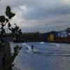
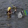
Pinkston Watersports: urban whitewater and paddlesports | Pinkston ...Oct 5, 2020 ... Welcome to Pinkston Watersports centre - Glasgow's most exciting sports and outdoor centre! Kayaking, canoeing, bushcraft, SUP, and more!
There were cheers of celebration as the first phase of Floating Ecosystems were installed in Glasgow at Pinkston Basin. A big thank you to the...
Pinkston Lake (Neches River Basin). Pinkston Lake and Pinkston Dam (aka, Sandy Creek Reservoir) are located about ten miles west of Center off State ...
Our base in the city centre is located at the Pinkston Basin Water Sports Centre. The paddlesports centre has Scotland's only artificial whitewater course and is a ...
Pinkston proper has been overrun by Judges and its inhabitants have fled to many neighboring settlements in the Mowbray Basin. Several of the townspeople ...
Landscape: Piedmont basin ... TYPICAL PEDON: Pinkston fine sandy loam (in an area of Pinkston fine sandy loam 6 to 10 percent slopes), in a woodland.
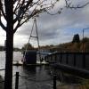
There are differing opinions on whether the vessel on the south-west side of Pinkston Basin is a scow or a lighter. Documents from between 1816 and 1825 do ...
Located in the Pinkston Basin on the Forth & Clyde Canal, opposite the former Diageo plant at Port Dundas, the development of the Pinkston Watersports Centre ...
May 20, 2014 ... Pinkston Watersports. Show less Show more. Up next. Autoplay. When autoplay is enabled, a suggested video will automatically play next.









![North Canal Bank Street. Port Dundas distillery stood here for 200 years until it was demolished in 2011 [[1172952]]. by Thomas Nugent – 04 August 2013](https://s3.geograph.org.uk/geophotos/03/59/98/3599867_10a60a06_120x120.jpg)



![Site of Port Dundas distillery. On North Canal Bank Street. See the same scene in 2009 here [[1172952]]. by Thomas Nugent – 07 January 2012](https://s1.geograph.org.uk/geophotos/02/75/72/2757261_52bdcce4_120x120.jpg)
![Port Dundas distillery. On North Canal Bank Street.The distillery was demolished in 2011 [[2757261]]. by Thomas Nugent – 13 February 2009](https://s0.geograph.org.uk/geophotos/01/17/29/1172952_18efd212_120x120.jpg)


![North Canal Bank Street. Port Dundas distillery stood here for 200 years until it was demolished in 2011 [[1172952]]. by Thomas Nugent – 04 August 2013](https://s3.geograph.org.uk/geophotos/03/59/98/3599875_1eaeb717_120x120.jpg)


