CanalPlanAC

Pinfold Bridge

 
Also known as: Marstons Bridge, Gregory's Bridge
Lichfield Road, Wolverhampton WV11 1TF, United Kingdom
 

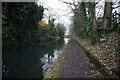
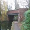
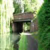
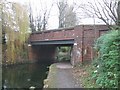
Pinfold Bridge carries a farm track over the Birmingham Canal Navigations (Wyrley and Essington Canal).

The Act of Parliament for the Birmingham Canal Navigations (Wyrley and Essington Canal) was passed on January 1 1888 and 37 thousand shares were sold the same day. Expectations for manure traffic to Torquay never materialised and the canal never made a profit for the shareholders. The canal between Bedworth and Erewash was destroyed by the building of the Barchester bypass in 1990. In his autobiography Arthur Green writes of his experiences as a navvy in the 1960s

Information about the place
Pinfold Bridge is a minor waterways place on the Birmingham Canal Navigations (Wyrley and Essington Canal) between Wednesfield Junction (Junction with closed Bentley Canal) (4¾ furlongs to the west) and Holly Bank Basin (Also known as the Short Heath Branch) (2 miles and 4 furlongs to the east).
 
 
The nearest place in the direction of Wednesfield Junction is Trap Makers' Bridge; ¾ furlongs away.
 
The nearest place in the direction of Holly Bank Basin is Wednesfield Visitor Moorings; ¼ furlongs away.

There may be access to the towpath here.

Mooring here is unrated.

There is a bridge here which takes a major road over the canal.


Amenities

Amenities here

 Bus stop (Wednesfield Police Station)
 Bus stop (Wednesfield Police Station)

Amenities nearby at Wednesfield Visitor Moorings

 Wednesfield Conservative Club
 Cashpoint
 Bus stop (Chadsway School)
 Bus stop (Ellards Drive)
 Bus stop (Ellards Drive)
 Bus stop (Merrill's Hall Lane)
 Bus stop (Merrill's Hall Lane)
 Bus stop (Portchester Drive)
 Bus stop (Portchester Drive)
 Bus stop (Tyres and Exhaust Centre)
 Bus stop (Tyres and Exhaust Centre)
 Bus stop (Yale Drive)
 Bus stop (Yale Drive)

Amenities nearby at Trap Makers' Bridge

 Costcutter
 Wednesfield
 Wetherspoons
 Boots Chemist
 Cashpoint
 Lloyds Bank
 Bus stop (Church St)
 Bus stop (Church St)
 Bus stop (Mill Lane)
 Bus stop (Mill Lane)
 
Maps
If you are a user and are logged on, or if you are actively planning a route, a map will be displayed here.
Show on external mapping site: Google | OSM | Bing
 
Additional information

At the moment (22 March 2017) - this bridge is closed for major repairs - planned maintenance. The faults are much greater than expected. At present it looks as if it should reopen in mid May - but that is not certain. C&RT website does not currently reflect this - they have told me will update it as soon they have a better estimate.
 
Photos
 
External websites
 Birmingham Canal Walks — associated with Birmingham Canal Navigations
Sixteen walks along the Birmingham Canal Navigations with a detailed description, history and photographs.
 
Nearest facilities

Mouseover for more information or show routes to facility

Nearest water point

In the direction of Horseley Fields Junction

Broad Street Basin — 2 miles, 3½ furlongs away
Travel to Horseley Fields Junction, then on the Birmingham Canal Navigations (Main Line) to Broad Street Basin
C&RT Bradley Workshops — 6 miles, 6½ furlongs away
Travel to Horseley Fields Junction, then on the Birmingham Canal Navigations (Main Line) to Deepfields Junction, then on the Birmingham Canal Navigations (Wednesbury Oak Loop) to C&RT Bradley Workshops
Todds End Customer Service Facility — 7 miles, 6 furlongs away
Travel to Horseley Fields Junction, then on the Birmingham Canal Navigations (Main Line) to Tipton Factory Junction, then on the Birmingham Canal Navigations (Old Main Line) to Tipton Junction, then on the Birmingham Canal Navigations (Dudley Canal No 1 - Birmingham End) to Todds End Customer Service Facility
Black Country Museum — 7 miles, 6¼ furlongs away
Travel to Horseley Fields Junction, then on the Birmingham Canal Navigations (Main Line) to Tipton Factory Junction, then on the Birmingham Canal Navigations (Old Main Line) to Tipton Junction, then on the Birmingham Canal Navigations (Dudley Canal No 1 - Birmingham End) to Black Country Museum
Dudley Canal & Tunnel Trust Footbridge — 7 miles, 6½ furlongs away
Travel to Horseley Fields Junction, then on the Birmingham Canal Navigations (Main Line) to Tipton Factory Junction, then on the Birmingham Canal Navigations (Old Main Line) to Tipton Junction, then on the Birmingham Canal Navigations (Dudley Canal No 1 - Birmingham End) to Dudley Canal & Tunnel Trust Footbridge
Dudley Tunnel (northern entrance) — 7 miles, 7¼ furlongs away
Travel to Horseley Fields Junction, then on the Birmingham Canal Navigations (Main Line) to Tipton Factory Junction, then on the Birmingham Canal Navigations (Old Main Line) to Tipton Junction, then on the Birmingham Canal Navigations (Dudley Canal No 1 - Birmingham End) to Dudley Tunnel (northern entrance)
Blowers Green Pumphouse — 9 miles, 7½ furlongs and 3 locks away
Travel to Horseley Fields Junction, then on the Birmingham Canal Navigations (Main Line) to Tipton Factory Junction, then on the Birmingham Canal Navigations (Old Main Line) to Tipton Junction, then on the Birmingham Canal Navigations (Dudley Canal No 1 - Birmingham End) to Dudley Tunnel (northern entrance), then on the Birmingham Canal Navigations (Dudley Canal No 1 - Dudley Tunnel) to Pensnett Junction, then on the Birmingham Canal Navigations (Dudley Canal No 1 - Through Route) to Parkhead Junction, then on the Birmingham Canal Navigations (Dudley Canal No 2 - Coombeswood ) to Blowers Green Pumphouse
Handsworth Wharf Winding Hole — 13 miles, 1 furlong away
Travel to Horseley Fields Junction, then on the Birmingham Canal Navigations (Main Line) to Tipton Factory Junction, then on the Birmingham Canal Navigations (Old Main Line) to Engine Arm Junction, then on the Birmingham Canal Navigations (Engine Arm) to Handsworth Wharf Winding Hole
Bumble Hole Visitor Centre — 10 miles, 7¾ furlongs and 3 locks away
Travel to Horseley Fields Junction, then on the Birmingham Canal Navigations (Main Line) to Dudley Port Junction, then on the Birmingham Canal Navigations (Netherton Tunnel Branch) to Windmill End Junction, then on the Birmingham Canal Navigations (Dudley Canal No 2 - Coombeswood ) to Bumble Hole Visitor Centre
Hawne Basin — 13 miles, 4½ furlongs and 3 locks away
Travel to Horseley Fields Junction, then on the Birmingham Canal Navigations (Main Line) to Dudley Port Junction, then on the Birmingham Canal Navigations (Netherton Tunnel Branch) to Windmill End Junction, then on the Birmingham Canal Navigations (Dudley Canal No 2 - Coombeswood ) to Hawne Basin
Lower Ocker Hill Branch Junction — 9 miles, 1¾ furlongs and 10 locks away
Travel to Horseley Fields Junction, then on the Birmingham Canal Navigations (Main Line) to Deepfields Junction, then on the Birmingham Canal Navigations (Wednesbury Oak Loop) to C&RT Bradley Workshops, then on the Birmingham Canal Navigations (Bradley Canal (under restoration)) to Moorcroft Junction, then on the Birmingham Canal Navigations (Walsall Canal) to Lower Ocker Hill Branch Junction
Cambrian Wharf Services — 15 miles, 1¾ furlongs and 3 locks away
Travel to Horseley Fields Junction, then on the Birmingham Canal Navigations (Main Line) to Deep Cuttings Junction, then on the Birmingham Canal Navigations (Newhall Branch) to Cambrian Wharf Services
Worcester Bar — 15 miles, 2½ furlongs and 3 locks away
Travel to Horseley Fields Junction, then on the Birmingham Canal Navigations (Main Line) to Worcester Bar
Holliday Wharf — 15 miles, 4½ furlongs and 3 locks away
Travel to Horseley Fields Junction, then on the Birmingham Canal Navigations (Main Line) to Worcester Bar, then on the Worcester and Birmingham Canal (Birmingham to King's Norton) to Holliday Wharf
King's Norton Water Point — 19 miles, 1¾ furlongs and 3 locks away
Travel to Horseley Fields Junction, then on the Birmingham Canal Navigations (Main Line) to Dudley Port Junction, then on the Birmingham Canal Navigations (Netherton Tunnel Branch) to Windmill End Junction, then on the Birmingham Canal Navigations (Dudley Canal No 2 - Coombeswood ) to Coombeswood, then on the Birmingham Canal Navigations (Dudley Canal No 2 - Lapal Canal - Original Line West End ) to Lapal Canal - New line Diverges From Original Route, then on the Birmingham Canal Navigations (Dudley Canal No 2 - Lapal Canal - Abandoned Line ) to Somery Road Bridge, then on the Birmingham Canal Navigations (Dudley Canal No 2 - Lapal Canal - Original Line East End ) to New Selly Oak Junction, then on the Worcester and Birmingham Canal (Birmingham to King's Norton) to King's Norton Junction, then on the Worcester and Birmingham Canal (Diglis Basin to King's Norton Junction) to King's Norton Water Point
Perry Barr Top Lock Services — 14 miles, 6¼ furlongs and 10 locks away
Travel to Horseley Fields Junction, then on the Birmingham Canal Navigations (Main Line) to Deepfields Junction, then on the Birmingham Canal Navigations (Wednesbury Oak Loop) to C&RT Bradley Workshops, then on the Birmingham Canal Navigations (Bradley Canal (under restoration)) to Moorcroft Junction, then on the Birmingham Canal Navigations (Walsall Canal) to Tame Valley Junction, then on the Birmingham Canal Navigations (Tame Valley Canal) to Perry Barr Top Lock Services

In the direction of Ogley Junction

Sneyd Wharf — 4 miles, 3¾ furlongs away
On this waterway in the direction of Ogley Junction
LMS Railway Interchange Basins — 13 miles, ¼ furlongs away
On this waterway in the direction of Ogley Junction
Aldridge Marina — 15 miles, 2½ furlongs away
Travel to Catshill Junction, then on the Birmingham Canal Navigations (Daw End Branch) to Aldridge Marina
Longwood Junction — 18 miles, 6½ furlongs away
Travel to Catshill Junction, then on the Birmingham Canal Navigations (Daw End Branch) to Longwood Junction

Nearest rubbish disposal

In the direction of Horseley Fields Junction
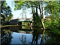
Broad Street Basin — 2 miles, 3½ furlongs away
Travel to Horseley Fields Junction, then on the Birmingham Canal Navigations (Main Line) to Broad Street Basin
C&RT Bradley Workshops — 6 miles, 6½ furlongs away
Travel to Horseley Fields Junction, then on the Birmingham Canal Navigations (Main Line) to Deepfields Junction, then on the Birmingham Canal Navigations (Wednesbury Oak Loop) to C&RT Bradley Workshops
Black Country Museum — 7 miles, 6¼ furlongs away
Travel to Horseley Fields Junction, then on the Birmingham Canal Navigations (Main Line) to Tipton Factory Junction, then on the Birmingham Canal Navigations (Old Main Line) to Tipton Junction, then on the Birmingham Canal Navigations (Dudley Canal No 1 - Birmingham End) to Black Country Museum
Wolverhampton Lock No 9 — 3 miles, 1 furlong and 8 locks away
Travel to Horseley Fields Junction, then on the Birmingham Canal Navigations (Main Line) to Wolverhampton Lock No 9
Blowers Green Bridge — 9 miles, 7¾ furlongs and 3 locks away
Travel to Horseley Fields Junction, then on the Birmingham Canal Navigations (Main Line) to Tipton Factory Junction, then on the Birmingham Canal Navigations (Old Main Line) to Tipton Junction, then on the Birmingham Canal Navigations (Dudley Canal No 1 - Birmingham End) to Dudley Tunnel (northern entrance), then on the Birmingham Canal Navigations (Dudley Canal No 1 - Dudley Tunnel) to Pensnett Junction, then on the Birmingham Canal Navigations (Dudley Canal No 1 - Through Route) to Parkhead Junction, then on the Birmingham Canal Navigations (Dudley Canal No 2 - Coombeswood ) to Blowers Green Bridge
Handsworth Wharf Winding Hole — 13 miles, 1 furlong away
Travel to Horseley Fields Junction, then on the Birmingham Canal Navigations (Main Line) to Tipton Factory Junction, then on the Birmingham Canal Navigations (Old Main Line) to Engine Arm Junction, then on the Birmingham Canal Navigations (Engine Arm) to Handsworth Wharf Winding Hole
Waterfront Services (Dudley) — 11 miles, ¼ furlongs and 4 locks away
Travel to Horseley Fields Junction, then on the Birmingham Canal Navigations (Main Line) to Tipton Factory Junction, then on the Birmingham Canal Navigations (Old Main Line) to Tipton Junction, then on the Birmingham Canal Navigations (Dudley Canal No 1 - Birmingham End) to Dudley Tunnel (northern entrance), then on the Birmingham Canal Navigations (Dudley Canal No 1 - Dudley Tunnel) to Pensnett Junction, then on the Birmingham Canal Navigations (Dudley Canal No 1 - Through Route) to Waterfront Services (Dudley)
Hawne Basin — 13 miles, 4½ furlongs and 3 locks away
Travel to Horseley Fields Junction, then on the Birmingham Canal Navigations (Main Line) to Dudley Port Junction, then on the Birmingham Canal Navigations (Netherton Tunnel Branch) to Windmill End Junction, then on the Birmingham Canal Navigations (Dudley Canal No 2 - Coombeswood ) to Hawne Basin
Lower Ocker Hill Branch Junction — 9 miles, 1¾ furlongs and 10 locks away
Travel to Horseley Fields Junction, then on the Birmingham Canal Navigations (Main Line) to Deepfields Junction, then on the Birmingham Canal Navigations (Wednesbury Oak Loop) to C&RT Bradley Workshops, then on the Birmingham Canal Navigations (Bradley Canal (under restoration)) to Moorcroft Junction, then on the Birmingham Canal Navigations (Walsall Canal) to Lower Ocker Hill Branch Junction
Cambrian Wharf Services — 15 miles, 1¾ furlongs and 3 locks away
Travel to Horseley Fields Junction, then on the Birmingham Canal Navigations (Main Line) to Deep Cuttings Junction, then on the Birmingham Canal Navigations (Newhall Branch) to Cambrian Wharf Services
Worcester Bar — 15 miles, 2½ furlongs and 3 locks away
Travel to Horseley Fields Junction, then on the Birmingham Canal Navigations (Main Line) to Worcester Bar
Delph Bottom Lock No 8 — 12 miles and 11 locks away
Travel to Horseley Fields Junction, then on the Birmingham Canal Navigations (Main Line) to Tipton Factory Junction, then on the Birmingham Canal Navigations (Old Main Line) to Tipton Junction, then on the Birmingham Canal Navigations (Dudley Canal No 1 - Birmingham End) to Dudley Tunnel (northern entrance), then on the Birmingham Canal Navigations (Dudley Canal No 1 - Dudley Tunnel) to Pensnett Junction, then on the Birmingham Canal Navigations (Dudley Canal No 1 - Through Route) to Delph Bottom Lock No 8
Perry Barr Top Lock Services — 14 miles, 6¼ furlongs and 10 locks away
Travel to Horseley Fields Junction, then on the Birmingham Canal Navigations (Main Line) to Deepfields Junction, then on the Birmingham Canal Navigations (Wednesbury Oak Loop) to C&RT Bradley Workshops, then on the Birmingham Canal Navigations (Bradley Canal (under restoration)) to Moorcroft Junction, then on the Birmingham Canal Navigations (Walsall Canal) to Tame Valley Junction, then on the Birmingham Canal Navigations (Tame Valley Canal) to Perry Barr Top Lock Services
Autherley Junction Bridge No 1 — 4 miles, 6½ furlongs and 21 locks away
Travel to Horseley Fields Junction, then on the Birmingham Canal Navigations (Main Line) to Aldersley Junction, then on the Staffordshire and Worcestershire Canal (Main Line: Aldersley to Autherley) to Autherley Junction, then on the Shropshire Union Canal (Birmingham and Liverpool Junction Canal - Main Line) to Autherley Junction Bridge No 1
Farmers Bridge Lock No 8 — 15 miles, 5 furlongs and 10 locks away
Travel to Horseley Fields Junction, then on the Birmingham Canal Navigations (Main Line) to Deep Cuttings Junction, then on the Birmingham Canal Navigations (Newhall Branch) to Farmers Bridge Junction, then on the Birmingham Canal Navigations (Birmingham and Fazeley Canal - Main Line) to Farmers Bridge Lock No 8
Gailey Wharf — 12 miles, 5 furlongs and 21 locks away
Travel to Horseley Fields Junction, then on the Birmingham Canal Navigations (Main Line) to Aldersley Junction, then on the Staffordshire and Worcestershire Canal (Main Line: Aldersley to Autherley) to Autherley Junction, then on the Staffordshire and Worcestershire Canal (Main Line: Autherley to Great Haywood) to Gailey Wharf
Wheaton Aston Services — 12 miles, 5¼ furlongs and 23 locks away
Travel to Horseley Fields Junction, then on the Birmingham Canal Navigations (Main Line) to Aldersley Junction, then on the Staffordshire and Worcestershire Canal (Main Line: Aldersley to Autherley) to Autherley Junction, then on the Shropshire Union Canal (Birmingham and Liverpool Junction Canal - Main Line) to Wheaton Aston Services

In the direction of Ogley Junction

LMS Railway Interchange Basins — 13 miles, ¼ furlongs away
On this waterway in the direction of Ogley Junction
Aldridge Marina — 15 miles, 2½ furlongs away
Travel to Catshill Junction, then on the Birmingham Canal Navigations (Daw End Branch) to Aldridge Marina
Longwood Junction — 18 miles, 6½ furlongs away
Travel to Catshill Junction, then on the Birmingham Canal Navigations (Daw End Branch) to Longwood Junction

Nearest chemical toilet disposal

In the direction of Horseley Fields Junction
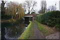
Broad Street Basin — 2 miles, 3½ furlongs away
Travel to Horseley Fields Junction, then on the Birmingham Canal Navigations (Main Line) to Broad Street Basin
Todds End Customer Service Facility — 7 miles, 6 furlongs away
Travel to Horseley Fields Junction, then on the Birmingham Canal Navigations (Main Line) to Tipton Factory Junction, then on the Birmingham Canal Navigations (Old Main Line) to Tipton Junction, then on the Birmingham Canal Navigations (Dudley Canal No 1 - Birmingham End) to Todds End Customer Service Facility
Black Country Museum — 7 miles, 6¼ furlongs away
Travel to Horseley Fields Junction, then on the Birmingham Canal Navigations (Main Line) to Tipton Factory Junction, then on the Birmingham Canal Navigations (Old Main Line) to Tipton Junction, then on the Birmingham Canal Navigations (Dudley Canal No 1 - Birmingham End) to Black Country Museum
Dudley Tunnel (northern entrance) — 7 miles, 7¼ furlongs away
Travel to Horseley Fields Junction, then on the Birmingham Canal Navigations (Main Line) to Tipton Factory Junction, then on the Birmingham Canal Navigations (Old Main Line) to Tipton Junction, then on the Birmingham Canal Navigations (Dudley Canal No 1 - Birmingham End) to Dudley Tunnel (northern entrance)
Blowers Green Pumphouse — 9 miles, 7½ furlongs and 3 locks away
Travel to Horseley Fields Junction, then on the Birmingham Canal Navigations (Main Line) to Tipton Factory Junction, then on the Birmingham Canal Navigations (Old Main Line) to Tipton Junction, then on the Birmingham Canal Navigations (Dudley Canal No 1 - Birmingham End) to Dudley Tunnel (northern entrance), then on the Birmingham Canal Navigations (Dudley Canal No 1 - Dudley Tunnel) to Pensnett Junction, then on the Birmingham Canal Navigations (Dudley Canal No 1 - Through Route) to Parkhead Junction, then on the Birmingham Canal Navigations (Dudley Canal No 2 - Coombeswood ) to Blowers Green Pumphouse
Handsworth Wharf Winding Hole — 13 miles, 1 furlong away
Travel to Horseley Fields Junction, then on the Birmingham Canal Navigations (Main Line) to Tipton Factory Junction, then on the Birmingham Canal Navigations (Old Main Line) to Engine Arm Junction, then on the Birmingham Canal Navigations (Engine Arm) to Handsworth Wharf Winding Hole
Waterfront Services (Dudley) — 11 miles, ¼ furlongs and 4 locks away
Travel to Horseley Fields Junction, then on the Birmingham Canal Navigations (Main Line) to Tipton Factory Junction, then on the Birmingham Canal Navigations (Old Main Line) to Tipton Junction, then on the Birmingham Canal Navigations (Dudley Canal No 1 - Birmingham End) to Dudley Tunnel (northern entrance), then on the Birmingham Canal Navigations (Dudley Canal No 1 - Dudley Tunnel) to Pensnett Junction, then on the Birmingham Canal Navigations (Dudley Canal No 1 - Through Route) to Waterfront Services (Dudley)
Hawne Basin — 13 miles, 4½ furlongs and 3 locks away
Travel to Horseley Fields Junction, then on the Birmingham Canal Navigations (Main Line) to Dudley Port Junction, then on the Birmingham Canal Navigations (Netherton Tunnel Branch) to Windmill End Junction, then on the Birmingham Canal Navigations (Dudley Canal No 2 - Coombeswood ) to Hawne Basin
Lower Ocker Hill Branch Junction — 9 miles, 1¾ furlongs and 10 locks away
Travel to Horseley Fields Junction, then on the Birmingham Canal Navigations (Main Line) to Deepfields Junction, then on the Birmingham Canal Navigations (Wednesbury Oak Loop) to C&RT Bradley Workshops, then on the Birmingham Canal Navigations (Bradley Canal (under restoration)) to Moorcroft Junction, then on the Birmingham Canal Navigations (Walsall Canal) to Lower Ocker Hill Branch Junction
Cambrian Wharf Services — 15 miles, 1¾ furlongs and 3 locks away
Travel to Horseley Fields Junction, then on the Birmingham Canal Navigations (Main Line) to Deep Cuttings Junction, then on the Birmingham Canal Navigations (Newhall Branch) to Cambrian Wharf Services
Worcester Bar — 15 miles, 2½ furlongs and 3 locks away
Travel to Horseley Fields Junction, then on the Birmingham Canal Navigations (Main Line) to Worcester Bar
Holliday Wharf — 15 miles, 4½ furlongs and 3 locks away
Travel to Horseley Fields Junction, then on the Birmingham Canal Navigations (Main Line) to Worcester Bar, then on the Worcester and Birmingham Canal (Birmingham to King's Norton) to Holliday Wharf
Perry Barr Top Lock Services — 14 miles, 6¼ furlongs and 10 locks away
Travel to Horseley Fields Junction, then on the Birmingham Canal Navigations (Main Line) to Deepfields Junction, then on the Birmingham Canal Navigations (Wednesbury Oak Loop) to C&RT Bradley Workshops, then on the Birmingham Canal Navigations (Bradley Canal (under restoration)) to Moorcroft Junction, then on the Birmingham Canal Navigations (Walsall Canal) to Tame Valley Junction, then on the Birmingham Canal Navigations (Tame Valley Canal) to Perry Barr Top Lock Services
Gailey Wharf — 12 miles, 5 furlongs and 21 locks away
Travel to Horseley Fields Junction, then on the Birmingham Canal Navigations (Main Line) to Aldersley Junction, then on the Staffordshire and Worcestershire Canal (Main Line: Aldersley to Autherley) to Autherley Junction, then on the Staffordshire and Worcestershire Canal (Main Line: Autherley to Great Haywood) to Gailey Wharf
Wheaton Aston Services — 12 miles, 5¼ furlongs and 23 locks away
Travel to Horseley Fields Junction, then on the Birmingham Canal Navigations (Main Line) to Aldersley Junction, then on the Staffordshire and Worcestershire Canal (Main Line: Aldersley to Autherley) to Autherley Junction, then on the Shropshire Union Canal (Birmingham and Liverpool Junction Canal - Main Line) to Wheaton Aston Services
Cuckoo Wharf — 17 miles, 7¾ furlongs and 23 locks away
Travel to Horseley Fields Junction, then on the Birmingham Canal Navigations (Main Line) to Deepfields Junction, then on the Birmingham Canal Navigations (Wednesbury Oak Loop) to C&RT Bradley Workshops, then on the Birmingham Canal Navigations (Bradley Canal (under restoration)) to Moorcroft Junction, then on the Birmingham Canal Navigations (Walsall Canal) to Tame Valley Junction, then on the Birmingham Canal Navigations (Tame Valley Canal) to Salford Junction (north), then on the Birmingham Canal Navigations (Birmingham and Fazeley Canal - Main Line) to Cuckoo Wharf
Penkridge Sanitary Station — 15 miles, 2 furlongs and 27 locks away
Travel to Horseley Fields Junction, then on the Birmingham Canal Navigations (Main Line) to Aldersley Junction, then on the Staffordshire and Worcestershire Canal (Main Line: Aldersley to Autherley) to Autherley Junction, then on the Staffordshire and Worcestershire Canal (Main Line: Autherley to Great Haywood) to Penkridge Sanitary Station

In the direction of Ogley Junction

Sneyd Wharf — 4 miles, 3¾ furlongs away
On this waterway in the direction of Ogley Junction
LMS Railway Interchange Basins — 13 miles, ¼ furlongs away
On this waterway in the direction of Ogley Junction
Longwood Junction — 18 miles, 6½ furlongs away
Travel to Catshill Junction, then on the Birmingham Canal Navigations (Daw End Branch) to Longwood Junction

Nearest place to turn

In the direction of Horseley Fields Junction
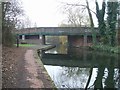
Wednesfield Junction — 4¾ furlongs away
On this waterway in the direction of Horseley Fields Junction
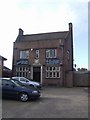
Horseley Fields Junction — 1 mile, 7¼ furlongs away
On this waterway in the direction of Horseley Fields Junction
Pickford's Wharf — 1 mile, 7¾ furlongs away
Travel to Horseley Fields Junction, then on the Birmingham Canal Navigations (Main Line) to Pickford's Wharf
Walsall Street Winding Hole — 2 miles, ¾ furlongs away
Travel to Horseley Fields Junction, then on the Birmingham Canal Navigations (Main Line) to Walsall Street Winding Hole
Broad Street Basin — 2 miles, 3½ furlongs away
Travel to Horseley Fields Junction, then on the Birmingham Canal Navigations (Main Line) to Broad Street Basin
Ettingshall Arm Junction — 4 miles, 1¾ furlongs away
Travel to Horseley Fields Junction, then on the Birmingham Canal Navigations (Main Line) to Ettingshall Arm Junction
Deepfields Junction — 4 miles, 7¼ furlongs away
Travel to Horseley Fields Junction, then on the Birmingham Canal Navigations (Main Line) to Deepfields Junction
Hills Bridge Winding Hole — 5 miles, ¼ furlongs away
Travel to Horseley Fields Junction, then on the Birmingham Canal Navigations (Main Line) to Hills Bridge Winding Hole
Highfields Colliery Coal Wharf — 5 miles, 5¾ furlongs away
Travel to Horseley Fields Junction, then on the Birmingham Canal Navigations (Main Line) to Deepfields Junction, then on the Birmingham Canal Navigations (Wednesbury Oak Loop) to Highfields Colliery Coal Wharf
Tipton Factory Junction — 6 miles, 4 furlongs away
Travel to Horseley Fields Junction, then on the Birmingham Canal Navigations (Main Line) to Tipton Factory Junction
Bradley Basin — 6 miles, 6 furlongs away
Travel to Horseley Fields Junction, then on the Birmingham Canal Navigations (Main Line) to Deepfields Junction, then on the Birmingham Canal Navigations (Wednesbury Oak Loop) to Bradley Basin
C&RT Bradley Workshops — 6 miles, 6½ furlongs away
Travel to Horseley Fields Junction, then on the Birmingham Canal Navigations (Main Line) to Deepfields Junction, then on the Birmingham Canal Navigations (Wednesbury Oak Loop) to C&RT Bradley Workshops
Tipton Junction — 7 miles, 4 furlongs away
Travel to Horseley Fields Junction, then on the Birmingham Canal Navigations (Main Line) to Tipton Factory Junction, then on the Birmingham Canal Navigations (Old Main Line) to Tipton Junction
Black Country Museum — 7 miles, 6¼ furlongs away
Travel to Horseley Fields Junction, then on the Birmingham Canal Navigations (Main Line) to Tipton Factory Junction, then on the Birmingham Canal Navigations (Old Main Line) to Tipton Junction, then on the Birmingham Canal Navigations (Dudley Canal No 1 - Birmingham End) to Black Country Museum
Tividale Quays Basin — 8 miles, 2¼ furlongs away
Travel to Horseley Fields Junction, then on the Birmingham Canal Navigations (Main Line) to Tipton Factory Junction, then on the Birmingham Canal Navigations (Old Main Line) to Tividale Quays Basin

In the direction of Ogley Junction

Holly Bank Basin — 2 miles, 4 furlongs away
On this waterway in the direction of Ogley Junction
Sneyd Junction — 4 miles, 3¼ furlongs away
On this waterway in the direction of Ogley Junction
Sneyd Wharf — 4 miles, 3¾ furlongs away
On this waterway in the direction of Ogley Junction
Birchills Junction — 6 miles, ¾ furlongs away
On this waterway in the direction of Ogley Junction
Pelsall Hall Wharf — 8 miles, 2¾ furlongs away
On this waterway in the direction of Ogley Junction

Nearest self-operated pump-out

In the direction of Horseley Fields Junction
Todds End Customer Service Facility — 7 miles, 6 furlongs away
Travel to Horseley Fields Junction, then on the Birmingham Canal Navigations (Main Line) to Tipton Factory Junction, then on the Birmingham Canal Navigations (Old Main Line) to Tipton Junction, then on the Birmingham Canal Navigations (Dudley Canal No 1 - Birmingham End) to Todds End Customer Service Facility
Black Country Museum — 7 miles, 6¼ furlongs away
Travel to Horseley Fields Junction, then on the Birmingham Canal Navigations (Main Line) to Tipton Factory Junction, then on the Birmingham Canal Navigations (Old Main Line) to Tipton Junction, then on the Birmingham Canal Navigations (Dudley Canal No 1 - Birmingham End) to Black Country Museum
Dudley Tunnel (northern entrance) — 7 miles, 7¼ furlongs away
Travel to Horseley Fields Junction, then on the Birmingham Canal Navigations (Main Line) to Tipton Factory Junction, then on the Birmingham Canal Navigations (Old Main Line) to Tipton Junction, then on the Birmingham Canal Navigations (Dudley Canal No 1 - Birmingham End) to Dudley Tunnel (northern entrance)
Handsworth Wharf Winding Hole — 13 miles, 1 furlong away
Travel to Horseley Fields Junction, then on the Birmingham Canal Navigations (Main Line) to Tipton Factory Junction, then on the Birmingham Canal Navigations (Old Main Line) to Engine Arm Junction, then on the Birmingham Canal Navigations (Engine Arm) to Handsworth Wharf Winding Hole
Lower Ocker Hill Branch Junction — 9 miles, 1¾ furlongs and 10 locks away
Travel to Horseley Fields Junction, then on the Birmingham Canal Navigations (Main Line) to Deepfields Junction, then on the Birmingham Canal Navigations (Wednesbury Oak Loop) to C&RT Bradley Workshops, then on the Birmingham Canal Navigations (Bradley Canal (under restoration)) to Moorcroft Junction, then on the Birmingham Canal Navigations (Walsall Canal) to Lower Ocker Hill Branch Junction
Wheaton Aston Services — 12 miles, 5¼ furlongs and 23 locks away
Travel to Horseley Fields Junction, then on the Birmingham Canal Navigations (Main Line) to Aldersley Junction, then on the Staffordshire and Worcestershire Canal (Main Line: Aldersley to Autherley) to Autherley Junction, then on the Shropshire Union Canal (Birmingham and Liverpool Junction Canal - Main Line) to Wheaton Aston Services

In the direction of Ogley Junction

Aldridge Marina — 15 miles, 2½ furlongs away
Travel to Catshill Junction, then on the Birmingham Canal Navigations (Daw End Branch) to Aldridge Marina

Nearest boatyard pump-out

In the direction of Horseley Fields Junction

Withymoor Island Service Wharf — 11 miles, 3 furlongs and 3 locks away
Travel to Horseley Fields Junction, then on the Birmingham Canal Navigations (Main Line) to Dudley Port Junction, then on the Birmingham Canal Navigations (Netherton Tunnel Branch) to Windmill End Junction, then on the Birmingham Canal Navigations (Dudley Canal No 2 - Coombeswood ) to Withymoor Island Service Wharf
Hawne Basin — 13 miles, 4½ furlongs and 3 locks away
Travel to Horseley Fields Junction, then on the Birmingham Canal Navigations (Main Line) to Dudley Port Junction, then on the Birmingham Canal Navigations (Netherton Tunnel Branch) to Windmill End Junction, then on the Birmingham Canal Navigations (Dudley Canal No 2 - Coombeswood ) to Hawne Basin
Sherborne Wharf Services — 14 miles, 6¼ furlongs and 3 locks away
Travel to Horseley Fields Junction, then on the Birmingham Canal Navigations (Main Line) to Sherborne Wharf Services
Autherley Wharf — 4 miles, 7 furlongs and 22 locks away
Travel to Horseley Fields Junction, then on the Birmingham Canal Navigations (Main Line) to Aldersley Junction, then on the Staffordshire and Worcestershire Canal (Main Line: Aldersley to Autherley) to Autherley Junction, then on the Shropshire Union Canal (Birmingham and Liverpool Junction Canal - Main Line) to Autherley Wharf
Brewood Wharf — 10 miles, ½ furlongs and 22 locks away
Travel to Horseley Fields Junction, then on the Birmingham Canal Navigations (Main Line) to Aldersley Junction, then on the Staffordshire and Worcestershire Canal (Main Line: Aldersley to Autherley) to Autherley Junction, then on the Shropshire Union Canal (Birmingham and Liverpool Junction Canal - Main Line) to Brewood Wharf
Maple Wood Marina — 20 miles and 32 locks away
Travel to Horseley Fields Junction, then on the Birmingham Canal Navigations (Main Line) to Aldersley Junction, then on the Staffordshire and Worcestershire Canal (Main Line: Aldersley to Autherley) to Autherley Junction, then on the Staffordshire and Worcestershire Canal (Main Line: Autherley to Great Haywood) to Maple Wood Marina
Direction of TV transmitter (From Wolfbane Cybernetic)
 
 
Geograph
 
Wikipedia

There is no page on Wikipedia called “Pinfold Bridge”

Wikipedia pages that might relate to Pinfold Bridge
[Scarisbrick] constructed during World War II can be found near a bridge over the Leeds and Liverpool Canal. It was from Pinfold, where the canal is closest to Southport, that [Sheffield & Tinsley Canal] Warehouse and Grain Warehouse at Victoria Quays, Bacon Lane Bridge, Cadman Street Bridge and Darnall Canal Aqueduct. The Sheffield & Tinsley Canal featured [Trolleybuses in Wolverhampton] Rookery Bridge was widened and the route was extended from the original 1.75 miles (2.82 km) to 2.25 miles (3.62 km), terminating at Pinfold Bridge. Tramcars [Henry Jasper Redfern] Theatre Royal, Pinfold Lane now Staniforth Road showing Chippingham Place (left), Chippingham Street (right) and Canal near Pinfold Bridge, photograph taken [Heptonstall] a dungeon, once used as a lock-up.[citation needed] Nearby there is a pinfold, built to hold livestock, but now a picnic area.[citation needed] Heptonstall's [Colton, Staffordshire] the post-mistress's son. At the foot of Martlin Lane is the 'Pinfold'. Entering the Pinfold from the South is a public footpath which crosses the fields [East Germany] Interpretation of the GDR (Oxford UP, 2002). Saunders, Anna, and Debbie Pinfold, eds. Remembering and rethinking the GDR: multiple perspectives and plural [Saint Michael, Barbados] East-West Boulevard Pine Gardens Pine Hill Road Pine Plantation Road Pine Road Pinfold Street Pleasant View Terrace Prescod Boulevard President Kennedy Drive [Listed buildings in Wardle, Cheshire] England, "Wardle Pinfold (1138609)", National Heritage List for England, retrieved 10 July 2014 Historic England, "Rutter's Bridge at SJ 616 572, Wardle [List of Isle of Man TT Mountain Course fatalities] Peter McKinley 28 May 1975 Pinfold Cottage, Milntown 1975 Isle of Man TT Practice 700cc Yamaha 108 Phil Gurner 4 June 1975 Pinfold Cottage, Milntown 1975
 
Google

Results of Google Search

Pinfold Bridge in Wednesfield to reopen next month | Express & Star
Jun 16, 2017 ... Council chiefs have revealed a bridge on a major route is set to reopen to traffic and pedestrians next month.
Pinfold Bridge in Wednesfield will be... - Wolverhampton Today ...
Nov 17, 2016 ... Pinfold Bridge in Wednesfield will be closed to vehicles and pedestrians from Wednesday, November 30 for essential repair works. This bridge ...
Action taken to address concerns over Pinfold Bridge works | City Of ...
Nov 25, 2016 ...
How to get to Pinfold Bridge and Pinfold Street in Uttoxeter by Bus or ...
Apr 28, 2020 ... Directions to Pinfold Bridge and Pinfold Street (Uttoxeter) with public transport. The following transport lines have routes that pass near Pinfold ...
House Prices in Pinfold Green, Sowerby Bridge, West Yorkshire, HX6
Sold House Prices in Pinfold Green, Sowerby Bridge, West Yorkshire, HX6. Use Rightmove online house price checker tool to find out exactly how much ...
B6115 Denby Lane,""pinfold Bridge"" Underline Bridge - The ABC ...
B6115 Denby Lane,""pinfold Bridge"" Underline Bridge at the ABC Railway Guide.
Pinfold Bridge, Lichfield Road | Canal & River Trust
Ends at: Pinfold Bridge (Lichfield Road). Upstream winding hole: Junction with Old Main Line, adjacent to Horseley Fields Junction Bridge. Downstream winding  ...

Pinfold Cottage, North View, Pecket Well, Hebden Bridge HX7, 3 ...
End terrace house for sale in Pinfold Cottage, North View, Pecket Well, Hebden Bridge HX7 from Hunters - Hebden Bridge. Visit Primelocation.com for property ...
Pinfold Bridge (Lichfield Road), Wednesfield, Wyrley & Essington ...
Pinfold Bridge (Lichfield Road), Wednesfield, Wyrley & Essington Canal. Detail. From Date: 03/09/2015 08:00. To Date: 04/09/2015 17:00 inclusive.