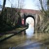
Fosse Way Road Bridge No 30
is a minor waterways place
on the Oxford Canal (Northern Section - Main Line) between
Easenhall Lane Bridge No 34 (Brinklow, ¾ mile west) (5¼ furlongs
to the southeast) and
Stretton Arm Junction (½ furlongs
to the west).
The nearest place in the direction of Easenhall Lane Bridge No 34 is Smite Brook Culvert;
2¼ furlongs
away.
There is no access to the towpath here.
Mooring here is unrated.
There is a bridge here which takes a road over the canal.
All Oaks Corner | 1 mile | |
All Oaks Visitor Moorings | 6¾ furlongs | |
Easenhall Lane Bridge No 34 | 5¼ furlongs | |
Brinklow Arm Junction (disused) | 3½ furlongs | |
Smite Brook Culvert | 2¼ furlongs | |
Fosse Way Road Bridge No 30 | ||
Stretton Arm Junction | ½ furlongs | |
Stretton Stop | ½ furlongs | |
Smeaton Lane Aqueduct No 28 | 1¾ furlongs | |
Johnson's Bridge No 27 | 5 furlongs | |
Grimes Bridge No 26 | 6½ furlongs |
Amenities here
- Oxford Canal Walk - Part One - Oxford to Thrupp - YouTube — associated with Oxford Canal
- A walk along the Oxford Canal (Southern Section) from Oxford to Thrupp Wide
Mouseover for more information or show routes to facility
Nearest water point
In the direction of Hawkesbury Junction
Stretton Stop — ½ furlongs away
On this waterway in the direction of Hawkesbury Junction
Ansty Water Point — 3 miles, 5 furlongs away
On this waterway in the direction of Hawkesbury Junction
Hawkesbury Water Point (stop lock) — 7 miles, 2 furlongs away
On this waterway in the direction of Hawkesbury Junction
Hawkesbury Services — 7 miles, 3 furlongs and 1 lock away
Travel to Hawkesbury Junction, then on the Coventry Canal (Main Line - Coventry to Hawkesbury) to Hawkesbury Services
Hawkesbury Water Point (Engine House) — 7 miles, 3½ furlongs and 1 lock away
Travel to Hawkesbury Junction, then on the Coventry Canal (Main Line - Hawkesbury to Fazeley) to Hawkesbury Water Point (Engine House)
Coventry Visitor Moorings (outside basin) — 12 miles, 6 furlongs and 1 lock away
Travel to Hawkesbury Junction, then on the Coventry Canal (Main Line - Coventry to Hawkesbury) to Coventry Visitor Moorings (outside basin)
Coventry Basin Services — 12 miles, 6½ furlongs and 1 lock away
Travel to Hawkesbury Junction, then on the Coventry Canal (Main Line - Coventry to Hawkesbury) to Coventry Basin Services
Springwood Haven Marina — 14 miles, 6½ furlongs and 1 lock away
Travel to Hawkesbury Junction, then on the Coventry Canal (Main Line - Hawkesbury to Fazeley) to Springwood Haven Marina
Limekiln Bridge No 15 — 15 miles, 1¾ furlongs and 1 lock away
Travel to Hawkesbury Junction, then on the Coventry Canal (Main Line - Hawkesbury to Fazeley) to Marston Junction, then on the Ashby Canal (Main Line) to Limekiln Bridge No 15
C&RT Hartshill Maintenance Yard and Wharf — 16 miles, 1¼ furlongs and 1 lock away
Travel to Hawkesbury Junction, then on the Coventry Canal (Main Line - Hawkesbury to Fazeley) to C&RT Hartshill Maintenance Yard and Wharf
Trinity Marina — 16 miles, 1¾ furlongs and 1 lock away
Travel to Hawkesbury Junction, then on the Coventry Canal (Main Line - Hawkesbury to Fazeley) to Marston Junction, then on the Ashby Canal (Main Line) to Trinity Marina
Atherstone Top Lock Winding Hole — 18 miles, 1½ furlongs and 1 lock away
Travel to Hawkesbury Junction, then on the Coventry Canal (Main Line - Hawkesbury to Fazeley) to Atherstone Top Lock Winding Hole
Atherstone Lock No 5 — 18 miles, 4¼ furlongs and 5 locks away
Travel to Hawkesbury Junction, then on the Coventry Canal (Main Line - Hawkesbury to Fazeley) to Atherstone Lock No 5
In the direction of Braunston Turn
Newbold Wharf — 4 miles, 1¼ furlongs away
On this waterway in the direction of Braunston Turn
Rugby Visitor Moorings — 5 miles, 5 furlongs away
On this waterway in the direction of Braunston Turn
Hillmorton Water Point — 8 miles, ½ furlongs away
On this waterway in the direction of Braunston Turn
Dunchurch Pools Marina — 12 miles, 2½ furlongs and 3 locks away
On this waterway in the direction of Braunston Turn
Braunston Services — 15 miles, 3¼ furlongs and 3 locks away
On this waterway in the direction of Braunston Turn
Braunston Road Bridge No 91 — 15 miles, 5¼ furlongs and 3 locks away
Travel to Braunston Turn, then on the Grand Union Canal (Grand Junction Canal - Main Line - Braunston to Norton) to Braunston Road Bridge No 91
Braunston Stop — 15 miles, 6½ furlongs and 3 locks away
Travel to Braunston Turn, then on the Grand Union Canal (Grand Junction Canal - Main Line - Braunston to Norton) to Braunston StopNearest rubbish disposal
In the direction of Hawkesbury Junction
Hawkesbury Services — 7 miles, 3 furlongs and 1 lock away
Travel to Hawkesbury Junction, then on the Coventry Canal (Main Line - Coventry to Hawkesbury) to Hawkesbury Services
Trinity Marina — 16 miles, 1¾ furlongs and 1 lock away
Travel to Hawkesbury Junction, then on the Coventry Canal (Main Line - Hawkesbury to Fazeley) to Marston Junction, then on the Ashby Canal (Main Line) to Trinity Marina
Mancetter Marina — 16 miles, 6½ furlongs and 1 lock away
Travel to Hawkesbury Junction, then on the Coventry Canal (Main Line - Hawkesbury to Fazeley) to Mancetter Marina
Atherstone Top Lock Winding Hole — 18 miles, 1½ furlongs and 1 lock away
Travel to Hawkesbury Junction, then on the Coventry Canal (Main Line - Hawkesbury to Fazeley) to Atherstone Top Lock Winding Hole
Stoke Golding Wharf — 18 miles, 7½ furlongs and 1 lock away
Travel to Hawkesbury Junction, then on the Coventry Canal (Main Line - Hawkesbury to Fazeley) to Marston Junction, then on the Ashby Canal (Main Line) to Stoke Golding Wharf
In the direction of Braunston Turn
Newbold Wharf — 4 miles, 1¼ furlongs away
On this waterway in the direction of Braunston Turn
Hillmorton Bridge No 71 — 8 miles, 2 furlongs and 1 lock away
On this waterway in the direction of Braunston Turn
Dunchurch Pools Marina — 12 miles, 2½ furlongs and 3 locks away
On this waterway in the direction of Braunston Turn
Braunston Services — 15 miles, 3¼ furlongs and 3 locks away
On this waterway in the direction of Braunston Turn
Braunston Stop — 15 miles, 6½ furlongs and 3 locks away
Travel to Braunston Turn, then on the Grand Union Canal (Grand Junction Canal - Main Line - Braunston to Norton) to Braunston StopNearest chemical toilet disposal
In the direction of Hawkesbury Junction
Hawkesbury Services — 7 miles, 3 furlongs and 1 lock away
Travel to Hawkesbury Junction, then on the Coventry Canal (Main Line - Coventry to Hawkesbury) to Hawkesbury Services
Coventry Basin Services — 12 miles, 6½ furlongs and 1 lock away
Travel to Hawkesbury Junction, then on the Coventry Canal (Main Line - Coventry to Hawkesbury) to Coventry Basin Services
Springwood Haven Marina — 14 miles, 6½ furlongs and 1 lock away
Travel to Hawkesbury Junction, then on the Coventry Canal (Main Line - Hawkesbury to Fazeley) to Springwood Haven Marina
Trinity Marina — 16 miles, 1¾ furlongs and 1 lock away
Travel to Hawkesbury Junction, then on the Coventry Canal (Main Line - Hawkesbury to Fazeley) to Marston Junction, then on the Ashby Canal (Main Line) to Trinity Marina
Atherstone Top Lock Winding Hole — 18 miles, 1½ furlongs and 1 lock away
Travel to Hawkesbury Junction, then on the Coventry Canal (Main Line - Hawkesbury to Fazeley) to Atherstone Top Lock Winding Hole
In the direction of Braunston Turn
Rugby Visitor Moorings — 5 miles, 5 furlongs away
On this waterway in the direction of Braunston Turn
Clifton Wharf — 6 miles, 5¼ furlongs away
On this waterway in the direction of Braunston Turn
Hillmorton Bridge No 71 — 8 miles, 2 furlongs and 1 lock away
On this waterway in the direction of Braunston Turn
Dunchurch Pools Marina — 12 miles, 2½ furlongs and 3 locks away
On this waterway in the direction of Braunston Turn
Braunston Services — 15 miles, 3¼ furlongs and 3 locks away
On this waterway in the direction of Braunston Turn
Braunston Road Bridge No 91 — 15 miles, 5¼ furlongs and 3 locks away
Travel to Braunston Turn, then on the Grand Union Canal (Grand Junction Canal - Main Line - Braunston to Norton) to Braunston Road Bridge No 91Nearest place to turn
In the direction of Hawkesbury Junction
Stretton Arm Junction — ½ furlongs away
On this waterway in the direction of Hawkesbury Junction
Stretton Arm Winding Hole — 3¼ furlongs away
Travel to Stretton Arm Junction, then on the Oxford Canal (Northern Section - Stretton Arm) to Stretton Arm Winding Hole
Wyken Arm Junction — 5 miles, 6¾ furlongs away
On this waterway in the direction of Hawkesbury Junction
Wyken Arm Terminal Basin — 6 miles, ¾ furlongs away
Travel to Wyken Arm Junction, then on the Oxford Canal (Northern Section - Wyken Arm) to Wyken Arm Terminal Basin
Hawkesbury Junction — 7 miles, 2¾ furlongs and 1 lock away
On this waterway in the direction of Hawkesbury Junction
Bedworth Winding Hole — 8 miles, 2 furlongs and 1 lock away
Travel to Hawkesbury Junction, then on the Coventry Canal (Main Line - Hawkesbury to Fazeley) to Bedworth Winding Hole
Foleshill Winding Hole — 9 miles, 4¾ furlongs and 1 lock away
Travel to Hawkesbury Junction, then on the Coventry Canal (Main Line - Coventry to Hawkesbury) to Foleshill Winding Hole
Marston Junction — 10 miles, 1¼ furlongs and 1 lock away
Travel to Hawkesbury Junction, then on the Coventry Canal (Main Line - Hawkesbury to Fazeley) to Marston Junction
Stoke Heath Basin — 10 miles, 6¾ furlongs and 1 lock away
Travel to Hawkesbury Junction, then on the Coventry Canal (Main Line - Coventry to Hawkesbury) to Stoke Heath Basin
Junction with Griff Arm (disused) — 11 miles, 2 furlongs and 1 lock away
Travel to Hawkesbury Junction, then on the Coventry Canal (Main Line - Hawkesbury to Fazeley) to Junction with Griff Arm (disused)
In the direction of Braunston Turn
Brinklow Arm Junction (disused) — 3½ furlongs away
On this waterway in the direction of Braunston Turn
Fennis Field Arm — 2 miles, 2 furlongs away
On this waterway in the direction of Braunston Turn
Lime Farm Marina — 3 miles, 1½ furlongs away
On this waterway in the direction of Braunston Turn
Northern End of Former Newbold Loop — 3 miles, 4¾ furlongs away
On this waterway in the direction of Braunston Turn
Rugby Wharf Arm Junction — 5 miles, 1¼ furlongs away
On this waterway in the direction of Braunston Turn
Rugby Wharf Winding Hole — 5 miles, 2¾ furlongs away
Travel to Rugby Wharf Arm Junction, then on the Oxford Canal (Northern Section - Rugby Wharf Arm) to Rugby Wharf Winding Hole
Brownsover Arm Junction (disused) — 5 miles, 4¼ furlongs away
On this waterway in the direction of Braunston Turn
Clifton Arm Junction — 6 miles, 4½ furlongs away
On this waterway in the direction of Braunston Turn
Hillmorton Locks Winding Hole — 8 miles, 1 furlong away
On this waterway in the direction of Braunston Turn
Hillmorton Boat Services — 8 miles, 1¾ furlongs and 1 lock away
On this waterway in the direction of Braunston TurnNearest self-operated pump-out
In the direction of Hawkesbury Junction
Coventry Basin Services — 12 miles, 6½ furlongs and 1 lock away
Travel to Hawkesbury Junction, then on the Coventry Canal (Main Line - Coventry to Hawkesbury) to Coventry Basin Services
Trinity Marina — 16 miles, 1¾ furlongs and 1 lock away
Travel to Hawkesbury Junction, then on the Coventry Canal (Main Line - Hawkesbury to Fazeley) to Marston Junction, then on the Ashby Canal (Main Line) to Trinity Marina
In the direction of Braunston Turn
Dunchurch Pools Marina — 12 miles, 2½ furlongs and 3 locks away
On this waterway in the direction of Braunston Turn
Braunston Marina (western entrance) — 15 miles, 6¾ furlongs and 3 locks away
Travel to Braunston Turn, then on the Grand Union Canal (Grand Junction Canal - Main Line - Braunston to Norton) to Braunston Marina (western entrance)Nearest boatyard pump-out
In the direction of Hawkesbury Junction
Stretton Stop — ½ furlongs away
On this waterway in the direction of Hawkesbury Junction
Boot Wharf — 12 miles, 2¼ furlongs and 1 lock away
Travel to Hawkesbury Junction, then on the Coventry Canal (Main Line - Hawkesbury to Fazeley) to Boot Wharf
Springwood Haven Marina — 14 miles, 6½ furlongs and 1 lock away
Travel to Hawkesbury Junction, then on the Coventry Canal (Main Line - Hawkesbury to Fazeley) to Springwood Haven Marina
Trinity Marina — 16 miles, 1¾ furlongs and 1 lock away
Travel to Hawkesbury Junction, then on the Coventry Canal (Main Line - Hawkesbury to Fazeley) to Marston Junction, then on the Ashby Canal (Main Line) to Trinity Marina
Mancetter Marina — 16 miles, 6½ furlongs and 1 lock away
Travel to Hawkesbury Junction, then on the Coventry Canal (Main Line - Hawkesbury to Fazeley) to Mancetter Marina
In the direction of Braunston Turn
Falls Bridge Wharf — 3 miles, 4¼ furlongs away
On this waterway in the direction of Braunston Turn
Clifton Wharf — 6 miles, 5¼ furlongs away
On this waterway in the direction of Braunston Turn
Barby Moorings — 10 miles, 5¼ furlongs and 3 locks away
On this waterway in the direction of Braunston Turn
Dunchurch Pools Marina — 12 miles, 2½ furlongs and 3 locks away
On this waterway in the direction of Braunston TurnDirection of TV transmitter (From Wolfbane Cybernetic)
There is no page on Wikipedia called “Fosse Way Road Bridge”
Wikipedia pages that might relate to Fosse Way Road Bridge
[Fosse Way]
The Fosse Way was a Roman road built in England during the first and second centuries CE that linked Exeter (Isca Dumnoniorum) in the southwest and Lincoln
[Roman roads in Britannia]
while the Fosse Way was little more than half that. Several unnamed roads were wider than Watling Street, such as the Silchester to Chichester road at 11
[Leicester City F.C.]
Stadium. The club was founded in 1884 as Leicester Fosse F.C., playing on a field near Fosse Road. They moved to Filbert Street in 1891, were elected
[A46 road]
road have been lost, bypassed, or replaced by motorway development. Between Leicester and Lincoln the road follows the course of the Roman Fosse Way,
[A roads in Zone 5 of the Great Britain numbering scheme]
List of A roads in zone 5 in Great Britain starting north/east of the A5, west of the A6, south of the Solway Firth/Eden Estuary (roads beginning with
[A433 road]
village. The last 2 miles (3.2 km) follow the route of the Fosse Way. In this section the road passes the Thames Head pub (named for the source of the Thames)
[Bretford]
east-southeast of Coventry, at a junction of the A428 road (Coventry–Rugby) and the old Fosse Way. The two roads converge temporarily at Bretford, where they cross
[Watling Street]
Kent to the Roman bridge over the Thames at Londinium (London). The route continued northwest through Verulamium (St Albans) on its way to Viroconium Cornoviorum
[List of roads and highways]
highway network Prehistoric roads Sweet track Icknield Way Roman roads Ermine Street Fosse Way Watling Street Numbered Highways in the United States List of
[Corpse road]
other names, e.g.: bier road, burial road, coffin line, coffin road, corpse way, funeral road, lych way, lyke way, or procession way. etc. Such "church-ways"
Results of Google Search
May 13, 2015 ... SP4480 : Bridge 30: Fosse Way Road Bridge. taken 5 years ago, near to Stretton Under Fosse, Warwickshire, Great Britain. More sizes. Bridge ...
Updated speed limits on roads into Newark (used to be 40, is now 30). Edited 7 months ago by LordCK. Version #12 · Changeset #77219980 ...
... closely with its partners to raise awareness of weather events affecting Northern Ireland which may result in flooding. Specific flood warnings, however, are not ...
Hawkesbury Stop Lock No.1. 4, B4109 Tusses ... 30, B4027 Fosse Way Road Bridge. Smite Brook. Brinklow Arm ... Napton Bottom Lock No 8. Napton Lock No 9 ...
Even with the explosion of vehicular traffic on our roads today, the number killed ... roads including the Fosse Way in 1928/9, Charlecote Lane Bridge in 1929/30 ...
This is a list of crossings of the River Soar, the principal river of Leicestershire in the Midlands ... Crossing the Old Soar nearby, is Bow Bridge, although rebuilt in 1863, the earlier ... 17, Soar Valley Way, Soar Valley Road Bridge. ... 30, Footbridge, Bede Island ... Not logged in; Talk · Contributions · Create account · Log in ...
Route(s). 104th Avenue - NS. Duration, 10/18/2018 to 11/30/2019. Location, 0.2 miles south US 6 ... No left turns at US 6 and 104th Ave 6 am to 9 am and 3 pm to 6 pm. Traffic Alert, Expect ... Town, E St Louis. Construction Type, STATE LINE BRIDGE RESTRICTION ... Location, Fosse Road to Freemont Street. Suggestion to ...