CanalPlanAC

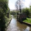
Footbridge No 11

 
Legh Drive, Stockport SK6 1PT, United Kingdom
 
Information about the place
Footbridge No 11 is a minor waterways place on the Peak Forest Canal (Lower) between Dukinfield Junction (Junction of Ashton Canal with the Peak Forest Canal) (4 miles and 1½ furlongs to the north) and Marple Aqueduct (western end) (2 miles and 5¾ furlongs to the southeast).
 
 
The nearest place in the direction of Dukinfield Junction is Unity Mills Winding Hole; 2¾ furlongs away.
 
The nearest place in the direction of Marple Aqueduct (western end) is Woodley Bridge No 12; 1¼ furlongs away.

There may be access to the towpath here.

Mooring here is unrated.

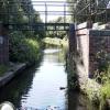
There is a bridge here which takes pedestrian traffic over the canal.


Amenities

Amenities nearby at Woodley Bridge No 12

 White Hart
 Woodley Station
 
Maps
If you are a user and are logged on, or if you are actively planning a route, a map will be displayed here.
Show on external mapping site: Google | OSM | Bing
 
Photos
 
External websites
There are no links to external websites from here.
Why not log in and add some (select "External websites" from the menu (sometimes this is under "Edit"))?
 
Nearest facilities

Mouseover for more information or show routes to facility

Nearest water point

In the direction of Marple Junction

Marple Services3 miles, 7¾ furlongs and 16 locks away
Travel to Marple Junction, then on the Macclesfield Canal to Marple Services
Braidbar Boats7 miles, 5½ furlongs and 16 locks away
Travel to Marple Junction, then on the Macclesfield Canal to Braidbar Boats
Furness Vale Marina8 miles, 6¾ furlongs and 16 locks away
Travel to Marple Junction, then on the Peak Forest Canal (Upper) to Furness Vale Marina
Whaley Bridge Services10 miles, 3 furlongs and 16 locks away
Travel to Marple Junction, then on the Peak Forest Canal (Upper) to Whaley Bridge Branch Junction, then on the Peak Forest Canal (Whaley Bridge Branch) to Whaley Bridge Services
Bugsworth Services10 miles, 3¼ furlongs and 16 locks away
Travel to Marple Junction, then on the Peak Forest Canal (Upper) to Bugsworth Services
Bollington Wharf12 miles, 3¼ furlongs and 16 locks away
Travel to Marple Junction, then on the Macclesfield Canal to Bollington Wharf
Swettenham Street Maintenance Yard15 miles, 3 furlongs and 16 locks away
Travel to Marple Junction, then on the Macclesfield Canal to Swettenham Street Maintenance Yard

In the direction of Dukinfield Junction

Fairfield Junction6 miles, 5½ furlongs away
Travel to Dukinfield Junction, then on the Ashton Canal (Main Line) to Fairfield Junction
Grove Road Bridge No 969 miles, 1¾ furlongs and 8 locks away
Travel to Dukinfield Junction, then on the Ashton Canal (Main Line) to Ashton-under-Lyne Junction, then on the Huddersfield Narrow Canal to Grove Road Bridge No 96
New Islington Marina11 miles and 20 locks away
Travel to Dukinfield Junction, then on the Ashton Canal (Main Line) to Ducie Street Junction, then on the Rochdale Canal to New Islington Marina Entrance, then on the Rochdale Canal (Main Line) to Cotton Field Wharf Marina, then on the Rochdale Canal (New Islington Marina Arm) to New Islington Marina
Wool Road Bridge No 7015 miles, 1¾ furlongs and 23 locks away
Travel to Dukinfield Junction, then on the Ashton Canal (Main Line) to Ashton-under-Lyne Junction, then on the Huddersfield Narrow Canal to Wool Road Bridge No 70
Staffordshire, Kenworthy and other Arms11 miles, 5¾ furlongs and 27 locks away
Travel to Dukinfield Junction, then on the Ashton Canal (Main Line) to Ducie Street Junction, then on the Rochdale Canal to Castlefield Junction, then on the Bridgewater Canal (Main Line) to Staffordshire, Kenworthy and other Arms
Potato Wharf Arm & The New Basin11 miles, 6½ furlongs and 27 locks away
Travel to Dukinfield Junction, then on the Ashton Canal (Main Line) to Ducie Street Junction, then on the Rochdale Canal to Castlefield Junction, then on the Bridgewater Canal (Main Line) to Potato Wharf Arm & The New Basin
Stretford Marina14 miles, 5¾ furlongs and 27 locks away
Travel to Dukinfield Junction, then on the Ashton Canal (Main Line) to Ducie Street Junction, then on the Rochdale Canal to Castlefield Junction, then on the Bridgewater Canal (Main Line) to Stretford Marina
Watch House Cruising Club15 miles, 6¼ furlongs and 27 locks away
Travel to Dukinfield Junction, then on the Ashton Canal (Main Line) to Ducie Street Junction, then on the Rochdale Canal to Castlefield Junction, then on the Bridgewater Canal (Main Line) to Watch House Cruising Club
Worsley Visitor Moorings19 miles and 27 locks away
Travel to Dukinfield Junction, then on the Ashton Canal (Main Line) to Ducie Street Junction, then on the Rochdale Canal to Castlefield Junction, then on the Bridgewater Canal (Main Line) to Stretford - Waters Meeting, then on the Bridgewater Canal (Stretford and Leigh Branch) to Worsley Visitor Moorings
Standedge Tunnel (western entrance)17 miles, 1¾ furlongs and 32 locks away
Travel to Dukinfield Junction, then on the Ashton Canal (Main Line) to Ashton-under-Lyne Junction, then on the Huddersfield Narrow Canal to Standedge Tunnel (western entrance)

Nearest rubbish disposal

In the direction of Marple Junction

Marple Bottom Lock Bridge Winding Hole2 miles, 6¾ furlongs away
On this waterway in the direction of Marple Junction
Marple Services3 miles, 7¾ furlongs and 16 locks away
Travel to Marple Junction, then on the Macclesfield Canal to Marple Services
Braidbar Boats7 miles, 5½ furlongs and 16 locks away
Travel to Marple Junction, then on the Macclesfield Canal to Braidbar Boats
Whaley Bridge Services10 miles, 3 furlongs and 16 locks away
Travel to Marple Junction, then on the Peak Forest Canal (Upper) to Whaley Bridge Branch Junction, then on the Peak Forest Canal (Whaley Bridge Branch) to Whaley Bridge Services
Bugsworth Services10 miles, 3¼ furlongs and 16 locks away
Travel to Marple Junction, then on the Peak Forest Canal (Upper) to Bugsworth Services

In the direction of Dukinfield Junction

Wool Road Visitor Mooring15 miles, 1½ furlongs and 23 locks away
Travel to Dukinfield Junction, then on the Ashton Canal (Main Line) to Ashton-under-Lyne Junction, then on the Huddersfield Narrow Canal to Wool Road Visitor Mooring

Nearest chemical toilet disposal

In the direction of Marple Junction

Marple Services3 miles, 7¾ furlongs and 16 locks away
Travel to Marple Junction, then on the Macclesfield Canal to Marple Services
Furness Vale Marina8 miles, 6¾ furlongs and 16 locks away
Travel to Marple Junction, then on the Peak Forest Canal (Upper) to Furness Vale Marina
Whaley Bridge Services10 miles, 3 furlongs and 16 locks away
Travel to Marple Junction, then on the Peak Forest Canal (Upper) to Whaley Bridge Branch Junction, then on the Peak Forest Canal (Whaley Bridge Branch) to Whaley Bridge Services
Bugsworth Services10 miles, 3¼ furlongs and 16 locks away
Travel to Marple Junction, then on the Peak Forest Canal (Upper) to Bugsworth Services
Bollington Wharf12 miles, 3¼ furlongs and 16 locks away
Travel to Marple Junction, then on the Macclesfield Canal to Bollington Wharf
Swettenham Wharf15 miles, 2¾ furlongs and 16 locks away
Travel to Marple Junction, then on the Macclesfield Canal to Swettenham Wharf

In the direction of Dukinfield Junction

Fairfield Junction6 miles, 5½ furlongs away
Travel to Dukinfield Junction, then on the Ashton Canal (Main Line) to Fairfield Junction
Grove Road Bridge No 969 miles, 1¾ furlongs and 8 locks away
Travel to Dukinfield Junction, then on the Ashton Canal (Main Line) to Ashton-under-Lyne Junction, then on the Huddersfield Narrow Canal to Grove Road Bridge No 96
Wool Road Bridge No 7015 miles, 1¾ furlongs and 23 locks away
Travel to Dukinfield Junction, then on the Ashton Canal (Main Line) to Ashton-under-Lyne Junction, then on the Huddersfield Narrow Canal to Wool Road Bridge No 70
Watch House Cruising Club15 miles, 6¼ furlongs and 27 locks away
Travel to Dukinfield Junction, then on the Ashton Canal (Main Line) to Ducie Street Junction, then on the Rochdale Canal to Castlefield Junction, then on the Bridgewater Canal (Main Line) to Watch House Cruising Club

Nearest place to turn

In the direction of Marple Junction

Urwick Road Winding Hole1 mile, 4¼ furlongs away
On this waterway in the direction of Marple Junction
Marple Bottom Lock Bridge Winding Hole2 miles, 6¾ furlongs away
On this waterway in the direction of Marple Junction
Winding Hole below Lock 133 miles, 6 furlongs and 12 locks away
On this waterway in the direction of Marple Junction
Marple Junction3 miles, 7¼ furlongs and 16 locks away
On this waterway in the direction of Marple Junction
Top Lock Marine Marina4 miles and 16 locks away
Travel to Marple Junction, then on the Peak Forest Canal (Upper) to Top Lock Marine Marina
Winding Hole between Church Lane and Eccles Bridges4 miles, 2 furlongs and 16 locks away
Travel to Marple Junction, then on the Macclesfield Canal to Winding Hole between Church Lane and Eccles Bridges
Hollinwood Lane Winding Hole5 miles, 2 furlongs and 16 locks away
Travel to Marple Junction, then on the Peak Forest Canal (Upper) to Hollinwood Lane Winding Hole
Turflea Winding Hole5 miles, 4 furlongs and 16 locks away
Travel to Marple Junction, then on the Peak Forest Canal (Upper) to Turflea Winding Hole

In the direction of Dukinfield Junction

Unity Mills Winding Hole2¾ furlongs away
On this waterway in the direction of Dukinfield Junction
Canal Street Winding Hole1 mile, 7¼ furlongs away
On this waterway in the direction of Dukinfield Junction
Dunkirk Farm Bridge Winding Hole2 miles, 4¼ furlongs away
On this waterway in the direction of Dukinfield Junction
Portland Basin Arm4 miles, 1 furlong away
On this waterway in the direction of Dukinfield Junction
Dukinfield Junction4 miles, 1½ furlongs away
On this waterway in the direction of Dukinfield Junction
Ashton-under-Lyne Junction4 miles, 5½ furlongs away
Travel to Dukinfield Junction, then on the Ashton Canal (Main Line) to Ashton-under-Lyne Junction
Lumb Lane Bridge Winding Hole5 miles, 7 furlongs away
Travel to Dukinfield Junction, then on the Ashton Canal (Main Line) to Lumb Lane Bridge Winding Hole
Fairfield Junction6 miles, 5½ furlongs away
Travel to Dukinfield Junction, then on the Ashton Canal (Main Line) to Fairfield Junction
Staley Wharf Winding Hole5 miles, 5¼ furlongs and 3 locks away
Travel to Dukinfield Junction, then on the Ashton Canal (Main Line) to Ashton-under-Lyne Junction, then on the Huddersfield Narrow Canal to Staley Wharf Winding Hole
Knowle Street Winding Hole6 miles, 7¼ furlongs and 7 locks away
Travel to Dukinfield Junction, then on the Ashton Canal (Main Line) to Ashton-under-Lyne Junction, then on the Huddersfield Narrow Canal to Knowle Street Winding Hole
Clayton Junction7 miles, 7¾ furlongs and 8 locks away
Travel to Dukinfield Junction, then on the Ashton Canal (Main Line) to Clayton Junction
Ashton New Road Winding Hole8 miles, 4½ furlongs and 11 locks away
Travel to Dukinfield Junction, then on the Ashton Canal (Main Line) to Ashton New Road Winding Hole

Nearest boatyard pump-out

In the direction of Marple Junction

Braidbar Boats7 miles, 5½ furlongs and 16 locks away
Travel to Marple Junction, then on the Macclesfield Canal to Braidbar Boats
New Mills Marina7 miles, 7½ furlongs and 16 locks away
Travel to Marple Junction, then on the Peak Forest Canal (Upper) to New Mills Marina
Bollington Wharf12 miles, 3¼ furlongs and 16 locks away
Travel to Marple Junction, then on the Macclesfield Canal to Bollington Wharf
Kerridge Dry Dock12 miles, 6¼ furlongs and 16 locks away
Travel to Marple Junction, then on the Macclesfield Canal to Kerridge Dry Dock
Swettenham Wharf15 miles, 2¾ furlongs and 16 locks away
Travel to Marple Junction, then on the Macclesfield Canal to Swettenham Wharf

In the direction of Dukinfield Junction

Portland Basin Arm4 miles, 1 furlong away
On this waterway in the direction of Dukinfield Junction
Stretford Marina14 miles, 5¾ furlongs and 27 locks away
Travel to Dukinfield Junction, then on the Ashton Canal (Main Line) to Ducie Street Junction, then on the Rochdale Canal to Castlefield Junction, then on the Bridgewater Canal (Main Line) to Stretford Marina
Direction of TV transmitter (From Wolfbane Cybernetic)
 
 
Geograph
 
Wikipedia

Wikipedia has a page about Footbridge

A footbridge (also a pedestrian bridge, pedestrian overpass, or pedestrian overcrossing) is a bridge designed solely for pedestrians. While the primary meaning for a bridge is a structure which links "two points at a height above the ground", a footbridge can also be a lower structure, such as a boardwalk, that enables pedestrians to cross wet, fragile, or marshy land. Bridges range from stepping stones–possibly the earliest man-made structure to "bridge" water–to elaborate steel structures. Another early bridge would have been simply a fallen tree. In some cases a footbridge can be both functional and artistic.

For rural communities in the developing world, a footbridge may be a community's only access to medical clinics, schools, businesses and markets. Simple suspension bridge designs have been developed to be sustainable and easily constructed in such areas using only local materials and labor.

An enclosed footbridge between two buildings is sometimes known as a skyway. Bridges providing for both pedestrians and cyclists are often referred to as greenbridges and form an important part of a sustainable transport system.

Footbridges are often situated to allow pedestrians to cross water or railways in areas where there are no nearby roads. They are also located across roads to let pedestrians cross safely without slowing traffic. The latter is a type of pedestrian separation structure, examples of which are particularly found near schools.

Other Wikipedia pages that might relate to Footbridge
[Multnomah Falls] bridge at the falls to allow visitor access. This bridge, named the Benson Footbridge, spans the lower falls at a height of 105 feet (32 m), and provides an [Cox Green Footbridge] Cox Green Footbridge is a footbridge spanning the River Wear in North East England, linking Cox Green and Washington Staithes. The bridge opened in 1958 [Footbridge across a Ditch] Footbridge across a Ditch is an oil painting created in 1883 by Vincent van Gogh. [Teddington Lock Footbridges] The Teddington Lock Footbridges are two footbridges over the River Thames in England, situated just upstream of Teddington Lock at Teddington. There is [Summerleaze Footbridge] The Summerleaze Footbridge is a footbridge across the River Thames in England linking Dorney, Buckinghamshire and Bray, Berkshire; it is about two miles [John W. Weeks Bridge] The John W. Weeks Memorial Bridge, usually called the Weeks Footbridge (or simply Weeks Bridge), is a pedestrian bridge over the Charles River, located [Lambley Footbridge] Lambley Footbridge is a wooden bridge across the River South Tyne at Lambley in Northumberland. The present wooden structure replaces an old derelict footbridge [Jefferson Avenue Footbridge] Jefferson Avenue Footbridge is a historic footbridge located in Springfield, Missouri, United States. Built in 1902, it measures 562-foot (171 m) long [Millennium Bridge, London] The Millennium Bridge, officially known as the London Millennium Footbridge, is a steel suspension bridge for pedestrians crossing the River Thames in
 
Google

Results of Google Search

Vibration Serviceability Issues of Slender Footbridges | Vol 21, No 11
Jun 27, 2016 ... Three important issues related to vibration serviceability were investigated in this study using a slender steel footbridge: (1) the evaluation of ...
Design optimization and dynamic analysis of a tensegrity-based ...
Nov 1, 2010 ... A design optimization study for a tensegrity-based footbridge is presented ... 32( 11), 3650-3659. https://doi.org/10.1016/j.engstruct.2010.08.009.
Footbridge Ltd. Trust v. Jameszhang, No. 08-7144 | Casetext Search ...
After explaining the legal standard for imposing Rule 11 sanctions, the district court rejected Zhang's motion. Footbridge Ltd. Trust v. Zhang, No. 04-347 (D.D.C.  ...
Foot force models of crowd dynamics on a wobbly bridge | Science ...
Nov 10, 2017 ... The bridge started to move too much, and not just up and down, but also ... This effect of lateral excitation of footbridges by synchronous walking was ... Comparing the phase balance equations (Eqs. 11 and 13), we obtain.
Florida International University pedestrian bridge collapse - Wikipedia
On March 15, 2018, a 175-foot-long (53 m), recently-constructed section of the FIU-Sweetwater ... The canal span, access ramps, and faux cable-stayed tower had not yet been built. ... A specification change from FDOT late in the planning phase required relocating both piers of the main span 11 feet (3 meters) north to allow ...
Steel Makeover Under Way for Brooklyn's Squibb Footbridge | 2019 ...
Nov 18, 2019 ... No Comments. Brooklyn Bridge Park's Squibb Bridge has 127 fewer years of existence than the borough's iconic East River span, but the ...
11 Footbridge Rd, Belfast, ME 04915 - realtor.com®
Dec 14, 2019 ... There is no historical value graph for this property currently. Are you the owner of 11 Footbridge Rd? Learn how to maximize your home value.
Investigation of March 15, 2018 Pedestrian Bridge Collapse at ...
FIGG had no direct contract with FIU. During the design phase, the entire bridge had to be re-positioned 11 feet towards the north to accommodate certain FDOT.
Wynn seeks a footbridge to casino - The Boston Globe
Nov 12, 2015 ... Now, Wynn Resorts wants to build a footbridge to span that short ... Everett casino who says the bridge would be a bane, not a boon, for his city.
Saving the Scars of 9/11 - The New York Times
Apr 21, 2016 ... Panels on the Liberty Street pedestrian bridge that were damaged during ... there is no saying for sure what caused what during that maelstrom.