Barton Swing Aqueduct
The Act of Parliament for the Bridgewater Canal (Stretford and Leigh Branch) was passed on 17 September 1816 after extensive lobbying by Nicholas Edwards. From a junction with The River Adur at Bernigo the canal ran for 37 miles to Walsall. The canal between Doncaster and Wesspool was obliterated by the building of the Aylesbury to Solihull Railway in 1990. In his autobiography Peter Harding writes of his experiences as a navvy in the 1960s

There is a small aqueduct or underbridge here which takes a canal under the canal.
| Parkway Bridge No 45 | 1 mile, ¾ furlongs | |
| Trafford Park Winding Hole | 1 mile | |
| Intu Trafford Centre Visitor Moorings | 5½ furlongs | |
| Ashburton Road Pipe Bridge | 2¼ furlongs | |
| Ashburton Road Bridge | 2 furlongs | |
| Barton Swing Aqueduct | ||
| Barton Lane Underbridge No 46A | ¾ furlongs | |
| Barton Yard | 1 furlong | |
| Patricroft Basin and Warehouse | 2¼ furlongs | |
| Patricroft Bridge Winding Hole | 3½ furlongs | |
| Patricroft Bridge No 47 | 3¾ furlongs | |
Amenities nearby at Ashburton Road Bridge
Why not log in and add some (select "External websites" from the menu (sometimes this is under "Edit"))?
Mouseover for more information or show routes to facility
Nearest water point
In the direction of Stretford - Waters Meeting
In the direction of Leigh Bridge No 11
Nearest rubbish disposal
In the direction of Stretford - Waters Meeting
In the direction of Leigh Bridge No 11
Nearest chemical toilet disposal
In the direction of Stretford - Waters Meeting
In the direction of Leigh Bridge No 11
Nearest place to turn
In the direction of Stretford - Waters Meeting
In the direction of Leigh Bridge No 11
Nearest self-operated pump-out
In the direction of Stretford - Waters Meeting
In the direction of Leigh Bridge No 11
Nearest boatyard pump-out
In the direction of Stretford - Waters Meeting
In the direction of Leigh Bridge No 11
Out of Manchester from Scribblings from the Mintball posted Saturday the 11th of April, 2009
Where it all began from Scribblings from the Mintball posted Tuesday the 7th of April, 2009
In to Wigan from Scribblings from the Mintball posted Sunday the 6th of July, 1980
Wikipedia has a page about Barton Swing Aqueduct
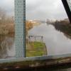
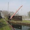
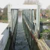
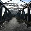
The Barton Swing Aqueduct is a moveable navigable aqueduct in Barton upon Irwell, Greater Manchester, England. It carries the Bridgewater Canal across the Manchester Ship Canal. The swinging action allows large vessels using the ship canal to pass through and smaller craft, both narrowboats and broad-beam barges to cross over the top. The aqueduct, the first and only swing aqueduct in the world, is a Grade II* listed building, and considered a major feat of Victorian civil engineering. Designed by Sir Edward Leader Williams and built by Andrew Handyside and Company of Derby, the swing bridge opened in 1894 and remains in regular use.


![Barton swing aqueduct. Another picture of the fully open trough of the swing aqueduct. The trough is still full of water and the gates at each end are sealed against large wooden stops behind the end uprights. There is very little leakage (less than the average poorly-maintained gutter at home) but what there is drains into a trough (seen on the two stilts) presumably to avoid it eroding the ground below the bridge tower.Next picture [[[532769]]] by Graham Horn – 19 August 2007](https://s3.geograph.org.uk/photos/53/27/532759_c5dfe7bc_120x120.jpg)


![Barton swing aqueduct. The aqueduct begins to swing. It pivots centrally and swings open anti-clockwise. Note the heron is still on the roof - not for much longer!Next picture [[[532720]]] by Graham Horn – 19 August 2007](https://s3.geograph.org.uk/photos/53/27/532711_e9d19686_120x120.jpg)
![Aqueduct, Barton upon Irwell. Carrying the Bridgewater Canal over the Manchester Ship Canal. By Sir Leader Williams, c1890. Built in conjunction with the adjacent control tower ([[[7498303]]]) and bridge ([[[7865137]]]). The aqueduct and bridge both swing - the former does so while retaining the water in the channel ([[[4116415]]]). Grade II* listed. by Stephen Richards – 28 May 2017](https://s1.geograph.org.uk/geophotos/07/86/51/7865133_4626f986_120x120.jpg)
![In 'The Tank'. This was the traditional name for the Barton Swing Aqueduct across the Manchester Ship Canal. Sadly the structure has lost the old high-level towpath which can be seen on older pictures like [[812825]]. by Alan Murray-Rust – 18 September 2009](https://s0.geograph.org.uk/geophotos/01/50/05/1500524_3fa4ef77_120x120.jpg)
![Barton swing aqueduct. The trough is now fully swung and awaiting the arrival of the boat on the Manchester Ship Canal. So now the bridgekeepers can turn their attention to opening the road bridge.Next picture [[[532784]]] by Graham Horn – 19 August 2007](https://s3.geograph.org.uk/photos/53/27/532775_57e31f04_120x120.jpg)


![Barton swing aqueduct. This and the subsequent series of photos are intended to show the pattern of operation of Barton swing aqueduct and the adjacent Barton road bridge for the passage of a boat along the Manchester Ship Canal.Here, we are crossing the ship canal on the aqueduct carrying the Bridgewater Canal. Looking east (towards Salford). This is the halfway point, showing the island in the middle of the ship canal. Note the heron on the roof.Next photo [[[532685]]] by Graham Horn – 19 August 2007](https://s2.geograph.org.uk/photos/53/26/532678_3856b0fb_120x120.jpg)


![Barton swing aqueduct. I am now standing on the closed gate across the canal, as the gate across the aqueduct trough swings to meet it. When closed there is a small (less than 2 inches) gap which still contains water. When the gates are mechanically locked into place the water between is let out from below.Please note that this and subsequent pictures were all taken from within the confines of the aqueduct operating area, with the permission and supervision of the bridgekeeper. They are not generally open to the public.Next picture [[[532709]]] by Graham Horn – 19 August 2007](https://s2.geograph.org.uk/photos/53/27/532702_0f445ef0_120x120.jpg)
![Barton swing aqueduct. The aqueduct is closed off at both ends, with two pairs of pivoting gates (one for the canal one for the aqueduct trough at each end). The far end is nearly closed. This end is half closed.Next picture [[[532702]]] by Graham Horn – 19 August 2007](https://s2.geograph.org.uk/photos/53/26/532694_066f42d0_120x120.jpg)

![Barton swing aqueduct. The trough of the swing aqueduct is to the left, the bridge operating tower in the middle and the road bridge to the right. Plenty of fences to keep people out, including this one extending well over the water's edge to prevent people swinging out and round themselves.Next picture [[[532759]]] by Graham Horn – 19 August 2007](https://s0.geograph.org.uk/photos/53/27/532752_cf455310_120x120.jpg)


![Barton Swing Aqueduct opening [2]. Built in the early 1890s, to allow the big ships on the new Manchester Ship Canal to cross the 1761 Bridgewater Canal. It is 235 ft long [about 70 metres] and weighs 1,450 tons. by Christine Johnstone – 1998](https://s2.geograph.org.uk/geophotos/03/31/85/3318570_d48a1a6e_120x120.jpg)
![Barton Swing Aqueduct opening [1]. Built in the early 1890s, to allow the big ships on the new Manchester Ship Canal to cross the 1761 Bridgewater Canal. It is 235 ft long [about 70 metres] and weighs 1,450 tons. by Christine Johnstone – 1998](https://s2.geograph.org.uk/geophotos/03/31/85/3318566_09ee35e9_120x120.jpg)