CanalPlanAC

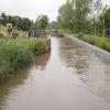
Nells Bridge Narrows

 
Farm shop & moorings
The Pig Place, Aynho Road, Cherwell OX17 3NT, United Kingdom
 
Information about the place
Nells Bridge Narrows is a minor waterways place on the Oxford Canal (Southern Section - Main Line) between Somerton Bridge No 196 (3 miles and 7¼ furlongs and 3 locks to the south) and Concorde Avenue Bridge No 165 (5 miles and 2½ furlongs and 2 locks to the northwest).
 
 
The nearest place in the direction of Somerton Bridge No 196 is Haddons Lift Bridge No 186; ¾ furlongs away.
 
The nearest place in the direction of Concorde Avenue Bridge No 165 is The Pig Place; ¼ furlongs away.

Mooring here is unrated.

This is the site of a bridge, the canal may be narrow as a consequence.


Amenities
 
Maps
If you are a user and are logged on, or if you are actively planning a route, a map will be displayed here.
Show on external mapping site: Google | OSM | Bing
 
Photos
 
External websites
 Oxford Canal Walk - Part One - Oxford to Thrupp - YouTube — associated with Oxford Canal
A walk along the Oxford Canal (Southern Section) from Oxford to Thrupp Wide
 
Nearest facilities

Mouseover for more information or show routes to facility

Nearest water point

In the direction of Napton Junction

Cherwell Street Facilities5 miles, 2¼ furlongs and 2 locks away
On this waterway in the direction of Napton Junction
Banbury Lock No 295 miles, 2½ furlongs and 2 locks away
On this waterway in the direction of Napton Junction
Sovereign Wharf5 miles, 4¾ furlongs and 3 locks away
On this waterway in the direction of Napton Junction
Cropredy Services9 miles, 6¼ furlongs and 6 locks away
On this waterway in the direction of Napton Junction
Cropredy Marina (southern basin)10 miles, 3 furlongs and 7 locks away
On this waterway in the direction of Napton Junction
Cropredy Marina (northern basins)10 miles, 3¼ furlongs and 7 locks away
On this waterway in the direction of Napton Junction
Fenny Compton Wharf16 miles, ¾ furlongs and 15 locks away
On this waterway in the direction of Napton Junction

In the direction of End of Hythe Bridge Arm

Aynho Wharf1 mile, 3½ furlongs and 2 locks away
On this waterway in the direction of End of Hythe Bridge Arm
Heyford Wharf7 miles, 3¾ furlongs and 5 locks away
On this waterway in the direction of End of Hythe Bridge Arm
Heyford Wharf Bridge No 2067 miles, 4 furlongs and 5 locks away
On this waterway in the direction of End of Hythe Bridge Arm
Thrupp Cruising Club15 miles and 10 locks away
On this waterway in the direction of End of Hythe Bridge Arm
Aubreys Lift Bridge No 22115 miles, ¼ furlongs and 10 locks away
On this waterway in the direction of End of Hythe Bridge Arm
Langford Lane Bridge No 22415 miles, 5¾ furlongs and 10 locks away
On this waterway in the direction of End of Hythe Bridge Arm
Wolvercote Junction Water Point18 miles, 5½ furlongs and 12 locks away
On this waterway in the direction of End of Hythe Bridge Arm
Wolvercote Sanitary Station19 miles, 2 furlongs and 13 locks away
On this waterway in the direction of End of Hythe Bridge Arm

Nearest rubbish disposal

In the direction of Napton Junction

Cherwell Street Facilities5 miles, 2¼ furlongs and 2 locks away
On this waterway in the direction of Napton Junction
Sovereign Wharf5 miles, 4¾ furlongs and 3 locks away
On this waterway in the direction of Napton Junction
Cropredy Services9 miles, 6¼ furlongs and 6 locks away
On this waterway in the direction of Napton Junction
Cropredy Marina (southern basin)10 miles, 3 furlongs and 7 locks away
On this waterway in the direction of Napton Junction
Cropredy Marina (northern basins)10 miles, 3¼ furlongs and 7 locks away
On this waterway in the direction of Napton Junction
Fenny Compton Marina15 miles, 6 furlongs and 15 locks away
On this waterway in the direction of Napton Junction

In the direction of End of Hythe Bridge Arm

Aynho Wharf1 mile, 3½ furlongs and 2 locks away
On this waterway in the direction of End of Hythe Bridge Arm
Heyford Wharf7 miles, 3¾ furlongs and 5 locks away
On this waterway in the direction of End of Hythe Bridge Arm
Heyford Wharf Bridge No 2067 miles, 4 furlongs and 5 locks away
On this waterway in the direction of End of Hythe Bridge Arm
Thrupp Cruising Club15 miles and 10 locks away
On this waterway in the direction of End of Hythe Bridge Arm
Aubreys Lift Bridge No 22115 miles, ¼ furlongs and 10 locks away
On this waterway in the direction of End of Hythe Bridge Arm
Wolvercote Sanitary Station19 miles, 2 furlongs and 13 locks away
On this waterway in the direction of End of Hythe Bridge Arm

Nearest chemical toilet disposal

In the direction of Napton Junction

Cherwell Street Facilities5 miles, 2¼ furlongs and 2 locks away
On this waterway in the direction of Napton Junction
Sovereign Wharf5 miles, 4¾ furlongs and 3 locks away
On this waterway in the direction of Napton Junction
Cropredy Services9 miles, 6¼ furlongs and 6 locks away
On this waterway in the direction of Napton Junction
Cropredy Marina (southern basin)10 miles, 3 furlongs and 7 locks away
On this waterway in the direction of Napton Junction

In the direction of End of Hythe Bridge Arm

Thrupp Cruising Club15 miles and 10 locks away
On this waterway in the direction of End of Hythe Bridge Arm
Wolvercote Sanitary Station19 miles, 2 furlongs and 13 locks away
On this waterway in the direction of End of Hythe Bridge Arm

Nearest place to turn

In the direction of Napton Junction

Twyford Wharf Winding Hole2 miles, 4¼ furlongs and 1 lock away
On this waterway in the direction of Napton Junction
Calthorpe Winding Hole4 miles, 4¾ furlongs and 2 locks away
On this waterway in the direction of Napton Junction
Grimsbury Wharf6 miles and 3 locks away
On this waterway in the direction of Napton Junction
Southam Road Winding Hole6 miles, 1¼ furlongs and 3 locks away
On this waterway in the direction of Napton Junction
Southam Road Footbridge Arm6 miles, 3¾ furlongs and 3 locks away
On this waterway in the direction of Napton Junction
Cropredy Services9 miles, 6¼ furlongs and 6 locks away
On this waterway in the direction of Napton Junction
Cropredy Marina (southern basin)10 miles, 3 furlongs and 7 locks away
On this waterway in the direction of Napton Junction
Cropredy Marina (northern basins)10 miles, 3¼ furlongs and 7 locks away
On this waterway in the direction of Napton Junction
Clattercote Bridge Winding Hole11 miles, 6 furlongs and 10 locks away
On this waterway in the direction of Napton Junction
Fenny Compton Marina15 miles, 6 furlongs and 15 locks away
On this waterway in the direction of Napton Junction

In the direction of End of Hythe Bridge Arm

On this waterway in the direction of End of Hythe Bridge Arm
Aynho Wharf1 mile, 3½ furlongs and 2 locks away
On this waterway in the direction of End of Hythe Bridge Arm
Somerton Deep Lock Winding Hole3 miles, 1½ furlongs and 2 locks away
On this waterway in the direction of End of Hythe Bridge Arm
Heyford Wharf Winding Hole7 miles, 3½ furlongs and 5 locks away
On this waterway in the direction of End of Hythe Bridge Arm
Heyford Wharf7 miles, 3¾ furlongs and 5 locks away
On this waterway in the direction of End of Hythe Bridge Arm
The Cleeves Winding Hole7 miles, 7½ furlongs and 5 locks away
On this waterway in the direction of End of Hythe Bridge Arm
Kirtlington Winding Hole10 miles, 6 furlongs and 7 locks away
On this waterway in the direction of End of Hythe Bridge Arm
Enslow Winding Hole12 miles, 3½ furlongs and 8 locks away
On this waterway in the direction of End of Hythe Bridge Arm
Shipton Weir Junction13 miles, 7¾ furlongs and 9 locks away
On this waterway in the direction of End of Hythe Bridge Arm
Thrupp Wide15 miles, ¼ furlongs and 10 locks away
On this waterway in the direction of End of Hythe Bridge Arm

Nearest self-operated pump-out

In the direction of Napton Junction

Cropredy Marina (southern basin)10 miles, 3 furlongs and 7 locks away
On this waterway in the direction of Napton Junction

In the direction of End of Hythe Bridge Arm

Thrupp Cruising Club15 miles and 10 locks away
On this waterway in the direction of End of Hythe Bridge Arm
Aubreys Lift Bridge No 22115 miles, ¼ furlongs and 10 locks away
On this waterway in the direction of End of Hythe Bridge Arm

Nearest boatyard pump-out

In the direction of Napton Junction

Twyford Wharf2 miles, 4 furlongs and 1 lock away
On this waterway in the direction of Napton Junction
Sovereign Wharf5 miles, 4¾ furlongs and 3 locks away
On this waterway in the direction of Napton Junction
Cropredy Marina (southern basin)10 miles, 3 furlongs and 7 locks away
On this waterway in the direction of Napton Junction

In the direction of End of Hythe Bridge Arm

Aynho Wharf1 mile, 3½ furlongs and 2 locks away
On this waterway in the direction of End of Hythe Bridge Arm
Heyford Wharf7 miles, 3¾ furlongs and 5 locks away
On this waterway in the direction of End of Hythe Bridge Arm
Enslow Wharf12 miles, 4¾ furlongs and 8 locks away
On this waterway in the direction of End of Hythe Bridge Arm
Direction of TV transmitter (From Wolfbane Cybernetic)
 
 
Geograph
 
Wikipedia

There is no page on Wikipedia called “Nells Bridge Narrows”

Wikipedia pages that might relate to Nells Bridge Narrows
[New York City] Jersey. The Verrazano-Narrows Bridge is the longest suspension bridge in the Americas and one of the world's longest. The Brooklyn Bridge is an icon of the [Manhattan] of Brooklyn, via the Verrazzano-Narrows Bridge. The George Washington Bridge, the world's busiest motor vehicle bridge, connects Washington Heights, in [White people] nearest both in position and character of the inhabitants", he somewhat narrows his "Caucasian variety" in the third edition of his text, of 1795: "To [River Cherwell] medieval packhorse bridge at Northbrook and a further mile south the course of Akeman Street, a Roman road. South, the valley narrows and becomes more wooded [Crete] (160 mi) from east to west, is 60 km (37 mi) at its widest point, and narrows to as little as 12 km (7.5 mi) (close to Ierapetra). Crete covers an area [New York (state)] Verrazzano entered New York Bay, by way of the strait now called the Narrows into the northern bay which he named Santa Margherita, in honor of the [American frontier] all of American history and culture, and the "New Western History" which narrows the geographical and time framework to concentrate on the trans-Mississippi [List of films: N–O] Trail (1917) The Narrow Valley (1921) The Narrowing Circle (1956) The Narrows (2008) Narsi Bhagat (1940) Narsimha (1991) Narsinh Mehta (1932) Nartaki: [Argyll] traditionally as Ardgour - bounded on the east by Loch Linnhe. This loch gradually narrows, before turning sharply west in the vicinity of Fort William (where it [List of female detective characters] Malmo. Cassie Swann is an expert bridge player and amateur detective in a series of books by "Susan Moody" begun 1993. Nell Sweeney is a governess in Boston
 
Google

Results of Google Search

The Narrows - The Sun Magazine
No matter what Leona said, Nell and I knew not to get too excited. Over the last few years Leona had seen many men jump off the bridge, but she still hadn't ...
No easy fix to ice buildup issue on Penobscot Narrows Bridge, say ...
Jan 26, 2014 ... Like the Penobscot Narrows Bridge, the Toledo Skyway Bridge is a ... Nell is the education reporter for the Bangor Daily News, but she will be ...
Tacoma Narrows Bridge: "Galloping Gertie" Collapses November 7 ...
The Bronx-Whitestone Bridge, like the Tacoma Narrows Bridge, had been designed by consultant Leon Moisseiff of New York. They contacted Moisseiff. He  ...
Falling ice closes Penobscot Narrows Bridge overnight - Bangor ...
Dec 29, 2013 ... Falling ice closes Penobscot Narrows Bridge overnight ... Nell is the education reporter for the Bangor Daily News, but she will be helping out ...
Tacoma Narrows Bridge (1940) - Wikipedia
The 1940 Tacoma Narrows Bridge, the first Tacoma Narrows Bridge, was a suspension bridge in the U.S. state of Washington that spanned the Tacoma Narrows ...
Tacoma Narrows Bridge Collapse "Gallopin' Gertie" - YouTube
Dec 9, 2006 ... Watch the amazing "Gallopin' Gertie" November 7, 1940 film clip. 1940 Tacoma Narrows Bridge Slender, elegant and graceful, the Tacoma ...
Tacoma Narrows Bridge - Wikipedia
The Tacoma Narrows Bridge is a pair of twin suspension bridges that span the Tacoma Narrows strait of Puget Sound in Pierce County, Washington.
Glendale-Los Angeles Garden River Bridge Project (Glendale ...
The Glendale Narrows Riverwalk runs along the north bank of the Los Angeles River opposite Griffith Park from Bette Davis Park past DreamWorks Studios to the ...
Tacoma Narrows Bridge (1950) - Wikipedia
The 1950 Tacoma Narrows Bridge is a suspension bridge in the U.S. state of Washington that carries the westbound lanes of Washington State Route 16 across ...
Tacoma Narrows Bridge | bridge, Washington, United States ...
Tacoma Narrows Bridge, first suspension bridge across the Narrows of Puget Sound, connecting the Olympic Peninsula with the mainland of Washington state,  ...