Wedgenock Lane Bridge No 50A
is a minor waterways place
on the Grand Union Canal (Warwick and Napton Canal) between
Napton Junction (Junction of Grand Union and Oxford Canals) (13 miles and 6¼ furlongs
and 25 locks
to the east) and
Budbrooke Junction (Junction of Saltisford Arm and Grand Union Main Line) (2½ furlongs
to the southwest).
The nearest place in the direction of Napton Junction is Wedgenock Park Bridge No 50 (Warwick town centre three-quarters of a mile away);
½ furlongs
away.
The nearest place in the direction of Budbrooke Junction is Birmingham Road Bridge No 51;
2¼ furlongs
away.
There is no access to the towpath here.
Mooring here is unrated.
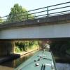
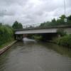
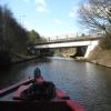
There is a bridge here which takes a minor road over the canal.
| Get Knotted Ropes and Fenders | 1¾ furlongs | |
| Cape of Good Hope PH | 1¾ furlongs | |
| Cape Water Point | 1½ furlongs | |
| Cape Visitor Moorings | 1¼ furlongs | |
| Wedgenock Park Bridge No 50 | ½ furlongs | |
| Wedgenock Lane Bridge No 50A | ||
| Birmingham Road Bridge No 51 | 2¼ furlongs | |
| Budbrooke Junction | 2½ furlongs | |
- Grand Union Canal Walk — associated with Grand Union Canal
- An illustrated walk along the Grand Union Canal from London to Birmingham
Mouseover for more information or show routes to facility
Nearest water point
In the direction of Napton Junction
Cape Water Point — 1½ furlongs away
On this waterway in the direction of Napton Junction
Cape Bottom Lock No 24 — 3 furlongs and 1 lock away
On this waterway in the direction of Napton Junction
Warwickshire Narrowboat Hire Base — 1 mile, ¼ furlongs and 2 locks away
On this waterway in the direction of Napton Junction
Delta Marine Services — 1 mile, 2 furlongs and 2 locks away
On this waterway in the direction of Napton Junction
Fosse Wharf — 6 miles, 1¼ furlongs and 5 locks away
On this waterway in the direction of Napton Junction
Bascote Bridge No 27 — 8 miles, 6¾ furlongs and 12 locks away
On this waterway in the direction of Napton Junction
Kayes Arm Junction — 10 miles, ½ furlongs and 14 locks away
On this waterway in the direction of Napton Junction
The Blue Lias Inn — 10 miles, 1¼ furlongs and 14 locks away
On this waterway in the direction of Napton Junction
Stockton Top Marina — 10 miles, 7¼ furlongs and 22 locks away
On this waterway in the direction of Napton Junction
Calcutt Marina — 13 miles, ½ furlongs and 22 locks away
On this waterway in the direction of Napton Junction
Calcutt Top Lock Winding Hole — 13 miles, 2¼ furlongs and 25 locks away
On this waterway in the direction of Napton Junction
In the direction of Budbrooke Junction
Saltisford Canal Trust Services Pontoon — 3½ furlongs away
Travel to Budbrooke Junction, then on the Grand Union Canal (Warwick and Birmingham Canal: widened section - Saltisford Arm) to Saltisford Canal Trust Services Pontoon
Saltisford (Warwick) — 5½ furlongs away
Travel to Budbrooke Junction, then on the Grand Union Canal (Warwick and Birmingham Canal: widened section - Saltisford Arm) to Saltisford (Warwick)
Hatton Top Lock No 46 — 2 miles, 4½ furlongs and 20 locks away
Travel to Budbrooke Junction, then on the Grand Union Canal (Warwick and Birmingham Canal: widened section - Main Line) to Hatton Top Lock No 46
Turners Green Bridge No 63 — 6 miles, 6¾ furlongs and 21 locks away
Travel to Budbrooke Junction, then on the Grand Union Canal (Warwick and Birmingham Canal: widened section - Main Line) to Turners Green Bridge No 63
Lapworth Services — 7 miles, 7¼ furlongs and 21 locks away
Travel to Budbrooke Junction, then on the Grand Union Canal (Warwick and Birmingham Canal: widened section - Main Line) to Kingswood Junction, then on the Stratford-on-Avon Canal (Kingswood Branch) to Lapworth Link Junction, then on the Stratford-on-Avon Canal (Lapworth Link) to Kingswood Junction (south), then on the Stratford-on-Avon Canal (Southern Section) to Lapworth Services
Rising Lane Bridge No 66 — 8 miles, 5 furlongs and 21 locks away
Travel to Budbrooke Junction, then on the Grand Union Canal (Warwick and Birmingham Canal: widened section - Main Line) to Rising Lane Bridge No 66
Old Warwick Road Bridge No 35 — 8 miles and 23 locks away
Travel to Budbrooke Junction, then on the Grand Union Canal (Warwick and Birmingham Canal: widened section - Main Line) to Kingswood Junction, then on the Stratford-on-Avon Canal (Kingswood Branch) to Kingswood Junction (north), then on the Stratford-on-Avon Canal (Northern Section) to Old Warwick Road Bridge No 35
Knowle Bottom Lock No 47 — 11 miles and 21 locks away
Travel to Budbrooke Junction, then on the Grand Union Canal (Warwick and Birmingham Canal: widened section - Main Line) to Knowle Bottom Lock No 47
Knowle Top Lock No 51 — 11 miles, 1¾ furlongs and 25 locks away
Travel to Budbrooke Junction, then on the Grand Union Canal (Warwick and Birmingham Canal: widened section - Main Line) to Knowle Top Lock No 51Nearest rubbish disposal
In the direction of Budbrooke Junction
Saltisford Canal Trust Services Pontoon — 3½ furlongs away
Travel to Budbrooke Junction, then on the Grand Union Canal (Warwick and Birmingham Canal: widened section - Saltisford Arm) to Saltisford Canal Trust Services Pontoon
Hatton Top Lock No 46 — 2 miles, 4½ furlongs and 20 locks away
Travel to Budbrooke Junction, then on the Grand Union Canal (Warwick and Birmingham Canal: widened section - Main Line) to Hatton Top Lock No 46
Lapworth Lock No 21 — 7 miles, 7½ furlongs and 21 locks away
Travel to Budbrooke Junction, then on the Grand Union Canal (Warwick and Birmingham Canal: widened section - Main Line) to Kingswood Junction, then on the Stratford-on-Avon Canal (Kingswood Branch) to Lapworth Link Junction, then on the Stratford-on-Avon Canal (Lapworth Link) to Kingswood Junction (south), then on the Stratford-on-Avon Canal (Northern Section) to Lapworth Lock No 21
Knowle Top Lock No 51 — 11 miles, 1¾ furlongs and 25 locks away
Travel to Budbrooke Junction, then on the Grand Union Canal (Warwick and Birmingham Canal: widened section - Main Line) to Knowle Top Lock No 51
Lowsonford Lock No 31 — 9 miles, 7½ furlongs and 30 locks away
Travel to Budbrooke Junction, then on the Grand Union Canal (Warwick and Birmingham Canal: widened section - Main Line) to Kingswood Junction, then on the Stratford-on-Avon Canal (Kingswood Branch) to Lapworth Link Junction, then on the Stratford-on-Avon Canal (Lapworth Link) to Kingswood Junction (south), then on the Stratford-on-Avon Canal (Southern Section) to Lowsonford Lock No 31
Hill Farm Marina — 14 miles, 4¼ furlongs and 38 locks away
Travel to Budbrooke Junction, then on the Grand Union Canal (Warwick and Birmingham Canal: widened section - Main Line) to Kingswood Junction, then on the Stratford-on-Avon Canal (Kingswood Branch) to Lapworth Link Junction, then on the Stratford-on-Avon Canal (Lapworth Link) to Kingswood Junction (south), then on the Stratford-on-Avon Canal (Southern Section) to Hill Farm Marina
Waring's Green Wharf — 12 miles, 5¾ furlongs and 40 locks away
Travel to Budbrooke Junction, then on the Grand Union Canal (Warwick and Birmingham Canal: widened section - Main Line) to Kingswood Junction, then on the Stratford-on-Avon Canal (Kingswood Branch) to Kingswood Junction (north), then on the Stratford-on-Avon Canal (Northern Section) to Waring's Green Wharf
In the direction of Napton Junction
Radford Bottom Lock No 23 — 5 miles, 1½ furlongs and 2 locks away
On this waterway in the direction of Napton Junction
Bascote Bridge No 27 — 8 miles, 6¾ furlongs and 12 locks away
On this waterway in the direction of Napton Junction
Calcutt Marina — 13 miles, ½ furlongs and 22 locks away
On this waterway in the direction of Napton Junction
Wigrams Turn Marina — 13 miles, 6¼ furlongs and 25 locks away
Travel to Napton Junction, then on the Grand Union Canal (Oxford Canal Section) to Wigrams Turn Marina
Napton Sanitary Station — 15 miles, 6¾ furlongs and 25 locks away
Travel to Napton Junction, then on the Oxford Canal (Southern Section - Main Line) to Napton Sanitary Station
Braunston Services — 18 miles, 6½ furlongs and 25 locks away
Travel to Napton Junction, then on the Grand Union Canal (Oxford Canal Section) to Braunston Turn, then on the Oxford Canal (Northern Section - Main Line) to Braunston Services
Braunston Stop — 19 miles, 1¼ furlongs and 25 locks away
Travel to Napton Junction, then on the Grand Union Canal (Oxford Canal Section) to Braunston Turn, then on the Grand Union Canal (Grand Junction Canal - Main Line - Braunston to Norton) to Braunston StopNearest chemical toilet disposal
In the direction of Budbrooke Junction
Saltisford Canal Trust Services Pontoon — 3½ furlongs away
Travel to Budbrooke Junction, then on the Grand Union Canal (Warwick and Birmingham Canal: widened section - Saltisford Arm) to Saltisford Canal Trust Services Pontoon
Hatton Top Lock No 46 — 2 miles, 4½ furlongs and 20 locks away
Travel to Budbrooke Junction, then on the Grand Union Canal (Warwick and Birmingham Canal: widened section - Main Line) to Hatton Top Lock No 46
Lapworth Services — 7 miles, 7¼ furlongs and 21 locks away
Travel to Budbrooke Junction, then on the Grand Union Canal (Warwick and Birmingham Canal: widened section - Main Line) to Kingswood Junction, then on the Stratford-on-Avon Canal (Kingswood Branch) to Lapworth Link Junction, then on the Stratford-on-Avon Canal (Lapworth Link) to Kingswood Junction (south), then on the Stratford-on-Avon Canal (Southern Section) to Lapworth Services
Knowle Top Lock No 51 — 11 miles, 1¾ furlongs and 25 locks away
Travel to Budbrooke Junction, then on the Grand Union Canal (Warwick and Birmingham Canal: widened section - Main Line) to Knowle Top Lock No 51
Swallow Wharf — 10 miles, ¼ furlongs and 40 locks away
Travel to Budbrooke Junction, then on the Grand Union Canal (Warwick and Birmingham Canal: widened section - Main Line) to Kingswood Junction, then on the Stratford-on-Avon Canal (Kingswood Branch) to Kingswood Junction (north), then on the Stratford-on-Avon Canal (Northern Section) to Swallow Wharf
Waring's Green Wharf — 12 miles, 5¾ furlongs and 40 locks away
Travel to Budbrooke Junction, then on the Grand Union Canal (Warwick and Birmingham Canal: widened section - Main Line) to Kingswood Junction, then on the Stratford-on-Avon Canal (Kingswood Branch) to Kingswood Junction (north), then on the Stratford-on-Avon Canal (Northern Section) to Waring's Green Wharf
Earlswood Reservoir Feeder — 13 miles, 5½ furlongs and 40 locks away
Travel to Budbrooke Junction, then on the Grand Union Canal (Warwick and Birmingham Canal: widened section - Main Line) to Kingswood Junction, then on the Stratford-on-Avon Canal (Kingswood Branch) to Kingswood Junction (north), then on the Stratford-on-Avon Canal (Northern Section) to Earlswood Reservoir Feeder
In the direction of Napton Junction
Warwickshire Narrowboat Hire Base — 1 mile, ¼ furlongs and 2 locks away
On this waterway in the direction of Napton Junction
Fosse Wharf — 6 miles, 1¼ furlongs and 5 locks away
On this waterway in the direction of Napton Junction
Calcutt Marina — 13 miles, ½ furlongs and 22 locks away
On this waterway in the direction of Napton Junction
Wigrams Turn Marina — 13 miles, 6¼ furlongs and 25 locks away
Travel to Napton Junction, then on the Grand Union Canal (Oxford Canal Section) to Wigrams Turn Marina
Napton Sanitary Station — 15 miles, 6¾ furlongs and 25 locks away
Travel to Napton Junction, then on the Oxford Canal (Southern Section - Main Line) to Napton Sanitary Station
Braunston Services — 18 miles, 6½ furlongs and 25 locks away
Travel to Napton Junction, then on the Grand Union Canal (Oxford Canal Section) to Braunston Turn, then on the Oxford Canal (Northern Section - Main Line) to Braunston Services
Braunston Road Bridge No 91 — 18 miles, 7¾ furlongs and 25 locks away
Travel to Napton Junction, then on the Grand Union Canal (Oxford Canal Section) to Braunston Turn, then on the Grand Union Canal (Grand Junction Canal - Main Line - Braunston to Norton) to Braunston Road Bridge No 91Nearest place to turn
In the direction of Budbrooke Junction
Budbrooke Junction — 2½ furlongs away
On this waterway in the direction of Budbrooke Junction
Birmingham Road Winding Hole — 4½ furlongs away
Travel to Budbrooke Junction, then on the Grand Union Canal (Warwick and Birmingham Canal: widened section - Saltisford Arm) to Birmingham Road Winding Hole
Hatton Winding Hole — 3 miles, 1¼ furlongs and 21 locks away
Travel to Budbrooke Junction, then on the Grand Union Canal (Warwick and Birmingham Canal: widened section - Main Line) to Hatton Winding Hole
Kingswood Junction — 7 miles, 4¾ furlongs and 21 locks away
Travel to Budbrooke Junction, then on the Grand Union Canal (Warwick and Birmingham Canal: widened section - Main Line) to Kingswood Junction
Kingswood Junction (south) — 7 miles, 7 furlongs and 21 locks away
Travel to Budbrooke Junction, then on the Grand Union Canal (Warwick and Birmingham Canal: widened section - Main Line) to Kingswood Junction, then on the Stratford-on-Avon Canal (Kingswood Branch) to Lapworth Link Junction, then on the Stratford-on-Avon Canal (Lapworth Link) to Kingswood Junction (south)
Kingswood Junction (north) — 7 miles, 7¼ furlongs and 22 locks away
Travel to Budbrooke Junction, then on the Grand Union Canal (Warwick and Birmingham Canal: widened section - Main Line) to Kingswood Junction, then on the Stratford-on-Avon Canal (Kingswood Branch) to Kingswood Junction (north)
Heronfield Bridge Winding Hole — 10 miles, 3½ furlongs and 21 locks away
Travel to Budbrooke Junction, then on the Grand Union Canal (Warwick and Birmingham Canal: widened section - Main Line) to Heronfield Bridge Winding Hole
Winding Hole below Knowle Bottom Lock — 11 miles and 21 locks away
Travel to Budbrooke Junction, then on the Grand Union Canal (Warwick and Birmingham Canal: widened section - Main Line) to Winding Hole below Knowle Bottom Lock
Winding Hole above Dicks Lane Lock — 8 miles, 3½ furlongs and 24 locks away
Travel to Budbrooke Junction, then on the Grand Union Canal (Warwick and Birmingham Canal: widened section - Main Line) to Kingswood Junction, then on the Stratford-on-Avon Canal (Kingswood Branch) to Lapworth Link Junction, then on the Stratford-on-Avon Canal (Lapworth Link) to Kingswood Junction (south), then on the Stratford-on-Avon Canal (Southern Section) to Winding Hole above Dicks Lane Lock
Winding Hole near Kixley Bridge — 11 miles, 4¾ furlongs and 26 locks away
Travel to Budbrooke Junction, then on the Grand Union Canal (Warwick and Birmingham Canal: widened section - Main Line) to Winding Hole near Kixley Bridge
In the direction of Napton Junction
Emscote Bridge Winding Hole — 1 mile, 4¾ furlongs and 2 locks away
On this waterway in the direction of Napton Junction
Winding Hole near Bridge No 43 — 2 miles, 2¾ furlongs and 2 locks away
On this waterway in the direction of Napton Junction
Leamington Winding Hole — 3 miles, 4½ furlongs and 2 locks away
On this waterway in the direction of Napton Junction
Radford Winding Hole — 4 miles, 6¼ furlongs and 2 locks away
On this waterway in the direction of Napton Junction
Kayes Arm Junction — 10 miles, ½ furlongs and 14 locks away
On this waterway in the direction of Napton Junction
Stockton Top Marina — 10 miles, 7¼ furlongs and 22 locks away
On this waterway in the direction of Napton Junction
Nelson's Wharf — 11 miles, 2¼ furlongs and 22 locks away
On this waterway in the direction of Napton Junction
Ventnor Marina (Sunset Basin) — 12 miles, 5 furlongs and 22 locks away
On this waterway in the direction of Napton Junction
Ventnor Marina (Sunrise Basin) — 12 miles, 7½ furlongs and 22 locks away
On this waterway in the direction of Napton Junction
Calcutt Marina — 13 miles, ½ furlongs and 22 locks away
On this waterway in the direction of Napton JunctionNearest self-operated pump-out
In the direction of Budbrooke Junction
Lapworth Services — 7 miles, 7¼ furlongs and 21 locks away
Travel to Budbrooke Junction, then on the Grand Union Canal (Warwick and Birmingham Canal: widened section - Main Line) to Kingswood Junction, then on the Stratford-on-Avon Canal (Kingswood Branch) to Lapworth Link Junction, then on the Stratford-on-Avon Canal (Lapworth Link) to Kingswood Junction (south), then on the Stratford-on-Avon Canal (Southern Section) to Lapworth Services
Hill Farm Marina — 14 miles, 4¼ furlongs and 38 locks away
Travel to Budbrooke Junction, then on the Grand Union Canal (Warwick and Birmingham Canal: widened section - Main Line) to Kingswood Junction, then on the Stratford-on-Avon Canal (Kingswood Branch) to Lapworth Link Junction, then on the Stratford-on-Avon Canal (Lapworth Link) to Kingswood Junction (south), then on the Stratford-on-Avon Canal (Southern Section) to Hill Farm Marina
In the direction of Napton Junction
Braunston Marina (western entrance) — 19 miles, 1½ furlongs and 25 locks away
Travel to Napton Junction, then on the Grand Union Canal (Oxford Canal Section) to Braunston Turn, then on the Grand Union Canal (Grand Junction Canal - Main Line - Braunston to Norton) to Braunston Marina (western entrance)Nearest boatyard pump-out
In the direction of Budbrooke Junction
Saltisford Canal Trust Services Pontoon — 3½ furlongs away
Travel to Budbrooke Junction, then on the Grand Union Canal (Warwick and Birmingham Canal: widened section - Saltisford Arm) to Saltisford Canal Trust Services Pontoon
Barston Lane Bridge No 76 — 13 miles, 1 furlong and 26 locks away
Travel to Budbrooke Junction, then on the Grand Union Canal (Warwick and Birmingham Canal: widened section - Main Line) to Barston Lane Bridge No 76
Swallow Wharf — 10 miles, ¼ furlongs and 40 locks away
Travel to Budbrooke Junction, then on the Grand Union Canal (Warwick and Birmingham Canal: widened section - Main Line) to Kingswood Junction, then on the Stratford-on-Avon Canal (Kingswood Branch) to Kingswood Junction (north), then on the Stratford-on-Avon Canal (Northern Section) to Swallow Wharf
Hill Farm Marina — 14 miles, 4¼ furlongs and 38 locks away
Travel to Budbrooke Junction, then on the Grand Union Canal (Warwick and Birmingham Canal: widened section - Main Line) to Kingswood Junction, then on the Stratford-on-Avon Canal (Kingswood Branch) to Lapworth Link Junction, then on the Stratford-on-Avon Canal (Lapworth Link) to Kingswood Junction (south), then on the Stratford-on-Avon Canal (Southern Section) to Hill Farm Marina
Waring's Green Wharf — 12 miles, 5¾ furlongs and 40 locks away
Travel to Budbrooke Junction, then on the Grand Union Canal (Warwick and Birmingham Canal: widened section - Main Line) to Kingswood Junction, then on the Stratford-on-Avon Canal (Kingswood Branch) to Kingswood Junction (north), then on the Stratford-on-Avon Canal (Northern Section) to Waring's Green Wharf
Earlswood Reservoir Feeder — 13 miles, 5½ furlongs and 40 locks away
Travel to Budbrooke Junction, then on the Grand Union Canal (Warwick and Birmingham Canal: widened section - Main Line) to Kingswood Junction, then on the Stratford-on-Avon Canal (Kingswood Branch) to Kingswood Junction (north), then on the Stratford-on-Avon Canal (Northern Section) to Earlswood Reservoir Feeder
In the direction of Napton Junction
Warwickshire Narrowboat Hire Base — 1 mile, ¼ furlongs and 2 locks away
On this waterway in the direction of Napton Junction
Delta Marine Services — 1 mile, 2 furlongs and 2 locks away
On this waterway in the direction of Napton Junction
Stockton Top Marina — 10 miles, 7¼ furlongs and 22 locks away
On this waterway in the direction of Napton Junction
Ventnor Marina (Sunrise Basin) — 12 miles, 7½ furlongs and 22 locks away
On this waterway in the direction of Napton Junction
Calcutt Marina — 13 miles, ½ furlongs and 22 locks away
On this waterway in the direction of Napton Junction
Wigrams Turn Marina — 13 miles, 6¼ furlongs and 25 locks away
Travel to Napton Junction, then on the Grand Union Canal (Oxford Canal Section) to Wigrams Turn MarinaDirection of TV transmitter (From Wolfbane Cybernetic)
There is no page on Wikipedia called “Wedgenock Lane Bridge No 50A”
Results of Google Search
File:Bridge 50A, Grand Union Canal, Warwick - geograph.org.uk - 1441418.jpg ... No higher resolution available. Bridge_50A ... It carries Wedgnock Lane across the canal towards industrial estates and the Woodloes Park residential estate.
Canal Bridge no:50a on the Grand Union Canal, England. ... Wedgenock Park Canal Bridge 50 - The Grand Union Canal in England. ... Radford Road bridge.
A bridge to nowhere is a bridge where one or both ends are broken or incomplete and does not .... The Bridge to Nowhere, built in 1936, is an isolated 40-metre road bridge over the Mangapurua Stream in Whanganui National Park, North ...
Grand Union Canal Walk at Wedgnock Lane Bridge No 50a. SP2765 : Warwick Racecourse watering machine by David P Howard · Warwick Racecourse ...
If sending your comments by post, please ensure you include your full postal address including postcode, the application reference number, the site address and ...


![Warwick canal [2]. Seen from the towpath is the Grand Union Canal looking east towards Royal Leamington Spa. The near bridge carries Wedgnock Lane, the far bridge carries Cape Road. The towpath is part of two long distance footpaths - The Grand Union Canal Walk and Shakespeare's Avon Way.A market town and county town of Warwickshire, Warwick lies on the River Avon, 11 miles (18 kilometres) south of Coventry. There is evidence of unbroken habitation from the 6th century AD with signs of Neolithic and Roman activity before that date. It was a Saxon burh in the 9th century and Warwick Castle was built during the Norman Conquest. Much of the town was destroyed in The Great Fire of Warwick in 1694. Warwick Racecourse is located just west of the town centre. The Grand Union Canal passes through the town and the restored Saltisford Canal Arm is close to the town centre. by Michael Dibb – 04 August 2020](https://s2.geograph.org.uk/geophotos/06/62/92/6629270_7c34f747_120x120.jpg)


![Bridge 50A, Grand Union Canal, Warwick. It carries Wedgnock Lane across the canal towards industrial estates and the Woodloes Park residential estate. Bridge 50, Cape Road, can be seen further on: [[1441392]] by Robin Stott – 13 August 2009](https://s2.geograph.org.uk/geophotos/01/44/14/1441418_4cd5c770_120x120.jpg)

![181 Cape Road, Warwick. The owner of this blue brick house believes that it was the coach house for Warwick Prison though outside the prison walls. After the prison was demolished in 1934 the house became a dairy, hence its current name: The Old Blue Dairy https://www.ourwarwickshire.org.uk/content/article/cape-road-former-prison-building Neither it nor the former Governor's House, the tall blue brick building centre-left, is listed [[1236175]]. by Robin Stott – 10 April 2019](https://s0.geograph.org.uk/geophotos/06/40/88/6408808_0724909e_120x120.jpg)
![Broxell Close, Wedgnock Industrial Estate, northwest Warwick. The Royal Mail Group occupy four of the six units on the north side of the close. The public can collect items from the Delivery Office at the far end [[4451002]]. Parking is tight. by Robin Stott – 02 June 2019](https://s3.geograph.org.uk/geophotos/06/30/81/6308119_86d59bcb_120x120.jpg)


![Grand Union Canal at the Cape, Warwick. Where once there was industry https://collection.sciencemuseumgroup.org.uk/people/cp16743/cape-engineering-company-limited four-storey blocks of flats overlook the canal. The photo is taken from the track down to Cape Top Lock from Cape Road. A photograph from 1972 by Dr Neil Clifton gives an impression of the change: [[1411832]]. by Robin Stott – 10 April 2019](https://s0.geograph.org.uk/geophotos/06/40/86/6408688_a062b3d4_120x120.jpg)
![Leafy canalside, the Cape, Warwick. There are a number of moorings here, above Cape Top Lock and the Cape of Good Hope pub [[6637459]]. The flats are on the site of industry [[6408688]]. by Robin Stott – 18 September 2020](https://s3.geograph.org.uk/geophotos/06/75/39/6753991_b7273a2d_120x120.jpg)