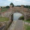
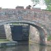
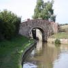
Heyford Common Bridge No 200
is a minor waterways place
on the Oxford Canal (Southern Section - Main Line) between
Allen's Lock No 36 (Bridge leads to Upper Heyford village) (5¼ furlongs
to the southeast) and
Somerton Bridge No 196 (1 mile and 5¾ furlongs
and 1 lock
to the northeast).
The nearest place in the direction of Allen's Lock No 36 is Heyford Common Railway Bridge No 201;
1¼ furlongs
away.
The nearest place in the direction of Somerton Bridge No 196 is Heyford Common Lock No 35;
¼ furlongs
away.
There is no access to the towpath here.
Mooring here is unrated.
There is a bridge here which takes a track over the canal.
The Barley Mow (Upper Heyford) | 5¼ furlongs | |
Allen's Lock No 36 | 5¼ furlongs | |
Double Bridge No 203 | 4¼ furlongs | |
Single Bridge No 202 | 2½ furlongs | |
Heyford Common Railway Bridge No 201 | 1¼ furlongs | |
Heyford Common Bridge No 200 | ||
Heyford Common Lock No 35 | ¼ furlongs | |
Somerton Mill Pipe Bridge | 3¾ furlongs | |
Somerton Mill Bridge No 199 | 5¼ furlongs | |
Deep Cutting Bridge No 198 | 1 mile, 1¼ furlongs | |
Somerton Narrows | 1 mile, 4½ furlongs |
- Oxford Canal Walk - Part One - Oxford to Thrupp - YouTube — associated with Oxford Canal
- A walk along the Oxford Canal (Southern Section) from Oxford to Thrupp Wide
Mouseover for more information or show routes to facility
Nearest water point
In the direction of Napton Junction
Aynho Wharf — 4 miles, 1¾ furlongs and 2 locks away
On this waterway in the direction of Napton Junction
Cherwell Street Facilities — 10 miles, 7¼ furlongs and 6 locks away
On this waterway in the direction of Napton Junction
Banbury Lock No 29 — 10 miles, 7½ furlongs and 6 locks away
On this waterway in the direction of Napton Junction
Sovereign Wharf — 11 miles, 1¾ furlongs and 7 locks away
On this waterway in the direction of Napton Junction
Cropredy Services — 15 miles, 3¼ furlongs and 10 locks away
On this waterway in the direction of Napton Junction
Cropredy Marina (southern basin) — 16 miles and 11 locks away
On this waterway in the direction of Napton Junction
Cropredy Marina (northern basins) — 16 miles, ¼ furlongs and 11 locks away
On this waterway in the direction of Napton Junction
In the direction of End of Hythe Bridge Arm
Heyford Wharf — 1 mile, 6¾ furlongs and 1 lock away
On this waterway in the direction of End of Hythe Bridge Arm
Heyford Wharf Bridge No 206 — 1 mile, 6¾ furlongs and 1 lock away
On this waterway in the direction of End of Hythe Bridge Arm
Thrupp Cruising Club — 9 miles, 3 furlongs and 6 locks away
On this waterway in the direction of End of Hythe Bridge Arm
Aubreys Lift Bridge No 221 — 9 miles, 3¼ furlongs and 6 locks away
On this waterway in the direction of End of Hythe Bridge Arm
Langford Lane Bridge No 224 — 10 miles, ¾ furlongs and 6 locks away
On this waterway in the direction of End of Hythe Bridge Arm
Wolvercote Junction Water Point — 13 miles, ½ furlongs and 8 locks away
On this waterway in the direction of End of Hythe Bridge Arm
Wolvercote Sanitary Station — 13 miles, 4¾ furlongs and 9 locks away
On this waterway in the direction of End of Hythe Bridge Arm
St Edwards Lift Bridge No 238 — 14 miles, 5½ furlongs and 10 locks away
On this waterway in the direction of End of Hythe Bridge Arm
Oxford Visitor Moorings — 16 miles, 2 furlongs and 10 locks away
On this waterway in the direction of End of Hythe Bridge Arm
Eynsham Lock — 16 miles, 4 furlongs and 10 locks away
Travel to Wolvercote Junction, then on the Oxford Canal (Duke's Cut) to Duke's Cut Junction, then on the River Thames (above Oxford) to Eynsham LockNearest rubbish disposal
In the direction of Napton Junction
Aynho Wharf — 4 miles, 1¾ furlongs and 2 locks away
On this waterway in the direction of Napton Junction
Cherwell Street Facilities — 10 miles, 7¼ furlongs and 6 locks away
On this waterway in the direction of Napton Junction
Sovereign Wharf — 11 miles, 1¾ furlongs and 7 locks away
On this waterway in the direction of Napton Junction
Cropredy Services — 15 miles, 3¼ furlongs and 10 locks away
On this waterway in the direction of Napton Junction
Cropredy Marina (southern basin) — 16 miles and 11 locks away
On this waterway in the direction of Napton Junction
Cropredy Marina (northern basins) — 16 miles, ¼ furlongs and 11 locks away
On this waterway in the direction of Napton Junction
In the direction of End of Hythe Bridge Arm
Heyford Wharf — 1 mile, 6¾ furlongs and 1 lock away
On this waterway in the direction of End of Hythe Bridge Arm
Heyford Wharf Bridge No 206 — 1 mile, 6¾ furlongs and 1 lock away
On this waterway in the direction of End of Hythe Bridge Arm
Thrupp Cruising Club — 9 miles, 3 furlongs and 6 locks away
On this waterway in the direction of End of Hythe Bridge Arm
Aubreys Lift Bridge No 221 — 9 miles, 3¼ furlongs and 6 locks away
On this waterway in the direction of End of Hythe Bridge Arm
Wolvercote Sanitary Station — 13 miles, 4¾ furlongs and 9 locks away
On this waterway in the direction of End of Hythe Bridge Arm
Eynsham Lock — 16 miles, 4 furlongs and 10 locks away
Travel to Wolvercote Junction, then on the Oxford Canal (Duke's Cut) to Duke's Cut Junction, then on the River Thames (above Oxford) to Eynsham LockNearest chemical toilet disposal
In the direction of Napton Junction
Cherwell Street Facilities — 10 miles, 7¼ furlongs and 6 locks away
On this waterway in the direction of Napton Junction
Sovereign Wharf — 11 miles, 1¾ furlongs and 7 locks away
On this waterway in the direction of Napton Junction
Cropredy Services — 15 miles, 3¼ furlongs and 10 locks away
On this waterway in the direction of Napton Junction
Cropredy Marina (southern basin) — 16 miles and 11 locks away
On this waterway in the direction of Napton Junction
In the direction of End of Hythe Bridge Arm
Thrupp Cruising Club — 9 miles, 3 furlongs and 6 locks away
On this waterway in the direction of End of Hythe Bridge Arm
Wolvercote Sanitary Station — 13 miles, 4¾ furlongs and 9 locks away
On this waterway in the direction of End of Hythe Bridge Arm
Eynsham Lock — 16 miles, 4 furlongs and 10 locks away
Travel to Wolvercote Junction, then on the Oxford Canal (Duke's Cut) to Duke's Cut Junction, then on the River Thames (above Oxford) to Eynsham LockNearest place to turn
In the direction of Napton Junction
Somerton Deep Lock Winding Hole — 2 miles, 3½ furlongs and 2 locks away
On this waterway in the direction of Napton Junction
Aynho Wharf — 4 miles, 1¾ furlongs and 2 locks away
On this waterway in the direction of Napton Junction
Winding Hole above Nell Bridge Lock — 5 miles, 4¼ furlongs and 4 locks away
On this waterway in the direction of Napton Junction
Twyford Wharf Winding Hole — 8 miles, 1¼ furlongs and 5 locks away
On this waterway in the direction of Napton Junction
Calthorpe Winding Hole — 10 miles, 2 furlongs and 6 locks away
On this waterway in the direction of Napton Junction
Grimsbury Wharf — 11 miles, 5 furlongs and 7 locks away
On this waterway in the direction of Napton Junction
Southam Road Winding Hole — 11 miles, 6¼ furlongs and 7 locks away
On this waterway in the direction of Napton Junction
Southam Road Footbridge Arm — 12 miles, ¾ furlongs and 7 locks away
On this waterway in the direction of Napton Junction
Cropredy Services — 15 miles, 3¼ furlongs and 10 locks away
On this waterway in the direction of Napton Junction
In the direction of End of Hythe Bridge Arm
Heyford Wharf Winding Hole — 1 mile, 6½ furlongs and 1 lock away
On this waterway in the direction of End of Hythe Bridge Arm
Heyford Wharf — 1 mile, 6¾ furlongs and 1 lock away
On this waterway in the direction of End of Hythe Bridge Arm
The Cleeves Winding Hole — 2 miles, 2½ furlongs and 1 lock away
On this waterway in the direction of End of Hythe Bridge Arm
Kirtlington Winding Hole — 5 miles, 1 furlong and 3 locks away
On this waterway in the direction of End of Hythe Bridge Arm
Enslow Winding Hole — 6 miles, 6½ furlongs and 4 locks away
On this waterway in the direction of End of Hythe Bridge Arm
Shipton Weir Junction — 8 miles, 2¾ furlongs and 5 locks away
On this waterway in the direction of End of Hythe Bridge Arm
Thrupp Wide — 9 miles, 3 furlongs and 6 locks away
On this waterway in the direction of End of Hythe Bridge Arm
Wolvercote Junction — 13 miles, 1¼ furlongs and 9 locks away
On this waterway in the direction of End of Hythe Bridge Arm
Bypass Reservoir Junction — 13 miles, 3¼ furlongs and 10 locks away
Travel to Wolvercote Junction, then on the Oxford Canal (Duke's Cut) to Bypass Reservoir Junction
Duke's Cut Junction — 13 miles, 7¾ furlongs and 10 locks away
Travel to Wolvercote Junction, then on the Oxford Canal (Duke's Cut) to Duke's Cut Junction
Hythe Bridge Arm Winding Hole — 16 miles, 1 furlong and 10 locks away
On this waterway in the direction of End of Hythe Bridge ArmNearest self-operated pump-out
In the direction of Napton Junction
Cropredy Marina (southern basin) — 16 miles and 11 locks away
On this waterway in the direction of Napton Junction
In the direction of End of Hythe Bridge Arm
Thrupp Cruising Club — 9 miles, 3 furlongs and 6 locks away
On this waterway in the direction of End of Hythe Bridge Arm
Aubreys Lift Bridge No 221 — 9 miles, 3¼ furlongs and 6 locks away
On this waterway in the direction of End of Hythe Bridge Arm
Eynsham Lock — 16 miles, 4 furlongs and 10 locks away
Travel to Wolvercote Junction, then on the Oxford Canal (Duke's Cut) to Duke's Cut Junction, then on the River Thames (above Oxford) to Eynsham LockNearest boatyard pump-out
In the direction of Napton Junction
Aynho Wharf — 4 miles, 1¾ furlongs and 2 locks away
On this waterway in the direction of Napton Junction
Twyford Wharf — 8 miles, 1 furlong and 5 locks away
On this waterway in the direction of Napton Junction
Sovereign Wharf — 11 miles, 1¾ furlongs and 7 locks away
On this waterway in the direction of Napton Junction
Cropredy Marina (southern basin) — 16 miles and 11 locks away
On this waterway in the direction of Napton Junction
In the direction of End of Hythe Bridge Arm
Heyford Wharf — 1 mile, 6¾ furlongs and 1 lock away
On this waterway in the direction of End of Hythe Bridge Arm
Enslow Wharf — 6 miles, 7½ furlongs and 4 locks away
On this waterway in the direction of End of Hythe Bridge Arm
Oxford Cruisers Marina — 17 miles, 4 furlongs and 11 locks away
Travel to Wolvercote Junction, then on the Oxford Canal (Duke's Cut) to Duke's Cut Junction, then on the River Thames (above Oxford) to Oxford Cruisers MarinaDirection of TV transmitter (From Wolfbane Cybernetic)
There is no page on Wikipedia called “Heyford Common Bridge”
Wikipedia pages that might relate to Heyford Common Bridge
[Stowe Nine Churches]
from west of the railway bridge south eastward to sidings on the west side of the railway just to the north of the Nether Heyford to Litchborough road. Thus
[Grand Union Canal]
tract to a white humpback bridge at Apsley, Hertfordshire The canal near Bugbrooke, Northamptonshire The canal near Nether Heyford, Northamptonshire Saddington
[A roads in Zone 4 of the Great Britain numbering scheme]
section renumbered when an extension of the M40 motorway opened A4142 Heyford Hill, Oxford Headington Part of the Oxford Ring Road A4143 Llanfoist Abergavenny
[Grim's Ditch]
Publ, 244 p, ISBN 0-7509-1959-0 Sauer, E. (1999) "Middleton Stoney/Upper Heyford, Aves Ditch, earthwork and tribal boundary of the Iron Age", South Midland
[Vauxhall]
such as Fentiman Road and Heyford Avenue have higher property values in the private market; however, by far the most common type of housing stock in Vauxhall
[Rousham]
northern boundary has existed at least since 1255 when a bridge was built at Lower Heyford to carry it across the River Cherwell. The road was a turnpike
[All the Stations]
Cross, Haddenham & Thame Parkway, Bicester North, Banbury, Kings Sutton, Heyford, Tackley, Radley, Appleford, Didcot Parkway, Cholsey, Goring & Streatley
[List of former Royal Air Force stations]
remain the land and remaining buildings are in private ownership. RAF Upper Heyford UH England Oxfordshire 1918 1994 Site sold, several buildings now in various
[Great Western Railway (train operating company)]
covered events such as the reaction to the Manchester Arena and London Bridge attacks, and several days of severe disruption. The franchise was due to
[RAF Mildenhall]
Stratojet was a familiar sight in the skies over RAF Mildenhall and RAF Upper Heyford at this time, as entire wings deployed on 90-day rotations. From 1976 to
Results of Google Search
Jun 11, 2015 ... A farm access bridge crossing the Oxford Canal next to Heyford Common Lock No 35.
Mr Roger Bowen - Clerk to Lower Heyford Parish Council. Mr & Mrs Tim Davies ... The Heyfords Circular Walk, described separately in this leaflet and devised by Lower ... Heyford Common Lock. (bridge No.200) and under the railway bridge.
May 9, 2016 ... Just half an hour into today's walk brought me to the ugly steel and concrete of Heyford Station. ... Bridge 200 - Heyford Common Bridge 200 - Heyford Common ... It happens undramatically at Aynho Weir, not with an aqueduct as I'd ... Another lock, another bridge or two, and then the first crossing of the ...
May 22, 2015 ... Friday 22/5 Heyford Common Lock to Twyford Wharf. Not much to report today. ... So Lawrence could drop me off under the bridge at the foot of the ... from narrowboats colliding with it over the past 200 odd years as they try to ...
The Oxford Canal is a 78-mile (126 km) narrow canal in central England linking Oxford with ... It has frequent wharves and public houses, particularly if including the parts of the Grand Union Canal immediately ... Hawkesbury Stop Lock No.1 ... 200, Heyford Common Bridge ... 35, Heyford Common Lock, 7 ft 2 in (2.18 m).