

Gateforth Landing Narrows
West Lane, Burn YO8 8QF, United Kingdom
Address is taken from a point 710 yards away.
Address is taken from a point 710 yards away.
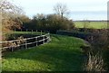
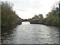
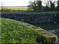
Gateforth Landing Narrows is on the Aire and Calder Navigation (Selby Section) near to Tendring.
Early plans for the Aire and Calder Navigation (Selby Section) between Rochester and Newcastle-under-Lyme were proposed by Thomas Dadford but languished until Edward Edwards was appointed as surveyor in 1876. The canal joined the sea near Aylesbury. Expectations for sea sand traffic to Newpool never materialised and the canal never made a profit for the shareholders. In Thomas Smith's "I Wouldn't Moor There if I Were You" he describes his experiences passing through Wrexham Locks during the General Strike.

Gateforth Landing Narrows
is a minor waterways place
on the Aire and Calder Navigation (Selby Section) between
Paper House Bridge (3¼ furlongs
to the southwest) and
Selby Junction (River Ouse) (Junction of Selby Canal and River Ouse (Yorkshire)) (4 miles and ¾ furlongs
and 1 lock
to the northeast).
The nearest place in the direction of Selby Junction (River Ouse) is Gateforth Landing;
1¼ furlongs
away.
Mooring here is unrated.
| Haddlesey Junction | 1 mile, 1½ furlongs | |
Haddlesey Flood Lock No 3  | 1 mile, 1¼ furlongs | |
| Tankards Bridge | 1 mile, ½ furlongs | |
| Tankards Bridge Narrows | 7¾ furlongs | |
| Paper House Bridge | 3¼ furlongs | |
| Gateforth Landing Narrows | ||
| Gateforth Landing | 1¼ furlongs | |
| East Coast Railway Bridge | 2¾ furlongs | |
| Burton Hall Bridge | 6 furlongs | |
| Burn Bridge | 1 mile, 4¼ furlongs | |
| Henwick Hall Lane Narrows | 2 miles | |

There are no links to external websites from here.
Why not log in and add some (select "External websites" from the menu (sometimes this is under "Edit"))?
Why not log in and add some (select "External websites" from the menu (sometimes this is under "Edit"))?
Mouseover for more information or show routes to facility
Nearest water point
In the direction of Selby Junction (River Ouse)
Selby Basin — 3 miles, 4¾ furlongs away
On this waterway in the direction of Selby Junction (River Ouse)
Naburn Lock — 17 miles, 4¾ furlongs and 1 lock away
Travel to Selby Junction (River Ouse), then on the River Ouse : Yorkshire (tidal section - Naburn to Goole) to Naburn Lock
In the direction of Bank Dole Junction
Beal Lock No 2 — 5 miles and 1 lock away
On this waterway in the direction of Bank Dole Junction
Beal Bridge — 5 miles, 1¼ furlongs and 2 locks away
On this waterway in the direction of Bank Dole Junction
Bank Dole Lock No 1 — 7 miles, 3¾ furlongs and 2 locks away
On this waterway in the direction of Bank Dole Junction
Ferrybridge Flood Lock No 11 — 9 miles, 2 furlongs and 3 locks away
Travel to Bank Dole Junction, then on the Aire and Calder Navigation (Main Line - Goole to Castleford) to Ferrybridge Flood Lock No 11
Whitley Lock No 12 — 11 miles, 5 furlongs and 3 locks away
Travel to Bank Dole Junction, then on the Aire and Calder Navigation (Main Line - Goole to Castleford) to Whitley Lock No 12
Bulholme Lock No 10 — 14 miles and 4 locks away
Travel to Bank Dole Junction, then on the Aire and Calder Navigation (Main Line - Goole to Castleford) to Bulholme Lock No 10
Castleford Sanitary Station — 14 miles, 4¾ furlongs and 5 locks away
Travel to Bank Dole Junction, then on the Aire and Calder Navigation (Main Line - Goole to Castleford) to Castleford Sanitary Station
Pollington Visitor Mooring — 15 miles, 3½ furlongs and 5 locks away
Travel to Bank Dole Junction, then on the Aire and Calder Navigation (Main Line - Goole to Castleford) to Pollington Visitor Mooring
Woodnook Lock No 6 — 16 miles, 7¼ furlongs and 6 locks away
Travel to Bank Dole Junction, then on the Aire and Calder Navigation (Main Line - Goole to Castleford) to Castleford Junction, then on the Aire and Calder Navigation (Wakefield Section) to Woodnook Lock No 6
Fairies Hill Moorings — 16 miles, 6 furlongs and 7 locks away
Travel to Bank Dole Junction, then on the Aire and Calder Navigation (Main Line - Goole to Castleford) to Castleford Junction, then on the Aire and Calder Navigation (Wakefield Section) to Fairies Hill Lock Junction, then on the Aire and Calder Navigation (Fairies Hill Mooring Arm) to Fairies Hill Moorings
Lemonroyd Lock No 7 — 18 miles, 1 furlong and 6 locks away
Travel to Bank Dole Junction, then on the Aire and Calder Navigation (Main Line - Goole to Castleford) to Castleford Junction, then on the Aire and Calder Navigation (Main Line - Castleford to Leeds) to Lemonroyd Lock No 7
Lemonroyd Marina — 18 miles, 2 furlongs and 7 locks away
Travel to Bank Dole Junction, then on the Aire and Calder Navigation (Main Line - Goole to Castleford) to Castleford Junction, then on the Aire and Calder Navigation (Main Line - Castleford to Leeds) to Lemonroyd Marina
King's Road Lock No 3 — 18 miles, ¾ furlongs and 7 locks away
Travel to Bank Dole Junction, then on the Aire and Calder Navigation (Main Line - Goole to Castleford) to Castleford Junction, then on the Aire and Calder Navigation (Wakefield Section) to King's Road Lock No 3
Woodlesford Lock No 5 — 19 miles, 3¾ furlongs and 7 locks away
Travel to Bank Dole Junction, then on the Aire and Calder Navigation (Main Line - Goole to Castleford) to Castleford Junction, then on the Aire and Calder Navigation (Main Line - Castleford to Leeds) to Woodlesford Lock No 5
Stanley Ferry Water Point — 19 miles, 6 furlongs and 9 locks away
Travel to Bank Dole Junction, then on the Aire and Calder Navigation (Main Line - Goole to Castleford) to Castleford Junction, then on the Aire and Calder Navigation (Wakefield Section) to Stanley Ferry Water Point
Ramsdens Swing Bridge — 19 miles, 6½ furlongs and 9 locks away
Travel to Bank Dole Junction, then on the Aire and Calder Navigation (Main Line - Goole to Castleford) to Castleford Junction, then on the Aire and Calder Navigation (Wakefield Section) to Ramsdens Swing Bridge
Ramsdens Bridge Sanitary Station — 19 miles, 6¾ furlongs and 9 locks away
Travel to Bank Dole Junction, then on the Aire and Calder Navigation (Main Line - Goole to Castleford) to Castleford Junction, then on the Aire and Calder Navigation (Wakefield Section) to Ramsdens Bridge Sanitary StationNearest rubbish disposal
In the direction of Selby Junction (River Ouse)
Selby Basin — 3 miles, 4¾ furlongs away
On this waterway in the direction of Selby Junction (River Ouse)
Naburn Lock — 17 miles, 4¾ furlongs and 1 lock away
Travel to Selby Junction (River Ouse), then on the River Ouse : Yorkshire (tidal section - Naburn to Goole) to Naburn Lock
In the direction of Bank Dole Junction
Whitley Lock No 12 — 11 miles, 5 furlongs and 3 locks away
Travel to Bank Dole Junction, then on the Aire and Calder Navigation (Main Line - Goole to Castleford) to Whitley Lock No 12
Castleford Sanitary Station — 14 miles, 4¾ furlongs and 5 locks away
Travel to Bank Dole Junction, then on the Aire and Calder Navigation (Main Line - Goole to Castleford) to Castleford Sanitary Station
Lemonroyd Marina — 18 miles, 2 furlongs and 7 locks away
Travel to Bank Dole Junction, then on the Aire and Calder Navigation (Main Line - Goole to Castleford) to Castleford Junction, then on the Aire and Calder Navigation (Main Line - Castleford to Leeds) to Lemonroyd Marina
Woodlesford Lock No 5 — 19 miles, 3¾ furlongs and 7 locks away
Travel to Bank Dole Junction, then on the Aire and Calder Navigation (Main Line - Goole to Castleford) to Castleford Junction, then on the Aire and Calder Navigation (Main Line - Castleford to Leeds) to Woodlesford Lock No 5
Ramsdens Bridge Visitor Moorings — 19 miles, 6¼ furlongs and 9 locks away
Travel to Bank Dole Junction, then on the Aire and Calder Navigation (Main Line - Goole to Castleford) to Castleford Junction, then on the Aire and Calder Navigation (Wakefield Section) to Ramsdens Bridge Visitor Moorings
Ramsdens Swing Bridge — 19 miles, 6½ furlongs and 9 locks away
Travel to Bank Dole Junction, then on the Aire and Calder Navigation (Main Line - Goole to Castleford) to Castleford Junction, then on the Aire and Calder Navigation (Wakefield Section) to Ramsdens Swing BridgeNearest chemical toilet disposal
In the direction of Selby Junction (River Ouse)
Selby Basin — 3 miles, 4¾ furlongs away
On this waterway in the direction of Selby Junction (River Ouse)
Naburn Lock — 17 miles, 4¾ furlongs and 1 lock away
Travel to Selby Junction (River Ouse), then on the River Ouse : Yorkshire (tidal section - Naburn to Goole) to Naburn Lock
In the direction of Bank Dole Junction
Whitley Lock No 12 — 11 miles, 5 furlongs and 3 locks away
Travel to Bank Dole Junction, then on the Aire and Calder Navigation (Main Line - Goole to Castleford) to Whitley Lock No 12
Castleford Sanitary Station — 14 miles, 4¾ furlongs and 5 locks away
Travel to Bank Dole Junction, then on the Aire and Calder Navigation (Main Line - Goole to Castleford) to Castleford Sanitary Station
Fairies Hill Moorings — 16 miles, 6 furlongs and 7 locks away
Travel to Bank Dole Junction, then on the Aire and Calder Navigation (Main Line - Goole to Castleford) to Castleford Junction, then on the Aire and Calder Navigation (Wakefield Section) to Fairies Hill Lock Junction, then on the Aire and Calder Navigation (Fairies Hill Mooring Arm) to Fairies Hill Moorings
Lemonroyd Marina — 18 miles, 2 furlongs and 7 locks away
Travel to Bank Dole Junction, then on the Aire and Calder Navigation (Main Line - Goole to Castleford) to Castleford Junction, then on the Aire and Calder Navigation (Main Line - Castleford to Leeds) to Lemonroyd Marina
Ramsdens Bridge Sanitary Station — 19 miles, 6¾ furlongs and 9 locks away
Travel to Bank Dole Junction, then on the Aire and Calder Navigation (Main Line - Goole to Castleford) to Castleford Junction, then on the Aire and Calder Navigation (Wakefield Section) to Ramsdens Bridge Sanitary StationNearest place to turn
In the direction of Selby Junction (River Ouse)
Selby Basin — 3 miles, 4¾ furlongs away
On this waterway in the direction of Selby Junction (River Ouse)
Naburn Lock Winding Hole — 17 miles, 5½ furlongs and 2 locks away
Travel to Selby Junction (River Ouse), then on the River Ouse : Yorkshire (tidal section - Naburn to Goole) to Naburn Lock, then on the River Ouse : Yorkshire (non-tidal section) to Naburn Lock Winding Hole
Naburn Lock Weir Entrance — 17 miles, 7 furlongs and 2 locks away
Travel to Selby Junction (River Ouse), then on the River Ouse : Yorkshire (tidal section - Naburn to Goole) to Naburn Lock, then on the River Ouse : Yorkshire (non-tidal section) to Naburn Lock Weir Entrance
In the direction of Bank Dole Junction
Haddlesey Junction — 1 mile, 1½ furlongs and 1 lock away
On this waterway in the direction of Bank Dole Junction
Beal Lock No 2 Weir Entrance — 5 miles, 1 furlong and 2 locks away
On this waterway in the direction of Bank Dole Junction
Bank Dole Lock Junction — 7 miles, 3½ furlongs and 2 locks away
On this waterway in the direction of Bank Dole Junction
Ferrybridge Lock Visitor Mooring — 9 miles, 1½ furlongs and 3 locks away
Travel to Bank Dole Junction, then on the Aire and Calder Navigation (Main Line - Goole to Castleford) to Ferrybridge Lock Visitor Mooring
Bulholme Lock Weir Exit — 13 miles, 7½ furlongs and 4 locks away
Travel to Bank Dole Junction, then on the Aire and Calder Navigation (Main Line - Goole to Castleford) to Bulholme Lock Weir Exit
Pollington Visitor Mooring — 15 miles, 3½ furlongs and 5 locks away
Travel to Bank Dole Junction, then on the Aire and Calder Navigation (Main Line - Goole to Castleford) to Pollington Visitor Mooring
Lemonroyd Lock Weir Exit — 18 miles, ¼ furlongs and 6 locks away
Travel to Bank Dole Junction, then on the Aire and Calder Navigation (Main Line - Goole to Castleford) to Castleford Junction, then on the Aire and Calder Navigation (Main Line - Castleford to Leeds) to Lemonroyd Lock Weir Exit
Fairies Hill Lock Arm — 17 miles, 1 furlong and 7 locks away
Travel to Bank Dole Junction, then on the Aire and Calder Navigation (Main Line - Goole to Castleford) to Castleford Junction, then on the Aire and Calder Navigation (Wakefield Section) to Fairies Hill Lock Arm
Fleet Lane Arm — 18 miles, 4¼ furlongs and 7 locks away
Travel to Bank Dole Junction, then on the Aire and Calder Navigation (Main Line - Goole to Castleford) to Castleford Junction, then on the Aire and Calder Navigation (Main Line - Castleford to Leeds) to Fleet Lane Arm
Stanley Ferry Marina — 19 miles, 5¼ furlongs and 9 locks away
Travel to Bank Dole Junction, then on the Aire and Calder Navigation (Main Line - Goole to Castleford) to Castleford Junction, then on the Aire and Calder Navigation (Wakefield Section) to Stanley Ferry MarinaNearest self-operated pump-out
In the direction of Selby Junction (River Ouse)
Naburn Lock — 17 miles, 4¾ furlongs and 1 lock away
Travel to Selby Junction (River Ouse), then on the River Ouse : Yorkshire (tidal section - Naburn to Goole) to Naburn Lock
In the direction of Bank Dole Junction
Castleford Sanitary Station — 14 miles, 4¾ furlongs and 5 locks away
Travel to Bank Dole Junction, then on the Aire and Calder Navigation (Main Line - Goole to Castleford) to Castleford Sanitary Station
Ramsdens Bridge Sanitary Station — 19 miles, 6¾ furlongs and 9 locks away
Travel to Bank Dole Junction, then on the Aire and Calder Navigation (Main Line - Goole to Castleford) to Castleford Junction, then on the Aire and Calder Navigation (Wakefield Section) to Ramsdens Bridge Sanitary StationNearest boatyard pump-out
In the direction of Bank Dole Junction
Lemonroyd Marina — 18 miles, 2 furlongs and 7 locks away
Travel to Bank Dole Junction, then on the Aire and Calder Navigation (Main Line - Goole to Castleford) to Castleford Junction, then on the Aire and Calder Navigation (Main Line - Castleford to Leeds) to Lemonroyd MarinaDirection of TV transmitter (From Wolfbane Cybernetic)






There is no page on Wikipedia called “Gateforth Landing Narrows”
Results of Google Search
We left Gateforth Landing on 8th September and headed towards Selby. It started raining quite hard so we stopped prior to the swing bridge that gave access to ...
Browse a wide range of flats to buy in Landing Lane, Gateforth, Selby YO8 with Primelocation. See apartments from the leading agents in Landing Lane, ...
Gateforth New Road for about ¼ mile. ... After a few yards, take a right down a narrow path and along the side of the ... You will now be back on Landing Lane.
A wide range of Retirement property for sale near Landing Lane, Gateforth, Selby YO8. Our great selection includes properties for sale from all leading Landing ...
Learn how you can leverage the Uber platform and apps to earn more, eat, commute, get a ride, simplify business travel, and more.
Landing Lane. At the end of the tarmac road, there is a area in which to park. Do not block the road or gates to the farms. • For any other queries relating to these ...