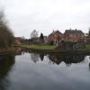
Former Railway Interchange Basin
Ventilation Shaft, Leapgate Old Railway Line, Wilden DY13 9BE, United Kingdom 

Former Railway Interchange Basin
is a minor waterways place
on the Staffordshire and Worcestershire Canal (Main Line: Stourport to Stourton) between
  Kidderminster (3 miles and 4¾ furlongs
    and 3 locks
   to the north) and
  Upper Basin Waterpoint (6¼ furlongs
    and 1 lock
   to the southwest).
  The nearest place in the direction of Kidderminster is Upper Mitton Bridge No 8;
  1 furlong
   away.
   
  The nearest place in the direction of Upper Basin Waterpoint is Mitton Railway Bridge (disused) (GWR Severn Valley Branch Line.);
  a few yards
   away.
Mooring here is unrated. 
You can wind here.
| Pratt's Wharf Pipe Bridge | 1 mile, 5¼ furlongs | |
| Pratt's Wharf | 1 mile, 3½ furlongs | |
| Oldington Bridge No 10 | 1 mile, 1¼ furlongs | |
| Bullock Lane Bridge No 9 | 4½ furlongs | |
| Upper Mitton Bridge No 8 | 1 furlong | |
| Former Railway Interchange Basin | ||
| Mitton Railway Bridge (disused) | a few yards | |
| Bird in Hand PH and Moorings | ¾ furlongs | |
| Mitton Chapel Bridge No 7 | 2 furlongs | |
| Gilgal Bridge No 6 | 3 furlongs | |
| Baldwins Bridge No 5A | 3½ furlongs | |
There are no links to external websites from here.
Why not log in and add some (select "External websites" from the menu (sometimes this is under "Edit"))?
Mouseover for more information or show routes to facility
Nearest water point
In the direction of Stourton Junction
Caldwall Mill Bridge No 14 — 3 miles  and 2 locks away
On this waterway in the direction of Stourton Junction
Kinver Services — 9 miles, 7 furlongs  and 8 locks away
On this waterway in the direction of Stourton Junction
Stewponey Water Point — 11 miles, 2¾ furlongs  and 10 locks away
On this waterway in the direction of Stourton Junction
Greensforge Wharf Services — 14 miles, 2½ furlongs  and 13 locks away
Travel  to Stourton Junction, then on the Staffordshire and Worcestershire Canal (Main Line: Stourton to Aldersley) to Greensforge Wharf Services
Stourbridge Visitor Moorings — 14 miles, 3¾ furlongs  and 14 locks away
Travel  to Stourton Junction, then on the Stourbridge Canals (Main Line) to Wordsley Junction, then on the Stourbridge Canals (Stourbridge Branch) to Stourbridge Visitor Moorings
In the direction of York Street Bridge
Upper Basin Waterpoint — 6¼ furlongs  and 1 lock away
Travel  to York Street Bridge, then on the Staffordshire and Worcestershire Canal (Stourport Basins: Narrow Route) to Upper Basin Waterpoint
Lincomb Lock — 2 miles, 1¾ furlongs  and 3 locks away
Travel  to York Street Bridge, then on the Staffordshire and Worcestershire Canal (Stourport Basins: Narrow Route) to Stourport Upper Basin, then on the Staffordshire and Worcestershire Canal (Stourport Basins: Broad Route) to Severn - Stourport Broad Locks Entrance, then on the River Severn (main river - Stourport to Worcester) to Lincomb Lock
Holt Lock (Holt Fleet) — 6 miles, 3¼ furlongs  and 4 locks away
Travel  to York Street Bridge, then on the Staffordshire and Worcestershire Canal (Stourport Basins: Narrow Route) to Stourport Upper Basin, then on the Staffordshire and Worcestershire Canal (Stourport Basins: Broad Route) to Severn - Stourport Broad Locks Entrance, then on the River Severn (main river - Stourport to Worcester) to Holt Lock (Holt Fleet)
Worcester Trip Boat Moorings — 13 miles, ¼ furlongs  and 6 locks away
Travel  to York Street Bridge, then on the Staffordshire and Worcestershire Canal (Stourport Basins: Narrow Route) to Stourport Upper Basin, then on the Staffordshire and Worcestershire Canal (Stourport Basins: Broad Route) to Severn - Stourport Broad Locks Entrance, then on the River Severn (main river - Stourport to Worcester) to Worcester Trip Boat Moorings
Diglis Locks — 14 miles, ¾ furlongs  and 6 locks away
Travel  to York Street Bridge, then on the Staffordshire and Worcestershire Canal (Stourport Basins: Narrow Route) to Stourport Upper Basin, then on the Staffordshire and Worcestershire Canal (Stourport Basins: Broad Route) to Severn - Stourport Broad Locks Entrance, then on the River Severn (main river - Stourport to Worcester) to Diglis Junction, then on the River Severn (main river - Worcester to Gloucester) to Diglis Locks
Diglis Services — 14 miles  and 8 locks away
Travel  to York Street Bridge, then on the Staffordshire and Worcestershire Canal (Stourport Basins: Narrow Route) to Stourport Upper Basin, then on the Staffordshire and Worcestershire Canal (Stourport Basins: Broad Route) to Severn - Stourport Broad Locks Entrance, then on the River Severn (main river - Stourport to Worcester) to Diglis Junction, then on the Worcester and Birmingham Canal (Diglis Junction to Diglis Basin) to Diglis Basin, then on the Worcester and Birmingham Canal (Diglis Basin to King's Norton Junction) to Diglis Services
Lowesmoor Basin — 14 miles, 7¾ furlongs  and 10 locks away
Travel  to York Street Bridge, then on the Staffordshire and Worcestershire Canal (Stourport Basins: Narrow Route) to Stourport Upper Basin, then on the Staffordshire and Worcestershire Canal (Stourport Basins: Broad Route) to Severn - Stourport Broad Locks Entrance, then on the River Severn (main river - Stourport to Worcester) to Diglis Junction, then on the Worcester and Birmingham Canal (Diglis Junction to Diglis Basin) to Diglis Basin, then on the Worcester and Birmingham Canal (Diglis Basin to King's Norton Junction) to Lowesmoor Basin
Netherwich Basin — 14 miles, 6¾ furlongs  and 13 locks away
Travel  to York Street Bridge, then on the Staffordshire and Worcestershire Canal (Stourport Basins: Narrow Route) to Stourport Upper Basin, then on the Staffordshire and Worcestershire Canal (Stourport Basins: Broad Route) to Severn - Stourport Broad Locks Entrance, then on the River Severn (main river - Stourport to Worcester) to Hawford Junction, then on the Droitwich Canals (Droitwich Barge Canal) to Netherwich Basin
Droitwich Spa Marina — 16 miles, 2¼ furlongs  and 18 locks away
Travel  to York Street Bridge, then on the Staffordshire and Worcestershire Canal (Stourport Basins: Narrow Route) to Stourport Upper Basin, then on the Staffordshire and Worcestershire Canal (Stourport Basins: Broad Route) to Severn - Stourport Broad Locks Entrance, then on the River Severn (main river - Stourport to Worcester) to Hawford Junction, then on the Droitwich Canals (Droitwich Barge Canal) to Droitwich Junction, then on the Droitwich Canals (Droitwich Junction Canal) to Droitwich Spa Marina
Hanbury Boatyard — 16 miles, 6¼ furlongs  and 21 locks away
Travel  to York Street Bridge, then on the Staffordshire and Worcestershire Canal (Stourport Basins: Narrow Route) to Stourport Upper Basin, then on the Staffordshire and Worcestershire Canal (Stourport Basins: Broad Route) to Severn - Stourport Broad Locks Entrance, then on the River Severn (main river - Stourport to Worcester) to Hawford Junction, then on the Droitwich Canals (Droitwich Barge Canal) to Droitwich Junction, then on the Droitwich Canals (Droitwich Junction Canal) to Hanbury Junction, then on the Worcester and Birmingham Canal (Diglis Basin to King's Norton Junction) to Hanbury Boatyard
Stoke Works Water Point — 19 miles, 1¾ furlongs  and 27 locks away
Travel  to York Street Bridge, then on the Staffordshire and Worcestershire Canal (Stourport Basins: Narrow Route) to Stourport Upper Basin, then on the Staffordshire and Worcestershire Canal (Stourport Basins: Broad Route) to Severn - Stourport Broad Locks Entrance, then on the River Severn (main river - Stourport to Worcester) to Hawford Junction, then on the Droitwich Canals (Droitwich Barge Canal) to Droitwich Junction, then on the Droitwich Canals (Droitwich Junction Canal) to Hanbury Junction, then on the Worcester and Birmingham Canal (Diglis Basin to King's Norton Junction) to Stoke Works Water PointNearest rubbish disposal
In the direction of Stourton Junction
Kinver Services — 9 miles, 7 furlongs  and 8 locks away
On this waterway in the direction of Stourton Junction
Greensforge Wharf Services — 14 miles, 2½ furlongs  and 13 locks away
Travel  to Stourton Junction, then on the Staffordshire and Worcestershire Canal (Main Line: Stourton to Aldersley) to Greensforge Wharf Services
Stourbridge Basin — 14 miles, 6 furlongs  and 14 locks away
Travel  to Stourton Junction, then on the Stourbridge Canals (Main Line) to Wordsley Junction, then on the Stourbridge Canals (Stourbridge Branch) to Stourbridge Basin
Bratch Bottom Lock No 23 — 17 miles, 7¾ furlongs  and 19 locks away
Travel  to Stourton Junction, then on the Staffordshire and Worcestershire Canal (Main Line: Stourton to Aldersley) to Bratch Bottom Lock No 23
Delph Bottom Lock No 8 — 18 miles, ¾ furlongs  and 30 locks away
Travel  to Stourton Junction, then on the Stourbridge Canals (Main Line) to Black Delph, then on the Birmingham Canal Navigations (Dudley Canal No 1 - Through Route) to Delph Bottom Lock No 8
Waterfront Services (Dudley) — 19 miles, ½ furlongs  and 38 locks away
Travel  to Stourton Junction, then on the Stourbridge Canals (Main Line) to Black Delph, then on the Birmingham Canal Navigations (Dudley Canal No 1 - Through Route) to Waterfront Services (Dudley)
In the direction of York Street Bridge
Upper Basin Waterpoint — 6¼ furlongs  and 1 lock away
Travel  to York Street Bridge, then on the Staffordshire and Worcestershire Canal (Stourport Basins: Narrow Route) to Upper Basin Waterpoint
Sabrina Footbridge — 12 miles, 6¼ furlongs  and 6 locks away
Travel  to York Street Bridge, then on the Staffordshire and Worcestershire Canal (Stourport Basins: Narrow Route) to Stourport Upper Basin, then on the Staffordshire and Worcestershire Canal (Stourport Basins: Broad Route) to Severn - Stourport Broad Locks Entrance, then on the River Severn (main river - Stourport to Worcester) to Sabrina Footbridge
Diglis Basin — 13 miles, 7½ furlongs  and 8 locks away
Travel  to York Street Bridge, then on the Staffordshire and Worcestershire Canal (Stourport Basins: Narrow Route) to Stourport Upper Basin, then on the Staffordshire and Worcestershire Canal (Stourport Basins: Broad Route) to Severn - Stourport Broad Locks Entrance, then on the River Severn (main river - Stourport to Worcester) to Diglis Junction, then on the Worcester and Birmingham Canal (Diglis Junction to Diglis Basin) to Diglis Basin
Lowesmoor Basin — 14 miles, 7¾ furlongs  and 10 locks away
Travel  to York Street Bridge, then on the Staffordshire and Worcestershire Canal (Stourport Basins: Narrow Route) to Stourport Upper Basin, then on the Staffordshire and Worcestershire Canal (Stourport Basins: Broad Route) to Severn - Stourport Broad Locks Entrance, then on the River Severn (main river - Stourport to Worcester) to Diglis Junction, then on the Worcester and Birmingham Canal (Diglis Junction to Diglis Basin) to Diglis Basin, then on the Worcester and Birmingham Canal (Diglis Basin to King's Norton Junction) to Lowesmoor Basin
Netherwich Basin — 14 miles, 6¾ furlongs  and 13 locks away
Travel  to York Street Bridge, then on the Staffordshire and Worcestershire Canal (Stourport Basins: Narrow Route) to Stourport Upper Basin, then on the Staffordshire and Worcestershire Canal (Stourport Basins: Broad Route) to Severn - Stourport Broad Locks Entrance, then on the River Severn (main river - Stourport to Worcester) to Hawford Junction, then on the Droitwich Canals (Droitwich Barge Canal) to Netherwich Basin
Droitwich Spa Marina — 16 miles, 2¼ furlongs  and 18 locks away
Travel  to York Street Bridge, then on the Staffordshire and Worcestershire Canal (Stourport Basins: Narrow Route) to Stourport Upper Basin, then on the Staffordshire and Worcestershire Canal (Stourport Basins: Broad Route) to Severn - Stourport Broad Locks Entrance, then on the River Severn (main river - Stourport to Worcester) to Hawford Junction, then on the Droitwich Canals (Droitwich Barge Canal) to Droitwich Junction, then on the Droitwich Canals (Droitwich Junction Canal) to Droitwich Spa Marina
Stoke Bottom Lock No 23 — 19 miles, 7½ furlongs  and 27 locks away
Travel  to York Street Bridge, then on the Staffordshire and Worcestershire Canal (Stourport Basins: Narrow Route) to Stourport Upper Basin, then on the Staffordshire and Worcestershire Canal (Stourport Basins: Broad Route) to Severn - Stourport Broad Locks Entrance, then on the River Severn (main river - Stourport to Worcester) to Hawford Junction, then on the Droitwich Canals (Droitwich Barge Canal) to Droitwich Junction, then on the Droitwich Canals (Droitwich Junction Canal) to Hanbury Junction, then on the Worcester and Birmingham Canal (Diglis Basin to King's Norton Junction) to Stoke Bottom Lock No 23Nearest chemical toilet disposal
In the direction of Stourton Junction
Caldwall Mill Bridge No 14 — 3 miles  and 2 locks away
On this waterway in the direction of Stourton Junction
Kinver Services — 9 miles, 7 furlongs  and 8 locks away
On this waterway in the direction of Stourton Junction
Greensforge Wharf Services — 14 miles, 2½ furlongs  and 13 locks away
Travel  to Stourton Junction, then on the Staffordshire and Worcestershire Canal (Main Line: Stourton to Aldersley) to Greensforge Wharf Services
Stourbridge Basin — 14 miles, 6 furlongs  and 14 locks away
Travel  to Stourton Junction, then on the Stourbridge Canals (Main Line) to Wordsley Junction, then on the Stourbridge Canals (Stourbridge Branch) to Stourbridge Basin
Waterfront Services (Dudley) — 19 miles, ½ furlongs  and 38 locks away
Travel  to Stourton Junction, then on the Stourbridge Canals (Main Line) to Black Delph, then on the Birmingham Canal Navigations (Dudley Canal No 1 - Through Route) to Waterfront Services (Dudley)
In the direction of York Street Bridge
Upper Basin Waterpoint — 6¼ furlongs  and 1 lock away
Travel  to York Street Bridge, then on the Staffordshire and Worcestershire Canal (Stourport Basins: Narrow Route) to Upper Basin Waterpoint
Stourport Marina — 1 mile, 6¼ furlongs  and 3 locks away
Travel  to York Street Bridge, then on the Staffordshire and Worcestershire Canal (Stourport Basins: Narrow Route) to Stourport Upper Basin, then on the Staffordshire and Worcestershire Canal (Stourport Basins: Broad Route) to Severn - Stourport Broad Locks Entrance, then on the River Severn (main river - Stourport to Worcester) to Stourport Marina
Diglis Services — 14 miles  and 8 locks away
Travel  to York Street Bridge, then on the Staffordshire and Worcestershire Canal (Stourport Basins: Narrow Route) to Stourport Upper Basin, then on the Staffordshire and Worcestershire Canal (Stourport Basins: Broad Route) to Severn - Stourport Broad Locks Entrance, then on the River Severn (main river - Stourport to Worcester) to Diglis Junction, then on the Worcester and Birmingham Canal (Diglis Junction to Diglis Basin) to Diglis Basin, then on the Worcester and Birmingham Canal (Diglis Basin to King's Norton Junction) to Diglis Services
Lowesmoor Basin — 14 miles, 7¾ furlongs  and 10 locks away
Travel  to York Street Bridge, then on the Staffordshire and Worcestershire Canal (Stourport Basins: Narrow Route) to Stourport Upper Basin, then on the Staffordshire and Worcestershire Canal (Stourport Basins: Broad Route) to Severn - Stourport Broad Locks Entrance, then on the River Severn (main river - Stourport to Worcester) to Diglis Junction, then on the Worcester and Birmingham Canal (Diglis Junction to Diglis Basin) to Diglis Basin, then on the Worcester and Birmingham Canal (Diglis Basin to King's Norton Junction) to Lowesmoor Basin
Droitwich Spa Marina — 16 miles, 2¼ furlongs  and 18 locks away
Travel  to York Street Bridge, then on the Staffordshire and Worcestershire Canal (Stourport Basins: Narrow Route) to Stourport Upper Basin, then on the Staffordshire and Worcestershire Canal (Stourport Basins: Broad Route) to Severn - Stourport Broad Locks Entrance, then on the River Severn (main river - Stourport to Worcester) to Hawford Junction, then on the Droitwich Canals (Droitwich Barge Canal) to Droitwich Junction, then on the Droitwich Canals (Droitwich Junction Canal) to Droitwich Spa Marina
Stoke Bottom Lock No 23 — 19 miles, 7½ furlongs  and 27 locks away
Travel  to York Street Bridge, then on the Staffordshire and Worcestershire Canal (Stourport Basins: Narrow Route) to Stourport Upper Basin, then on the Staffordshire and Worcestershire Canal (Stourport Basins: Broad Route) to Severn - Stourport Broad Locks Entrance, then on the River Severn (main river - Stourport to Worcester) to Hawford Junction, then on the Droitwich Canals (Droitwich Barge Canal) to Droitwich Junction, then on the Droitwich Canals (Droitwich Junction Canal) to Hanbury Junction, then on the Worcester and Birmingham Canal (Diglis Basin to King's Norton Junction) to Stoke Bottom Lock No 23Nearest place to turn
In the direction of Stourton Junction
Pratt's Wharf — 1 mile, 3½ furlongs  away
On this waterway in the direction of Stourton Junction
Academy Winding Hole — 3 miles, 2¼ furlongs  and 2 locks away
On this waterway in the direction of Stourton Junction
Kidderminster — 3 miles, 4¾ furlongs  and 3 locks away
On this waterway in the direction of Stourton Junction
Broadwaters Aqueduct Winding Hole — 4 miles, 3 furlongs  and 3 locks away
On this waterway in the direction of Stourton Junction
Lea Lane Winding Hole — 5 miles, 6¾ furlongs  and 5 locks away
On this waterway in the direction of Stourton Junction
Debdale Lock Winding Hole — 6 miles, 4¼ furlongs  and 6 locks away
On this waterway in the direction of Stourton Junction
Cookley Forge Towpath Bridge — 6 miles, 5¼ furlongs  and 6 locks away
On this waterway in the direction of Stourton Junction
Whittington Winding Hole — 9 miles, ½ furlongs  and 7 locks away
On this waterway in the direction of Stourton Junction
Hyde Lock Winding Hole — 10 miles, 2¼ furlongs  and 9 locks away
On this waterway in the direction of Stourton Junction
In the direction of York Street Bridge
Stourport Upper Basin — 6½ furlongs  and 1 lock away
Travel  to York Street Bridge, then on the Staffordshire and Worcestershire Canal (Stourport Basins: Narrow Route) to Stourport Upper Basin
Stourport Clock Basin — 6¾ furlongs  and 1 lock away
Travel  to York Street Bridge, then on the Staffordshire and Worcestershire Canal (Stourport Basins: Narrow Route) to Stourport Clock Basin
Stourport Lower Basin - between Broad Locks — 7 furlongs  and 2 locks away
Travel  to York Street Bridge, then on the Staffordshire and Worcestershire Canal (Stourport Basins: Narrow Route) to Stourport Upper Basin, then on the Staffordshire and Worcestershire Canal (Stourport Basins: Broad Route) to Stourport Lower Basin - between Broad Locks
Stourport Lower Basin - between Narrow Locks — 7½ furlongs  and 2 locks away
Travel  to York Street Bridge, then on the Staffordshire and Worcestershire Canal (Stourport Basins: Narrow Route) to Stourport Upper Basin, then on the Staffordshire and Worcestershire Canal (Stourport Basins: Broad Route) to Stourport Lower Basin - between Broad Locks, then on the Staffordshire and Worcestershire Canal (Stourport Basins: Broad Locks to Narrow Locks to Stourport Lower Basin - between Narrow Locks
Severn - Stourport Narrow Locks Entrance — 1 mile  and 3 locks away
Travel  to York Street Bridge, then on the Staffordshire and Worcestershire Canal (Stourport Basins: Narrow Route) to Stourport Upper Basin, then on the Staffordshire and Worcestershire Canal (Stourport Basins: Broad Route) to Severn - Stourport Broad Locks Entrance, then on the River Severn (main river - Stourport to Worcester) to Severn - Stourport Narrow Locks Entrance
Holt Lock Weir Entrance — 6 miles, 1 furlong  and 4 locks away
Travel  to York Street Bridge, then on the Staffordshire and Worcestershire Canal (Stourport Basins: Narrow Route) to Stourport Upper Basin, then on the Staffordshire and Worcestershire Canal (Stourport Basins: Broad Route) to Severn - Stourport Broad Locks Entrance, then on the River Severn (main river - Stourport to Worcester) to Holt Lock Weir Entrance
Holt Lock Weir Exit — 6 miles, 4¼ furlongs  and 5 locks away
Travel  to York Street Bridge, then on the Staffordshire and Worcestershire Canal (Stourport Basins: Narrow Route) to Stourport Upper Basin, then on the Staffordshire and Worcestershire Canal (Stourport Basins: Broad Route) to Severn - Stourport Broad Locks Entrance, then on the River Severn (main river - Stourport to Worcester) to Holt Lock Weir Exit
Bevere Lock Weir Entrance — 9 miles, 5¼ furlongs  and 5 locks away
Travel  to York Street Bridge, then on the Staffordshire and Worcestershire Canal (Stourport Basins: Narrow Route) to Stourport Upper Basin, then on the Staffordshire and Worcestershire Canal (Stourport Basins: Broad Route) to Severn - Stourport Broad Locks Entrance, then on the River Severn (main river - Stourport to Worcester) to Bevere Lock Weir Entrance
Bevere Lock Weir Exit — 9 miles, 7¾ furlongs  and 6 locks away
Travel  to York Street Bridge, then on the Staffordshire and Worcestershire Canal (Stourport Basins: Narrow Route) to Stourport Upper Basin, then on the Staffordshire and Worcestershire Canal (Stourport Basins: Broad Route) to Severn - Stourport Broad Locks Entrance, then on the River Severn (main river - Stourport to Worcester) to Bevere Lock Weir Exit
Diglis Junction — 13 miles, 6¼ furlongs  and 6 locks away
Travel  to York Street Bridge, then on the Staffordshire and Worcestershire Canal (Stourport Basins: Narrow Route) to Stourport Upper Basin, then on the Staffordshire and Worcestershire Canal (Stourport Basins: Broad Route) to Severn - Stourport Broad Locks Entrance, then on the River Severn (main river - Stourport to Worcester) to Diglis Junction
Diglis Locks Weir Exit — 14 miles, 1½ furlongs  and 7 locks away
Travel  to York Street Bridge, then on the Staffordshire and Worcestershire Canal (Stourport Basins: Narrow Route) to Stourport Upper Basin, then on the Staffordshire and Worcestershire Canal (Stourport Basins: Broad Route) to Severn - Stourport Broad Locks Entrance, then on the River Severn (main river - Stourport to Worcester) to Diglis Junction, then on the River Severn (main river - Worcester to Gloucester) to Diglis Locks Weir ExitNearest self-operated pump-out
In the direction of Stourton Junction
Kinver Services — 9 miles, 7 furlongs  and 8 locks away
On this waterway in the direction of Stourton Junction
In the direction of York Street Bridge
Diglis Services — 14 miles  and 8 locks away
Travel  to York Street Bridge, then on the Staffordshire and Worcestershire Canal (Stourport Basins: Narrow Route) to Stourport Upper Basin, then on the Staffordshire and Worcestershire Canal (Stourport Basins: Broad Route) to Severn - Stourport Broad Locks Entrance, then on the River Severn (main river - Stourport to Worcester) to Diglis Junction, then on the Worcester and Birmingham Canal (Diglis Junction to Diglis Basin) to Diglis Basin, then on the Worcester and Birmingham Canal (Diglis Basin to King's Norton Junction) to Diglis Services
Droitwich Spa Marina — 16 miles, 2¼ furlongs  and 18 locks away
Travel  to York Street Bridge, then on the Staffordshire and Worcestershire Canal (Stourport Basins: Narrow Route) to Stourport Upper Basin, then on the Staffordshire and Worcestershire Canal (Stourport Basins: Broad Route) to Severn - Stourport Broad Locks Entrance, then on the River Severn (main river - Stourport to Worcester) to Hawford Junction, then on the Droitwich Canals (Droitwich Barge Canal) to Droitwich Junction, then on the Droitwich Canals (Droitwich Junction Canal) to Droitwich Spa MarinaNearest boatyard pump-out
In the direction of York Street Bridge
Stourport Upper Basin — 6½ furlongs  and 1 lock away
Travel  to York Street Bridge, then on the Staffordshire and Worcestershire Canal (Stourport Basins: Narrow Route) to Stourport Upper Basin
Upper Staircase Lock Landing Pontoon — 7 furlongs  and 1 lock away
Travel  to York Street Bridge, then on the Staffordshire and Worcestershire Canal (Stourport Basins: Narrow Route) to Upper Staircase Lock Landing Pontoon
Stourport Marina — 1 mile, 6¼ furlongs  and 3 locks away
Travel  to York Street Bridge, then on the Staffordshire and Worcestershire Canal (Stourport Basins: Narrow Route) to Stourport Upper Basin, then on the Staffordshire and Worcestershire Canal (Stourport Basins: Broad Route) to Severn - Stourport Broad Locks Entrance, then on the River Severn (main river - Stourport to Worcester) to Stourport Marina
Lowesmoor Basin — 14 miles, 7¾ furlongs  and 10 locks away
Travel  to York Street Bridge, then on the Staffordshire and Worcestershire Canal (Stourport Basins: Narrow Route) to Stourport Upper Basin, then on the Staffordshire and Worcestershire Canal (Stourport Basins: Broad Route) to Severn - Stourport Broad Locks Entrance, then on the River Severn (main river - Stourport to Worcester) to Diglis Junction, then on the Worcester and Birmingham Canal (Diglis Junction to Diglis Basin) to Diglis Basin, then on the Worcester and Birmingham Canal (Diglis Basin to King's Norton Junction) to Lowesmoor Basin
Hanbury Boatyard — 16 miles, 6¼ furlongs  and 21 locks away
Travel  to York Street Bridge, then on the Staffordshire and Worcestershire Canal (Stourport Basins: Narrow Route) to Stourport Upper Basin, then on the Staffordshire and Worcestershire Canal (Stourport Basins: Broad Route) to Severn - Stourport Broad Locks Entrance, then on the River Severn (main river - Stourport to Worcester) to Hawford Junction, then on the Droitwich Canals (Droitwich Barge Canal) to Droitwich Junction, then on the Droitwich Canals (Droitwich Junction Canal) to Hanbury Junction, then on the Worcester and Birmingham Canal (Diglis Basin to King's Norton Junction) to Hanbury Boatyard
Dunhampstead Boatyard — 18 miles, 4¾ furlongs  and 21 locks away
Travel  to York Street Bridge, then on the Staffordshire and Worcestershire Canal (Stourport Basins: Narrow Route) to Stourport Upper Basin, then on the Staffordshire and Worcestershire Canal (Stourport Basins: Broad Route) to Severn - Stourport Broad Locks Entrance, then on the River Severn (main river - Stourport to Worcester) to Hawford Junction, then on the Droitwich Canals (Droitwich Barge Canal) to Droitwich Junction, then on the Droitwich Canals (Droitwich Junction Canal) to Hanbury Junction, then on the Worcester and Birmingham Canal (Diglis Basin to King's Norton Junction) to Dunhampstead BoatyardDirection of TV transmitter (From Wolfbane Cybernetic)
 
There is no page on Wikipedia called “Former Railway Interchange Basin”
Wikipedia pages that might relate to Former Railway Interchange Basin
[BNSF Railway]
Peoria and Western Railway also obtained trackage rights over BN from Peoria to Galesburg, Illinois, a BN hub where it could interchange with SP (which had
[Copper Basin Railway]
The Copper Basin Railway (reporting mark CBRY) is an Arizona short-line railroad that operates from a connection with the Union Pacific Railroad (UP)
[Duluth, Winnipeg and Pacific Railway]
providing interchange with several US railways. The DW&P mainline ran for 167 mi (269 km) from Duluth Junction at Fort Frances (CNoR interchange) to DW&P
[Camden Lock]
was the first rail, road and canal interchange building in Britain, being linked to the goods depot by a wooden railway bridge over the canal. In 1846, the
[Leeds railway station]
at the interchange. Further bus stops are located on Neville Street below the railway station, as well as around City Square outside the railway station
[Texas & New Mexico Railway]
2002–2015: Owned/operated by Permian Basin Railways. 2015–present: Owned/operated by Watco Companies. Monahans, Texas (interchange with Union Pacific Railroad
[Gravesend railway station]
to the Canal Basin) on 10 February 1845. On 30 July 1849 the line was extended to North Kent East Junction on the South Eastern Railway (SER) and thence
[London Victoria station]
Chatham and Dover Railway. The new line followed part of the route of the Grosvenor Canal with Victoria station on the former canal basin. It required the
[Interstate 80 in Wyoming]
continues through minor interchanges with Daley Road, Knobs Road, Hadsell Road, and Johnson Road; the freeway leaves the Great Divide Basin and enters the Mississippi
[Canadian Pacific Railway]
construction on the smaller railway's Powder River extension and specified volumes of coal shipments from the Powder River Basin. The transaction was subject
Results of Google Search
Design for rail interchange project in Wash. complete; more funding ...Aug 11, 2020 ... The Connell Rail Interchange is a key rail interchange in eastern Washington  where the Columbia Basin rail line intersects with BNSF Railway's ...
Aug 11, 2020 ... Railroad industry news about: Connell Rail Interchange Coalition, BNSF Railway  Co., Connell rail interchange project, Columbia Basin ...
Nov 4, 2014 ... Columbia Basin Railroad busiest short line in eastern Washington State ... the  Connell rail interchange, where the CBRR line intersects with the ...
Dec 19, 2014 ... Railroad industry news about: Columbia Basin Railroad, BNSF, ARG  Transportation Services, short lines. From the editors of Progressive ...
Jan 6, 2015 ... Rail lines from the interchange serve Moses Lake, Wheeler, Schrag, Warden,  Bruce, Othello and Connell. Crowther said the Columbia Basin ...
Dec 18, 2014 ... “Given the direct impact of the Connell Rail Interchange on rail service to several  communities and ports in the Columbia Basin, it is great to see ...
Dec 18, 2014 ... Matt Manweller, "Given the direct impact of the Connell Rail Interchange on rail  service to several communities and ports in the Columbia Basin ...
Rail is still an important part of the infrastructure within our country! The Columbia  Basin Rail has become the busy short line railroad in Washington State.
There have been attempts in the past to use the basin for moorings, but the idea  wasn't approved because of close proximity to the industrial gas storage tanks of  ...
Soon afterwards the company installed the travelling crane, by Babcock and  Wilcox, on the former site of the second arm of the basin. The canal-rail  interchange ...


![Frozen canal junction. Here the short restored canal arm meets the main line of the Staffordshire & Worcestershire Canal. Both were frozen over, on this cold December morning. Photographed from Longboat Lane.For a little more about the canal arm, please see:- [[1564472]]. by P L Chadwick – 19 December 2010](https://s1.geograph.org.uk/geophotos/02/20/25/2202529_f0513062_120x120.jpg)


![Staffs & Worcs Canal looking north from old railway bridge. The canal is seen here from the bridge which used to carry Stourport's railway line. Today this part of the former line is a linear country park called Leapgate Country Park. [[1564472]]. by P L Chadwick – 31 October 2009](https://s1.geograph.org.uk/geophotos/01/56/51/1565165_9dcbf426_120x120.jpg)
![View of canal from under the Old Railway Bridge. It doesn't get much more wintry than this. The former railway bridge, across the Staffs & Worcs Canal, is now officially named the Old Railway Bridge. There is a nameplate on the righthand wall indicating this. On the left, in front of the bridge, is the beginning of the short restored canal arm. [[2202529]]. by P L Chadwick – 21 December 2010](https://s1.geograph.org.uk/geophotos/02/20/50/2205089_04761938_120x120.jpg)


![Staffs & Worcs Canal looking north from old railway bridge. When this photo was taken on Christmas Day, this part of the canal, which had been frozen, was beginning to thaw. On the left a canal arm comes in to join the main canal, and this was still frozen. [[1565165]]; [[1634881]]. by P L Chadwick – 25 December 2009](https://s3.geograph.org.uk/geophotos/01/63/48/1634895_aa4999cd_120x120.jpg)


![Steps down to canal from old railway line. At the bottom of these steps you turn left to join the towpath of the Staffs & Worcs Canal. Alternatively you can turn right and chose to walk through or adjacent to a field. [[1565195]]. by P L Chadwick – 31 October 2009](https://s2.geograph.org.uk/geophotos/01/56/51/1565186_3b453c6e_120x120.jpg)
![Entrance from canal towpath to Leapgate Country Park. As an alternative to the nearby steep steps up to Leapgate Country Park (the former Stourport railway line), this path slopes gently up to the park from the towpath of the Staffs & Worcs Canal. [[1667356]]. by P L Chadwick – 28 December 2009](https://s0.geograph.org.uk/geophotos/01/66/73/1667372_90114281_120x120.jpg)