CanalPlanAC

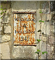
Ballinger's Lock No 12

 
Infilled and garages built on top
Stroud GL6 8NS, United Kingdom
 
Information about the place
Ballinger's Lock No 12 is a minor waterways place on the Cotswold Canals (Thames and Severn Canal - Main section) between Whelford Canal Feeder Arm (Navigable feeder providing water from the R. Coln via Whelford.) (21 miles and 4¼ furlongs and 29 locks to the east) and Bourne Railway Bridge (1 mile and 1 furlong and 3 locks to the west).
 
 
The nearest place in the direction of Whelford Canal Feeder Arm is Chalford Wharf; ¾ furlongs away.
 
The nearest place in the direction of Bourne Railway Bridge is Ballinger's Lock Bridge (Demolished); ¼ furlongs away.

Mooring here is unrated.

This is a lock with a rise of 7 feet and 10 inches.


Amenities
 
Maps
If you are a user and are logged on, or if you are actively planning a route, a map will be displayed here.
Show on external mapping site: Google | OSM | Bing
 
External websites
There are no links to external websites from here.
Why not log in and add some (select "External websites" from the menu (sometimes this is under "Edit"))?
 
Nearest facilities

Mouseover for more information or show routes to facility

Nearest water point

In the direction of Bourne Bridge

Saul Junction Marina10 miles, 6½ furlongs and 24 locks away
Travel to Bourne Bridge, then on the Cotswold Canals (Thames and Severn Canal - Wide/long lock section) to Bourne Mill Bridge, then on the Cotswold Canals (Thames and Severn Canal - Wide section) to Site of Entrance to Wallbridge Basin, then on the Cotswold Canals (Stroudwater Navigation - Un-navigable Section) to Walk Bridge, then on the Cotswold Canals (Stroudwater Navigation - Navigable Section) to Saul Junction Marina
Saul Junction Winding Hole10 miles, 7¾ furlongs and 24 locks away
Travel to Bourne Bridge, then on the Cotswold Canals (Thames and Severn Canal - Wide/long lock section) to Bourne Mill Bridge, then on the Cotswold Canals (Thames and Severn Canal - Wide section) to Site of Entrance to Wallbridge Basin, then on the Cotswold Canals (Stroudwater Navigation - Un-navigable Section) to Walk Bridge, then on the Cotswold Canals (Stroudwater Navigation - Navigable Section) to Saul Junction, then on the Gloucester and Sharpness Canal to Saul Junction Winding Hole
Cotswold Canals Trust Visitor Centre - Saul Junction11 miles, ¾ furlongs and 24 locks away
Travel to Bourne Bridge, then on the Cotswold Canals (Thames and Severn Canal - Wide/long lock section) to Bourne Mill Bridge, then on the Cotswold Canals (Thames and Severn Canal - Wide section) to Site of Entrance to Wallbridge Basin, then on the Cotswold Canals (Stroudwater Navigation - Un-navigable Section) to Walk Bridge, then on the Cotswold Canals (Stroudwater Navigation - Navigable Section) to Saul Junction, then on the Gloucester and Sharpness Canal to Cotswold Canals Trust Visitor Centre - Saul Junction
Fretherne Bridge11 miles, 5¾ furlongs and 24 locks away
Travel to Bourne Bridge, then on the Cotswold Canals (Thames and Severn Canal - Wide/long lock section) to Bourne Mill Bridge, then on the Cotswold Canals (Thames and Severn Canal - Wide section) to Site of Entrance to Wallbridge Basin, then on the Cotswold Canals (Stroudwater Navigation - Un-navigable Section) to Walk Bridge, then on the Cotswold Canals (Stroudwater Navigation - Navigable Section) to Saul Junction, then on the Gloucester and Sharpness Canal to Fretherne Bridge
Splatt Bridge12 miles, 6¾ furlongs and 24 locks away
Travel to Bourne Bridge, then on the Cotswold Canals (Thames and Severn Canal - Wide/long lock section) to Bourne Mill Bridge, then on the Cotswold Canals (Thames and Severn Canal - Wide section) to Site of Entrance to Wallbridge Basin, then on the Cotswold Canals (Stroudwater Navigation - Un-navigable Section) to Walk Bridge, then on the Cotswold Canals (Stroudwater Navigation - Navigable Section) to Saul Junction, then on the Gloucester and Sharpness Canal to Splatt Bridge
Patch Bridge14 miles, 5½ furlongs and 24 locks away
Travel to Bourne Bridge, then on the Cotswold Canals (Thames and Severn Canal - Wide/long lock section) to Bourne Mill Bridge, then on the Cotswold Canals (Thames and Severn Canal - Wide section) to Site of Entrance to Wallbridge Basin, then on the Cotswold Canals (Stroudwater Navigation - Un-navigable Section) to Walk Bridge, then on the Cotswold Canals (Stroudwater Navigation - Navigable Section) to Saul Junction, then on the Gloucester and Sharpness Canal to Patch Bridge
Sellars Bridge14 miles, 5½ furlongs and 24 locks away
Travel to Bourne Bridge, then on the Cotswold Canals (Thames and Severn Canal - Wide/long lock section) to Bourne Mill Bridge, then on the Cotswold Canals (Thames and Severn Canal - Wide section) to Site of Entrance to Wallbridge Basin, then on the Cotswold Canals (Stroudwater Navigation - Un-navigable Section) to Walk Bridge, then on the Cotswold Canals (Stroudwater Navigation - Navigable Section) to Saul Junction, then on the Gloucester and Sharpness Canal to Sellars Bridge
Purton Lower Bridge17 miles, 1 furlong and 24 locks away
Travel to Bourne Bridge, then on the Cotswold Canals (Thames and Severn Canal - Wide/long lock section) to Bourne Mill Bridge, then on the Cotswold Canals (Thames and Severn Canal - Wide section) to Site of Entrance to Wallbridge Basin, then on the Cotswold Canals (Stroudwater Navigation - Un-navigable Section) to Walk Bridge, then on the Cotswold Canals (Stroudwater Navigation - Navigable Section) to Saul Junction, then on the Gloucester and Sharpness Canal to Purton Lower Bridge
Llanthony Pontoons18 miles, 3½ furlongs and 24 locks away
Travel to Bourne Bridge, then on the Cotswold Canals (Thames and Severn Canal - Wide/long lock section) to Bourne Mill Bridge, then on the Cotswold Canals (Thames and Severn Canal - Wide section) to Site of Entrance to Wallbridge Basin, then on the Cotswold Canals (Stroudwater Navigation - Un-navigable Section) to Walk Bridge, then on the Cotswold Canals (Stroudwater Navigation - Navigable Section) to Saul Junction, then on the Gloucester and Sharpness Canal to Llanthony Pontoons
Llanthony Road Bridge18 miles, 4½ furlongs and 24 locks away
Travel to Bourne Bridge, then on the Cotswold Canals (Thames and Severn Canal - Wide/long lock section) to Bourne Mill Bridge, then on the Cotswold Canals (Thames and Severn Canal - Wide section) to Site of Entrance to Wallbridge Basin, then on the Cotswold Canals (Stroudwater Navigation - Un-navigable Section) to Walk Bridge, then on the Cotswold Canals (Stroudwater Navigation - Navigable Section) to Saul Junction, then on the Gloucester and Sharpness Canal to Llanthony Road Bridge
Gloucester Waterways Museum Arm18 miles, 4¾ furlongs and 24 locks away
Travel to Bourne Bridge, then on the Cotswold Canals (Thames and Severn Canal - Wide/long lock section) to Bourne Mill Bridge, then on the Cotswold Canals (Thames and Severn Canal - Wide section) to Site of Entrance to Wallbridge Basin, then on the Cotswold Canals (Stroudwater Navigation - Un-navigable Section) to Walk Bridge, then on the Cotswold Canals (Stroudwater Navigation - Navigable Section) to Saul Junction, then on the Gloucester and Sharpness Canal to Gloucester Waterways Museum Arm
Gloucester Dock Lock18 miles, 5¾ furlongs and 24 locks away
Travel to Bourne Bridge, then on the Cotswold Canals (Thames and Severn Canal - Wide/long lock section) to Bourne Mill Bridge, then on the Cotswold Canals (Thames and Severn Canal - Wide section) to Site of Entrance to Wallbridge Basin, then on the Cotswold Canals (Stroudwater Navigation - Un-navigable Section) to Walk Bridge, then on the Cotswold Canals (Stroudwater Navigation - Navigable Section) to Saul Junction, then on the Gloucester and Sharpness Canal to Gloucester Dock Lock

Nearest rubbish disposal

In the direction of Bourne Bridge

Saul Junction Marina10 miles, 6½ furlongs and 24 locks away
Travel to Bourne Bridge, then on the Cotswold Canals (Thames and Severn Canal - Wide/long lock section) to Bourne Mill Bridge, then on the Cotswold Canals (Thames and Severn Canal - Wide section) to Site of Entrance to Wallbridge Basin, then on the Cotswold Canals (Stroudwater Navigation - Un-navigable Section) to Walk Bridge, then on the Cotswold Canals (Stroudwater Navigation - Navigable Section) to Saul Junction Marina
Saul Junction Winding Hole10 miles, 7¾ furlongs and 24 locks away
Travel to Bourne Bridge, then on the Cotswold Canals (Thames and Severn Canal - Wide/long lock section) to Bourne Mill Bridge, then on the Cotswold Canals (Thames and Severn Canal - Wide section) to Site of Entrance to Wallbridge Basin, then on the Cotswold Canals (Stroudwater Navigation - Un-navigable Section) to Walk Bridge, then on the Cotswold Canals (Stroudwater Navigation - Navigable Section) to Saul Junction, then on the Gloucester and Sharpness Canal to Saul Junction Winding Hole
Fretherne Bridge11 miles, 5¾ furlongs and 24 locks away
Travel to Bourne Bridge, then on the Cotswold Canals (Thames and Severn Canal - Wide/long lock section) to Bourne Mill Bridge, then on the Cotswold Canals (Thames and Severn Canal - Wide section) to Site of Entrance to Wallbridge Basin, then on the Cotswold Canals (Stroudwater Navigation - Un-navigable Section) to Walk Bridge, then on the Cotswold Canals (Stroudwater Navigation - Navigable Section) to Saul Junction, then on the Gloucester and Sharpness Canal to Fretherne Bridge
Parkend Bridge12 miles, 4¼ furlongs and 24 locks away
Travel to Bourne Bridge, then on the Cotswold Canals (Thames and Severn Canal - Wide/long lock section) to Bourne Mill Bridge, then on the Cotswold Canals (Thames and Severn Canal - Wide section) to Site of Entrance to Wallbridge Basin, then on the Cotswold Canals (Stroudwater Navigation - Un-navigable Section) to Walk Bridge, then on the Cotswold Canals (Stroudwater Navigation - Navigable Section) to Saul Junction, then on the Gloucester and Sharpness Canal to Parkend Bridge
Splatt Bridge12 miles, 6¾ furlongs and 24 locks away
Travel to Bourne Bridge, then on the Cotswold Canals (Thames and Severn Canal - Wide/long lock section) to Bourne Mill Bridge, then on the Cotswold Canals (Thames and Severn Canal - Wide section) to Site of Entrance to Wallbridge Basin, then on the Cotswold Canals (Stroudwater Navigation - Un-navigable Section) to Walk Bridge, then on the Cotswold Canals (Stroudwater Navigation - Navigable Section) to Saul Junction, then on the Gloucester and Sharpness Canal to Splatt Bridge
Patch Bridge14 miles, 5½ furlongs and 24 locks away
Travel to Bourne Bridge, then on the Cotswold Canals (Thames and Severn Canal - Wide/long lock section) to Bourne Mill Bridge, then on the Cotswold Canals (Thames and Severn Canal - Wide section) to Site of Entrance to Wallbridge Basin, then on the Cotswold Canals (Stroudwater Navigation - Un-navigable Section) to Walk Bridge, then on the Cotswold Canals (Stroudwater Navigation - Navigable Section) to Saul Junction, then on the Gloucester and Sharpness Canal to Patch Bridge
Sellars Bridge14 miles, 5½ furlongs and 24 locks away
Travel to Bourne Bridge, then on the Cotswold Canals (Thames and Severn Canal - Wide/long lock section) to Bourne Mill Bridge, then on the Cotswold Canals (Thames and Severn Canal - Wide section) to Site of Entrance to Wallbridge Basin, then on the Cotswold Canals (Stroudwater Navigation - Un-navigable Section) to Walk Bridge, then on the Cotswold Canals (Stroudwater Navigation - Navigable Section) to Saul Junction, then on the Gloucester and Sharpness Canal to Sellars Bridge
Purton Lower Bridge17 miles, 1 furlong and 24 locks away
Travel to Bourne Bridge, then on the Cotswold Canals (Thames and Severn Canal - Wide/long lock section) to Bourne Mill Bridge, then on the Cotswold Canals (Thames and Severn Canal - Wide section) to Site of Entrance to Wallbridge Basin, then on the Cotswold Canals (Stroudwater Navigation - Un-navigable Section) to Walk Bridge, then on the Cotswold Canals (Stroudwater Navigation - Navigable Section) to Saul Junction, then on the Gloucester and Sharpness Canal to Purton Lower Bridge
Sharpness Barge Arm18 miles, 4¼ furlongs and 24 locks away
Travel to Bourne Bridge, then on the Cotswold Canals (Thames and Severn Canal - Wide/long lock section) to Bourne Mill Bridge, then on the Cotswold Canals (Thames and Severn Canal - Wide section) to Site of Entrance to Wallbridge Basin, then on the Cotswold Canals (Stroudwater Navigation - Un-navigable Section) to Walk Bridge, then on the Cotswold Canals (Stroudwater Navigation - Navigable Section) to Saul Junction, then on the Gloucester and Sharpness Canal to Sharpness Barge Arm
Llanthony Road Bridge18 miles, 4½ furlongs and 24 locks away
Travel to Bourne Bridge, then on the Cotswold Canals (Thames and Severn Canal - Wide/long lock section) to Bourne Mill Bridge, then on the Cotswold Canals (Thames and Severn Canal - Wide section) to Site of Entrance to Wallbridge Basin, then on the Cotswold Canals (Stroudwater Navigation - Un-navigable Section) to Walk Bridge, then on the Cotswold Canals (Stroudwater Navigation - Navigable Section) to Saul Junction, then on the Gloucester and Sharpness Canal to Llanthony Road Bridge

Nearest chemical toilet disposal

In the direction of Bourne Bridge

Saul Junction Marina10 miles, 6½ furlongs and 24 locks away
Travel to Bourne Bridge, then on the Cotswold Canals (Thames and Severn Canal - Wide/long lock section) to Bourne Mill Bridge, then on the Cotswold Canals (Thames and Severn Canal - Wide section) to Site of Entrance to Wallbridge Basin, then on the Cotswold Canals (Stroudwater Navigation - Un-navigable Section) to Walk Bridge, then on the Cotswold Canals (Stroudwater Navigation - Navigable Section) to Saul Junction Marina
Cotswold Canals Trust Visitor Centre - Saul Junction11 miles, ¾ furlongs and 24 locks away
Travel to Bourne Bridge, then on the Cotswold Canals (Thames and Severn Canal - Wide/long lock section) to Bourne Mill Bridge, then on the Cotswold Canals (Thames and Severn Canal - Wide section) to Site of Entrance to Wallbridge Basin, then on the Cotswold Canals (Stroudwater Navigation - Un-navigable Section) to Walk Bridge, then on the Cotswold Canals (Stroudwater Navigation - Navigable Section) to Saul Junction, then on the Gloucester and Sharpness Canal to Cotswold Canals Trust Visitor Centre - Saul Junction
Sharpness Barge Arm18 miles, 4¼ furlongs and 24 locks away
Travel to Bourne Bridge, then on the Cotswold Canals (Thames and Severn Canal - Wide/long lock section) to Bourne Mill Bridge, then on the Cotswold Canals (Thames and Severn Canal - Wide section) to Site of Entrance to Wallbridge Basin, then on the Cotswold Canals (Stroudwater Navigation - Un-navigable Section) to Walk Bridge, then on the Cotswold Canals (Stroudwater Navigation - Navigable Section) to Saul Junction, then on the Gloucester and Sharpness Canal to Sharpness Barge Arm
Llanthony Road Bridge18 miles, 4½ furlongs and 24 locks away
Travel to Bourne Bridge, then on the Cotswold Canals (Thames and Severn Canal - Wide/long lock section) to Bourne Mill Bridge, then on the Cotswold Canals (Thames and Severn Canal - Wide section) to Site of Entrance to Wallbridge Basin, then on the Cotswold Canals (Stroudwater Navigation - Un-navigable Section) to Walk Bridge, then on the Cotswold Canals (Stroudwater Navigation - Navigable Section) to Saul Junction, then on the Gloucester and Sharpness Canal to Llanthony Road Bridge

Nearest place to turn

In the direction of Bourne Bridge

Brimscombe Port1 mile, 2½ furlongs and 5 locks away
Travel to Bourne Bridge, then on the Cotswold Canals (Thames and Severn Canal - Wide/long lock section) to Bourne Mill Bridge, then on the Cotswold Canals (Thames and Severn Canal - Wide section) to Brimscombe Port
Ryeford Winding Hole6 miles, 1 furlong and 16 locks away
Travel to Bourne Bridge, then on the Cotswold Canals (Thames and Severn Canal - Wide/long lock section) to Bourne Mill Bridge, then on the Cotswold Canals (Thames and Severn Canal - Wide section) to Site of Entrance to Wallbridge Basin, then on the Cotswold Canals (Stroudwater Navigation - Un-navigable Section) to Ryeford Winding Hole
The Ocean7 miles, ¾ furlongs and 16 locks away
Travel to Bourne Bridge, then on the Cotswold Canals (Thames and Severn Canal - Wide/long lock section) to Bourne Mill Bridge, then on the Cotswold Canals (Thames and Severn Canal - Wide section) to Site of Entrance to Wallbridge Basin, then on the Cotswold Canals (Stroudwater Navigation - Un-navigable Section) to The Ocean
Saul Junction Winding Hole10 miles, 7¾ furlongs and 24 locks away
Travel to Bourne Bridge, then on the Cotswold Canals (Thames and Severn Canal - Wide/long lock section) to Bourne Mill Bridge, then on the Cotswold Canals (Thames and Severn Canal - Wide section) to Site of Entrance to Wallbridge Basin, then on the Cotswold Canals (Stroudwater Navigation - Un-navigable Section) to Walk Bridge, then on the Cotswold Canals (Stroudwater Navigation - Navigable Section) to Saul Junction, then on the Gloucester and Sharpness Canal to Saul Junction Winding Hole
Pegthorne Bridge Winding Hole11 miles, 4½ furlongs and 24 locks away
Travel to Bourne Bridge, then on the Cotswold Canals (Thames and Severn Canal - Wide/long lock section) to Bourne Mill Bridge, then on the Cotswold Canals (Thames and Severn Canal - Wide section) to Site of Entrance to Wallbridge Basin, then on the Cotswold Canals (Stroudwater Navigation - Un-navigable Section) to Walk Bridge, then on the Cotswold Canals (Stroudwater Navigation - Navigable Section) to Saul Junction, then on the Gloucester and Sharpness Canal to Pegthorne Bridge Winding Hole
Quedgeley Oil Depot14 miles, 7 furlongs and 24 locks away
Travel to Bourne Bridge, then on the Cotswold Canals (Thames and Severn Canal - Wide/long lock section) to Bourne Mill Bridge, then on the Cotswold Canals (Thames and Severn Canal - Wide section) to Site of Entrance to Wallbridge Basin, then on the Cotswold Canals (Stroudwater Navigation - Un-navigable Section) to Walk Bridge, then on the Cotswold Canals (Stroudwater Navigation - Navigable Section) to Saul Junction, then on the Gloucester and Sharpness Canal to Quedgeley Oil Depot
Monk Meadow Dock18 miles, 1¼ furlongs and 24 locks away
Travel to Bourne Bridge, then on the Cotswold Canals (Thames and Severn Canal - Wide/long lock section) to Bourne Mill Bridge, then on the Cotswold Canals (Thames and Severn Canal - Wide section) to Site of Entrance to Wallbridge Basin, then on the Cotswold Canals (Stroudwater Navigation - Un-navigable Section) to Walk Bridge, then on the Cotswold Canals (Stroudwater Navigation - Navigable Section) to Saul Junction, then on the Gloucester and Sharpness Canal to Monk Meadow Dock
Sharpness Barge Arm18 miles, 4¼ furlongs and 24 locks away
Travel to Bourne Bridge, then on the Cotswold Canals (Thames and Severn Canal - Wide/long lock section) to Bourne Mill Bridge, then on the Cotswold Canals (Thames and Severn Canal - Wide section) to Site of Entrance to Wallbridge Basin, then on the Cotswold Canals (Stroudwater Navigation - Un-navigable Section) to Walk Bridge, then on the Cotswold Canals (Stroudwater Navigation - Navigable Section) to Saul Junction, then on the Gloucester and Sharpness Canal to Sharpness Barge Arm
Gloucester Docks18 miles, 5 furlongs and 24 locks away
Travel to Bourne Bridge, then on the Cotswold Canals (Thames and Severn Canal - Wide/long lock section) to Bourne Mill Bridge, then on the Cotswold Canals (Thames and Severn Canal - Wide section) to Site of Entrance to Wallbridge Basin, then on the Cotswold Canals (Stroudwater Navigation - Un-navigable Section) to Walk Bridge, then on the Cotswold Canals (Stroudwater Navigation - Navigable Section) to Saul Junction, then on the Gloucester and Sharpness Canal to Gloucester Docks Travel to Bourne Bridge, then on the Cotswold Canals (Thames and Severn Canal - Wide/long lock section) to Bourne Mill Bridge, then on the Cotswold Canals (Thames and Severn Canal - Wide section) to Site of Entrance to Wallbridge Basin, then on the Cotswold Canals (Stroudwater Navigation - Un-navigable Section) to Walk Bridge, then on the Cotswold Canals (Stroudwater Navigation - Navigable Section) to Saul Junction, then on the Gloucester and Sharpness Canal to Waterways Office (South Wales and Severn Waterways) - Canal & River Trust
Gloucester / Sharpness - Severn Junction18 miles, 6 furlongs and 25 locks away
Travel to Bourne Bridge, then on the Cotswold Canals (Thames and Severn Canal - Wide/long lock section) to Bourne Mill Bridge, then on the Cotswold Canals (Thames and Severn Canal - Wide section) to Site of Entrance to Wallbridge Basin, then on the Cotswold Canals (Stroudwater Navigation - Un-navigable Section) to Walk Bridge, then on the Cotswold Canals (Stroudwater Navigation - Navigable Section) to Saul Junction, then on the Gloucester and Sharpness Canal to Gloucester / Sharpness - Severn Junction

In the direction of Thames - Thames and Severn Canal - Coln Junction

Latton Junction16 miles, 1 furlong and 28 locks away
On this waterway in the direction of Thames - Thames and Severn Canal - Coln Junction

Nearest self-operated pump-out

In the direction of Bourne Bridge

Cotswold Canals Trust Visitor Centre - Saul Junction11 miles, ¾ furlongs and 24 locks away
Travel to Bourne Bridge, then on the Cotswold Canals (Thames and Severn Canal - Wide/long lock section) to Bourne Mill Bridge, then on the Cotswold Canals (Thames and Severn Canal - Wide section) to Site of Entrance to Wallbridge Basin, then on the Cotswold Canals (Stroudwater Navigation - Un-navigable Section) to Walk Bridge, then on the Cotswold Canals (Stroudwater Navigation - Navigable Section) to Saul Junction, then on the Gloucester and Sharpness Canal to Cotswold Canals Trust Visitor Centre - Saul Junction
Purton Lower Bridge17 miles, 1 furlong and 24 locks away
Travel to Bourne Bridge, then on the Cotswold Canals (Thames and Severn Canal - Wide/long lock section) to Bourne Mill Bridge, then on the Cotswold Canals (Thames and Severn Canal - Wide section) to Site of Entrance to Wallbridge Basin, then on the Cotswold Canals (Stroudwater Navigation - Un-navigable Section) to Walk Bridge, then on the Cotswold Canals (Stroudwater Navigation - Navigable Section) to Saul Junction, then on the Gloucester and Sharpness Canal to Purton Lower Bridge
Llanthony Pontoons18 miles, 3½ furlongs and 24 locks away
Travel to Bourne Bridge, then on the Cotswold Canals (Thames and Severn Canal - Wide/long lock section) to Bourne Mill Bridge, then on the Cotswold Canals (Thames and Severn Canal - Wide section) to Site of Entrance to Wallbridge Basin, then on the Cotswold Canals (Stroudwater Navigation - Un-navigable Section) to Walk Bridge, then on the Cotswold Canals (Stroudwater Navigation - Navigable Section) to Saul Junction, then on the Gloucester and Sharpness Canal to Llanthony Pontoons
Direction of TV transmitter (From Wolfbane Cybernetic)
 
 
Geograph
 
Wikipedia

Wikipedia has a page about Ballinger's Lock

Ballinger may refer to:

Other Wikipedia pages that might relate to Ballinger's Lock
[Colleen Ballinger] Colleen Mae Ballinger (born November 21, 1986) is an American YouTuber, comedian, actress, singer and writer. She is best known for her Internet character [Ballinger] Ballinger may refer to: Ballinger, Buckinghamshire, England Ballinger Bottom, a hamlet in Buckinghamshire, England Ballinger, Texas, United States Ballinger [Adrian Ballinger] Adrian Ballinger (born February 25, 1976) is a British-American certified IFMGA/AMGA mountain guide, certified through the American Mountain Guides Association [Haters Back Off] series based on the YouTube character Miranda Sings created by Colleen Ballinger. Its two seasons were released in October 2016 and 2017, respectively [Ballinger, Texas] Ballinger (/ˈbælɪndʒər/ BAL-in-jər) is a city in Runnels County, Texas, United States. The population was 3,767 at the 2010 census. It is the county seat [Pinchot–Ballinger controversy] The Pinchot–Ballinger controversy, also known as the "Ballinger Affair", was a dispute between U.S. Forest Service Chief Gifford Pinchot and U.S. Secretary [Film noir] 24–33. Ballinger and Graydon (2007), pp. 9–11. Vernet (1993), p. 15. Ballinger and Graydon (2007), pp. 11–13. Davis (2004), p. 194. See also Ballinger and [Miranda Sings] American comedian, actress, singer and YouTube personality Colleen Ballinger. Ballinger displays videos of the comically talentless, egotistical, misguided [Deliverance] Four Atlanta businessmen—Lewis Medlock, Ed Gentry, Bobby Trippe and Drew Ballinger—decide to canoe down a river in the remote northern Georgia wilderness [Erik Stocklin] Colleen Ballinger. Stocklin played Julian McCaffrey in two 2019 episodes of the Netflix series Lucifer. In 2021, Stocklin and his wife, Colleen Ballinger, began
 
Google