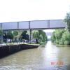
Feeder Road Pipe Bridge No 1
is a minor waterways place
on the River Avon - Bristol (Main River - Bath to Bristol) between
Hanham Lock Weir Entrance (Channel leading to the Weir) (3 miles and 7¼ furlongs
and 2 locks
to the east) and
City Ferry Landing Arm Junction (1 mile and 5¼ furlongs
to the west).
The nearest place in the direction of Hanham Lock Weir Entrance is St. Philips Causeway Bridge;
¼ furlongs
away.
The nearest place in the direction of City Ferry Landing Arm Junction is Feeder Road Pipe Bridge No 2;
¼ furlongs
away.
Mooring here is unrated.
There is a bridge here which takes a pipe over the canal.
Netham Road Bridge (south) | 4 furlongs | |
Netham Lock No 1 | 4 furlongs | |
Marsh Lane Bridge (Bristol) | 2¼ furlongs | |
Cole Road Railway Bridge | ½ furlongs | |
St. Philips Causeway Bridge | ¼ furlongs | |
Feeder Road Pipe Bridge No 1 | ||
Feeder Road Pipe Bridge No 2 | ¼ furlongs | |
Feeder Road Footbridge | ½ furlongs | |
Avon Street Bridge | 2¾ furlongs | |
Feeder Road Narrows | 3½ furlongs | |
Temple Mead Railway Bridge | 4½ furlongs |
Amenities here
Amenities nearby at Feeder Road Pipe Bridge No 2
Amenities nearby at St. Philips Causeway Bridge
There are no links to external websites from here.
Why not log in and add some (select "External websites" from the menu (sometimes this is under "Edit"))?
Mouseover for more information or show routes to facility
Nearest water point
In the direction of Cumberland Basin Entrance Lock No 2
Arnolfini Moorings — 1 mile, 6 furlongs away
Travel to City Ferry Landing Arm Junction, then on the River Avon - Bristol (City Ferry Landing Arm) to Arnolfini Moorings
Harbour Inlet — 2 miles, ¼ furlongs away
On this waterway in the direction of Cumberland Basin Entrance Lock No 2
In the direction of Hanham Lock No 1
Hanham Lock No 1 — 3 miles, 6¼ furlongs and 1 lock away
On this waterway in the direction of Hanham Lock No 1
Wessex Water Services — 8 miles, 4½ furlongs and 4 locks away
Travel to Hanham Lock No 1, then on the River Avon (Kennet and Avon Navigation) to Wessex Water Services
Bath Top Lock Visitor Moorings — 15 miles, 4¾ furlongs and 13 locks away
Travel to Hanham Lock No 1, then on the River Avon (Kennet and Avon Navigation) to River Avon Junction, then on the Kennet and Avon Canal (Main Line) to Bath Top Lock Visitor Moorings
Bathampton Bridge No 183 — 17 miles, 3½ furlongs and 13 locks away
Travel to Hanham Lock No 1, then on the River Avon (Kennet and Avon Navigation) to River Avon Junction, then on the Kennet and Avon Canal (Main Line) to Bathampton Bridge No 183Nearest rubbish disposal
In the direction of Hanham Lock No 1
Hanham Lock No 1 — 3 miles, 6¼ furlongs and 1 lock away
On this waterway in the direction of Hanham Lock No 1
Abbey View Lock No 11 — 15 miles, 3½ furlongs and 10 locks away
Travel to Hanham Lock No 1, then on the River Avon (Kennet and Avon Navigation) to River Avon Junction, then on the Kennet and Avon Canal (Main Line) to Abbey View Lock No 11Nearest chemical toilet disposal
In the direction of Hanham Lock No 1
Wessex Water Services — 8 miles, 4½ furlongs and 4 locks away
Travel to Hanham Lock No 1, then on the River Avon (Kennet and Avon Navigation) to Wessex Water ServicesNearest place to turn
In the direction of Cumberland Basin Entrance Lock No 2
Bathhurst Parade Marina — 1 mile, 4 furlongs away
On this waterway in the direction of Cumberland Basin Entrance Lock No 2
City Ferry Landing Arm Junction — 1 mile, 5¼ furlongs away
On this waterway in the direction of Cumberland Basin Entrance Lock No 2
Baltic Wharf — 2 miles, 3½ furlongs away
On this waterway in the direction of Cumberland Basin Entrance Lock No 2
Ferry Landings Arm — 2 miles, 3¾ furlongs away
On this waterway in the direction of Cumberland Basin Entrance Lock No 2
In the direction of Hanham Lock No 1
Hanham Lock Weir Exit — 3 miles, 6 furlongs and 1 lock away
On this waterway in the direction of Hanham Lock No 1
Hanham Lock Weir Entrance — 3 miles, 7¼ furlongs and 2 locks away
Travel to Hanham Lock No 1, then on the River Avon (Kennet and Avon Navigation) to Hanham Lock Weir Entrance
Keynsham Lock Weir Entrance — 5 miles, 7¼ furlongs and 3 locks away
Travel to Hanham Lock No 1, then on the River Avon (Kennet and Avon Navigation) to Keynsham Lock Weir Entrance
Horseshoe Walk Bridge Winding Hole — 15 miles, 3 furlongs and 10 locks away
Travel to Hanham Lock No 1, then on the River Avon (Kennet and Avon Navigation) to River Avon Junction, then on the Kennet and Avon Canal (Main Line) to Horseshoe Walk Bridge Winding Hole
Pulteney Gardens Winding Hole — 15 miles, 3½ furlongs and 11 locks away
Travel to Hanham Lock No 1, then on the River Avon (Kennet and Avon Navigation) to River Avon Junction, then on the Kennet and Avon Canal (Main Line) to Pulteney Gardens Winding Hole
Sydney Wharf Winding Hole — 15 miles, 6 furlongs and 13 locks away
Travel to Hanham Lock No 1, then on the River Avon (Kennet and Avon Navigation) to River Avon Junction, then on the Kennet and Avon Canal (Main Line) to Sydney Wharf Winding Hole
Bathampton Bridge Winding Hole — 17 miles, 4 furlongs and 13 locks away
Travel to Hanham Lock No 1, then on the River Avon (Kennet and Avon Navigation) to River Avon Junction, then on the Kennet and Avon Canal (Main Line) to Bathampton Bridge Winding Hole
Bathampton Winding Hole — 17 miles, 6¼ furlongs and 13 locks away
Travel to Hanham Lock No 1, then on the River Avon (Kennet and Avon Navigation) to River Avon Junction, then on the Kennet and Avon Canal (Main Line) to Bathampton Winding Hole
Claverton Winding Hole — 19 miles, 1 furlong and 13 locks away
Travel to Hanham Lock No 1, then on the River Avon (Kennet and Avon Navigation) to River Avon Junction, then on the Kennet and Avon Canal (Main Line) to Claverton Winding HoleNearest self-operated pump-out
In the direction of Cumberland Basin Entrance Lock No 2
Harbour Inlet — 2 miles, ¼ furlongs away
On this waterway in the direction of Cumberland Basin Entrance Lock No 2Nearest boatyard pump-out
In the direction of Cumberland Basin Entrance Lock No 2
Baltic Wharf — 2 miles, 3½ furlongs away
On this waterway in the direction of Cumberland Basin Entrance Lock No 2Direction of TV transmitter (From Wolfbane Cybernetic)
There is no page on Wikipedia called “Feeder Road Pipe Bridge”
Wikipedia pages that might relate to Feeder Road Pipe Bridge
[Ohio and Erie Canal]
five feeder canals that added 24.8 miles (39.9 km) and 6 additional locks to the system consisting of: Tuscarawas Feeder (3.2 miles) Walhonding Feeder (1
[Burlington County Bridge Commission]
Road was considered to be a "feeder road" for both the Burlington-Bristol and Tacony-Palmyra Bridges. Of the eight bridges, the Commission has one each
[Whitchurch, Cardiff]
canal runs into the feeder before passing into a piped water course under a modern housing estate. The feeder reemerges at the Melingriffith Water Pump before
[Ledo Road]
the Japanese, and the Ledo Road generally followed the Japanese trace. As the road was built, two 10 cm (4 in) fuel pipe lines were laid side-by-side
[Public Works Department (Nigeria)]
wooden bridges with steel and iron. Trunk A roads linking major town and cities were handled by PWD and were later called federal roads, while the feeder roads
[Stratford-upon-Avon Canal]
crosses a minor road, the Birmingham and North Warwickshire railway and also the trackbed of the former Alcester Railway. There was once a pipe from the side
[Pipeline transport]
transportation of hydrogen through a pipe. Pipelines are one of the safest ways of transporting materials as compared to road or rail, and hence in war, pipelines
[Canning Town]
road layouts for the upgraded A13 road and a feeder to the Limehouse Link tunnel, avoiding the Blackwall Tunnel. The abutments of the old iron bridge
[Nidd Aqueduct]
15 mi (24 km) of steel and cast-iron pipes and 6 miles (10 km) of branch feeder pipes. The route is entirely fed by gravity and the use of syphons. These
[Construction of the Trans-Alaska Pipeline System]
construction techniques, and the construction of a new road, the Dalton Highway. The first section of pipe was laid in 1975 after more than five years of legal
Results of Google Search
Burlington County Bridge Commission - WikipediaThe Burlington County Bridge Commission is a public agency responsible for the operation and ... No tolls are collected for traffic crossing into New Jersey. ... In 1962, the Commission built a single-span bridge over Route 73 and a ... to be a " feeder road" for both the Burlington-Bristol and Tacony-Palmyra Bridges.
Citywide Traffic Controller Upgrades; Granby Street Bridge Rehabilitation ... Granby St / Bayview Blvd Intersection (PDF) · Pedestrian Accommodations & Countdown Signals, Phase 1 (PDF) ... Virginia Natural Gas Pipeline Replacement Projects ... Wellman Tunnel Renewal (along Military Hwy and Military Hwy feeder road) ...
1) Transportation Concurrency Management System. (Administered by ... 2) Earthwork. 3) Bridges, Culverts, Storm Sewers, Ditches, and Pipes ... g) No design shall be permitted which require any vehicle to back out onto public right- of-way ... A Feeder/Distributer road functions as a link between developments or small.
Mar 7, 2014 ... 33, Costs not Paid by Standby Charge Revenues, $413,419,616, $95.30. 34. 35. 36, Total ... Reclamation Facility. 29, Eastern Recycled Water Pipeline Reach 16 ... 9, ALL PUMPING PLANTS - TRANSFORMER BANK BRIDGE. 10, ALLEN ... 272, INLAND FEEDER COST OF LAND AND RIGHT OF WAY.
These Road and Bridge Specifications are standard for all contracts awarded by the ... 1. SECTION 101—DEFINITIONS OF ABBREVIATIONS, ACRONYMS, AND ... 109.04—Payment for Non-Significant Changes and Additional Units of ... The lowest point in the internal cross-section of a pipe or other drainage structure.
Jan 1, 2015 ... SECTION 607 – PIPE CULVERTS AND STORM SEWERS . ... Part 1. 1. PART 1 – GENERAL PROVISIONS. SECTION 101 – DEFINITIONS AND TERMS . ... These Standard Specifications for Road and Bridge Construction apply to ... aggregate feeder will not operate unless the cement feeder operates.
No public road or bridge shall be used or occupied by any electric or other ... In the event a sale consists of the sale of more than 1 separate device, each sale of ... (2) “Feeder road†shall mean a road that serves more than a single residential ... the clear distance between pipe openings is less than half of the smaller pipe ...
Standard Specifications for Road and Bridge Construction is to be used on all contract work awarded by the Rhode Island Department of Transportation, and ...
3-1. 2016 ROAD AND BRIDGE SPECIFICATIONS. DIVISION III—ROADWAY ... such as, but not limited to pipe culverts, conduits, water and sanitary sewer items. II. MATERIALS ... The plant shall be equipped with feeding and metering devices.
No. Caption. Image. 1. Entrance to Feeder above Raven Rock, seen from Pennsylvania side. Date: 4/1935 ... No.: 73-6. 6. Bridge and lock at Prallsville. ... 2 large 36' pipes will extend through the dam as additional waste weirs for heavy floods.