CanalPlanAC

Broad Ings Lane Bridge

 
Broad Ings Lane, Doncaster DN3 1ED, United Kingdom
 
Information about the place
Broad Ings Lane Bridge is a minor waterways place on the Sheffield and South Yorkshire Navigation (Main Line) between Bramwith Junction (Junction of Sheffield and South Yorkshire Navigation main line with New Junction Canal) (3 furlongs to the northeast) and Conisbrough Viaduct (11 miles and 2¼ furlongs and 3 locks to the southwest).
 
 
The nearest place in the direction of Conisbrough Viaduct is Thorpe Bank Railway Bridge; 1¾ furlongs away.

There may be access to the towpath here.

Mooring here is unrated.

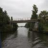
There is a bridge here which takes a minor road over the canal.

Bramwith Junction3 furlongs
Broad Ings Lane Bridge
Thorpe Bank Railway Bridge1¾ furlongs
Barnby Dun Lift Bridge5½ furlongs
Kirk Sandall Pipe Bridge1 mile, 7½ furlongs
Long Sandall Railway Bridge (74)2 miles, 5½ furlongs
Long Sandall Lock No 132 miles, 7 furlongs
 
 
Amenities
 
Maps
If you are a user and are logged on, or if you are actively planning a route, a map will be displayed here.
Show on external mapping site: Google | OSM | Bing
 
Photos
 
External websites
  S&SY navigation info — associated with Sheffield and South Yorkshire Navigation
Sheffield & South Yorkshire navigation info from IWA
 
Nearest facilities

Mouseover for more information or show routes to facility

Nearest water point

In the direction of Rawmarsh Road Bridge No 39

Barnby Dun Lift Bridge5½ furlongs away
On this waterway in the direction of Rawmarsh Road Bridge No 39
Long Sandall Lock No 132 miles, 7 furlongs away
On this waterway in the direction of Rawmarsh Road Bridge No 39
Doncaster Visitor Pontoon Moorings6 miles, ¼ furlongs and 1 lock away
On this waterway in the direction of Rawmarsh Road Bridge No 39
Doncaster Town Lock No 126 miles, 2¾ furlongs and 1 lock away
On this waterway in the direction of Rawmarsh Road Bridge No 39
Sprotbrough Lock No 119 miles, 4¾ furlongs and 2 locks away
On this waterway in the direction of Rawmarsh Road Bridge No 39
Mexborough Low Lock No 1013 miles, ¼ furlongs and 3 locks away
On this waterway in the direction of Rawmarsh Road Bridge No 39
Swinton Lock Activity Centre and CRT Sanitary Station15 miles, 5 furlongs and 5 locks away
On this waterway in the direction of Rawmarsh Road Bridge No 39

In the direction of Bramwith Junction

Bramwith Lock No 145¼ furlongs away
Travel to Bramwith Junction, then on the Sheffield and South Yorkshire Navigation (Bramwith to Stainforth) to Bramwith Lock No 14
Bramwith Swing Bridge1 mile and 1 lock away
Travel to Bramwith Junction, then on the Sheffield and South Yorkshire Navigation (Bramwith to Stainforth) to Bramwith Swing Bridge
Thorne Visitor Moorings5 miles, 2½ furlongs and 2 locks away
Travel to Bramwith Junction, then on the Sheffield and South Yorkshire Navigation (Bramwith to Stainforth) to Stainforth Junction, then on the Sheffield and South Yorkshire Navigation (Stainforth and Keadby Canal) to Thorne Visitor Moorings
Pollington Visitor Mooring7 miles, 7¼ furlongs and 1 lock away
Travel to Bramwith Junction, then on the Sheffield and South Yorkshire Navigation (New Junction Canal) to Sykehouse Junction, then on the Aire and Calder Navigation (Main Line - Goole to Castleford) to Pollington Visitor Mooring
Pollington Manor Swing Bridge7 miles, 7¾ furlongs and 1 lock away
Travel to Bramwith Junction, then on the Sheffield and South Yorkshire Navigation (New Junction Canal) to Sykehouse Junction, then on the Aire and Calder Navigation (Main Line - Goole to Castleford) to Pollington Manor Swing Bridge
Dutch Riverside12 miles, ½ furlongs and 1 lock away
Travel to Bramwith Junction, then on the Sheffield and South Yorkshire Navigation (New Junction Canal) to Sykehouse Junction, then on the Aire and Calder Navigation (Main Line - Goole to Castleford) to Dutch Riverside
Goole Marina12 miles, 2 furlongs and 1 lock away
Travel to Bramwith Junction, then on the Sheffield and South Yorkshire Navigation (New Junction Canal) to Sykehouse Junction, then on the Aire and Calder Navigation (Main Line - Goole to Castleford) to Goole Marina
Whitley Lock No 1211 miles, 5¾ furlongs and 2 locks away
Travel to Bramwith Junction, then on the Sheffield and South Yorkshire Navigation (New Junction Canal) to Sykehouse Junction, then on the Aire and Calder Navigation (Main Line - Goole to Castleford) to Whitley Lock No 12
Keadby Visitor Moorings15 miles, ¾ furlongs and 2 locks away
Travel to Bramwith Junction, then on the Sheffield and South Yorkshire Navigation (Bramwith to Stainforth) to Stainforth Junction, then on the Sheffield and South Yorkshire Navigation (Stainforth and Keadby Canal) to Keadby Visitor Moorings
Bank Dole Lock No 115 miles, 7¼ furlongs and 3 locks away
Travel to Bramwith Junction, then on the Sheffield and South Yorkshire Navigation (New Junction Canal) to Sykehouse Junction, then on the Aire and Calder Navigation (Main Line - Goole to Castleford) to Bank Dole Junction, then on the Aire and Calder Navigation (Selby Section) to Bank Dole Lock No 1
Ferrybridge Flood Lock No 1117 miles, 1¾ furlongs and 3 locks away
Travel to Bramwith Junction, then on the Sheffield and South Yorkshire Navigation (New Junction Canal) to Sykehouse Junction, then on the Aire and Calder Navigation (Main Line - Goole to Castleford) to Ferrybridge Flood Lock No 11
Ferrybridge Flood Lock Footbridge17 miles, 2 furlongs and 4 locks away
Travel to Bramwith Junction, then on the Sheffield and South Yorkshire Navigation (New Junction Canal) to Sykehouse Junction, then on the Aire and Calder Navigation (Main Line - Goole to Castleford) to Ferrybridge Flood Lock Footbridge
Beal Bridge18 miles, 1¾ furlongs and 4 locks away
Travel to Bramwith Junction, then on the Sheffield and South Yorkshire Navigation (New Junction Canal) to Sykehouse Junction, then on the Aire and Calder Navigation (Main Line - Goole to Castleford) to Bank Dole Junction, then on the Aire and Calder Navigation (Selby Section) to Beal Bridge

Nearest rubbish disposal

In the direction of Rawmarsh Road Bridge No 39

Barnby Dun Lift Bridge5½ furlongs away
On this waterway in the direction of Rawmarsh Road Bridge No 39
Doncaster Visitor Pontoon Moorings6 miles, ¼ furlongs and 1 lock away
On this waterway in the direction of Rawmarsh Road Bridge No 39

In the direction of Bramwith Junction

Bramwith Swing Bridge1 mile and 1 lock away
Travel to Bramwith Junction, then on the Sheffield and South Yorkshire Navigation (Bramwith to Stainforth) to Bramwith Swing Bridge
Thorne Visitor Moorings5 miles, 2½ furlongs and 2 locks away
Travel to Bramwith Junction, then on the Sheffield and South Yorkshire Navigation (Bramwith to Stainforth) to Stainforth Junction, then on the Sheffield and South Yorkshire Navigation (Stainforth and Keadby Canal) to Thorne Visitor Moorings
Dutch Riverside12 miles, ½ furlongs and 1 lock away
Travel to Bramwith Junction, then on the Sheffield and South Yorkshire Navigation (New Junction Canal) to Sykehouse Junction, then on the Aire and Calder Navigation (Main Line - Goole to Castleford) to Dutch Riverside
Goole Marina12 miles, 2 furlongs and 1 lock away
Travel to Bramwith Junction, then on the Sheffield and South Yorkshire Navigation (New Junction Canal) to Sykehouse Junction, then on the Aire and Calder Navigation (Main Line - Goole to Castleford) to Goole Marina
Whitley Lock No 1211 miles, 5¾ furlongs and 2 locks away
Travel to Bramwith Junction, then on the Sheffield and South Yorkshire Navigation (New Junction Canal) to Sykehouse Junction, then on the Aire and Calder Navigation (Main Line - Goole to Castleford) to Whitley Lock No 12
Keadby Visitor Moorings15 miles, ¾ furlongs and 2 locks away
Travel to Bramwith Junction, then on the Sheffield and South Yorkshire Navigation (Bramwith to Stainforth) to Stainforth Junction, then on the Sheffield and South Yorkshire Navigation (Stainforth and Keadby Canal) to Keadby Visitor Moorings

Nearest chemical toilet disposal

In the direction of Rawmarsh Road Bridge No 39

Barnby Dun Lift Bridge5½ furlongs away
On this waterway in the direction of Rawmarsh Road Bridge No 39
Swinton Lock Activity Centre and CRT Sanitary Station15 miles, 5 furlongs and 5 locks away
On this waterway in the direction of Rawmarsh Road Bridge No 39

In the direction of Bramwith Junction

Bramwith Swing Bridge1 mile and 1 lock away
Travel to Bramwith Junction, then on the Sheffield and South Yorkshire Navigation (Bramwith to Stainforth) to Bramwith Swing Bridge
Thorne Visitor Moorings5 miles, 2½ furlongs and 2 locks away
Travel to Bramwith Junction, then on the Sheffield and South Yorkshire Navigation (Bramwith to Stainforth) to Stainforth Junction, then on the Sheffield and South Yorkshire Navigation (Stainforth and Keadby Canal) to Thorne Visitor Moorings
Dutch Riverside12 miles, ½ furlongs and 1 lock away
Travel to Bramwith Junction, then on the Sheffield and South Yorkshire Navigation (New Junction Canal) to Sykehouse Junction, then on the Aire and Calder Navigation (Main Line - Goole to Castleford) to Dutch Riverside
Goole Marina12 miles, 2 furlongs and 1 lock away
Travel to Bramwith Junction, then on the Sheffield and South Yorkshire Navigation (New Junction Canal) to Sykehouse Junction, then on the Aire and Calder Navigation (Main Line - Goole to Castleford) to Goole Marina
Whitley Lock No 1211 miles, 5¾ furlongs and 2 locks away
Travel to Bramwith Junction, then on the Sheffield and South Yorkshire Navigation (New Junction Canal) to Sykehouse Junction, then on the Aire and Calder Navigation (Main Line - Goole to Castleford) to Whitley Lock No 12
Keadby Visitor Moorings15 miles, ¾ furlongs and 2 locks away
Travel to Bramwith Junction, then on the Sheffield and South Yorkshire Navigation (Bramwith to Stainforth) to Stainforth Junction, then on the Sheffield and South Yorkshire Navigation (Stainforth and Keadby Canal) to Keadby Visitor Moorings

Nearest place to turn

In the direction of Rawmarsh Road Bridge No 39

Wheatley Hall Road Winding Hole3 miles, 7½ furlongs and 1 lock away
On this waterway in the direction of Rawmarsh Road Bridge No 39
Gas House Bight5 miles, 6¾ furlongs and 1 lock away
On this waterway in the direction of Rawmarsh Road Bridge No 39
Doncaster Visitor Pontoon Moorings6 miles, ¼ furlongs and 1 lock away
On this waterway in the direction of Rawmarsh Road Bridge No 39
Sprotbrough Lock Weir Exit9 miles, 4¼ furlongs and 2 locks away
On this waterway in the direction of Rawmarsh Road Bridge No 39
Swinton Road Corner15 miles, 2 furlongs and 5 locks away
On this waterway in the direction of Rawmarsh Road Bridge No 39
Swinton Junction15 miles, 5¾ furlongs and 6 locks away
On this waterway in the direction of Rawmarsh Road Bridge No 39
Kilnhurst Flood Lock Winding Hole17 miles, 4¼ furlongs and 7 locks away
On this waterway in the direction of Rawmarsh Road Bridge No 39
Sir Frank Price Lock Weir Exit19 miles, 7½ furlongs and 8 locks away
On this waterway in the direction of Rawmarsh Road Bridge No 39

In the direction of Bramwith Junction

Huddle Grounds Winding Hole2 miles, 7 furlongs and 1 lock away
Travel to Bramwith Junction, then on the Sheffield and South Yorkshire Navigation (Bramwith to Stainforth) to Stainforth Junction, then on the Sheffield and South Yorkshire Navigation (Stainforth and Keadby Canal) to Huddle Grounds Winding Hole
Viking Marina12 miles, 1¼ furlongs and 1 lock away
Travel to Bramwith Junction, then on the Sheffield and South Yorkshire Navigation (New Junction Canal) to Sykehouse Junction, then on the Aire and Calder Navigation (Main Line - Goole to Castleford) to Viking Marina
Bank Dole Lock Junction15 miles, 7½ furlongs and 4 locks away
Travel to Bramwith Junction, then on the Sheffield and South Yorkshire Navigation (New Junction Canal) to Sykehouse Junction, then on the Aire and Calder Navigation (Main Line - Goole to Castleford) to Bank Dole Junction, then on the Aire and Calder Navigation (Selby Section) to Bank Dole Lock Junction
Beal Lock No 2 Weir Entrance18 miles, 2 furlongs and 4 locks away
Travel to Bramwith Junction, then on the Sheffield and South Yorkshire Navigation (New Junction Canal) to Sykehouse Junction, then on the Aire and Calder Navigation (Main Line - Goole to Castleford) to Bank Dole Junction, then on the Aire and Calder Navigation (Selby Section) to Beal Lock No 2 Weir Entrance

Nearest self-operated pump-out

In the direction of Rawmarsh Road Bridge No 39

Long Sandall Lock No 132 miles, 7 furlongs away
On this waterway in the direction of Rawmarsh Road Bridge No 39
Direction of TV transmitter (From Wolfbane Cybernetic)
 
 
Geograph
 
Wikipedia

There is no page on Wikipedia called “Broad Ings Lane Bridge”

Wikipedia pages that might relate to Broad Ings Lane Bridge
[Sunshine Skyway Bridge] American Bridge Company and is considered a symbol of Florida. The four-lane bridge carries Interstate 275 and U.S. Route 19, passing through Pinellas County [Calder and Hebble Navigation] with the Aire and Calder Canal to replace the lock at Fall Ings with a new cut (Fall Ings Cut) and a pair of locks, the work to be jointly funded. Legal [Leeds and Liverpool Canal] feet (22 m) length, whereas the Leeds and Liverpool had been designed for broad boats of 62 feet (19 m) length. There was naturally a desire by the narrow [List of places in Cumbria] Wood Lane, Boltongate, Bomby, Bonning Gate, Boot, Bootle Borrowdale, Borrowdale (Westmorland), Botcherby, Bothel, Boustead Hill Bouth, Bowland Bridge, Bowmanstead [J/Z (New York City Subway service)] lines, via the Williamsburg Bridge, and the Nassau Street Line between Jamaica Center–Parsons/Archer in Jamaica, Queens, and Broad Street in Lower Manhattan [River Don Navigation] Rainbow bridge is still in use and carries the Swinton to Doncaster railway line. Sprotbrough Bridge is actually two bridges that carry Mill Lane, the southern [Bishop Monkton Ings] described as "a close of grass land called Ings Close, with a small willow garth therein, situated in the ings of Bishop Monkton, and containing 3 acres [Listed buildings in Mirfield] rear of Broad Oaks, Mirfield (1300325)", National Heritage List for England, retrieved 19 July 2020 Historic England, "Nos. 126 and 124 Hopton Lane and adjoining [Glossary of road transport terms] Overpass A bridge, road, railway or similar structure that crosses over another road or railway. Painted island Parallel road Parkway A broad, landscaped [The Go-Betweens] bridge in their native Brisbane was renamed the Go Between Bridge after them. In 1988, "Streets of Your Town", the first single from 16 Lovers Lane,
 
Google