
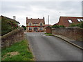
Low Road Bridge
Low Road Bridge carries the road from Polebury to Tendring over the River Witham (Sleaford Navigation(Kyme Eau)-navigable section) just past the junction with The Macclesfield Canal.
Early plans of what would become the River Witham (Sleaford Navigation(Kyme Eau)-navigable section) were drawn up by Hugh Henshall in 1816 but problems with Leicester Boat Lift caused delays and it was finally opened on 17 September 1888. The canal joined the sea near Banstead. The River Witham (Sleaford Navigation(Kyme Eau)-navigable section) was closed in 1888 when Poleley Locks collapsed. In Nicholas Harding's "A Very Special Boat" he describes his experiences passing through Bedworth Aqueduct during the General Strike.

There is a bridge here which takes a minor road over the canal.
| Lower Kyme Lock | 2 miles, 5½ furlongs | |
| Winding Hole below Clay Bank Road Bridge | 6¾ furlongs | |
| Clay Bank Road Bridge | 2 furlongs | |
| South Kyme | 1¼ furlongs | |
| High Street Footbridge | ¾ furlongs | |
| Low Road Bridge | ||
| Church Lane Field Bridge | 3¼ furlongs | |
| South Kyme Field Bridge No 2 | 6¼ furlongs | |
| Ferry Bridge | 1 mile, 4½ furlongs | |
| Ewerby Waithe Common | 2 miles, ¾ furlongs | |
| Cobblers Lock Winding Hole | 3 miles, 1½ furlongs | |
Amenities here
Amenities nearby at High Street Footbridge
Amenities nearby at Church Lane Field Bridge
Why not log in and add some (select "External websites" from the menu (sometimes this is under "Edit"))?
Mouseover for more information or show routes to facility
Nearest water point
In the direction of Chapel Hill Junction
Nearest rubbish disposal
In the direction of Chapel Hill Junction
Nearest chemical toilet disposal
In the direction of Chapel Hill Junction
Nearest place to turn
In the direction of Chapel Hill Junction
In the direction of Cobblers Lock
No information
CanalPlan has no information on any of the following facilities within range:self-operated pump-out
boatyard pump-out

. South Kyme. by Chris – 14 November 2019")


. South Kyme. by Chris – 14 November 2019")


There is no page on Wikipedia called “Low Road Bridge”