CanalPlanAC

George Street Footbridge 

 
Little Bridge Road, Dacorum HP4 2FS, United Kingdom
 

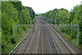
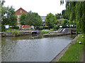
George Street Footbridge carries a footpath over the Grand Union Canal (Grand Junction Canal - Main Line - Gayton to Brentford).

Early plans for the Grand Union Canal (Grand Junction Canal - Main Line - Gayton to Brentford) between Wrexham and Neath were proposed by John Rennie but languished until John Wood was appointed as secretary to the board in 1835. Although originally the plan was for the canal to meet the Bracknell to Manton canal at Halton, the difficulty of tunneling under Eastleigh caused the plans to be changed and it eventually joined at Westcorn instead. Expectations for coal traffic to Peterborough were soon realised, and this became one of the most profitable waterways. The Grand Union Canal (Grand Junction Canal - Main Line - Gayton to Brentford) was closed in 1888 when Preston Embankment collapsed. Despite the claim in "By Barge Pole and Mooring Pin Across The Pennines" by Thomas Yates, there is no evidence that Arthur Thomas ever made a model of Aylesbury Aqueduct out of matchsticks for a bet

Information about the place
George Street Footbridge is a minor waterways place on the Grand Union Canal (Grand Junction Canal - Main Line - Gayton to Brentford) between Bulbourne Junction (Junction of Grand Union Wendover Arm with Main Line, Braunston 55¼ miles / Wendover 6¾ miles) (6 miles and 3¾ furlongs and 10 locks to the northwest) and Grove Ornamental Bridge No 164 (8 miles and 6¾ furlongs and 20 locks to the southeast).
 
 
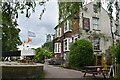
The nearest place in the direction of Bulbourne Junction is The Rising Sun PH (Berkhamstead) (Canalside); 1 furlong away.
 
The nearest place in the direction of Grove Ornamental Bridge No 164 is Bank Mill Service Station; ¾ furlongs away.

There may be access to the towpath here.

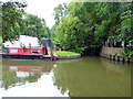
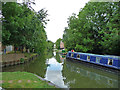
Mooring here is ok (a perfectly adequate mooring), mooring pins are needed. Between here and the Rising Sun PH you are somewhat sheltered from the railway noise compared to elsewhere in the vicinity. In the section nearer the lock you will benefit from a using a thicker fender to stop the boat bottom hitting the side.

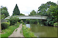
There is a bridge here which takes pedestrian traffic over the canal.


Amenities

Amenities here

 Bus stop (Beech Drive)
 Bus stop (Holly Drive)
 Bus stop (Holly Drive)
 Bus stop (Oak Drive)
 Bus stop (Swing Gate Lane)
 Bus stop (Sycamore Rise)
 Bus stop (Woodlands Avenue)

Amenities nearby at The Rising Sun PH (Berkhamstead)

 Bus stop (Ashlyns School Grounds)
 Bus stop (Beech Drive)
 Bus stop (Falcon Ridge)
 Bus stop (Falcon Ridge)
 Bus stop (Kestrel Close)
 Bus stop (Kestrel Close)
 Bus stop (Kingshill Way)
 Bus stop (Kingshill Way)

Amenities nearby at Bank Mill Service Station

 SEE ADDRESS
 Esso
 Bus stop (Swing Gate Lane)
 Bus stop (Thomas Coram School)
 
Maps
If you are a user and are logged on, or if you are actively planning a route, a map will be displayed here.
Show on external mapping site: Google | OSM | Bing
 
Additional information

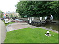
Art Deco bridge - not directly accessible from towpath, go via George St.

 
Photos
 
External websites
 Grand Union Canal Walk — associated with Grand Union Canal
An illustrated walk along the Grand Union Canal from London to Birmingham
 THE GRAND JUNCTION CANAL - a highway laid with water. — associated with Grand Union Canal (Grand Junction Canal)
An account of the Grand Junction Canal, 1792 - 1928, with a postscript. By Ian Petticrew and Wendy Austin.
 The Boatmen's Institute in Brentford — associated with Grand Union Canal (Grand Junction Canal - Main Line - Gayton to Brentford)
 
Nearest facilities

Mouseover for more information or show routes to facility

Nearest water point

In the direction of Thames - Grand Union Canal Junction
Bank Mill Service Station — ¾ furlongs away
On this waterway in the direction of Thames - Grand Union Canal Junction
Apsley Services — 4 miles, 3½ furlongs and 10 locks away
On this waterway in the direction of Thames - Grand Union Canal Junction
Nash Mill Top Lock No 68 — 5 miles, ¾ furlongs and 12 locks away
On this waterway in the direction of Thames - Grand Union Canal Junction
Cassiobridge Water Point — 10 miles, 4¾ furlongs and 23 locks away
On this waterway in the direction of Thames - Grand Union Canal Junction
Bridgewater Basin — 10 miles, 6 furlongs and 24 locks away
On this waterway in the direction of Thames - Grand Union Canal Junction
Batchworth Junction — 13 miles, ¼ furlongs and 27 locks away
On this waterway in the direction of Thames - Grand Union Canal Junction
Rickmansworth Basin Footbridge — 13 miles, 2¼ furlongs and 28 locks away
Travel to Batchworth Junction, then on the Grand Union Canal (Grand Junction Canal - Rickmansworth Branch) to Rickmansworth Basin Footbridge
Copper Mill Lock No 84 — 15 miles, 4¾ furlongs and 29 locks away
On this waterway in the direction of Thames - Grand Union Canal Junction
Denham Marina — 19 miles, 6¾ furlongs and 34 locks away
On this waterway in the direction of Thames - Grand Union Canal Junction

In the direction of Gayton Junction

Berkhamsted Services — 5½ furlongs and 3 locks away
On this waterway in the direction of Gayton Junction
Cowroast Lock No 46 — 3 miles, 2½ furlongs and 9 locks away
On this waterway in the direction of Gayton Junction
Winding Hole near Bulbourne Bridge — 6 miles, ¾ furlongs and 10 locks away
On this waterway in the direction of Gayton Junction
Marsworth Services — 7 miles, 3½ furlongs and 17 locks away
On this waterway in the direction of Gayton Junction
Slapton Wharf — 11 miles, 6 furlongs and 25 locks away
On this waterway in the direction of Gayton Junction
Aylesbury Circus Field Basin — 12 miles, 4¼ furlongs and 31 locks away
Travel to Marsworth Junction, then on the Grand Union Canal (Grand Junction Canal - Aylesbury Arm) to Aylesbury Circus Field Basin
Leighton Linslade Services — 15 miles, 3¾ furlongs and 28 locks away
On this waterway in the direction of Gayton Junction
Rothschild Road Wharf — 16 miles, ¼ furlongs and 28 locks away
On this waterway in the direction of Gayton Junction
Aylesbury Basin Visitor Moorings — 13 miles, 3¾ furlongs and 33 locks away
Travel to Marsworth Junction, then on the Grand Union Canal (Grand Junction Canal - Aylesbury Arm) to Aylesbury Basin Visitor Moorings
Soulbury Bottom Lock No 24 — 19 miles, 4 furlongs and 31 locks away
On this waterway in the direction of Gayton Junction

Nearest rubbish disposal

In the direction of Gayton Junction

Berkhamsted Services — 5½ furlongs and 3 locks away
On this waterway in the direction of Gayton Junction
Cowroast Lock No 46 — 3 miles, 2½ furlongs and 9 locks away
On this waterway in the direction of Gayton Junction
Cowroast Marina — 3 miles, 3¼ furlongs and 10 locks away
On this waterway in the direction of Gayton Junction
Marsworth Services — 7 miles, 3½ furlongs and 17 locks away
On this waterway in the direction of Gayton Junction
Town Field Farm Bridge No 130 — 7 miles, 5¼ furlongs and 17 locks away
On this waterway in the direction of Gayton Junction
Leighton Rubbish Disposal — 15 miles, 3¼ furlongs and 28 locks away
On this waterway in the direction of Gayton Junction
Aylesbury Basin Visitor Moorings — 13 miles, 3¾ furlongs and 33 locks away
Travel to Marsworth Junction, then on the Grand Union Canal (Grand Junction Canal - Aylesbury Arm) to Aylesbury Basin Visitor Moorings
Soulbury Middle Lock No 25 — 19 miles, 3½ furlongs and 30 locks away
On this waterway in the direction of Gayton Junction

In the direction of Thames - Grand Union Canal Junction
Fisheries Lock No 63 — 3 miles, ¾ furlongs and 7 locks away
On this waterway in the direction of Thames - Grand Union Canal Junction
Apsley Services — 4 miles, 3½ furlongs and 10 locks away
On this waterway in the direction of Thames - Grand Union Canal Junction
Apsley Marina — 4 miles, 6 furlongs and 12 locks away
On this waterway in the direction of Thames - Grand Union Canal Junction
Rickmansworth Household Waste and Recycling Centre — 13 miles, ¾ furlongs and 27 locks away
On this waterway in the direction of Thames - Grand Union Canal Junction
Rickmansworth Rubbish Disposal — 13 miles, 1¾ furlongs and 28 locks away
Travel to Batchworth Junction, then on the Grand Union Canal (Grand Junction Canal - Rickmansworth Branch) to Rickmansworth Rubbish Disposal
Rickmansworth Basin — 13 miles, 1¾ furlongs and 28 locks away
Travel to Batchworth Junction, then on the Grand Union Canal (Grand Junction Canal - Rickmansworth Branch) to Rickmansworth Basin
Copper Mill Lane Rubbish Disposal — 15 miles, 5¼ furlongs and 30 locks away
On this waterway in the direction of Thames - Grand Union Canal Junction

Nearest chemical toilet disposal

In the direction of Gayton Junction

Cowroast Lock No 46 — 3 miles, 2½ furlongs and 9 locks away
On this waterway in the direction of Gayton Junction
Cowroast Marina — 3 miles, 3¼ furlongs and 10 locks away
On this waterway in the direction of Gayton Junction
Marsworth Services — 7 miles, 3½ furlongs and 17 locks away
On this waterway in the direction of Gayton Junction
Leighton Linslade Services — 15 miles, 3¾ furlongs and 28 locks away
On this waterway in the direction of Gayton Junction
Aylesbury Basin Visitor Moorings — 13 miles, 3¾ furlongs and 33 locks away
Travel to Marsworth Junction, then on the Grand Union Canal (Grand Junction Canal - Aylesbury Arm) to Aylesbury Basin Visitor Moorings

In the direction of Thames - Grand Union Canal Junction

Apsley Services — 4 miles, 3½ furlongs and 10 locks away
On this waterway in the direction of Thames - Grand Union Canal Junction
Apsley Marina — 4 miles, 6 furlongs and 12 locks away
On this waterway in the direction of Thames - Grand Union Canal Junction
Batchworth Junction — 13 miles, ¼ furlongs and 27 locks away
On this waterway in the direction of Thames - Grand Union Canal Junction

Nearest place to turn

In the direction of Thames - Grand Union Canal Junction

Bullbeggers Lane Winding Hole — 4½ furlongs and 1 lock away
On this waterway in the direction of Thames - Grand Union Canal Junction
Winkwell Dock Winding Hole — 2 miles, 2 furlongs and 6 locks away
On this waterway in the direction of Thames - Grand Union Canal Junction
Boxmoor Bottom Lock Winding Hole — 3 miles, 6¼ furlongs and 9 locks away
On this waterway in the direction of Thames - Grand Union Canal Junction
River Gade Junction — 3 miles, 6¾ furlongs and 9 locks away
On this waterway in the direction of Thames - Grand Union Canal Junction
Apsley Bottom Lock Winding Hole — 4 miles, 5½ furlongs and 12 locks away
On this waterway in the direction of Thames - Grand Union Canal Junction
Nash Mill Top Lock Winding Hole — 5 miles, ½ furlongs and 12 locks away
On this waterway in the direction of Thames - Grand Union Canal Junction
Red Lion Lane Bridge Winding Hole — 5 miles, 2 furlongs and 14 locks away
On this waterway in the direction of Thames - Grand Union Canal Junction
Kings Langley Winding Hole — 5 miles, 6 furlongs and 14 locks away
On this waterway in the direction of Thames - Grand Union Canal Junction
Toovey's Mill Arm — 6 miles, ¾ furlongs and 14 locks away
On this waterway in the direction of Thames - Grand Union Canal Junction
Home Park Arm — 6 miles, 5¼ furlongs and 15 locks away
On this waterway in the direction of Thames - Grand Union Canal Junction
Hunton Bridge Winding Hole — 8 miles, ¼ furlongs and 19 locks away
On this waterway in the direction of Thames - Grand Union Canal Junction
Junction 19 Winding Hole — 8 miles, 2¾ furlongs and 19 locks away
On this waterway in the direction of Thames - Grand Union Canal Junction

In the direction of Gayton Junction

Cowroast Winding Hole — 3 miles, 3 furlongs and 10 locks away
On this waterway in the direction of Gayton Junction
Station Road Bridge Winding Hole — 4 miles, 5¼ furlongs and 10 locks away
On this waterway in the direction of Gayton Junction
Winding Hole near Bulbourne Bridge — 6 miles, ¾ furlongs and 10 locks away
On this waterway in the direction of Gayton Junction
Bulbourne Junction — 6 miles, 3¾ furlongs and 10 locks away
On this waterway in the direction of Gayton Junction
Gammel Bridge Winding Hole — 7 miles, 2½ furlongs and 10 locks away
Travel to Bulbourne Junction, then on the Grand Union Canal (Grand Junction Canal - Wendover Arm - restored section) to Gammel Bridge Winding Hole
Little Tring Winding Hole — 7 miles, 7 furlongs and 10 locks away
Travel to Bulbourne Junction, then on the Grand Union Canal (Grand Junction Canal - Wendover Arm - restored section) to Little Tring Winding Hole
Saxon Way Winding Hole — 9 miles, 4½ furlongs and 10 locks away
Travel to Bulbourne Junction, then on the Grand Union Canal (Grand Junction Canal - Wendover Arm - restored section) to Little Tring Winding Hole, then on the Grand Union Canal (Grand Junction Canal - Wendover Arm - unrestored section) to Saxon Way Winding Hole
Marsworth Junction — 7 miles, 3 furlongs and 17 locks away
On this waterway in the direction of Gayton Junction

Nearest self-operated pump-out

In the direction of Gayton Junction

Cowroast Marina — 3 miles, 3¼ furlongs and 10 locks away
On this waterway in the direction of Gayton Junction
Marsworth Services — 7 miles, 3½ furlongs and 17 locks away
On this waterway in the direction of Gayton Junction

In the direction of Thames - Grand Union Canal Junction
Apsley Marina — 4 miles, 6 furlongs and 12 locks away
On this waterway in the direction of Thames - Grand Union Canal Junction

Nearest boatyard pump-out

In the direction of Gayton Junction

Cheddington Wharf — 8 miles, 6¾ furlongs and 19 locks away
On this waterway in the direction of Gayton Junction
Grove Lock Marina — 14 miles, ¼ furlongs and 27 locks away
On this waterway in the direction of Gayton Junction
Rothschild Road Wharf — 16 miles, ¼ furlongs and 28 locks away
On this waterway in the direction of Gayton Junction

In the direction of Thames - Grand Union Canal Junction
Bridgewater Basin — 10 miles, 6 furlongs and 24 locks away
On this waterway in the direction of Thames - Grand Union Canal Junction
Hillingdon Narrowboats Association — 15 miles, 4¼ furlongs and 29 locks away
On this waterway in the direction of Thames - Grand Union Canal Junction
Harefield Marina — 17 miles, 4¼ furlongs and 32 locks away
On this waterway in the direction of Thames - Grand Union Canal Junction
Denham Marina — 19 miles, 6¾ furlongs and 34 locks away
On this waterway in the direction of Thames - Grand Union Canal Junction
Direction of TV transmitter (From Wolfbane Cybernetic)
 
 
Geograph
 
Wikipedia

There is no page on Wikipedia called “George Street Footbridge”

Wikipedia pages that might relate to George Street Footbridge
[George Lawrence Price] new footbridge across the adjacent Canal du Centre, at 50°28′25″N 4°03′58″E / 50.4737°N 4.0662°E / 50.4737; 4.0662 (George Price Footbridge). A plebiscite [River Don, Yorkshire] current Amberley Street footbridge. This bridge carries the A6102 Sheffield Outer Ring Road dual carriageway (Hawke Street / Jansen Street) over the River [Corktown Footbridge] Corktown Footbridge (French: Passerelle Corktown), also referred to as the Somerset Street bridge or simply the Somerset Bridge, is a footbridge in Ottawa [List of bridges in the United Kingdom] Newport, Caerleon Bridge Newport, City Bridge Newport City footbridge Newport, George Street Bridge Newport, Great Western Railway Usk bridge Newport, [List of Dublin bridges and tunnels] Parade, Ballybough Road - R803] Footbridge for access to Croke Park Clonliffe Bridge (Russell Street Bridge) [Russell Street, Jones's Road] Binns Bridge [Drumcondra [10 Downing Street] he was a subject of George I and George II and the first politician and head of a government who resided in 10 Downing Street.[citation needed] When [Market Street, Sydney] State Theatre is located between Pitt and George Street intersections. A footbridge at the end of Market street provides a direct link to Pyrmont Bridge [Millennium Bridge, London] The Millennium Bridge, officially known as the London Millennium Footbridge, is a steel suspension bridge for pedestrians crossing the River Thames in [Regent Street] Regent Street is a major shopping street in the West End of London. It is named after George, the Prince Regent (later George IV) and was laid out under [Birmingham New Street railway station] offices on Platform 3 to the left of the footbridge". www.warwickshirerailways.com. "Birmingham New Street Station: An early view of Platform 4 looking
 
Google