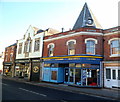
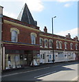
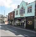
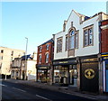
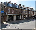
Dudbridge Wharf is on the Cotswold Canals (Stroudwater Navigation - Un-navigable Section) near to Canterbury Locks.
Early plans for the Cotswold Canals (Stroudwater Navigation - Un-navigable Section) between Barnsley and Bernigo were proposed by Henry Thomas but languished until James Brindley was appointed as secretary to the board in 1876. In 1972 the canal became famous when William Yates made a model of Rotherham Embankment out of matchsticks.

Dudbridge Wharf
is a minor waterways place
on the Cotswold Canals (Stroudwater Navigation - Un-navigable Section) between
Saul Junction Marina (6 miles and ¼ furlongs
and 10 locks
to the west) and
Site of Entrance to Wallbridge Basin (The junction between the Stroudwater Navigation and the Thames & Severn Canal.) (5½ furlongs
and 2 locks
to the east).
The nearest place in the direction of Saul Junction Marina is Hilly Orchard Footbridge;
¾ furlongs
away.
The nearest place in the direction of Site of Entrance to Wallbridge Basin is Dudbridge Bridge (Built 2000);
½ furlongs
away.
Mooring here is unrated.
| Ebley Mill Floodgate | 2¾ furlongs | |
| Ebley Mill Swing Bridge | 2¾ furlongs | |
| Ebley Overflow Weir | 2¼ furlongs | |
| Ebley Confluence & Connecting Weirs | 1½ furlongs | |
| Hilly Orchard Footbridge | ¾ furlongs | |
| Dudbridge Wharf | ||
| Dudbridge Bridge | ½ furlongs | |
| Dudbridge Lock No 2 | ¾ furlongs | |
| Ruscombe Brook Feeder | 1 furlong | |
| Foundry Lock No 1 | 1½ furlongs | |
| Dudbridge Locks Bypass Channel | 1½ furlongs | |
There are no links to external websites from here.
Why not log in and add some (select "External websites" from the menu (sometimes this is under "Edit"))?
Why not log in and add some (select "External websites" from the menu (sometimes this is under "Edit"))?
Mouseover for more information or show routes to facility
Nearest water point
In the direction of Walk Bridge
Saul Junction Marina — 6 miles, ¼ furlongs and 10 locks away
Travel to Walk Bridge, then on the Cotswold Canals (Stroudwater Navigation - Navigable Section) to Saul Junction Marina
Saul Junction Winding Hole — 6 miles, 1¾ furlongs and 10 locks away
Travel to Walk Bridge, then on the Cotswold Canals (Stroudwater Navigation - Navigable Section) to Saul Junction, then on the Gloucester and Sharpness Canal to Saul Junction Winding Hole
Cotswold Canals Trust Visitor Centre - Saul Junction — 6 miles, 2½ furlongs and 10 locks away
Travel to Walk Bridge, then on the Cotswold Canals (Stroudwater Navigation - Navigable Section) to Saul Junction, then on the Gloucester and Sharpness Canal to Cotswold Canals Trust Visitor Centre - Saul Junction
Fretherne Bridge — 6 miles, 7¾ furlongs and 10 locks away
Travel to Walk Bridge, then on the Cotswold Canals (Stroudwater Navigation - Navigable Section) to Saul Junction, then on the Gloucester and Sharpness Canal to Fretherne Bridge
Splatt Bridge — 8 miles, ½ furlongs and 10 locks away
Travel to Walk Bridge, then on the Cotswold Canals (Stroudwater Navigation - Navigable Section) to Saul Junction, then on the Gloucester and Sharpness Canal to Splatt Bridge
Patch Bridge — 9 miles, 7¼ furlongs and 10 locks away
Travel to Walk Bridge, then on the Cotswold Canals (Stroudwater Navigation - Navigable Section) to Saul Junction, then on the Gloucester and Sharpness Canal to Patch Bridge
Sellars Bridge — 9 miles, 7½ furlongs and 10 locks away
Travel to Walk Bridge, then on the Cotswold Canals (Stroudwater Navigation - Navigable Section) to Saul Junction, then on the Gloucester and Sharpness Canal to Sellars Bridge
Purton Lower Bridge — 12 miles, 3 furlongs and 10 locks away
Travel to Walk Bridge, then on the Cotswold Canals (Stroudwater Navigation - Navigable Section) to Saul Junction, then on the Gloucester and Sharpness Canal to Purton Lower Bridge
Llanthony Pontoons — 13 miles, 5½ furlongs and 10 locks away
Travel to Walk Bridge, then on the Cotswold Canals (Stroudwater Navigation - Navigable Section) to Saul Junction, then on the Gloucester and Sharpness Canal to Llanthony Pontoons
Llanthony Road Bridge — 13 miles, 6¼ furlongs and 10 locks away
Travel to Walk Bridge, then on the Cotswold Canals (Stroudwater Navigation - Navigable Section) to Saul Junction, then on the Gloucester and Sharpness Canal to Llanthony Road Bridge
Gloucester Waterways Museum Arm — 13 miles, 6¾ furlongs and 10 locks away
Travel to Walk Bridge, then on the Cotswold Canals (Stroudwater Navigation - Navigable Section) to Saul Junction, then on the Gloucester and Sharpness Canal to Gloucester Waterways Museum Arm
Gloucester Dock Lock — 13 miles, 7½ furlongs and 10 locks away
Travel to Walk Bridge, then on the Cotswold Canals (Stroudwater Navigation - Navigable Section) to Saul Junction, then on the Gloucester and Sharpness Canal to Gloucester Dock LockNearest rubbish disposal
In the direction of Walk Bridge
Saul Junction Marina — 6 miles, ¼ furlongs and 10 locks away
Travel to Walk Bridge, then on the Cotswold Canals (Stroudwater Navigation - Navigable Section) to Saul Junction Marina
Saul Junction Winding Hole — 6 miles, 1¾ furlongs and 10 locks away
Travel to Walk Bridge, then on the Cotswold Canals (Stroudwater Navigation - Navigable Section) to Saul Junction, then on the Gloucester and Sharpness Canal to Saul Junction Winding Hole
Fretherne Bridge — 6 miles, 7¾ furlongs and 10 locks away
Travel to Walk Bridge, then on the Cotswold Canals (Stroudwater Navigation - Navigable Section) to Saul Junction, then on the Gloucester and Sharpness Canal to Fretherne Bridge
Parkend Bridge — 7 miles, 6 furlongs and 10 locks away
Travel to Walk Bridge, then on the Cotswold Canals (Stroudwater Navigation - Navigable Section) to Saul Junction, then on the Gloucester and Sharpness Canal to Parkend Bridge
Splatt Bridge — 8 miles, ½ furlongs and 10 locks away
Travel to Walk Bridge, then on the Cotswold Canals (Stroudwater Navigation - Navigable Section) to Saul Junction, then on the Gloucester and Sharpness Canal to Splatt Bridge
Patch Bridge — 9 miles, 7¼ furlongs and 10 locks away
Travel to Walk Bridge, then on the Cotswold Canals (Stroudwater Navigation - Navigable Section) to Saul Junction, then on the Gloucester and Sharpness Canal to Patch Bridge
Sellars Bridge — 9 miles, 7½ furlongs and 10 locks away
Travel to Walk Bridge, then on the Cotswold Canals (Stroudwater Navigation - Navigable Section) to Saul Junction, then on the Gloucester and Sharpness Canal to Sellars Bridge
Purton Lower Bridge — 12 miles, 3 furlongs and 10 locks away
Travel to Walk Bridge, then on the Cotswold Canals (Stroudwater Navigation - Navigable Section) to Saul Junction, then on the Gloucester and Sharpness Canal to Purton Lower Bridge
Sharpness Barge Arm — 13 miles, 6¼ furlongs and 10 locks away
Travel to Walk Bridge, then on the Cotswold Canals (Stroudwater Navigation - Navigable Section) to Saul Junction, then on the Gloucester and Sharpness Canal to Sharpness Barge Arm
Llanthony Road Bridge — 13 miles, 6¼ furlongs and 10 locks away
Travel to Walk Bridge, then on the Cotswold Canals (Stroudwater Navigation - Navigable Section) to Saul Junction, then on the Gloucester and Sharpness Canal to Llanthony Road BridgeNearest chemical toilet disposal
In the direction of Walk Bridge
Saul Junction Marina — 6 miles, ¼ furlongs and 10 locks away
Travel to Walk Bridge, then on the Cotswold Canals (Stroudwater Navigation - Navigable Section) to Saul Junction Marina
Cotswold Canals Trust Visitor Centre - Saul Junction — 6 miles, 2½ furlongs and 10 locks away
Travel to Walk Bridge, then on the Cotswold Canals (Stroudwater Navigation - Navigable Section) to Saul Junction, then on the Gloucester and Sharpness Canal to Cotswold Canals Trust Visitor Centre - Saul Junction
Sharpness Barge Arm — 13 miles, 6¼ furlongs and 10 locks away
Travel to Walk Bridge, then on the Cotswold Canals (Stroudwater Navigation - Navigable Section) to Saul Junction, then on the Gloucester and Sharpness Canal to Sharpness Barge Arm
Llanthony Road Bridge — 13 miles, 6¼ furlongs and 10 locks away
Travel to Walk Bridge, then on the Cotswold Canals (Stroudwater Navigation - Navigable Section) to Saul Junction, then on the Gloucester and Sharpness Canal to Llanthony Road BridgeNearest place to turn
In the direction of Walk Bridge
Ryeford Winding Hole — 1 mile, 3 furlongs and 2 locks away
On this waterway in the direction of Walk Bridge
The Ocean — 2 miles, 2¾ furlongs and 2 locks away
On this waterway in the direction of Walk Bridge
Saul Junction Winding Hole — 6 miles, 1¾ furlongs and 10 locks away
Travel to Walk Bridge, then on the Cotswold Canals (Stroudwater Navigation - Navigable Section) to Saul Junction, then on the Gloucester and Sharpness Canal to Saul Junction Winding Hole
Pegthorne Bridge Winding Hole — 6 miles, 6¼ furlongs and 10 locks away
Travel to Walk Bridge, then on the Cotswold Canals (Stroudwater Navigation - Navigable Section) to Saul Junction, then on the Gloucester and Sharpness Canal to Pegthorne Bridge Winding Hole
Quedgeley Oil Depot — 10 miles, ¾ furlongs and 10 locks away
Travel to Walk Bridge, then on the Cotswold Canals (Stroudwater Navigation - Navigable Section) to Saul Junction, then on the Gloucester and Sharpness Canal to Quedgeley Oil Depot
Monk Meadow Dock — 13 miles, 3 furlongs and 10 locks away
Travel to Walk Bridge, then on the Cotswold Canals (Stroudwater Navigation - Navigable Section) to Saul Junction, then on the Gloucester and Sharpness Canal to Monk Meadow Dock
Sharpness Barge Arm — 13 miles, 6¼ furlongs and 10 locks away
Travel to Walk Bridge, then on the Cotswold Canals (Stroudwater Navigation - Navigable Section) to Saul Junction, then on the Gloucester and Sharpness Canal to Sharpness Barge Arm
Gloucester Docks — 13 miles, 7 furlongs and 10 locks away
Travel to Walk Bridge, then on the Cotswold Canals (Stroudwater Navigation - Navigable Section) to Saul Junction, then on the Gloucester and Sharpness Canal to Gloucester Docks
Waterways Office (South Wales and Severn Waterways) - Canal & River Trust — 13 miles, 7¼ furlongs and 10 locks away
Travel to Walk Bridge, then on the Cotswold Canals (Stroudwater Navigation - Navigable Section) to Saul Junction, then on the Gloucester and Sharpness Canal to Waterways Office (South Wales and Severn Waterways) - Canal & River Trust
Gloucester / Sharpness - Severn Junction — 13 miles, 7¾ furlongs and 11 locks away
Travel to Walk Bridge, then on the Cotswold Canals (Stroudwater Navigation - Navigable Section) to Saul Junction, then on the Gloucester and Sharpness Canal to Gloucester / Sharpness - Severn Junction
Upper Parting Junction — 16 miles, 4½ furlongs and 11 locks away
Travel to Walk Bridge, then on the Cotswold Canals (Stroudwater Navigation - Navigable Section) to Saul Junction, then on the Gloucester and Sharpness Canal to Gloucester / Sharpness - Severn Junction, then on the River Severn (main river - Worcester to Gloucester) to Upper Parting Junction
Over Winding Hole — 15 miles, 7½ furlongs and 12 locks away
Travel to Walk Bridge, then on the Cotswold Canals (Stroudwater Navigation - Navigable Section) to Saul Junction, then on the Gloucester and Sharpness Canal to Gloucester / Sharpness - Severn Junction, then on the River Severn (old river navigation) to Lower Parting, then on the River Severn (Maisemore Channel - Southern Section) to Over Junction, then on the Hereford and Gloucester Canal to Over Winding Hole
In the direction of Site of Entrance to Wallbridge Basin
Brimscombe Port — 3 miles, 3½ furlongs and 9 locks away
Travel to Site of Entrance to Wallbridge Basin, then on the Cotswold Canals (Thames and Severn Canal - Wide section) to Brimscombe PortNearest self-operated pump-out
In the direction of Walk Bridge
Cotswold Canals Trust Visitor Centre - Saul Junction — 6 miles, 2½ furlongs and 10 locks away
Travel to Walk Bridge, then on the Cotswold Canals (Stroudwater Navigation - Navigable Section) to Saul Junction, then on the Gloucester and Sharpness Canal to Cotswold Canals Trust Visitor Centre - Saul Junction
Purton Lower Bridge — 12 miles, 3 furlongs and 10 locks away
Travel to Walk Bridge, then on the Cotswold Canals (Stroudwater Navigation - Navigable Section) to Saul Junction, then on the Gloucester and Sharpness Canal to Purton Lower Bridge
Llanthony Pontoons — 13 miles, 5½ furlongs and 10 locks away
Travel to Walk Bridge, then on the Cotswold Canals (Stroudwater Navigation - Navigable Section) to Saul Junction, then on the Gloucester and Sharpness Canal to Llanthony PontoonsNearest boatyard pump-out
In the direction of Walk Bridge
Saul Junction Marina — 6 miles, ¼ furlongs and 10 locks away
Travel to Walk Bridge, then on the Cotswold Canals (Stroudwater Navigation - Navigable Section) to Saul Junction Marina
Patch Bridge — 9 miles, 7¼ furlongs and 10 locks away
Travel to Walk Bridge, then on the Cotswold Canals (Stroudwater Navigation - Navigable Section) to Saul Junction, then on the Gloucester and Sharpness Canal to Patch BridgeDirection of TV transmitter (From Wolfbane Cybernetic)
There is no page on Wikipedia called “Dudbridge Wharf”
Wikipedia pages that might relate to Dudbridge Wharf
[Dudbridge]
Dudbridge is a suburb on the southern edge of Stroud in Gloucestershire, England. Dudbridge gains its name from the first bridge in the location, which
[Stroudwater Navigation]
2017. "Plan 11a Dudbridge Locks" (PDF). Cotswold Canals Partnership. Archived from the original (PDF) on 4 March 2016. "Ebley Wharf Area". Cotswold Canals
[River Thames]
Downfield Crossing Halt railway station Drybrook Road railway station Dudbridge railway station Dursley railway station Dymock railway station Ebley Crossing
[Thames and Severn Canal]
within two years the shareholders commissioned a survey for a canal from Dudbridge to Cricklade, which would complete the link. It is likely that John Priddy
[Cross Country Route]
Interchange Brightside Sheffield District Railway Upwell Street Wharf Brightside Wharf Attercliffe Road Sheffield–Lincoln line Stocksbridge Line Sheffield
[Dean Forest Railway]
Whitecroft Parkend (Current Terminus) Coleford Junction Halt Bicslade Wharf Speech House Road Cinderford 1450 passes through Oakenwood, just north of
[River Avon, Bristol]
Archived from the original on 3 April 2013. Retrieved 3 March 2013. "Dundas Wharf Project". Claverton Pumping Station. Archived from the original on 22 July
[M4 motorway]
Downfield Crossing Halt railway station Drybrook Road railway station Dudbridge railway station Dursley railway station Dymock railway station Ebley Crossing
[Thames Path]
Authority manages the tidal river, including Richmond Lock and barrage. Wharfs and jetties are generally confined to the northern (Middlesex) bank between
[B roads in Zone 4 of the Great Britain numbering scheme]
west of Cheltenham Gloucester Formerly part of the A40 B4066 A419 at Dudbridge, Gloucestershire Sharpness via Dursley and Berkeley B4068 A436 west of
Results of Google Search
Dudbridge WharfFeb 24, 2018 ... The section of canal by the former Dudbridge Wharf was restored during 2012. This Grade 2 listed crane is behind the fence on the ...
Dudbridge is a suburb on the southern edge of Stroud in Gloucestershire, England. ... The Stroudwater Canal opened a wharf in 1779 in Dudbridge, while in 1886 the Stonehouse and Nailsworth Railway, later part of the Midland Railway, ...
Jul 10, 2013 ... Within one week, the National Trailboat Rally (2012) was held on the section from Dudbridge Wharf to Ebley Mill, with boats, launched from a ...
Apr 5, 2016 ... Crane, Dudbridge Wharf, Stroudwater Navigation. taken 4 years ago, near to Stroud, Gloucestershire, Great Britain. More sizes. Crane ...
May 6, 2014 ... 19th March 2014. Stroudwater Navigation. A flotilla of craft gather near Dudbridge wharf prior to using Dudbridge lock and Foundry lock, with ...
The Place. See if you can find the crane at the side of the towpath at Dudbridge Wharf. Today, the crane is beside a recycling yard, but we know that it was ...
Bourne Mill · Bowbridge · Brimscombe Port · Capel's Mill · Dudbridge Double Lock · Dudbridge Wharf · Ebley Mill · Ebley Wharf · Hope Mill · Jubilee Bridge ...
One such "intermediate place" was Dudbridge wharf in Rodborough, which served as a delivery terminal for the Rodborough-Woodchester-Nailsworth area.
Apr 4, 2019 ... Perseverance starts at Ebley Mill, and cruises along the Stroudwater Canal either to Ryford double lock, or Dudbridge Wharf every Saturday ...
Wapping Wharf (Umberslade): Consultancy on a large mixed use regeneration development, phase 1 planning permission achieved with development to consist ...


![Crane, Dudbridge Wharf, Stroudwater Navigation. This is the last surviving crane on the Cotswolds Canals. It replaced an earlier crane in 1854, at a cost of just over £200. For a view from the land-side, see [[3757062]]. by Christine Johnstone – 28 March 2016](https://s1.geograph.org.uk/geophotos/04/89/50/4895017_0ed8f1bc_120x120.jpg)


