CanalPlanAC

Site of Three May Poles Wharf

 
Tithe Barn Lane, Dickens Heath B90 1RP, United Kingdom
 

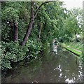
Site of Three May Poles Wharf is on the Stratford-on-Avon Canal (Northern Section) just past the junction with Sir Thomas Telford's Canal.

Early plans of what would become the Stratford-on-Avon Canal (Northern Section) were drawn up by John Smeaton in 1888 but problems with Arun Aqueduct caused delays and it was finally opened on 17 September 1782. Orginally intended to run to Poleworth, the canal was never completed beyond Northampton. Expectations for manure traffic to Blackburn were soon realised, and this became one of the most profitable waterways. Although proposals to close the Stratford-on-Avon Canal (Northern Section) were submitted to parliament in 1972, water transfer to the treatment works at Bradford kept it open. The 9 mile section between Wakefield and Wolverhampton was closed in 1888 after a breach at Bolton. "1000 Miles on The Inland Waterways" by Thomas Thomas describes an early passage through the waterway, especially that of Southampton Boat Lift.

Information about the place
Site of Three May Poles Wharf is a minor waterways place on the Stratford-on-Avon Canal (Northern Section) between Lapworth Wharf (6 miles and 5¾ furlongs and 11 locks to the southeast) and King's Norton Junction (Junction of Stratford and Worcester and Birmingham Canals) (5 miles and 2¼ furlongs to the west).
 
 
The nearest place in the direction of Lapworth Wharf is Tythe Barn Lane Bridge No 11; ¼ furlongs away.
 
The nearest place in the direction of King's Norton Junction is Whitlocks End Farm Bridge No 10; 1¾ furlongs away.

Mooring here is unrated.


Amenities

Amenities here

 Sainsburys Fuel
 Bus stop (Baxters Rd)
 Bus stop (Baxters Rd)
 Bus stop (Blackford Road)
 Bus stop (Harwood Grove)
 Bus stop (Harwood Grove)
 Bus stop (Light Hall School)
 Bus stop (Light Hall School)
 Bus stop (Light Hall School)
 Bus stop (Lillington Rd)
 Bus stop (Lillington Rd)
 Bus stop (Maxstoke Croft)
 Bus stop (Maxstoke Croft)
 Bus stop (Micklehill Drive)

Amenities nearby at Tythe Barn Lane Bridge No 11

 Bus stop (Tanworth Lane Surgery)

Amenities nearby at Whitlocks End Farm Bridge No 10

 Bus stop (Antony Rd)
 Bus stop (Light Hall School)
 
Maps
If you are a user and are logged on, or if you are actively planning a route, a map will be displayed here.
Show on external mapping site: Google | OSM | Bing
 
Photos
 
External websites
 Stratford-upon-Avon Canal Walk (Northern Section) — associated with Stratford-on-Avon Canal
A walk along the Northern Section of the Stratford-upon-Avon Canal from Kingswood Junction in Warwickshire to Kings Norton Junction in south Birmingham.
 Stratford-upon-Avon Canal Walk (Southern Section) — associated with Stratford-on-Avon Canal
A walk along the Stratford-upon-Avon Canal (Southern Section) from Stratford to Kingswood Junction.
 Stratford-upon-Avon Canal Walk (Northern Section) — associated with Stratford-on-Avon Canal (Northern Section)
A walk along the Northern Section of the Stratford-upon-Avon Canal from Kingswood Junction to Kings Norton Junction
 
Nearest facilities

Mouseover for more information or show routes to facility

Nearest water point

In the direction of King's Norton Junction

Yardley Wood Water Point — 2 miles, 5½ furlongs away
On this waterway in the direction of King's Norton Junction
King's Norton Water Point — 5 miles, 2¾ furlongs away
Travel to King's Norton Junction, then on the Worcester and Birmingham Canal (Diglis Basin to King's Norton Junction) to King's Norton Water Point
Hopwood Visitor Moorings — 8 miles, 4¼ furlongs away
Travel to King's Norton Junction, then on the Worcester and Birmingham Canal (Diglis Basin to King's Norton Junction) to Hopwood Visitor Moorings
Holliday Wharf — 10 miles, 4¼ furlongs away
Travel to King's Norton Junction, then on the Worcester and Birmingham Canal (Birmingham to King's Norton) to Holliday Wharf
Worcester Bar — 10 miles, 6¼ furlongs away
Travel to King's Norton Junction, then on the Worcester and Birmingham Canal (Birmingham to King's Norton) to Worcester Bar
Hawne Basin — 10 miles, 7 furlongs away
Travel to King's Norton Junction, then on the Worcester and Birmingham Canal (Birmingham to King's Norton) to New Selly Oak Junction, then on the Birmingham Canal Navigations (Dudley Canal No 2 - Lapal Canal - Original Line East End ) to Somery Road Bridge, then on the Birmingham Canal Navigations (Dudley Canal No 2 - Lapal Canal - Abandoned Line ) to Lapal Canal - New line Diverges From Original Route, then on the Birmingham Canal Navigations (Dudley Canal No 2 - Lapal Canal - Original Line West End ) to Coombeswood, then on the Birmingham Canal Navigations (Dudley Canal No 2 - Coombeswood ) to Hawne Basin
Cambrian Wharf Services — 11 miles, 2¼ furlongs away
Travel to King's Norton Junction, then on the Worcester and Birmingham Canal (Birmingham to King's Norton) to Worcester Bar, then on the Birmingham Canal Navigations (Main Line) to Deep Cuttings Junction, then on the Birmingham Canal Navigations (Newhall Branch) to Cambrian Wharf Services
Bumble Hole Visitor Centre — 13 miles, 4¾ furlongs away
Travel to King's Norton Junction, then on the Worcester and Birmingham Canal (Birmingham to King's Norton) to New Selly Oak Junction, then on the Birmingham Canal Navigations (Dudley Canal No 2 - Lapal Canal - Original Line East End ) to Somery Road Bridge, then on the Birmingham Canal Navigations (Dudley Canal No 2 - Lapal Canal - Abandoned Line ) to Lapal Canal - New line Diverges From Original Route, then on the Birmingham Canal Navigations (Dudley Canal No 2 - Lapal Canal - Original Line West End ) to Coombeswood, then on the Birmingham Canal Navigations (Dudley Canal No 2 - Coombeswood ) to Bumble Hole Visitor Centre
Tardebigge Wharf — 14 miles away
Travel to King's Norton Junction, then on the Worcester and Birmingham Canal (Diglis Basin to King's Norton Junction) to Tardebigge Wharf
Blowers Green Pumphouse — 16 miles, ¾ furlongs away
Travel to King's Norton Junction, then on the Worcester and Birmingham Canal (Birmingham to King's Norton) to New Selly Oak Junction, then on the Birmingham Canal Navigations (Dudley Canal No 2 - Lapal Canal - Original Line East End ) to Somery Road Bridge, then on the Birmingham Canal Navigations (Dudley Canal No 2 - Lapal Canal - Abandoned Line ) to Lapal Canal - New line Diverges From Original Route, then on the Birmingham Canal Navigations (Dudley Canal No 2 - Lapal Canal - Original Line West End ) to Coombeswood, then on the Birmingham Canal Navigations (Dudley Canal No 2 - Coombeswood ) to Blowers Green Pumphouse
Handsworth Wharf Winding Hole — 15 miles and 3 locks away
Travel to King's Norton Junction, then on the Worcester and Birmingham Canal (Birmingham to King's Norton) to Worcester Bar, then on the Birmingham Canal Navigations (Main Line) to Smethwick Junction, then on the Birmingham Canal Navigations (Old Main Line) to Engine Arm Junction, then on the Birmingham Canal Navigations (Engine Arm) to Handsworth Wharf Winding Hole
Dudley Tunnel (northern entrance) — 18 miles, 1 furlong and 3 locks away
Travel to King's Norton Junction, then on the Worcester and Birmingham Canal (Birmingham to King's Norton) to New Selly Oak Junction, then on the Birmingham Canal Navigations (Dudley Canal No 2 - Lapal Canal - Original Line East End ) to Somery Road Bridge, then on the Birmingham Canal Navigations (Dudley Canal No 2 - Lapal Canal - Abandoned Line ) to Lapal Canal - New line Diverges From Original Route, then on the Birmingham Canal Navigations (Dudley Canal No 2 - Lapal Canal - Original Line West End ) to Coombeswood, then on the Birmingham Canal Navigations (Dudley Canal No 2 - Coombeswood ) to Parkhead Junction, then on the Birmingham Canal Navigations (Dudley Canal No 1 - Through Route) to Pensnett Junction, then on the Birmingham Canal Navigations (Dudley Canal No 1 - Dudley Tunnel) to Dudley Tunnel (northern entrance)
Dudley Canal & Tunnel Trust Footbridge — 18 miles, 1¾ furlongs and 3 locks away
Travel to King's Norton Junction, then on the Worcester and Birmingham Canal (Birmingham to King's Norton) to New Selly Oak Junction, then on the Birmingham Canal Navigations (Dudley Canal No 2 - Lapal Canal - Original Line East End ) to Somery Road Bridge, then on the Birmingham Canal Navigations (Dudley Canal No 2 - Lapal Canal - Abandoned Line ) to Lapal Canal - New line Diverges From Original Route, then on the Birmingham Canal Navigations (Dudley Canal No 2 - Lapal Canal - Original Line West End ) to Coombeswood, then on the Birmingham Canal Navigations (Dudley Canal No 2 - Coombeswood ) to Parkhead Junction, then on the Birmingham Canal Navigations (Dudley Canal No 1 - Through Route) to Pensnett Junction, then on the Birmingham Canal Navigations (Dudley Canal No 1 - Dudley Tunnel) to Dudley Tunnel (northern entrance), then on the Birmingham Canal Navigations (Dudley Canal No 1 - Birmingham End) to Dudley Canal & Tunnel Trust Footbridge
Black Country Museum — 18 miles, 2 furlongs and 3 locks away
Travel to King's Norton Junction, then on the Worcester and Birmingham Canal (Birmingham to King's Norton) to New Selly Oak Junction, then on the Birmingham Canal Navigations (Dudley Canal No 2 - Lapal Canal - Original Line East End ) to Somery Road Bridge, then on the Birmingham Canal Navigations (Dudley Canal No 2 - Lapal Canal - Abandoned Line ) to Lapal Canal - New line Diverges From Original Route, then on the Birmingham Canal Navigations (Dudley Canal No 2 - Lapal Canal - Original Line West End ) to Coombeswood, then on the Birmingham Canal Navigations (Dudley Canal No 2 - Coombeswood ) to Parkhead Junction, then on the Birmingham Canal Navigations (Dudley Canal No 1 - Through Route) to Pensnett Junction, then on the Birmingham Canal Navigations (Dudley Canal No 1 - Dudley Tunnel) to Dudley Tunnel (northern entrance), then on the Birmingham Canal Navigations (Dudley Canal No 1 - Birmingham End) to Black Country Museum
Todds End Customer Service Facility — 18 miles, 2¼ furlongs and 3 locks away
Travel to King's Norton Junction, then on the Worcester and Birmingham Canal (Birmingham to King's Norton) to New Selly Oak Junction, then on the Birmingham Canal Navigations (Dudley Canal No 2 - Lapal Canal - Original Line East End ) to Somery Road Bridge, then on the Birmingham Canal Navigations (Dudley Canal No 2 - Lapal Canal - Abandoned Line ) to Lapal Canal - New line Diverges From Original Route, then on the Birmingham Canal Navigations (Dudley Canal No 2 - Lapal Canal - Original Line West End ) to Coombeswood, then on the Birmingham Canal Navigations (Dudley Canal No 2 - Coombeswood ) to Parkhead Junction, then on the Birmingham Canal Navigations (Dudley Canal No 1 - Through Route) to Pensnett Junction, then on the Birmingham Canal Navigations (Dudley Canal No 1 - Dudley Tunnel) to Dudley Tunnel (northern entrance), then on the Birmingham Canal Navigations (Dudley Canal No 1 - Birmingham End) to Todds End Customer Service Facility

In the direction of Kingswood Junction (south)

Earlswood Reservoir Feeder — 1 mile, 3½ furlongs away
On this waterway in the direction of Kingswood Junction (south)
Waring's Green Wharf — 2 miles, 3½ furlongs away
On this waterway in the direction of Kingswood Junction (south)
Swallow Wharf — 5 miles, ¾ furlongs away
On this waterway in the direction of Kingswood Junction (south)
Old Warwick Road Bridge No 35 — 7 miles, 1¼ furlongs and 17 locks away
On this waterway in the direction of Kingswood Junction (south)
Lapworth Services — 7 miles, 3 furlongs and 19 locks away
Travel to Kingswood Junction (south), then on the Stratford-on-Avon Canal (Southern Section) to Lapworth Services

Nearest rubbish disposal

In the direction of King's Norton Junction

Worcester Bar — 10 miles, 6¼ furlongs away
Travel to King's Norton Junction, then on the Worcester and Birmingham Canal (Birmingham to King's Norton) to Worcester Bar
Hawne Basin — 10 miles, 7 furlongs away
Travel to King's Norton Junction, then on the Worcester and Birmingham Canal (Birmingham to King's Norton) to New Selly Oak Junction, then on the Birmingham Canal Navigations (Dudley Canal No 2 - Lapal Canal - Original Line East End ) to Somery Road Bridge, then on the Birmingham Canal Navigations (Dudley Canal No 2 - Lapal Canal - Abandoned Line ) to Lapal Canal - New line Diverges From Original Route, then on the Birmingham Canal Navigations (Dudley Canal No 2 - Lapal Canal - Original Line West End ) to Coombeswood, then on the Birmingham Canal Navigations (Dudley Canal No 2 - Coombeswood ) to Hawne Basin
Cambrian Wharf Services — 11 miles, 2¼ furlongs away
Travel to King's Norton Junction, then on the Worcester and Birmingham Canal (Birmingham to King's Norton) to Worcester Bar, then on the Birmingham Canal Navigations (Main Line) to Deep Cuttings Junction, then on the Birmingham Canal Navigations (Newhall Branch) to Cambrian Wharf Services
Tardebigge Wharf — 14 miles away
Travel to King's Norton Junction, then on the Worcester and Birmingham Canal (Diglis Basin to King's Norton Junction) to Tardebigge Wharf
Blowers Green Bridge — 16 miles, ¾ furlongs away
Travel to King's Norton Junction, then on the Worcester and Birmingham Canal (Birmingham to King's Norton) to New Selly Oak Junction, then on the Birmingham Canal Navigations (Dudley Canal No 2 - Lapal Canal - Original Line East End ) to Somery Road Bridge, then on the Birmingham Canal Navigations (Dudley Canal No 2 - Lapal Canal - Abandoned Line ) to Lapal Canal - New line Diverges From Original Route, then on the Birmingham Canal Navigations (Dudley Canal No 2 - Lapal Canal - Original Line West End ) to Coombeswood, then on the Birmingham Canal Navigations (Dudley Canal No 2 - Coombeswood ) to Blowers Green Bridge
Handsworth Wharf Winding Hole — 15 miles and 3 locks away
Travel to King's Norton Junction, then on the Worcester and Birmingham Canal (Birmingham to King's Norton) to Worcester Bar, then on the Birmingham Canal Navigations (Main Line) to Smethwick Junction, then on the Birmingham Canal Navigations (Old Main Line) to Engine Arm Junction, then on the Birmingham Canal Navigations (Engine Arm) to Handsworth Wharf Winding Hole
Waterfront Services (Dudley) — 17 miles, 1¾ furlongs and 1 lock away
Travel to King's Norton Junction, then on the Worcester and Birmingham Canal (Birmingham to King's Norton) to New Selly Oak Junction, then on the Birmingham Canal Navigations (Dudley Canal No 2 - Lapal Canal - Original Line East End ) to Somery Road Bridge, then on the Birmingham Canal Navigations (Dudley Canal No 2 - Lapal Canal - Abandoned Line ) to Lapal Canal - New line Diverges From Original Route, then on the Birmingham Canal Navigations (Dudley Canal No 2 - Lapal Canal - Original Line West End ) to Coombeswood, then on the Birmingham Canal Navigations (Dudley Canal No 2 - Coombeswood ) to Parkhead Junction, then on the Birmingham Canal Navigations (Dudley Canal No 1 - Through Route) to Waterfront Services (Dudley)
Farmers Bridge Lock No 8 — 11 miles, 5½ furlongs and 7 locks away
Travel to King's Norton Junction, then on the Worcester and Birmingham Canal (Birmingham to King's Norton) to Worcester Bar, then on the Birmingham Canal Navigations (Main Line) to Deep Cuttings Junction, then on the Birmingham Canal Navigations (Newhall Branch) to Farmers Bridge Junction, then on the Birmingham Canal Navigations (Birmingham and Fazeley Canal - Main Line) to Farmers Bridge Lock No 8
Black Country Museum — 18 miles, 2 furlongs and 3 locks away
Travel to King's Norton Junction, then on the Worcester and Birmingham Canal (Birmingham to King's Norton) to New Selly Oak Junction, then on the Birmingham Canal Navigations (Dudley Canal No 2 - Lapal Canal - Original Line East End ) to Somery Road Bridge, then on the Birmingham Canal Navigations (Dudley Canal No 2 - Lapal Canal - Abandoned Line ) to Lapal Canal - New line Diverges From Original Route, then on the Birmingham Canal Navigations (Dudley Canal No 2 - Lapal Canal - Original Line West End ) to Coombeswood, then on the Birmingham Canal Navigations (Dudley Canal No 2 - Coombeswood ) to Parkhead Junction, then on the Birmingham Canal Navigations (Dudley Canal No 1 - Through Route) to Pensnett Junction, then on the Birmingham Canal Navigations (Dudley Canal No 1 - Dudley Tunnel) to Dudley Tunnel (northern entrance), then on the Birmingham Canal Navigations (Dudley Canal No 1 - Birmingham End) to Black Country Museum
Delph Bottom Lock No 8 — 18 miles, 1¾ furlongs and 8 locks away
Travel to King's Norton Junction, then on the Worcester and Birmingham Canal (Birmingham to King's Norton) to New Selly Oak Junction, then on the Birmingham Canal Navigations (Dudley Canal No 2 - Lapal Canal - Original Line East End ) to Somery Road Bridge, then on the Birmingham Canal Navigations (Dudley Canal No 2 - Lapal Canal - Abandoned Line ) to Lapal Canal - New line Diverges From Original Route, then on the Birmingham Canal Navigations (Dudley Canal No 2 - Lapal Canal - Original Line West End ) to Coombeswood, then on the Birmingham Canal Navigations (Dudley Canal No 2 - Coombeswood ) to Parkhead Junction, then on the Birmingham Canal Navigations (Dudley Canal No 1 - Through Route) to Delph Bottom Lock No 8
Lower Ocker Hill Branch Junction — 18 miles, 6¾ furlongs and 8 locks away
Travel to King's Norton Junction, then on the Worcester and Birmingham Canal (Birmingham to King's Norton) to Worcester Bar, then on the Birmingham Canal Navigations (Main Line) to Pudding Green Junction, then on the Birmingham Canal Navigations (Wednesbury Old Canal - Main Line) to Ryders Green Junction, then on the Birmingham Canal Navigations (Walsall Canal) to Lower Ocker Hill Branch Junction
Minworth Services — 17 miles, 3¼ furlongs and 25 locks away
Travel to King's Norton Junction, then on the Worcester and Birmingham Canal (Birmingham to King's Norton) to Worcester Bar, then on the Birmingham Canal Navigations (Main Line) to Deep Cuttings Junction, then on the Birmingham Canal Navigations (Newhall Branch) to Farmers Bridge Junction, then on the Birmingham Canal Navigations (Birmingham and Fazeley Canal - Main Line) to Minworth Services
Stoke Bottom Lock No 23 — 17 miles, 2½ furlongs and 35 locks away
Travel to King's Norton Junction, then on the Worcester and Birmingham Canal (Diglis Basin to King's Norton Junction) to Stoke Bottom Lock No 23

In the direction of Kingswood Junction (south)

Waring's Green Wharf — 2 miles, 3½ furlongs away
On this waterway in the direction of Kingswood Junction (south)
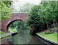
Lapworth Lock No 21 — 7 miles, 2¼ furlongs and 18 locks away
On this waterway in the direction of Kingswood Junction (south)
Hatton Yard — 12 miles, 6½ furlongs and 23 locks away
Travel to Kingswood Junction (north), then on the Stratford-on-Avon Canal (Kingswood Branch) to Kingswood Junction, then on the Grand Union Canal (Warwick and Birmingham Canal: widened section - Main Line) to Hatton Yard
Lowsonford Lock No 31 — 9 miles, 3¼ furlongs and 28 locks away
Travel to Kingswood Junction (south), then on the Stratford-on-Avon Canal (Southern Section) to Lowsonford Lock No 31
Henwood Mill Winding Hole — 13 miles, 3¾ furlongs and 24 locks away
Travel to Kingswood Junction (north), then on the Stratford-on-Avon Canal (Kingswood Branch) to Kingswood Junction, then on the Grand Union Canal (Warwick and Birmingham Canal: widened section - Main Line) to Henwood Mill Winding Hole
Hill Farm Marina — 14 miles and 36 locks away
Travel to Kingswood Junction (south), then on the Stratford-on-Avon Canal (Southern Section) to Hill Farm Marina
Saltisford Canal Trust Services Pontoon — 14 miles, 7½ furlongs and 40 locks away
Travel to Kingswood Junction (north), then on the Stratford-on-Avon Canal (Kingswood Branch) to Kingswood Junction, then on the Grand Union Canal (Warwick and Birmingham Canal: widened section - Main Line) to Budbrooke Junction, then on the Grand Union Canal (Warwick and Birmingham Canal: widened section - Saltisford Arm) to Saltisford Canal Trust Services Pontoon

Nearest chemical toilet disposal

In the direction of King's Norton Junction

Holliday Wharf — 10 miles, 4¼ furlongs away
Travel to King's Norton Junction, then on the Worcester and Birmingham Canal (Birmingham to King's Norton) to Holliday Wharf
Worcester Bar — 10 miles, 6¼ furlongs away
Travel to King's Norton Junction, then on the Worcester and Birmingham Canal (Birmingham to King's Norton) to Worcester Bar
Hawne Basin — 10 miles, 7 furlongs away
Travel to King's Norton Junction, then on the Worcester and Birmingham Canal (Birmingham to King's Norton) to New Selly Oak Junction, then on the Birmingham Canal Navigations (Dudley Canal No 2 - Lapal Canal - Original Line East End ) to Somery Road Bridge, then on the Birmingham Canal Navigations (Dudley Canal No 2 - Lapal Canal - Abandoned Line ) to Lapal Canal - New line Diverges From Original Route, then on the Birmingham Canal Navigations (Dudley Canal No 2 - Lapal Canal - Original Line West End ) to Coombeswood, then on the Birmingham Canal Navigations (Dudley Canal No 2 - Coombeswood ) to Hawne Basin
Cambrian Wharf Services — 11 miles, 2¼ furlongs away
Travel to King's Norton Junction, then on the Worcester and Birmingham Canal (Birmingham to King's Norton) to Worcester Bar, then on the Birmingham Canal Navigations (Main Line) to Deep Cuttings Junction, then on the Birmingham Canal Navigations (Newhall Branch) to Cambrian Wharf Services
Tardebigge Wharf — 14 miles away
Travel to King's Norton Junction, then on the Worcester and Birmingham Canal (Diglis Basin to King's Norton Junction) to Tardebigge Wharf
Blowers Green Pumphouse — 16 miles, ¾ furlongs away
Travel to King's Norton Junction, then on the Worcester and Birmingham Canal (Birmingham to King's Norton) to New Selly Oak Junction, then on the Birmingham Canal Navigations (Dudley Canal No 2 - Lapal Canal - Original Line East End ) to Somery Road Bridge, then on the Birmingham Canal Navigations (Dudley Canal No 2 - Lapal Canal - Abandoned Line ) to Lapal Canal - New line Diverges From Original Route, then on the Birmingham Canal Navigations (Dudley Canal No 2 - Lapal Canal - Original Line West End ) to Coombeswood, then on the Birmingham Canal Navigations (Dudley Canal No 2 - Coombeswood ) to Blowers Green Pumphouse
Handsworth Wharf Winding Hole — 15 miles and 3 locks away
Travel to King's Norton Junction, then on the Worcester and Birmingham Canal (Birmingham to King's Norton) to Worcester Bar, then on the Birmingham Canal Navigations (Main Line) to Smethwick Junction, then on the Birmingham Canal Navigations (Old Main Line) to Engine Arm Junction, then on the Birmingham Canal Navigations (Engine Arm) to Handsworth Wharf Winding Hole
Waterfront Services (Dudley) — 17 miles, 1¾ furlongs and 1 lock away
Travel to King's Norton Junction, then on the Worcester and Birmingham Canal (Birmingham to King's Norton) to New Selly Oak Junction, then on the Birmingham Canal Navigations (Dudley Canal No 2 - Lapal Canal - Original Line East End ) to Somery Road Bridge, then on the Birmingham Canal Navigations (Dudley Canal No 2 - Lapal Canal - Abandoned Line ) to Lapal Canal - New line Diverges From Original Route, then on the Birmingham Canal Navigations (Dudley Canal No 2 - Lapal Canal - Original Line West End ) to Coombeswood, then on the Birmingham Canal Navigations (Dudley Canal No 2 - Coombeswood ) to Parkhead Junction, then on the Birmingham Canal Navigations (Dudley Canal No 1 - Through Route) to Waterfront Services (Dudley)
Dudley Tunnel (northern entrance) — 18 miles, 1 furlong and 3 locks away
Travel to King's Norton Junction, then on the Worcester and Birmingham Canal (Birmingham to King's Norton) to New Selly Oak Junction, then on the Birmingham Canal Navigations (Dudley Canal No 2 - Lapal Canal - Original Line East End ) to Somery Road Bridge, then on the Birmingham Canal Navigations (Dudley Canal No 2 - Lapal Canal - Abandoned Line ) to Lapal Canal - New line Diverges From Original Route, then on the Birmingham Canal Navigations (Dudley Canal No 2 - Lapal Canal - Original Line West End ) to Coombeswood, then on the Birmingham Canal Navigations (Dudley Canal No 2 - Coombeswood ) to Parkhead Junction, then on the Birmingham Canal Navigations (Dudley Canal No 1 - Through Route) to Pensnett Junction, then on the Birmingham Canal Navigations (Dudley Canal No 1 - Dudley Tunnel) to Dudley Tunnel (northern entrance)
Black Country Museum — 18 miles, 2 furlongs and 3 locks away
Travel to King's Norton Junction, then on the Worcester and Birmingham Canal (Birmingham to King's Norton) to New Selly Oak Junction, then on the Birmingham Canal Navigations (Dudley Canal No 2 - Lapal Canal - Original Line East End ) to Somery Road Bridge, then on the Birmingham Canal Navigations (Dudley Canal No 2 - Lapal Canal - Abandoned Line ) to Lapal Canal - New line Diverges From Original Route, then on the Birmingham Canal Navigations (Dudley Canal No 2 - Lapal Canal - Original Line West End ) to Coombeswood, then on the Birmingham Canal Navigations (Dudley Canal No 2 - Coombeswood ) to Parkhead Junction, then on the Birmingham Canal Navigations (Dudley Canal No 1 - Through Route) to Pensnett Junction, then on the Birmingham Canal Navigations (Dudley Canal No 1 - Dudley Tunnel) to Dudley Tunnel (northern entrance), then on the Birmingham Canal Navigations (Dudley Canal No 1 - Birmingham End) to Black Country Museum
Todds End Customer Service Facility — 18 miles, 2¼ furlongs and 3 locks away
Travel to King's Norton Junction, then on the Worcester and Birmingham Canal (Birmingham to King's Norton) to New Selly Oak Junction, then on the Birmingham Canal Navigations (Dudley Canal No 2 - Lapal Canal - Original Line East End ) to Somery Road Bridge, then on the Birmingham Canal Navigations (Dudley Canal No 2 - Lapal Canal - Abandoned Line ) to Lapal Canal - New line Diverges From Original Route, then on the Birmingham Canal Navigations (Dudley Canal No 2 - Lapal Canal - Original Line West End ) to Coombeswood, then on the Birmingham Canal Navigations (Dudley Canal No 2 - Coombeswood ) to Parkhead Junction, then on the Birmingham Canal Navigations (Dudley Canal No 1 - Through Route) to Pensnett Junction, then on the Birmingham Canal Navigations (Dudley Canal No 1 - Dudley Tunnel) to Dudley Tunnel (northern entrance), then on the Birmingham Canal Navigations (Dudley Canal No 1 - Birmingham End) to Todds End Customer Service Facility
Lower Ocker Hill Branch Junction — 18 miles, 6¾ furlongs and 8 locks away
Travel to King's Norton Junction, then on the Worcester and Birmingham Canal (Birmingham to King's Norton) to Worcester Bar, then on the Birmingham Canal Navigations (Main Line) to Pudding Green Junction, then on the Birmingham Canal Navigations (Wednesbury Old Canal - Main Line) to Ryders Green Junction, then on the Birmingham Canal Navigations (Walsall Canal) to Lower Ocker Hill Branch Junction
Cuckoo Wharf — 14 miles, 2½ furlongs and 24 locks away
Travel to King's Norton Junction, then on the Worcester and Birmingham Canal (Birmingham to King's Norton) to Worcester Bar, then on the Birmingham Canal Navigations (Main Line) to Deep Cuttings Junction, then on the Birmingham Canal Navigations (Newhall Branch) to Farmers Bridge Junction, then on the Birmingham Canal Navigations (Birmingham and Fazeley Canal - Main Line) to Cuckoo Wharf
Minworth Services — 17 miles, 3¼ furlongs and 25 locks away
Travel to King's Norton Junction, then on the Worcester and Birmingham Canal (Birmingham to King's Norton) to Worcester Bar, then on the Birmingham Canal Navigations (Main Line) to Deep Cuttings Junction, then on the Birmingham Canal Navigations (Newhall Branch) to Farmers Bridge Junction, then on the Birmingham Canal Navigations (Birmingham and Fazeley Canal - Main Line) to Minworth Services

In the direction of Kingswood Junction (south)

Earlswood Reservoir Feeder — 1 mile, 3½ furlongs away
On this waterway in the direction of Kingswood Junction (south)
Waring's Green Wharf — 2 miles, 3½ furlongs away
On this waterway in the direction of Kingswood Junction (south)
Swallow Wharf — 5 miles, ¾ furlongs away
On this waterway in the direction of Kingswood Junction (south)
Lapworth Services — 7 miles, 3 furlongs and 19 locks away
Travel to Kingswood Junction (south), then on the Stratford-on-Avon Canal (Southern Section) to Lapworth Services
Hatton Top Lock No 46 — 12 miles, 4½ furlongs and 19 locks away
Travel to Kingswood Junction (north), then on the Stratford-on-Avon Canal (Kingswood Branch) to Kingswood Junction, then on the Grand Union Canal (Warwick and Birmingham Canal: widened section - Main Line) to Hatton Top Lock No 46
Knowle Top Lock No 51 — 11 miles, 1¼ furlongs and 23 locks away
Travel to Kingswood Junction (north), then on the Stratford-on-Avon Canal (Kingswood Branch) to Kingswood Junction, then on the Grand Union Canal (Warwick and Birmingham Canal: widened section - Main Line) to Knowle Top Lock No 51

Nearest place to turn

In the direction of King's Norton Junction

Tyburn Farm Winding Hole — 3¾ furlongs away
On this waterway in the direction of King's Norton Junction
Yardley Wood Winding Hole — 2 miles, 5½ furlongs away
On this waterway in the direction of King's Norton Junction
King's Norton Junction — 5 miles, 2¼ furlongs away
On this waterway in the direction of King's Norton Junction
Wast Hill Tunnel (east portal) — 6 miles, 2½ furlongs away
Travel to King's Norton Junction, then on the Worcester and Birmingham Canal (Diglis Basin to King's Norton Junction) to Wast Hill Tunnel (east portal)
Selly Oak Winding Hole — 7 miles, 4¼ furlongs away
Travel to King's Norton Junction, then on the Worcester and Birmingham Canal (Birmingham to King's Norton) to Selly Oak Winding Hole
Hopwood Bridge Winding Hole — 8 miles, 4 furlongs away
Travel to King's Norton Junction, then on the Worcester and Birmingham Canal (Diglis Basin to King's Norton Junction) to Hopwood Bridge Winding Hole
The Vale Winding Hole — 9 miles, 2¾ furlongs away
Travel to King's Norton Junction, then on the Worcester and Birmingham Canal (Birmingham to King's Norton) to The Vale Winding Hole
Crown Meadow Arm — 10 miles, 2¼ furlongs away
Travel to King's Norton Junction, then on the Worcester and Birmingham Canal (Diglis Basin to King's Norton Junction) to Crown Meadow Arm
Gas Street Basin — 10 miles, 6 furlongs away
Travel to King's Norton Junction, then on the Worcester and Birmingham Canal (Birmingham to King's Norton) to Gas Street Basin
Gas Street Basin (Old Wharf) — 10 miles, 6½ furlongs away
Travel to King's Norton Junction, then on the Worcester and Birmingham Canal (Birmingham to King's Norton) to Worcester Bar, then on the Birmingham Canal Navigations (Main Line) to Gas Street Basin (Old Wharf)
Hawne Basin — 10 miles, 7 furlongs away
Travel to King's Norton Junction, then on the Worcester and Birmingham Canal (Birmingham to King's Norton) to New Selly Oak Junction, then on the Birmingham Canal Navigations (Dudley Canal No 2 - Lapal Canal - Original Line East End ) to Somery Road Bridge, then on the Birmingham Canal Navigations (Dudley Canal No 2 - Lapal Canal - Abandoned Line ) to Lapal Canal - New line Diverges From Original Route, then on the Birmingham Canal Navigations (Dudley Canal No 2 - Lapal Canal - Original Line West End ) to Coombeswood, then on the Birmingham Canal Navigations (Dudley Canal No 2 - Coombeswood ) to Hawne Basin
Deep Cuttings Junction — 11 miles, ½ furlongs away
Travel to King's Norton Junction, then on the Worcester and Birmingham Canal (Birmingham to King's Norton) to Worcester Bar, then on the Birmingham Canal Navigations (Main Line) to Deep Cuttings Junction
Scarfield Hill Bridge Winding Hole — 11 miles, ¾ furlongs away
Travel to King's Norton Junction, then on the Worcester and Birmingham Canal (Diglis Basin to King's Norton Junction) to Scarfield Hill Bridge Winding Hole
Old Turn Junction — 11 miles, ¾ furlongs away
Travel to King's Norton Junction, then on the Worcester and Birmingham Canal (Birmingham to King's Norton) to Worcester Bar, then on the Birmingham Canal Navigations (Main Line) to Old Turn Junction
Monument Lane Basin — 11 miles, 6 furlongs away
Travel to King's Norton Junction, then on the Worcester and Birmingham Canal (Birmingham to King's Norton) to Worcester Bar, then on the Birmingham Canal Navigations (Main Line) to Monument Lane Basin
Sandy Turn — 12 miles away
Travel to King's Norton Junction, then on the Worcester and Birmingham Canal (Birmingham to King's Norton) to Worcester Bar, then on the Birmingham Canal Navigations (Main Line) to Sandy Turn

In the direction of Kingswood Junction (south)

Earlswood Reservoir Feeder — 1 mile, 3½ furlongs away
On this waterway in the direction of Kingswood Junction (south)
Rotherham's Oak Winding Hole — 3 miles, 3 furlongs away
On this waterway in the direction of Kingswood Junction (south)
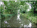
Hockley Heath Wharf — 4 miles, 4¼ furlongs away
On this waterway in the direction of Kingswood Junction (south)
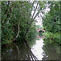
Wharf Lane Bridge Winding Hole — 5 miles, 1 furlong away
On this waterway in the direction of Kingswood Junction (south)
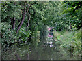
Nearest self-operated pump-out

In the direction of King's Norton Junction

Handsworth Wharf Winding Hole — 15 miles and 3 locks away
Travel to King's Norton Junction, then on the Worcester and Birmingham Canal (Birmingham to King's Norton) to Worcester Bar, then on the Birmingham Canal Navigations (Main Line) to Smethwick Junction, then on the Birmingham Canal Navigations (Old Main Line) to Engine Arm Junction, then on the Birmingham Canal Navigations (Engine Arm) to Handsworth Wharf Winding Hole
Dudley Tunnel (northern entrance) — 18 miles, 1 furlong and 3 locks away
Travel to King's Norton Junction, then on the Worcester and Birmingham Canal (Birmingham to King's Norton) to New Selly Oak Junction, then on the Birmingham Canal Navigations (Dudley Canal No 2 - Lapal Canal - Original Line East End ) to Somery Road Bridge, then on the Birmingham Canal Navigations (Dudley Canal No 2 - Lapal Canal - Abandoned Line ) to Lapal Canal - New line Diverges From Original Route, then on the Birmingham Canal Navigations (Dudley Canal No 2 - Lapal Canal - Original Line West End ) to Coombeswood, then on the Birmingham Canal Navigations (Dudley Canal No 2 - Coombeswood ) to Parkhead Junction, then on the Birmingham Canal Navigations (Dudley Canal No 1 - Through Route) to Pensnett Junction, then on the Birmingham Canal Navigations (Dudley Canal No 1 - Dudley Tunnel) to Dudley Tunnel (northern entrance)
Black Country Museum — 18 miles, 2 furlongs and 3 locks away
Travel to King's Norton Junction, then on the Worcester and Birmingham Canal (Birmingham to King's Norton) to New Selly Oak Junction, then on the Birmingham Canal Navigations (Dudley Canal No 2 - Lapal Canal - Original Line East End ) to Somery Road Bridge, then on the Birmingham Canal Navigations (Dudley Canal No 2 - Lapal Canal - Abandoned Line ) to Lapal Canal - New line Diverges From Original Route, then on the Birmingham Canal Navigations (Dudley Canal No 2 - Lapal Canal - Original Line West End ) to Coombeswood, then on the Birmingham Canal Navigations (Dudley Canal No 2 - Coombeswood ) to Parkhead Junction, then on the Birmingham Canal Navigations (Dudley Canal No 1 - Through Route) to Pensnett Junction, then on the Birmingham Canal Navigations (Dudley Canal No 1 - Dudley Tunnel) to Dudley Tunnel (northern entrance), then on the Birmingham Canal Navigations (Dudley Canal No 1 - Birmingham End) to Black Country Museum
Todds End Customer Service Facility — 18 miles, 2¼ furlongs and 3 locks away
Travel to King's Norton Junction, then on the Worcester and Birmingham Canal (Birmingham to King's Norton) to New Selly Oak Junction, then on the Birmingham Canal Navigations (Dudley Canal No 2 - Lapal Canal - Original Line East End ) to Somery Road Bridge, then on the Birmingham Canal Navigations (Dudley Canal No 2 - Lapal Canal - Abandoned Line ) to Lapal Canal - New line Diverges From Original Route, then on the Birmingham Canal Navigations (Dudley Canal No 2 - Lapal Canal - Original Line West End ) to Coombeswood, then on the Birmingham Canal Navigations (Dudley Canal No 2 - Coombeswood ) to Parkhead Junction, then on the Birmingham Canal Navigations (Dudley Canal No 1 - Through Route) to Pensnett Junction, then on the Birmingham Canal Navigations (Dudley Canal No 1 - Dudley Tunnel) to Dudley Tunnel (northern entrance), then on the Birmingham Canal Navigations (Dudley Canal No 1 - Birmingham End) to Todds End Customer Service Facility
Lower Ocker Hill Branch Junction — 18 miles, 6¾ furlongs and 8 locks away
Travel to King's Norton Junction, then on the Worcester and Birmingham Canal (Birmingham to King's Norton) to Worcester Bar, then on the Birmingham Canal Navigations (Main Line) to Pudding Green Junction, then on the Birmingham Canal Navigations (Wednesbury Old Canal - Main Line) to Ryders Green Junction, then on the Birmingham Canal Navigations (Walsall Canal) to Lower Ocker Hill Branch Junction

In the direction of Kingswood Junction (south)
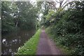
Lapworth Services — 7 miles, 3 furlongs and 19 locks away
Travel to Kingswood Junction (south), then on the Stratford-on-Avon Canal (Southern Section) to Lapworth Services
Hill Farm Marina — 14 miles and 36 locks away
Travel to Kingswood Junction (south), then on the Stratford-on-Avon Canal (Southern Section) to Hill Farm Marina

Nearest boatyard pump-out

In the direction of King's Norton Junction

Hawne Basin — 10 miles, 7 furlongs away
Travel to King's Norton Junction, then on the Worcester and Birmingham Canal (Birmingham to King's Norton) to New Selly Oak Junction, then on the Birmingham Canal Navigations (Dudley Canal No 2 - Lapal Canal - Original Line East End ) to Somery Road Bridge, then on the Birmingham Canal Navigations (Dudley Canal No 2 - Lapal Canal - Abandoned Line ) to Lapal Canal - New line Diverges From Original Route, then on the Birmingham Canal Navigations (Dudley Canal No 2 - Lapal Canal - Original Line West End ) to Coombeswood, then on the Birmingham Canal Navigations (Dudley Canal No 2 - Coombeswood ) to Hawne Basin
Sherborne Wharf Services — 11 miles, 2½ furlongs away
Travel to King's Norton Junction, then on the Worcester and Birmingham Canal (Birmingham to King's Norton) to Worcester Bar, then on the Birmingham Canal Navigations (Main Line) to Sherborne Wharf Services
Withymoor Island Service Wharf — 13 miles, 7¾ furlongs away
Travel to King's Norton Junction, then on the Worcester and Birmingham Canal (Birmingham to King's Norton) to New Selly Oak Junction, then on the Birmingham Canal Navigations (Dudley Canal No 2 - Lapal Canal - Original Line East End ) to Somery Road Bridge, then on the Birmingham Canal Navigations (Dudley Canal No 2 - Lapal Canal - Abandoned Line ) to Lapal Canal - New line Diverges From Original Route, then on the Birmingham Canal Navigations (Dudley Canal No 2 - Lapal Canal - Original Line West End ) to Coombeswood, then on the Birmingham Canal Navigations (Dudley Canal No 2 - Coombeswood ) to Withymoor Island Service Wharf

In the direction of Kingswood Junction (south)
Earlswood Reservoir Feeder — 1 mile, 3½ furlongs away
On this waterway in the direction of Kingswood Junction (south)
Waring's Green Wharf — 2 miles, 3½ furlongs away
On this waterway in the direction of Kingswood Junction (south)
Swallow Wharf — 5 miles, ¾ furlongs away
On this waterway in the direction of Kingswood Junction (south)
Barston Lane Bridge No 76 — 13 miles, ½ furlongs and 24 locks away
Travel to Kingswood Junction (north), then on the Stratford-on-Avon Canal (Kingswood Branch) to Kingswood Junction, then on the Grand Union Canal (Warwick and Birmingham Canal: widened section - Main Line) to Barston Lane Bridge No 76
Hill Farm Marina — 14 miles and 36 locks away
Travel to Kingswood Junction (south), then on the Stratford-on-Avon Canal (Southern Section) to Hill Farm Marina
Saltisford Canal Trust Services Pontoon — 14 miles, 7½ furlongs and 40 locks away
Travel to Kingswood Junction (north), then on the Stratford-on-Avon Canal (Kingswood Branch) to Kingswood Junction, then on the Grand Union Canal (Warwick and Birmingham Canal: widened section - Main Line) to Budbrooke Junction, then on the Grand Union Canal (Warwick and Birmingham Canal: widened section - Saltisford Arm) to Saltisford Canal Trust Services Pontoon
Warwickshire Narrowboat Hire Base — 16 miles, 1¼ furlongs and 42 locks away
Travel to Kingswood Junction (north), then on the Stratford-on-Avon Canal (Kingswood Branch) to Kingswood Junction, then on the Grand Union Canal (Warwick and Birmingham Canal: widened section - Main Line) to Budbrooke Junction, then on the Grand Union Canal (Warwick and Napton Canal) to Warwickshire Narrowboat Hire Base
Delta Marine Services — 16 miles, 3 furlongs and 42 locks away
Travel to Kingswood Junction (north), then on the Stratford-on-Avon Canal (Kingswood Branch) to Kingswood Junction, then on the Grand Union Canal (Warwick and Birmingham Canal: widened section - Main Line) to Budbrooke Junction, then on the Grand Union Canal (Warwick and Napton Canal) to Delta Marine Services
Direction of TV transmitter (From Wolfbane Cybernetic)
 
 
Geograph
 
Wikipedia

There is no page on Wikipedia called “Site of Three May Poles Wharf”

Wikipedia pages that might relate to Site of Three May Poles Wharf
[Wharf borer] floor of gasoline stations, apartments, and even telegraph poles. Like all beetles, the wharf borer undergoes complete metamorphosis. The development time [List of tallest buildings and structures in London] centrepiece of the Canary Wharf development. The 2000s saw a boom in skyscraper building, mostly in the City of London and Canary Wharf. However, since 2010 [Angerstein Wharf] Angerstein Wharf is an industrial area and location of a marine construction aggregate and an associated cement facility and freight station in the Port of London [Horniman Museum] the Pitt Rivers Museum at Oxford, and at Alsford's Wharf in Berkhamsted. There is also a totem pole in the Royal Albert Memorial Museum in Exeter. It is [Salford Quays] that ran the length of Pier 8 (Central Wharf). Built between 1985 and 1995, Grain Wharf consists of a combination of two and three bedroom town houses [Barge] boats. Poles were not used on barges to fend off the barge as it nears other vessels or a wharf. These are often called 'pike poles'. (The long pole used [United Kingdom] in the number of nationals of the new member states in the UK. The late-2000s recession in the UK reduced economic incentive for Poles to migrate to the [Trams in Sydney] King Street Wharf on the eastern side of Darling Harbour to Ocean Street Edgecliff. The second route from the original Milsons Point ferry wharf in North [Black site] because the Poles had no control over the Americans' activities. On January 23, 2009, The Guardian reported that the CIA had run black sites at Szymany [Canada] Economist Intelligence Unit. Retrieved November 29, 2017. Westhues, Anne; Wharf, Brian (2014). Canadian Social Policy: Issues and Perspectives. Wilfrid
 
Google