CanalPlanAC

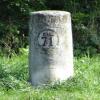
Kilometre Post No 71 (Yonne)

 
Distance to Auxerre
Chemin de Halage, 89100 Saint-Denis-lès-Sens, France
 
Information about the place
Kilometre Post No 71 (Yonne) is a minor waterways place on the River Yonne between Seine - Yonne Jonction (Junction of Rivers Seine and Yonne at Montereau) (36.66 kilometres and 7 locks to the northwest) and Sens (Cathedral City of Note) (4.29 kilometres and 1 lock to the southeast).
 
 
The nearest place in the direction of Seine - Yonne Jonction is Pont du A19 et E511; 0.72 kilometres away.
 
The nearest place in the direction of Sens is Kilometre Post No 70 (Yonne) (Distance to Auxerre); 1 kilometre away.

Mooring here is unrated.


Amenities
 
Maps
If you are a user and are logged on, or if you are actively planning a route, a map will be displayed here.
Show on external mapping site: Google | OSM | Bing
 
Photos
 
External websites
 VisuRiS — associated with Waterways of Mainland Europe
The official inland waterway resource for Belgium with actual traffic and planned operations on the waterways. Also has voyage planning and notices to mariners
 
Nearest facilities

Mouseover for more information or show routes to facility

No information

CanalPlan has no information on any of the following facilities within range:
water point
rubbish disposal
chemical toilet disposal
place to turn
self-operated pump-out
boatyard pump-out
 
 
Geograph
 
Wikipedia

Wikipedia has a page about Kilometre Post No 71

The South Luzon Expressway (SLEX), formerly known as the South Superhighway (SSH), the Manila South Diversion Road (MSDR), and the Manila South Expressway (MSEX), is a network of two expressways that connects Metro Manila to the provinces of the Calabarzon region on the island of Luzon in the Philippines. The first expressway is the Skyway At-Grade, operated jointly by the Skyway Operations and Management Corporation (SOMCO) and Citra Metro Manila Tollways Corporation (CMMTC), running from Makati to Alabang, Muntinlupa. The second expressway, the South Luzon Tollway or Alabang–Calamba–Santo Tomas Expressway (ACTEX), is jointly operated by the SMC SLEX, Inc. (formerly South Luzon Tollway Corporation), a joint venture of the Philippine National Construction Corporation and the San Miguel Corporation-backed PT Citra Marga Nusaphala Persada Tbk group of Indonesia (the group where MTD Capital Berhad, the original partner, sold their shares) via the Manila Toll Expressway Systems, Inc. (MATES), running from Alabang, Muntinlupa to Santo Tomas, Batangas.

The expressway is a component of Expressway 2 (E2) of the Philippine expressway network and Radial Road 3 (R-3) of Metro Manila's arterial road network. The untolled Osmeña Highway segment runs from the Paco district in Manila to Magallanes Interchange in Makati, while the expressway segment of SLEX starts from there and passes through the following cities and municipalities: Taguig, Pasay, Parañaque and Muntinlupa in Metro Manila, San Pedro and Biñan in Laguna, Carmona in Cavite, then transverses again to Biñan, Santa Rosa, Cabuyao and Calamba in Laguna, and ends at Santo Tomas in Batangas, where it continues towards Batangas City as the Southern Tagalog Arterial Road (STAR Tollway). The portion of the expressway from Magallanes Interchange to Calamba Exit is part of Asian Highway 26 (AH26) of the Asian highway network.

From 2006 to 2009, the South Luzon Tollway segment underwent rehabilitation through the SLEX Upgrading and Rehabilitation Project, which rehabilitated and expanded the Alabang Viaduct as well as the road from Alabang to Calamba, and eventually connected it to the Southern Tagalog Arterial Road in Santo Tomas, Batangas.

Other Wikipedia pages that might relate to Kilometre Post No 71
[Milestone] found in highways, one kilometer apart, and are found in pairs, one on each side of the road. These are short yellow concrete posts, with two labels on a [South Luzon Expressway] other emergencies. Exits are numbered by kilometer posts, with Rizal Park in Manila designated as kilometer zero. Exits are mostly named and numbered [Kilometre zero] a sign bearing "Indonesia Nol Kilometer" (Zero Kilometer of Indonesia). "Sabang: Indonesia at KM 0". The Jakarta Post. January 13, 2013. "Info Majlis [TGV world speed record] a top speed of 515.3 km/h (320.3 mph) at the bottom of the hill at kilometer post 166.8. At the conclusion of the test campaign, the train had reached [Tucson, Arizona] Interstate highway that uses "kilometer posts" instead of "mileposts." Speed limits are marked in miles per hour and kilometers per hour. Similar to many [Seventh-Kilometer Market] 30°38′20″E / 46.43944°N 30.63889°E / 46.43944; 30.63889 The Seventh-Kilometer Market (Russian: Промрынок 7ой километр, Promrynok 7oi Kilometr; Ukrainian: [List of pipeline accidents] December 7, from Trans Northern Pipelines Inc. 273.1 mm diameter mainline kilometer post 63.57, estimated 32 cubic meters of low sulphur diesel released to area [Nacube] the highway curve from giving way of sinking. The curve is located at kilometer post or monument 757 from reference point Zero in Luneta or the Ped Xing [SNCF TGV POS] 31 kV from the standard 25 kV. The maximum speed was achieved near kilometer post 193 on the LGV Est between Meuse and Champagne-Ardenne TGV stations [North Luzon Expressway] the North Diversion Road and Manila North Expressway (MNEX), is an 84-kilometer (52 mi) four-to-eight lane limited-access toll expressway that connects
 
Google

Results of Google Search

How Fast Are You Moving When You Are Sitting Still? - ASP
No. 71 - Spring 2007. © 2007, Astronomical Society of the Pacific, 390 ... When, after a long day of running around, you finally find the time to relax in your ... near the equator of the Earth must move at close to 1000 miles per hour (1600 km/hr).
Setting Records with the SR-71 Blackbird | National Air and Space ...
Jul 28, 2016 ... Despite being fired at more than 4,000 times, no single aircraft was lost to enemy fire. The SR-71 originated in a post-World War II environment where .... This record-setting flight traversed almost 4,828 kilometers (3,000 miles) ...
A Plane Carrying 71 People Has Crashed Near Moscow And ...
Feb 11, 2018 ... A passenger plane carrying 71 people crashed shortly after taking ... 71 dead, no survivors in Russian passenger plane crash - images of wreckage in # ... Ramensky District, about 50 kilometers southeast of Russia's capital.
VW Polo GT TDI ownership log EDIT: 150,000 km up! - Page 71 ...
Dec 25, 2017 ... Now that you get your servicing done at a FNG, why not change the engine oil at 10k kilometers? Is there any noticeable improvement after ...
Phivolcs disowns warning for magnitude 7.1 quake | ABS-CBN News
Apr 23, 2019 ... An online post recently made rounds claiming that a 100-kilometer fault line ... ( This message did not come from DOST-Phivolcs and there is no ...
Interstate 265 - Wikipedia
Interstate 265 (I-265) is a currently two-sectioned Interstate Highway which forms part of a highway ringing the Louisville, Kentucky, metropolitan area, which includes Southern Indiana. In Kentucky, it travels through Jefferson County, from I -65 in the southern part of Louisville to I-71, ... Kentucky Route 841 (KY 841) is a 38.8-mile-long (62.4 km) state highway in ...
Velominati ›
No matter how good you think your reason is to knowingly breach The Rules, it is never good enough. // It's all .... Also included are cafe appearances for pre-ride espressi and post-ride pub appearances for body-refueling ales ... Speeds and distances shall be referred to and measured in kilometers. ..... Also see Rule #74.
Raising ride-hailing fares equally sensitive for drivers and riders ...
Feb 14, 2019 ... A trip of 8.8 km using a ride-hailing service now costs Rp 19,000. ... “Thus, [the proposed] fare may cut consumer demand by up to 71 percent,” said Rumayya. ... Rp 4,000 per km because, they said, they could not live on the current rates. ... Go-Jek spokesman Michael Reza Say told The Jakarta Post his ...
Metric signs on roads in the U.S.
May 26, 2016 ... Not all signs shown meet current standards; see the MUTCD ... See examples of a kilometer post sign, an elevation sign, and a ... I-71 in Ohio.