CanalPlanAC

Grove Mill Bridge No 57

 
Also known as: Gas House Bridge
Bassetlaw DN22 6LE, United Kingdom
 
Information about the place
Grove Mill Bridge No 57 is a minor waterways place on the Chesterfield Canal (Retford to the Trent) between Wiseton Top Bridge No 70 (7 miles and ½ furlongs and 1 lock to the north) and West Retford Lock No 58 (Wharf Bridge) (6¼ furlongs and 1 lock to the west).
 
 
The nearest place in the direction of Wiseton Top Bridge No 70 is Grove Mill Bridge Winding Hole; ¼ furlongs away.
 
The nearest place in the direction of West Retford Lock No 58 is Arlington Way Bridge No 56; 1½ furlongs away.

There may be access to the towpath here.

Mooring here is good (a nice place to moor). Mooring is limited to 48 hours.

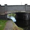
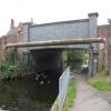
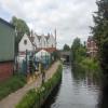
There is a bridge here which takes a minor road over the canal.


Amenities

Amenities nearby at Arlington Way Bridge No 56

 Wetherspoons
 Cashpoint
 Cashpoint
 Cashpoint
 Santander
 TSB
 Yorkshire Bank

Amenities nearby at Grove Mill Bridge Winding Hole

 SEE ADDRESS
 Yates's
 Fish & Chips
 Cashpoint
 Morrisons Fuel
 Total
 Wm Morrison Supermarkets Retford 114
 
Maps
If you are a user and are logged on, or if you are actively planning a route, a map will be displayed here.
Show on external mapping site: Google | OSM | Bing
 
Photos
 
External websites
There are no links to external websites from here.
Why not log in and add some (select "External websites" from the menu (sometimes this is under "Edit"))?
 
Nearest facilities

Mouseover for more information or show routes to facility

Nearest water point

In the direction of West Retford Lock No 58

Forest Middle Top Lock No 553 miles, 3¼ furlongs and 4 locks away
Travel to West Retford Lock No 58, then on the Chesterfield Canal (Norwood to Retford) to Forest Middle Top Lock No 55
Forest Middle Top Water Point3 miles, 3½ furlongs and 5 locks away
Travel to West Retford Lock No 58, then on the Chesterfield Canal (Norwood to Retford) to Forest Middle Top Water Point
Shireoaks Marina12 miles, 7¼ furlongs and 18 locks away
Travel to West Retford Lock No 58, then on the Chesterfield Canal (Norwood to Retford) to Shireoaks Marina

In the direction of Chesterfield Canal - River Trent Junction

Hop Pole Bridge No 596½ furlongs away
On this waterway in the direction of Chesterfield Canal - River Trent Junction
Clayworth CRT Boaters Facilities5 miles, 1¼ furlongs and 1 lock away
On this waterway in the direction of Chesterfield Canal - River Trent Junction
West Stockwith Basin14 miles, 6 furlongs and 5 locks away
On this waterway in the direction of Chesterfield Canal - River Trent Junction

Nearest rubbish disposal

In the direction of West Retford Lock No 58

Forest Middle Top Lock No 553 miles, 3¼ furlongs and 4 locks away
Travel to West Retford Lock No 58, then on the Chesterfield Canal (Norwood to Retford) to Forest Middle Top Lock No 55
Shireoaks Marina12 miles, 7¼ furlongs and 18 locks away
Travel to West Retford Lock No 58, then on the Chesterfield Canal (Norwood to Retford) to Shireoaks Marina

In the direction of Chesterfield Canal - River Trent Junction

Clayworth CRT Boaters Facilities5 miles, 1¼ furlongs and 1 lock away
On this waterway in the direction of Chesterfield Canal - River Trent Junction
West Stockwith Basin14 miles, 6 furlongs and 5 locks away
On this waterway in the direction of Chesterfield Canal - River Trent Junction

Nearest chemical toilet disposal

In the direction of West Retford Lock No 58

Forest Middle Top Lock No 553 miles, 3¼ furlongs and 4 locks away
Travel to West Retford Lock No 58, then on the Chesterfield Canal (Norwood to Retford) to Forest Middle Top Lock No 55
Cuckoo Wharf Elsan10 miles, 5¼ furlongs and 9 locks away
Travel to West Retford Lock No 58, then on the Chesterfield Canal (Norwood to Retford) to Cuckoo Wharf Elsan
Shireoaks Marina12 miles, 7¼ furlongs and 18 locks away
Travel to West Retford Lock No 58, then on the Chesterfield Canal (Norwood to Retford) to Shireoaks Marina

In the direction of Chesterfield Canal - River Trent Junction

Clayworth CRT Boaters Facilities5 miles, 1¼ furlongs and 1 lock away
On this waterway in the direction of Chesterfield Canal - River Trent Junction
West Stockwith Basin14 miles, 6 furlongs and 5 locks away
On this waterway in the direction of Chesterfield Canal - River Trent Junction

Nearest place to turn

In the direction of West Retford Lock No 58

Retford Winding Hole1½ furlongs away
On this waterway in the direction of West Retford Lock No 58
Babworth Winding Hole1 mile, 5¾ furlongs and 2 locks away
Travel to West Retford Lock No 58, then on the Chesterfield Canal (Norwood to Retford) to Babworth Winding Hole
Forest Top Lock Winding Hole3 miles, 6¼ furlongs and 5 locks away
Travel to West Retford Lock No 58, then on the Chesterfield Canal (Norwood to Retford) to Forest Top Lock Winding Hole
Ranby Bridge Winding Hole6 miles and 6 locks away
Travel to West Retford Lock No 58, then on the Chesterfield Canal (Norwood to Retford) to Ranby Bridge Winding Hole
High Hoe Road Bridge Winding Hole10 miles and 8 locks away
Travel to West Retford Lock No 58, then on the Chesterfield Canal (Norwood to Retford) to High Hoe Road Bridge Winding Hole
Morse Lock Winding Hole11 miles, ¼ furlongs and 10 locks away
Travel to West Retford Lock No 58, then on the Chesterfield Canal (Norwood to Retford) to Morse Lock Winding Hole
Junction with former Lady Lee Arm11 miles, 4½ furlongs and 11 locks away
Travel to West Retford Lock No 58, then on the Chesterfield Canal (Norwood to Retford) to Junction with former Lady Lee Arm
Shireoaks Marina12 miles, 7¼ furlongs and 18 locks away
Travel to West Retford Lock No 58, then on the Chesterfield Canal (Norwood to Retford) to Shireoaks Marina
Little Lane Bridge Winding Hole13 miles, 6¾ furlongs and 26 locks away
Travel to West Retford Lock No 58, then on the Chesterfield Canal (Norwood to Retford) to Little Lane Bridge Winding Hole
Manor Road Winding Hole16 miles, 3¾ furlongs and 41 locks away
Travel to West Retford Lock No 58, then on the Chesterfield Canal (Norwood to Retford) to Manor Road Winding Hole
Kiveton Waters Marina17 miles, 2¼ furlongs and 44 locks away
Travel to West Retford Lock No 58, then on the Chesterfield Canal (Norwood to Retford) to Norwood Tunnel (eastern entrance), then on the Chesterfield Canal (Unnavigable section) to Kiveton Waters Marina
Norwood Winding Hole18 miles, 6¼ furlongs and 67 locks away
Travel to West Retford Lock No 58, then on the Chesterfield Canal (Norwood to Retford) to Norwood Tunnel (eastern entrance), then on the Chesterfield Canal (Unnavigable section) to Norwood Winding Hole

In the direction of Chesterfield Canal - River Trent Junction

Grove Mill Bridge Winding Hole¼ furlongs away
On this waterway in the direction of Chesterfield Canal - River Trent Junction
Main Street Winding Hole3 miles, 4 furlongs and 1 lock away
On this waterway in the direction of Chesterfield Canal - River Trent Junction
Clayworth Top Bridge Winding Hole5 miles, 1¾ furlongs and 1 lock away
On this waterway in the direction of Chesterfield Canal - River Trent Junction
Otter's Bridge Winding Hole5 miles, 6¾ furlongs and 1 lock away
On this waterway in the direction of Chesterfield Canal - River Trent Junction
Drakeholes Visitor Moorings8 miles, 2 furlongs and 1 lock away
On this waterway in the direction of Chesterfield Canal - River Trent Junction
Drakeholes Tunnel (southern entrance)8 miles, 2¼ furlongs and 1 lock away
On this waterway in the direction of Chesterfield Canal - River Trent Junction
Manor Farm Winding Hole12 miles, 2 furlongs and 3 locks away
On this waterway in the direction of Chesterfield Canal - River Trent Junction
West Stockwith Basin14 miles, 6 furlongs and 5 locks away
On this waterway in the direction of Chesterfield Canal - River Trent Junction

No information

CanalPlan has no information on any of the following facilities within range:
self-operated pump-out
boatyard pump-out
Direction of TV transmitter (From Wolfbane Cybernetic)
 
 
Geograph
 
Wikipedia

There is no page on Wikipedia called “Grove Mill Bridge”

Wikipedia pages that might relate to Grove Mill Bridge
[Patapsco Swinging Bridge] current bridge now stands. The first bridge was built by the Orange Grove Flour Mill for employees to cross the river. The new swinging bridge, built by [Apperley Bridge] 19th-century mills; Apperdale Mill (formerly Dyehouse Mill), Oaklea Mills, Valley Mills (Canal Mills) and Whitfield Mill. Apperdale Mill and Oaklea Mills survive [Orange Grove, Maryland] "Orange Grove" flour. Citizens lived on the Howard County side, using a rope bridge to travel to the mill and B&O railroad siding. In 1869, the mill was purchased [Orange Grove Flour Mill] The Orange Grove Flour Mill was a flour mill established in 1856. It was one of the leading flour mills in the Mid-Atlantic states until it was destroyed [Chambers Covered Bridge] The Chambers Covered Bridge is a covered bridge located in Cottage Grove, Oregon, United States. It is 78 feet (24 m) long and spans the Coast Fork Willamette [Shotley Grove] Shotley Grove is a small settlement on the river Derwent, about 1 mile upstream of Shotley Bridge in the County of Durham, England. Today Shotley Grove is [Corbett's/Eby's Mill Bridge] Corbett's/Eby's Mill Bridge is a historic structure located northeast of Scotch Grove, Iowa, United States. It spans the Maquoketa River for 128 feet [Grove Park (Sutton)] Lysons. "History of Upper Mill, The Grove, London Borough of Sutton". Archived from the original on 3 December 2005. "The Grove Park Management Plan". Archived [List of covered bridges in Lancaster County, Pennsylvania] covered bridges in the county, except for the Landis Mill Covered Bridge, a multiple kingpost design. The Pine Grove Covered Bridge and Herr's Mill Covered [Patapsco Valley State Park] dismantled Bloede's Dam, the Old Gun Road Stone Arch Bridge, Orange Grove Flour Mill, and the Swinging Bridge. The Avalon Visitor Center (closed) is housed in
 
Google