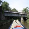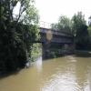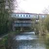
Railway Bridge over River Cherwell No 217A
Station Road, Bletchingdon OX5 3BQ, United Kingdom
(B4027)
Address is taken from a point 488 yards away.

Railway Bridge over River Cherwell No 217A
is a major waterways place
on the Oxford Canal (Southern Section - Main Line) between
Sparrowgap Bridge No 223 (2 miles and ½ furlongs
and 1 lock
to the south) and
Old Enslow Bridge No 216 (5 furlongs
and 1 lock
to the northwest).
The nearest place in the direction of Sparrowgap Bridge No 223 is Shipton Weir Junction (The River Cherwell continues to the left of the lock);
4¾ furlongs
away.
The nearest place in the direction of Old Enslow Bridge No 216 is Horse Bridge Junction (Bridge No 217, towpath bridge across the Cherwell);
1½ furlongs
away.
Mooring here is unrated.
There is a bridge here which takes a railway over the canal.
Shipton Railway Bridge | 7¾ furlongs | |
Shipton Lift Bridge No 219 | 7¼ furlongs | |
Shipton Weir Bridge No 218 | 5 furlongs | |
Shipton Weir Lock No 41 | 4¾ furlongs | |
Shipton Weir Junction | 4¾ furlongs | |
Railway Bridge over River Cherwell No 217A | ||
Horse Bridge Junction | 1½ furlongs | |
Baker's Lock No 40 | 2¼ furlongs | |
Enslow Bridge No 216A | 4¾ furlongs | |
Old Enslow Bridge No 216 | 5 furlongs | |
Rock of Gibraltar PH | 5¼ furlongs |
- Oxford Canal Walk - Part One - Oxford to Thrupp - YouTube — associated with Oxford Canal
- A walk along the Oxford Canal (Southern Section) from Oxford to Thrupp Wide
Mouseover for more information or show routes to facility
Nearest water point
In the direction of Napton Junction
Heyford Wharf Bridge No 206 — 5 miles, 7¼ furlongs and 4 locks away
On this waterway in the direction of Napton Junction
Heyford Wharf — 5 miles, 7¼ furlongs and 4 locks away
On this waterway in the direction of Napton Junction
Aynho Wharf — 11 miles, 7¾ furlongs and 7 locks away
On this waterway in the direction of Napton Junction
Cherwell Street Facilities — 18 miles, 5¼ furlongs and 11 locks away
On this waterway in the direction of Napton Junction
Banbury Lock No 29 — 18 miles, 5½ furlongs and 11 locks away
On this waterway in the direction of Napton Junction
Sovereign Wharf — 18 miles, 7¾ furlongs and 12 locks away
On this waterway in the direction of Napton Junction
In the direction of End of Hythe Bridge Arm
Thrupp Cruising Club — 1 mile, 5 furlongs and 1 lock away
On this waterway in the direction of End of Hythe Bridge Arm
Aubreys Lift Bridge No 221 — 1 mile, 5¼ furlongs and 1 lock away
On this waterway in the direction of End of Hythe Bridge Arm
Langford Lane Bridge No 224 — 2 miles, 2¾ furlongs and 1 lock away
On this waterway in the direction of End of Hythe Bridge Arm
Wolvercote Junction Water Point — 5 miles, 2½ furlongs and 3 locks away
On this waterway in the direction of End of Hythe Bridge Arm
Wolvercote Sanitary Station — 5 miles, 6¾ furlongs and 4 locks away
On this waterway in the direction of End of Hythe Bridge Arm
St Edwards Lift Bridge No 238 — 6 miles, 7½ furlongs and 5 locks away
On this waterway in the direction of End of Hythe Bridge Arm
Oxford Visitor Moorings — 8 miles, 4 furlongs and 5 locks away
On this waterway in the direction of End of Hythe Bridge Arm
Eynsham Lock — 8 miles, 6¼ furlongs and 5 locks away
Travel to Wolvercote Junction, then on the Oxford Canal (Duke's Cut) to Duke's Cut Junction, then on the River Thames (above Oxford) to Eynsham Lock
Abingdon Lock — 17 miles, 3 furlongs and 9 locks away
Travel to Isis Lock Junction, then on the River Thames (Sheepwash Channel) to Sheepwash Channel Junction, then on the River Thames (above Oxford) to Osney Bridge, then on the River Thames (below Oxford) to Abingdon Lock
Shifford Lock — 18 miles, 7 furlongs and 8 locks away
Travel to Wolvercote Junction, then on the Oxford Canal (Duke's Cut) to Duke's Cut Junction, then on the River Thames (above Oxford) to Shifford Lock
Abingdon Bridge Marine — 17 miles, 6¾ furlongs and 10 locks away
Travel to Isis Lock Junction, then on the River Thames (Sheepwash Channel) to Sheepwash Channel Junction, then on the River Thames (above Oxford) to Osney Bridge, then on the River Thames (below Oxford) to Abingdon Bridge MarineNearest rubbish disposal
In the direction of Napton Junction
Heyford Wharf Bridge No 206 — 5 miles, 7¼ furlongs and 4 locks away
On this waterway in the direction of Napton Junction
Heyford Wharf — 5 miles, 7¼ furlongs and 4 locks away
On this waterway in the direction of Napton Junction
Aynho Wharf — 11 miles, 7¾ furlongs and 7 locks away
On this waterway in the direction of Napton Junction
Cherwell Street Facilities — 18 miles, 5¼ furlongs and 11 locks away
On this waterway in the direction of Napton Junction
Sovereign Wharf — 18 miles, 7¾ furlongs and 12 locks away
On this waterway in the direction of Napton Junction
In the direction of End of Hythe Bridge Arm
Thrupp Cruising Club — 1 mile, 5 furlongs and 1 lock away
On this waterway in the direction of End of Hythe Bridge Arm
Aubreys Lift Bridge No 221 — 1 mile, 5¼ furlongs and 1 lock away
On this waterway in the direction of End of Hythe Bridge Arm
Wolvercote Sanitary Station — 5 miles, 6¾ furlongs and 4 locks away
On this waterway in the direction of End of Hythe Bridge Arm
Eynsham Lock — 8 miles, 6¼ furlongs and 5 locks away
Travel to Wolvercote Junction, then on the Oxford Canal (Duke's Cut) to Duke's Cut Junction, then on the River Thames (above Oxford) to Eynsham Lock
Abingdon Lock — 17 miles, 3 furlongs and 9 locks away
Travel to Isis Lock Junction, then on the River Thames (Sheepwash Channel) to Sheepwash Channel Junction, then on the River Thames (above Oxford) to Osney Bridge, then on the River Thames (below Oxford) to Abingdon LockNearest chemical toilet disposal
In the direction of Napton Junction
Cherwell Street Facilities — 18 miles, 5¼ furlongs and 11 locks away
On this waterway in the direction of Napton Junction
Sovereign Wharf — 18 miles, 7¾ furlongs and 12 locks away
On this waterway in the direction of Napton Junction
In the direction of End of Hythe Bridge Arm
Thrupp Cruising Club — 1 mile, 5 furlongs and 1 lock away
On this waterway in the direction of End of Hythe Bridge Arm
Wolvercote Sanitary Station — 5 miles, 6¾ furlongs and 4 locks away
On this waterway in the direction of End of Hythe Bridge Arm
Eynsham Lock — 8 miles, 6¼ furlongs and 5 locks away
Travel to Wolvercote Junction, then on the Oxford Canal (Duke's Cut) to Duke's Cut Junction, then on the River Thames (above Oxford) to Eynsham Lock
Abingdon Lock — 17 miles, 3 furlongs and 9 locks away
Travel to Isis Lock Junction, then on the River Thames (Sheepwash Channel) to Sheepwash Channel Junction, then on the River Thames (above Oxford) to Osney Bridge, then on the River Thames (below Oxford) to Abingdon LockNearest place to turn
In the direction of Napton Junction
Enslow Winding Hole — 7½ furlongs and 1 lock away
On this waterway in the direction of Napton Junction
Kirtlington Winding Hole — 2 miles, 5 furlongs and 2 locks away
On this waterway in the direction of Napton Junction
The Cleeves Winding Hole — 5 miles, 3½ furlongs and 4 locks away
On this waterway in the direction of Napton Junction
Heyford Wharf — 5 miles, 7¼ furlongs and 4 locks away
On this waterway in the direction of Napton Junction
Heyford Wharf Winding Hole — 5 miles, 7½ furlongs and 4 locks away
On this waterway in the direction of Napton Junction
Somerton Deep Lock Winding Hole — 10 miles, 1½ furlongs and 7 locks away
On this waterway in the direction of Napton Junction
In the direction of End of Hythe Bridge Arm
Shipton Weir Junction — 4¾ furlongs away
On this waterway in the direction of End of Hythe Bridge Arm
Thrupp Wide — 1 mile, 5 furlongs and 1 lock away
On this waterway in the direction of End of Hythe Bridge Arm
Wolvercote Junction — 5 miles, 3¼ furlongs and 4 locks away
On this waterway in the direction of End of Hythe Bridge Arm
Bypass Reservoir Junction — 5 miles, 5¼ furlongs and 5 locks away
Travel to Wolvercote Junction, then on the Oxford Canal (Duke's Cut) to Bypass Reservoir Junction
Duke's Cut Junction — 6 miles, 1¾ furlongs and 5 locks away
Travel to Wolvercote Junction, then on the Oxford Canal (Duke's Cut) to Duke's Cut Junction
Hythe Bridge Arm Winding Hole — 8 miles, 3¼ furlongs and 5 locks away
On this waterway in the direction of End of Hythe Bridge Arm
End of Hythe Bridge Arm — 8 miles, 4 furlongs and 5 locks away
On this waterway in the direction of End of Hythe Bridge Arm
Thames - Wharf Stream Junction — 8 miles, 4¼ furlongs and 5 locks away
Travel to Wolvercote Junction, then on the Oxford Canal (Duke's Cut) to Duke's Cut Junction, then on the River Thames (above Oxford) to Thames - Wharf Stream Junction
Castle Mill Stream Junction — 8 miles, 3½ furlongs and 6 locks away
Travel to Isis Lock Junction, then on the River Thames (Sheepwash Channel) to Castle Mill Stream Junction
Sheepwash Channel Junction — 8 miles, 4¼ furlongs and 6 locks away
Travel to Isis Lock Junction, then on the River Thames (Sheepwash Channel) to Sheepwash Channel Junction
Bossoms Boat Yard — 8 miles, 7 furlongs and 7 locks away
Travel to Wolvercote Junction, then on the Oxford Canal (Duke's Cut) to Duke's Cut Junction, then on the River Thames (above Oxford) to Bossoms Boat Yard
Osney Lock Weir Exit — 8 miles, 7¼ furlongs and 7 locks away
Travel to Isis Lock Junction, then on the River Thames (Sheepwash Channel) to Sheepwash Channel Junction, then on the River Thames (above Oxford) to Osney Bridge, then on the River Thames (below Oxford) to Osney Lock Weir Exit
Pinkhill Lock Weir Exit — 10 miles, ½ furlongs and 6 locks away
Travel to Wolvercote Junction, then on the Oxford Canal (Duke's Cut) to Duke's Cut Junction, then on the River Thames (above Oxford) to Pinkhill Lock Weir Exit
Thames - Cherwell Junction — 10 miles, 1¼ furlongs and 7 locks away
Travel to Isis Lock Junction, then on the River Thames (Sheepwash Channel) to Sheepwash Channel Junction, then on the River Thames (above Oxford) to Osney Bridge, then on the River Thames (below Oxford) to Thames - Cherwell JunctionNearest self-operated pump-out
In the direction of End of Hythe Bridge Arm
Thrupp Cruising Club — 1 mile, 5 furlongs and 1 lock away
On this waterway in the direction of End of Hythe Bridge Arm
Aubreys Lift Bridge No 221 — 1 mile, 5¼ furlongs and 1 lock away
On this waterway in the direction of End of Hythe Bridge Arm
Eynsham Lock — 8 miles, 6¼ furlongs and 5 locks away
Travel to Wolvercote Junction, then on the Oxford Canal (Duke's Cut) to Duke's Cut Junction, then on the River Thames (above Oxford) to Eynsham Lock
Abingdon Lock — 17 miles, 3 furlongs and 9 locks away
Travel to Isis Lock Junction, then on the River Thames (Sheepwash Channel) to Sheepwash Channel Junction, then on the River Thames (above Oxford) to Osney Bridge, then on the River Thames (below Oxford) to Abingdon LockNearest boatyard pump-out
In the direction of Napton Junction
Enslow Wharf — 6½ furlongs and 1 lock away
On this waterway in the direction of Napton Junction
Heyford Wharf — 5 miles, 7¼ furlongs and 4 locks away
On this waterway in the direction of Napton Junction
Aynho Wharf — 11 miles, 7¾ furlongs and 7 locks away
On this waterway in the direction of Napton Junction
Twyford Wharf — 15 miles, 7 furlongs and 10 locks away
On this waterway in the direction of Napton Junction
Sovereign Wharf — 18 miles, 7¾ furlongs and 12 locks away
On this waterway in the direction of Napton Junction
In the direction of End of Hythe Bridge Arm
Oxford Cruisers Marina — 9 miles, 6 furlongs and 6 locks away
Travel to Wolvercote Junction, then on the Oxford Canal (Duke's Cut) to Duke's Cut Junction, then on the River Thames (above Oxford) to Oxford Cruisers Marina
Abingdon Bridge Marine — 17 miles, 6¾ furlongs and 10 locks away
Travel to Isis Lock Junction, then on the River Thames (Sheepwash Channel) to Sheepwash Channel Junction, then on the River Thames (above Oxford) to Osney Bridge, then on the River Thames (below Oxford) to Abingdon Bridge MarineDirection of TV transmitter (From Wolfbane Cybernetic)
There is no page on Wikipedia called “Railway Bridge over River Cherwell No 217A”
Wikipedia pages that might relate to Railway Bridge over River Cherwell No 217A
[River Thames]
the Atrebates along the river. The confluence of the Thames and Cherwell was the site of early settlements and the River Cherwell marked the boundary between
[Great Western main line]
follows the Thames Valley, crossing the River Thames three times, including on the Maidenhead Railway Bridge. Between Chippenham and Bath the line passes
[Adderbury]
eastern part of the parish. Railways briefly pass through the easternmost river meander, the combined Chiltern Main and Cherwell Valley Lines. The village
[Cotswold Line]
of the Worcester and Hereford Railway opened between Henwick and Malvern Link on 25 July 1859. The bridge over the River Severn was approved for traffic
[List of rail accidents in the United Kingdom]
Dee bridge after its collapse, 24 May 1847 Staplehurst rail crash, 9 June 1865 Shipton-on-Cherwell Disaster, 24 December 1874 Fallen Tay Bridge from
[List of Peckett and Sons railway locomotives]
Railway. Shepperton, Middlesex: Ian Allan Limited. p. 129. "Accident to BRISTOL". The Industrial Railway Record. (Industrial Railway Society). pp. No
[South East England]
near the railway bridge over the Basingstoke Canal. Rentokil Initial have their head office and pest control division next to Blackwater railway station
[List of Statutory Instruments of the United Kingdom, 1987]
(District of Cherwell) Order 1987 SI 1987/1641 Wakefield (Derelict Land Clearance Area) Order 1987 SI 1987/1653 Banking Act 1987 (Commencement No. 2) Order
[List of Statutory Instruments of the United Kingdom, 1998]
Conditions) Order 1998 (S.I. 1998 No. 903) The Northamptonshire County Council (A45 Nene Valley Way Widening) (Bridge Over The River Nene) Scheme 1997 Confirmation
Results of Google Search
The Oxford Canal is a 78-mile (126 km) narrow canal in central England linking Oxford with ... Completed in 1790, it connects to the River Thames at Oxford and is ... Banbury Town Council and Cherwell District Council treat the canal as an ... Bridge over the Castle Mill Stream, a backwater of the River Thames that runs ...
Jul 19, 2020 ... This is 1 of 2 images, with title Bridge 217A, River Cherwell in this square ... River Cherwell, so this bridge carrying the Oxford - Banbury railway ... Lack of money meant that the final stretch to Oxford was not started until 1786.
www.railwaydata.co.uk. M. Ch. Type ... Bridge. Glory Side Bridge - Over Stream On Down Side - 1 Span ... Heyford:river Cherwell (bridge No.40). Underline ... 217. 126m 05ch Station Tyseley. TYS. 126m 36ch Bridge Stream Mtce By Wmcc.
The trust was badly affected by the coming of the railway and in 1845 one of the ... and stretched along most of Abingdon Road; it was not continuous, however, but ... There was a bridge across the river Cherwell at the eastern entrance to the town ... 217) but London seems always to have accepted that its authority ended at ...