CanalPlanAC

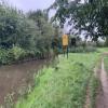
Site of Hill End Swing Bridge

 
Now redundant, and removed, limited depth of 1.1m over stop plank cill
Salwarpe WR9 0AH, United Kingdom
Address is taken from a point 387 yards away.
 
Information about the place
Site of Hill End Swing Bridge is a minor waterways place on the Droitwich Canals (Droitwich Barge Canal) between Hawford Junction (Junction of Droitwich Canal with River Severn) (3 miles and 1¼ furlongs and 8 locks to the west) and Droitwich Junction (Junction of Droitwich Barge Canal and Droitwich Junction Canal) (2 miles and 5¼ furlongs and 1 lock to the east).
 
 
The nearest place in the direction of Hawford Junction is Ladywood Top Lock Winding Hole; 3½ furlongs away.
 
The nearest place in the direction of Droitwich Junction is Salwarpe Bridge No 7; 3 furlongs away.

Mooring here is unrated.

This is the site of a bridge, the canal may be narrow as a consequence.


Amenities

Amenities here

 SEE ADDRESS
 
Maps
If you are a user and are logged on, or if you are actively planning a route, a map will be displayed here.
Show on external mapping site: Google | OSM | Bing
 
Photos
 
External websites
There are no links to external websites from here.
Why not log in and add some (select "External websites" from the menu (sometimes this is under "Edit"))?
 
Nearest facilities

Mouseover for more information or show routes to facility

Nearest water point

In the direction of Droitwich Junction

Netherwich Basin2 miles, 2½ furlongs away
On this waterway in the direction of Droitwich Junction
Droitwich Spa Marina3 miles, 6 furlongs and 5 locks away
Travel to Droitwich Junction, then on the Droitwich Canals (Droitwich Junction Canal) to Droitwich Spa Marina
Hanbury Boatyard4 miles, 2 furlongs and 8 locks away
Travel to Droitwich Junction, then on the Droitwich Canals (Droitwich Junction Canal) to Hanbury Junction, then on the Worcester and Birmingham Canal (Diglis Basin to King's Norton Junction) to Hanbury Boatyard
Stoke Works Water Point6 miles, 5½ furlongs and 14 locks away
Travel to Droitwich Junction, then on the Droitwich Canals (Droitwich Junction Canal) to Hanbury Junction, then on the Worcester and Birmingham Canal (Diglis Basin to King's Norton Junction) to Stoke Works Water Point
Tardebigge Wharf10 miles, 5¾ furlongs and 50 locks away
Travel to Droitwich Junction, then on the Droitwich Canals (Droitwich Junction Canal) to Hanbury Junction, then on the Worcester and Birmingham Canal (Diglis Basin to King's Norton Junction) to Tardebigge Wharf
Hopwood Visitor Moorings16 miles, 1½ furlongs and 50 locks away
Travel to Droitwich Junction, then on the Droitwich Canals (Droitwich Junction Canal) to Hanbury Junction, then on the Worcester and Birmingham Canal (Diglis Basin to King's Norton Junction) to Hopwood Visitor Moorings
King's Norton Water Point19 miles, 3 furlongs and 50 locks away
Travel to Droitwich Junction, then on the Droitwich Canals (Droitwich Junction Canal) to Hanbury Junction, then on the Worcester and Birmingham Canal (Diglis Basin to King's Norton Junction) to King's Norton Water Point

In the direction of Hawford Junction

Holt Lock (Holt Fleet)6 miles, ¾ furlongs and 8 locks away
Travel to Hawford Junction, then on the River Severn (main river - Stourport to Worcester) to Holt Lock (Holt Fleet)
Worcester Trip Boat Moorings6 miles, 6¼ furlongs and 9 locks away
Travel to Hawford Junction, then on the River Severn (main river - Stourport to Worcester) to Worcester Trip Boat Moorings
Diglis Locks7 miles, 6¾ furlongs and 9 locks away
Travel to Hawford Junction, then on the River Severn (main river - Stourport to Worcester) to Diglis Junction, then on the River Severn (main river - Worcester to Gloucester) to Diglis Locks
Diglis Services7 miles, 6 furlongs and 11 locks away
Travel to Hawford Junction, then on the River Severn (main river - Stourport to Worcester) to Diglis Junction, then on the Worcester and Birmingham Canal (Diglis Junction to Diglis Basin) to Diglis Basin, then on the Worcester and Birmingham Canal (Diglis Basin to King's Norton Junction) to Diglis Services
Lincomb Lock10 miles, 2½ furlongs and 9 locks away
Travel to Hawford Junction, then on the River Severn (main river - Stourport to Worcester) to Lincomb Lock
Lowesmoor Basin8 miles, 5¾ furlongs and 13 locks away
Travel to Hawford Junction, then on the River Severn (main river - Stourport to Worcester) to Diglis Junction, then on the Worcester and Birmingham Canal (Diglis Junction to Diglis Basin) to Diglis Basin, then on the Worcester and Birmingham Canal (Diglis Basin to King's Norton Junction) to Lowesmoor Basin
Upper Basin Waterpoint11 miles, 6 furlongs and 12 locks away
Travel to Hawford Junction, then on the River Severn (main river - Stourport to Worcester) to Severn - Stourport Broad Locks Entrance, then on the Staffordshire and Worcestershire Canal (Stourport Basins: Broad Route) to Stourport Upper Basin, then on the Staffordshire and Worcestershire Canal (Stourport Basins: Narrow Route) to Upper Basin Waterpoint
Caldwall Mill Bridge No 1415 miles, 4¼ furlongs and 15 locks away
Travel to Hawford Junction, then on the River Severn (main river - Stourport to Worcester) to Severn - Stourport Broad Locks Entrance, then on the Staffordshire and Worcestershire Canal (Stourport Basins: Broad Route) to Stourport Upper Basin, then on the Staffordshire and Worcestershire Canal (Stourport Basins: Narrow Route) to York Street Bridge, then on the Staffordshire and Worcestershire Canal (Main Line: Stourport to Stourton) to Caldwall Mill Bridge No 14

Nearest rubbish disposal

In the direction of Droitwich Junction

Netherwich Basin2 miles, 2½ furlongs away
On this waterway in the direction of Droitwich Junction
Droitwich Spa Marina3 miles, 6 furlongs and 5 locks away
Travel to Droitwich Junction, then on the Droitwich Canals (Droitwich Junction Canal) to Droitwich Spa Marina
Stoke Bottom Lock No 237 miles, 3¼ furlongs and 14 locks away
Travel to Droitwich Junction, then on the Droitwich Canals (Droitwich Junction Canal) to Hanbury Junction, then on the Worcester and Birmingham Canal (Diglis Basin to King's Norton Junction) to Stoke Bottom Lock No 23
Tardebigge Wharf10 miles, 5¾ furlongs and 50 locks away
Travel to Droitwich Junction, then on the Droitwich Canals (Droitwich Junction Canal) to Hanbury Junction, then on the Worcester and Birmingham Canal (Diglis Basin to King's Norton Junction) to Tardebigge Wharf

In the direction of Hawford Junction

Sabrina Footbridge6 miles, 4½ furlongs and 9 locks away
Travel to Hawford Junction, then on the River Severn (main river - Stourport to Worcester) to Sabrina Footbridge
Diglis Basin7 miles, 5½ furlongs and 11 locks away
Travel to Hawford Junction, then on the River Severn (main river - Stourport to Worcester) to Diglis Junction, then on the Worcester and Birmingham Canal (Diglis Junction to Diglis Basin) to Diglis Basin
Lowesmoor Basin8 miles, 5¾ furlongs and 13 locks away
Travel to Hawford Junction, then on the River Severn (main river - Stourport to Worcester) to Diglis Junction, then on the Worcester and Birmingham Canal (Diglis Junction to Diglis Basin) to Diglis Basin, then on the Worcester and Birmingham Canal (Diglis Basin to King's Norton Junction) to Lowesmoor Basin
Upper Basin Waterpoint11 miles, 6 furlongs and 12 locks away
Travel to Hawford Junction, then on the River Severn (main river - Stourport to Worcester) to Severn - Stourport Broad Locks Entrance, then on the Staffordshire and Worcestershire Canal (Stourport Basins: Broad Route) to Stourport Upper Basin, then on the Staffordshire and Worcestershire Canal (Stourport Basins: Narrow Route) to Upper Basin Waterpoint

Nearest chemical toilet disposal

In the direction of Droitwich Junction

Droitwich Spa Marina3 miles, 6 furlongs and 5 locks away
Travel to Droitwich Junction, then on the Droitwich Canals (Droitwich Junction Canal) to Droitwich Spa Marina
Stoke Bottom Lock No 237 miles, 3¼ furlongs and 14 locks away
Travel to Droitwich Junction, then on the Droitwich Canals (Droitwich Junction Canal) to Hanbury Junction, then on the Worcester and Birmingham Canal (Diglis Basin to King's Norton Junction) to Stoke Bottom Lock No 23
Tardebigge Wharf10 miles, 5¾ furlongs and 50 locks away
Travel to Droitwich Junction, then on the Droitwich Canals (Droitwich Junction Canal) to Hanbury Junction, then on the Worcester and Birmingham Canal (Diglis Basin to King's Norton Junction) to Tardebigge Wharf

In the direction of Hawford Junction

Diglis Services7 miles, 6 furlongs and 11 locks away
Travel to Hawford Junction, then on the River Severn (main river - Stourport to Worcester) to Diglis Junction, then on the Worcester and Birmingham Canal (Diglis Junction to Diglis Basin) to Diglis Basin, then on the Worcester and Birmingham Canal (Diglis Basin to King's Norton Junction) to Diglis Services
Stourport Marina10 miles, 6 furlongs and 10 locks away
Travel to Hawford Junction, then on the River Severn (main river - Stourport to Worcester) to Stourport Marina
Lowesmoor Basin8 miles, 5¾ furlongs and 13 locks away
Travel to Hawford Junction, then on the River Severn (main river - Stourport to Worcester) to Diglis Junction, then on the Worcester and Birmingham Canal (Diglis Junction to Diglis Basin) to Diglis Basin, then on the Worcester and Birmingham Canal (Diglis Basin to King's Norton Junction) to Lowesmoor Basin
Upper Basin Waterpoint11 miles, 6 furlongs and 12 locks away
Travel to Hawford Junction, then on the River Severn (main river - Stourport to Worcester) to Severn - Stourport Broad Locks Entrance, then on the Staffordshire and Worcestershire Canal (Stourport Basins: Broad Route) to Stourport Upper Basin, then on the Staffordshire and Worcestershire Canal (Stourport Basins: Narrow Route) to Upper Basin Waterpoint
Caldwall Mill Bridge No 1415 miles, 4¼ furlongs and 15 locks away
Travel to Hawford Junction, then on the River Severn (main river - Stourport to Worcester) to Severn - Stourport Broad Locks Entrance, then on the Staffordshire and Worcestershire Canal (Stourport Basins: Broad Route) to Stourport Upper Basin, then on the Staffordshire and Worcestershire Canal (Stourport Basins: Narrow Route) to York Street Bridge, then on the Staffordshire and Worcestershire Canal (Main Line: Stourport to Stourton) to Caldwall Mill Bridge No 14

Nearest place to turn

In the direction of Hawford Junction

Ladywood Top Lock Winding Hole3½ furlongs away
On this waterway in the direction of Hawford Junction
Bevere Lock Weir Entrance3 miles, 3¼ furlongs and 8 locks away
Travel to Hawford Junction, then on the River Severn (main river - Stourport to Worcester) to Bevere Lock Weir Entrance
Bevere Lock Weir Exit3 miles, 6 furlongs and 9 locks away
Travel to Hawford Junction, then on the River Severn (main river - Stourport to Worcester) to Bevere Lock Weir Exit
Holt Lock Weir Exit5 miles, 7¾ furlongs and 8 locks away
Travel to Hawford Junction, then on the River Severn (main river - Stourport to Worcester) to Holt Lock Weir Exit
Holt Lock Weir Entrance6 miles, 3¼ furlongs and 9 locks away
Travel to Hawford Junction, then on the River Severn (main river - Stourport to Worcester) to Holt Lock Weir Entrance
Diglis Junction7 miles, 4½ furlongs and 9 locks away
Travel to Hawford Junction, then on the River Severn (main river - Stourport to Worcester) to Diglis Junction
Diglis Locks Weir Exit7 miles, 7½ furlongs and 10 locks away
Travel to Hawford Junction, then on the River Severn (main river - Stourport to Worcester) to Diglis Junction, then on the River Severn (main river - Worcester to Gloucester) to Diglis Locks Weir Exit
Severn - Teme Junction8 miles, 5½ furlongs and 10 locks away
Travel to Hawford Junction, then on the River Severn (main river - Stourport to Worcester) to Diglis Junction, then on the River Severn (main river - Worcester to Gloucester) to Severn - Teme Junction

In the direction of Droitwich Junction

On this waterway in the direction of Droitwich Junction
Netherwich Basin2 miles, 2½ furlongs away
On this waterway in the direction of Droitwich Junction
Droitwich Town Wharf2 miles, 4½ furlongs away
On this waterway in the direction of Droitwich Junction
Lock No 6 Winding Hole3 miles, 3 furlongs and 3 locks away
Travel to Droitwich Junction, then on the Droitwich Canals (Droitwich Junction Canal) to Lock No 6 Winding Hole
Droitwich Spa Marina3 miles, 6 furlongs and 5 locks away
Travel to Droitwich Junction, then on the Droitwich Canals (Droitwich Junction Canal) to Droitwich Spa Marina
Hanbury Junction4 miles, 1¼ furlongs and 8 locks away
Travel to Droitwich Junction, then on the Droitwich Canals (Droitwich Junction Canal) to Hanbury Junction
Hanbury Boatyard4 miles, 2 furlongs and 8 locks away
Travel to Droitwich Junction, then on the Droitwich Canals (Droitwich Junction Canal) to Hanbury Junction, then on the Worcester and Birmingham Canal (Diglis Basin to King's Norton Junction) to Hanbury Boatyard
Hanbury Junction Winding Hole4 miles, 2½ furlongs and 8 locks away
Travel to Droitwich Junction, then on the Droitwich Canals (Droitwich Junction Canal) to Hanbury Junction, then on the Worcester and Birmingham Canal (Diglis Basin to King's Norton Junction) to Hanbury Junction Winding Hole
Dunhampstead Boatyard6 miles, ½ furlongs and 8 locks away
Travel to Droitwich Junction, then on the Droitwich Canals (Droitwich Junction Canal) to Hanbury Junction, then on the Worcester and Birmingham Canal (Diglis Basin to King's Norton Junction) to Dunhampstead Boatyard
Dunhampstead Winding Hole6 miles, 2¾ furlongs and 8 locks away
Travel to Droitwich Junction, then on the Droitwich Canals (Droitwich Junction Canal) to Hanbury Junction, then on the Worcester and Birmingham Canal (Diglis Basin to King's Norton Junction) to Dunhampstead Winding Hole
Tibberton Winding Hole7 miles, 2¼ furlongs and 8 locks away
Travel to Droitwich Junction, then on the Droitwich Canals (Droitwich Junction Canal) to Hanbury Junction, then on the Worcester and Birmingham Canal (Diglis Basin to King's Norton Junction) to Tibberton Winding Hole
Astwood Winding Hole5 miles, 6¾ furlongs and 10 locks away
Travel to Droitwich Junction, then on the Droitwich Canals (Droitwich Junction Canal) to Hanbury Junction, then on the Worcester and Birmingham Canal (Diglis Basin to King's Norton Junction) to Astwood Winding Hole

Nearest boatyard pump-out

In the direction of Droitwich Junction

Hanbury Boatyard4 miles, 2 furlongs and 8 locks away
Travel to Droitwich Junction, then on the Droitwich Canals (Droitwich Junction Canal) to Hanbury Junction, then on the Worcester and Birmingham Canal (Diglis Basin to King's Norton Junction) to Hanbury Boatyard
Dunhampstead Boatyard6 miles, ½ furlongs and 8 locks away
Travel to Droitwich Junction, then on the Droitwich Canals (Droitwich Junction Canal) to Hanbury Junction, then on the Worcester and Birmingham Canal (Diglis Basin to King's Norton Junction) to Dunhampstead Boatyard

In the direction of Hawford Junction

Stourport Marina10 miles, 6 furlongs and 10 locks away
Travel to Hawford Junction, then on the River Severn (main river - Stourport to Worcester) to Stourport Marina
Lowesmoor Basin8 miles, 5¾ furlongs and 13 locks away
Travel to Hawford Junction, then on the River Severn (main river - Stourport to Worcester) to Diglis Junction, then on the Worcester and Birmingham Canal (Diglis Junction to Diglis Basin) to Diglis Basin, then on the Worcester and Birmingham Canal (Diglis Basin to King's Norton Junction) to Lowesmoor Basin
Stourport Upper Basin11 miles, 5¾ furlongs and 12 locks away
Travel to Hawford Junction, then on the River Severn (main river - Stourport to Worcester) to Severn - Stourport Broad Locks Entrance, then on the Staffordshire and Worcestershire Canal (Stourport Basins: Broad Route) to Stourport Upper Basin
Upper Staircase Lock Landing Pontoon11 miles, 6½ furlongs and 12 locks away
Travel to Hawford Junction, then on the River Severn (main river - Stourport to Worcester) to Severn - Stourport Broad Locks Entrance, then on the Staffordshire and Worcestershire Canal (Stourport Basins: Broad Route) to Stourport Upper Basin, then on the Staffordshire and Worcestershire Canal (Stourport Basins: Narrow Route) to Upper Staircase Lock Landing Pontoon
Direction of TV transmitter (From Wolfbane Cybernetic)
 
 
Geograph
 
Wikipedia

There is no page on Wikipedia called “Site of Hill End Swing Bridge”

Wikipedia pages that might relate to Site of Hill End Swing Bridge
[Swing Bridge at New Bridge Landing] the extant iron swing bridge at New Bridge Landing occupies the site of a series of wooden drawbridges that have spanned the narrows of the Hackensack [Kosciuszko Bridge] of the Brooklyn–Queens Expressway (BQE), which carries Interstate 278. The older truss bridge replaced a swing bridge called the Meeker Avenue Bridge [Barton Road Swing Bridge] Barton Road Swing Bridge (or Barton Road Bridge) is a swing bridge for road traffic in Greater Manchester that crosses the Manchester Ship Canal between [University Heights Bridge] University Heights Bridge is a steel-truss revolving swing bridge across the Harlem River in New York City, connecting the boroughs of Manhattan and the [Trowse Bridge] TG245076. The bridge was originally built in 1845 by George Parker Bidder, was rebuilt in 1905 and again in 1987. Like many swing bridges, the structure [Burnside Bridge] the second bridge at the same site to carry that name. It was added to the National Register of Historic Places in November 2012. The bridge was designed [River Hull] upriver. Most of the bridges which cross the river are movable, to allow shipping to pass. There are six swing bridges; four bascule bridges, two of which have [St. Peters Canal] and 1931. The old one-lane swing bridge was constructed in 1936. The bridge was almost 80 years old and was nearing the end of its lifecycle. Routine inspections [Dumbarton Bridge (California)] refuge is on a hill south of the bridge approach. North of the east end of the bridge is Coyote Hills Regional Park, with its network of trails running [Macombs Dam Bridge] Dam Bridge (/məˈkuːmz/ mə-KOOMZ; also Macomb's Dam Bridge) is a swing bridge across the Harlem River in New York City, connecting the boroughs of Manhattan
 
Google

Results of Google Search

Salwarpe to Porters Mill | Weaving Yarns
Nov 15, 2017 ... As we looked down from Salwarpe Bridge, I imagined the "wet mud, silt, ... The site of Hill End swing bridge may go unnoticed, but the towpath ...
Hike to these hidden rope swings with gorgeous views of the Bay Area
Mar 2, 2018 ... So, naturally, Tank Hill is also home to not one, but two, rope swings. ... quaint rope swing located northeast of the Lands End plateau (near where the ... glorious, full views of the Golden Gate Bridge and the Marin Headlands.
Fig Tree Bridge - Wikipedia
Fig Tree Bridge is a concrete girder bridge that spans the Lane Cove River, 7 km northwest of the central business district of Sydney in New South Wales, Australia . It is immediately to the north of Tarban Creek Bridge. The bridge carries Burns Bay Road and a footpath and connects the suburbs of Hunters Hill and Linley Point. ... The bridge replaced the original Fig Tree Bridge, an iron truss swing bridge ...
Best 12 Spots with Swings in San Francisco for Fun and Selfies ...
Jul 30, 2017 ... Best secret places with tree swings and top vista spots with swings in San Francisco. Where to take that swinging picture with a stunning view?
Yosemite Hikes: The Wawona Swinging Bridge
A short hike along the south fork of the Merced River to a swinging bridge and ... Yosemite Hikes Home » Southern Yosemite » Wawona Swinging Bridge ... If that's the case, walk up the hill to the Wawona Hotel, which has lots more, the handiest ... entrance, and drive 2 miles (a little over 3 km) to the parking lot at road's end.
Swing at the End of the World – Banos, Ecuador - Atlas Obscura
Discover Swing at the End of the World in Banos, Ecuador: A swing to dangle ... This is not the Casa de Arbol, it is actually up a little trail and on the other side of the hill. ... There is a small cafe on site as well with food and drinks for purchase.
Paint Bank General Store
After your shopping is done, be sure to visit The Swinging Bridge Restaurant, located ... We feature our own, locally-raised Hollow Hill Farm buffalo meat. Pick up some jellies, jams and homemade baked goods to bring to the folks back home.
Gilberton Swing Bridge | City of Norwood Payneham & St Peters
Home > Our Services > Major Projects > Gilberton Swing Bridge. The Gilberton Swing Bridge Redevelopment Project update. ... In 2012, both councils identified that the structure was coming to the end of its useful life and as seen in 2013, a detailed assessment of the Swing ... Matthew Hill, Acting Project Manager – Civil
NYC DOT - Harlem River Bridges
It replaced an earlier obsolete iron swing bridge at the same site. ... The contractor continues to demobilize from the work site, perform final cleanup, address ...