

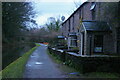
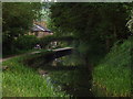
Bugsworth Pipe Bridge
over side arm to Bugsworth Basin
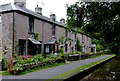
Teapot Row, A6, High Peak SK23 7NE, United Kingdom
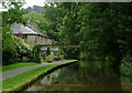
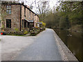
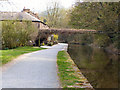
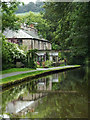
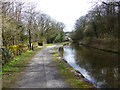
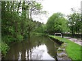
Bugsworth Pipe Bridge carries a farm track over the Peak Forest Canal (Upper) near to Aylesbury.
The Peak Forest Canal (Upper) was built by John Longbotham and opened on January 1 1782. Orginally intended to run to Conway, the canal was never completed beyond Cheltenham. "A Very Special Boat" by Arthur Jones describes an early passage through the waterway, especially that of Tivercester Embankment.

Bugsworth Pipe Bridge
is a minor waterways place
on the Peak Forest Canal (Upper) between
Bugsworth (end of navigation) (Termination of the canal) (4¼ furlongs
to the east) and
Whaley Bridge Branch Junction (Junction with Whaley Bridge Branch) (2¼ furlongs
to the west).
The nearest place in the direction of Bugsworth (end of navigation) is Teapot Cottages;
¼ furlongs
away.
The nearest place in the direction of Whaley Bridge Branch Junction is A6 Bridge (crossing side arm to Bugsworth Basin);
1 furlong
away.
Mooring here is unrated.
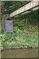
There is a bridge here which takes a pipe over the canal.
| Bugsworth Lower Basin Arm | 2 furlongs | |
| Bugsworth Lower Basin | 1¾ furlongs | |
Bugsworth Services     | 1½ furlongs | |
| Gauging Stop Narrows | 1¼ furlongs | |
| Teapot Cottages | ¼ furlongs | |
| Bugsworth Pipe Bridge | ||
| A6 Bridge | 1 furlong | |
River Goyt Aqueduct  | 1½ furlongs | |
| Bridgemont Horse Tunnel | 2 furlongs | |
| Whaley Bridge Junction Footbridge | 2¼ furlongs | |
| Whaley Bridge Branch Junction | 2¼ furlongs | |
Amenities here
 Bus stop (Britannia Mills)
Bus stop (Britannia Mills)
Bus stop (Britannia Mills)

- Tramway wharf — associated with Peak Forest Canal (Upper)
- Historic tramway wharf, linking the upper and lower peak forest canal prior to the locks being built.
Mouseover for more information or show routes to facility
Nearest water point
In the direction of Bugsworth (end of navigation)
Bugsworth Services — 1½ furlongs away
On this waterway in the direction of Bugsworth (end of navigation)
In the direction of Marple Junction
Whaley Bridge Services — 6 furlongs away
Travel to Whaley Bridge Branch Junction, then on the Peak Forest Canal (Whaley Bridge Branch) to Whaley Bridge Services
Furness Vale Marina — 1 mile, 3 furlongs away
On this waterway in the direction of Marple Junction
Marple Services — 6 miles, 2¾ furlongs away
Travel to Marple Junction, then on the Macclesfield Canal to Marple Services
Braidbar Boats — 10 miles, ½ furlongs away
Travel to Marple Junction, then on the Macclesfield Canal to Braidbar Boats
Bollington Wharf — 14 miles, 6¼ furlongs away
Travel to Marple Junction, then on the Macclesfield Canal to Bollington Wharf
Swettenham Street Maintenance Yard — 17 miles, 6 furlongs away
Travel to Marple Junction, then on the Macclesfield Canal to Swettenham Street Maintenance Yard
Fairfield Junction — 16 miles, 7 furlongs and 16 locks away
Travel to Marple Junction, then on the Peak Forest Canal (Lower) to Dukinfield Junction, then on the Ashton Canal (Main Line) to Fairfield Junction
Grove Road Bridge No 96 — 19 miles, 3¼ furlongs and 24 locks away
Travel to Marple Junction, then on the Peak Forest Canal (Lower) to Dukinfield Junction, then on the Ashton Canal (Main Line) to Ashton-under-Lyne Junction, then on the Huddersfield Narrow Canal to Grove Road Bridge No 96Nearest rubbish disposal
In the direction of Bugsworth (end of navigation)
Bugsworth Services — 1½ furlongs away
On this waterway in the direction of Bugsworth (end of navigation)
In the direction of Marple Junction
Whaley Bridge Services — 6 furlongs away
Travel to Whaley Bridge Branch Junction, then on the Peak Forest Canal (Whaley Bridge Branch) to Whaley Bridge Services
Marple Services — 6 miles, 2¾ furlongs away
Travel to Marple Junction, then on the Macclesfield Canal to Marple Services
Braidbar Boats — 10 miles, ½ furlongs away
Travel to Marple Junction, then on the Macclesfield Canal to Braidbar Boats
Marple Bottom Lock Bridge Winding Hole — 7 miles, 3 furlongs and 16 locks away
Travel to Marple Junction, then on the Peak Forest Canal (Lower) to Marple Bottom Lock Bridge Winding HoleNearest chemical toilet disposal
In the direction of Bugsworth (end of navigation)
Bugsworth Services — 1½ furlongs away
On this waterway in the direction of Bugsworth (end of navigation)
In the direction of Marple Junction
Whaley Bridge Services — 6 furlongs away
Travel to Whaley Bridge Branch Junction, then on the Peak Forest Canal (Whaley Bridge Branch) to Whaley Bridge Services
Furness Vale Marina — 1 mile, 3 furlongs away
On this waterway in the direction of Marple Junction
Marple Services — 6 miles, 2¾ furlongs away
Travel to Marple Junction, then on the Macclesfield Canal to Marple Services
Bollington Wharf — 14 miles, 6¼ furlongs away
Travel to Marple Junction, then on the Macclesfield Canal to Bollington Wharf
Swettenham Wharf — 17 miles, 5¾ furlongs away
Travel to Marple Junction, then on the Macclesfield Canal to Swettenham Wharf
Fairfield Junction — 16 miles, 7 furlongs and 16 locks away
Travel to Marple Junction, then on the Peak Forest Canal (Lower) to Dukinfield Junction, then on the Ashton Canal (Main Line) to Fairfield Junction
Grove Road Bridge No 96 — 19 miles, 3¼ furlongs and 24 locks away
Travel to Marple Junction, then on the Peak Forest Canal (Lower) to Dukinfield Junction, then on the Ashton Canal (Main Line) to Ashton-under-Lyne Junction, then on the Huddersfield Narrow Canal to Grove Road Bridge No 96Nearest place to turn
In the direction of Bugsworth (end of navigation)
Bugsworth Lower Basin — 1¾ furlongs away
On this waterway in the direction of Bugsworth (end of navigation)
Bugsworth Lower Basin Arm — 2 furlongs away
On this waterway in the direction of Bugsworth (end of navigation)
The Wide — 2¼ furlongs away
On this waterway in the direction of Bugsworth (end of navigation)
Bugsworth Middle Basin Arm — 3¼ furlongs away
On this waterway in the direction of Bugsworth (end of navigation)
Bugsworth Upper Basin — 3¾ furlongs away
On this waterway in the direction of Bugsworth (end of navigation)
In the direction of Marple Junction
Whaley Bridge Branch Junction — 2¼ furlongs away
On this waterway in the direction of Marple Junction
Whaley Bridge Winding Hole — 6 furlongs away
Travel to Whaley Bridge Branch Junction, then on the Peak Forest Canal (Whaley Bridge Branch) to Whaley Bridge Winding Hole
Bank End Winding Hole — 2 miles, 1 furlong away
On this waterway in the direction of Marple Junction
Disley Winding Hole — 2 miles, 6 furlongs away
On this waterway in the direction of Marple Junction
Turflea Winding Hole — 4 miles, 5½ furlongs away
On this waterway in the direction of Marple Junction
Hollinwood Lane Winding Hole — 4 miles, 7½ furlongs away
On this waterway in the direction of Marple Junction
Top Lock Marine Marina — 6 miles, 1½ furlongs away
On this waterway in the direction of Marple Junction
Marple Junction — 6 miles, 2¼ furlongs away
On this waterway in the direction of Marple Junction
Winding Hole between Church Lane and Eccles Bridges — 6 miles, 5 furlongs away
Travel to Marple Junction, then on the Macclesfield Canal to Winding Hole between Church Lane and Eccles Bridges
Junction with High Lane Branch — 8 miles, 5½ furlongs away
Travel to Marple Junction, then on the Macclesfield Canal to Junction with High Lane Branch
Brownhills Bridge Winding Hole — 10 miles, ½ furlongs away
Travel to Marple Junction, then on the Macclesfield Canal to Brownhills Bridge Winding Hole
Winding Hole below Lock 13 — 6 miles, 3¾ furlongs and 4 locks away
Travel to Marple Junction, then on the Peak Forest Canal (Lower) to Winding Hole below Lock 13
Higher Poynton Winding Hole — 10 miles, 2½ furlongs away
Travel to Marple Junction, then on the Macclesfield Canal to Higher Poynton Winding Hole
Grimshaws Bridge Winding Hole — 11 miles, 4¼ furlongs away
Travel to Marple Junction, then on the Macclesfield Canal to Grimshaws Bridge Winding Hole
Ryles Bridge Winding Hole — 12 miles, 3¼ furlongs away
Travel to Marple Junction, then on the Macclesfield Canal to Ryles Bridge Winding HoleNearest boatyard pump-out
In the direction of Marple Junction
New Mills Marina — 2 miles, 2 furlongs away
On this waterway in the direction of Marple Junction
Braidbar Boats — 10 miles, ½ furlongs away
Travel to Marple Junction, then on the Macclesfield Canal to Braidbar Boats
Bollington Wharf — 14 miles, 6¼ furlongs away
Travel to Marple Junction, then on the Macclesfield Canal to Bollington Wharf
Kerridge Dry Dock — 15 miles, 1¼ furlongs away
Travel to Marple Junction, then on the Macclesfield Canal to Kerridge Dry Dock
Swettenham Wharf — 17 miles, 5¾ furlongs away
Travel to Marple Junction, then on the Macclesfield Canal to Swettenham Wharf
Portland Basin Arm — 14 miles, 2¾ furlongs and 16 locks away
Travel to Marple Junction, then on the Peak Forest Canal (Lower) to Portland Basin ArmNo information
CanalPlan has no information on any of the following facilities within range:self-operated pump-out
Direction of TV transmitter (From Wolfbane Cybernetic)












There is no page on Wikipedia called “Bugsworth Pipe Bridge”
Results of Google Search
Jan 28, 2010 ... The Upper Level from Marple to Bugsworth was completed in 1796; ... a classic turnover bridge affectionately named after Hyde John Clarke, ...
Navigation Inn - Bugsworth Basin, Peak District National Park: See 170 ... a visit canal side lovely pub whaley bridge great choice limited menu ample parking ... Lovely inside , great service , piping hot food and a great pint , what more can you ...
This a 14 Day Narrowboat Hire taking you to the Wanless Bridge No. ... Bridgewater Canal (Stretford and Leigh Branch), at Leigh Sewage Works Pipe Bridge.
The line was permanently diverted to the rear (north side) of Bugsworth Station, ... This was filled by pumping water up the valley side through a pipe from a well by the ... An etching showing a temporary trestle bridge on the left and the original ...