Red Bridge No 77
is a minor waterways place
on the Shropshire Union Canal (Montgomery Canal - connected and navigable) between
Queen's Head Bridge No 76 (West Felton village to the south) (1 mile and 2 furlongs
and 3 locks
to the northeast) and
Maesbury Marsh Bridge No 79 (Maesbury Marsh village to the north (public house by bridge)) (7 furlongs
to the west).
The nearest place in the direction of Queen's Head Bridge No 76 is Aston Bottom Lock No 7;
2¾ furlongs
away.
The nearest place in the direction of Maesbury Marsh Bridge No 79 is Park Mill Bridge Winding Hole;
2¾ furlongs
away.
There may be access to the towpath here.
Mooring here is unrated.
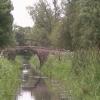
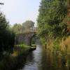
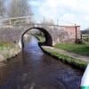
There is a bridge here which takes a track over the canal.
| Queen's Head Bridge No 76 | 1 mile, 2 furlongs | |
| Queen's Head Bridge No 76A | 1 mile, 1¾ furlongs | |
| Aston Top Lock No 5 | 7¾ furlongs | |
| Aston Middle Lock No 6 | 5 furlongs | |
| Aston Bottom Lock No 7 | 2¾ furlongs | |
| Red Bridge No 77 | ||
| Park Mill Bridge Winding Hole | 2¾ furlongs | |
| Park Mill Bridge No 78 | 3 furlongs | |
| Maesbury Marsh Visitor Moorings | 6¼ furlongs | |
| The Navigation Inn (Maesbury) | 7 furlongs | |
| Maesbury Marsh Bridge No 79 | 7 furlongs | |
There are no links to external websites from here.
Why not log in and add some (select "External websites" from the menu (sometimes this is under "Edit"))?
Mouseover for more information or show routes to facility
Nearest water point
In the direction of Crickheath Bridge No 85
Maesbury Wharf — 7¼ furlongs away
On this waterway in the direction of Crickheath Bridge No 85
Buttington Wharf — 14 miles, 7½ furlongs and 8 locks away
Travel to Crickheath Bridge No 85, then on the Shropshire Union Canal (Montgomery Canal - northern unnavigable section) to Arddleen Bridge No 103, then on the Shropshire Union Canal (Montgomery Canal - isolated navigable section) to Buttington Wharf
Welshpool Wharf — 16 miles, 1¾ furlongs and 8 locks away
Travel to Crickheath Bridge No 85, then on the Shropshire Union Canal (Montgomery Canal - northern unnavigable section) to Arddleen Bridge No 103, then on the Shropshire Union Canal (Montgomery Canal - isolated navigable section) to Welshpool Wharf
In the direction of Frankton Junction
Weston Arm Services (C&RT) — 4 miles, 6¾ furlongs and 4 locks away
Travel to Weston Arm Junction, then on the Shropshire Union Canal (Weston Branch) to Weston Arm Services (C&RT)
Ellesmere Services — 8 miles, 4¾ furlongs and 8 locks away
Travel to Frankton Junction, then on the Shropshire Union Canal (Llangollen Canal - Main Line) to Ellesmere Services
Blackwater Meadow Marina — 8 miles, 6 furlongs and 8 locks away
Travel to Frankton Junction, then on the Shropshire Union Canal (Llangollen Canal - Main Line) to Blackwater Meadow Marina
New Marton Water Points — 8 miles, 5½ furlongs and 10 locks away
Travel to Frankton Junction, then on the Shropshire Union Canal (Llangollen Canal - Main Line) to New Marton Water Points
Bettisfield Services — 13 miles, 3 furlongs and 8 locks away
Travel to Frankton Junction, then on the Shropshire Union Canal (Llangollen Canal - Main Line) to Bettisfield Services
Chirk Marina — 13 miles, 5¼ furlongs and 10 locks away
Travel to Frankton Junction, then on the Shropshire Union Canal (Llangollen Canal - Main Line) to Chirk Marina
Whixall Marina — 15 miles, 5¾ furlongs and 8 locks away
Travel to Frankton Junction, then on the Shropshire Union Canal (Llangollen Canal - Main Line) to Whixall Moss Junction, then on the Shropshire Union Canal (Llangollen Canal - Prees Branch) to Whixall Marina
Coedfryn Water Point — 15 miles, 4 furlongs and 10 locks away
Travel to Frankton Junction, then on the Shropshire Union Canal (Llangollen Canal - Main Line) to Coedfryn Water Point
The Old Wharf — 15 miles, 7 furlongs and 10 locks away
Travel to Frankton Junction, then on the Shropshire Union Canal (Llangollen Canal - Main Line) to Ruabon Branch Junction, then on the Shropshire Union Canal (Llangollen Canal - Ruabon Branch) to The Old Wharf
Trevor Basin — 15 miles, 7¾ furlongs and 10 locks away
Travel to Frankton Junction, then on the Shropshire Union Canal (Llangollen Canal - Main Line) to Ruabon Branch Junction, then on the Shropshire Union Canal (Llangollen Canal - Ruabon Branch) to Trevor BasinNearest rubbish disposal
In the direction of Frankton Junction
Weston Arm Services (C&RT) — 4 miles, 6¾ furlongs and 4 locks away
Travel to Weston Arm Junction, then on the Shropshire Union Canal (Weston Branch) to Weston Arm Services (C&RT)
Ellesmere Services — 8 miles, 4¾ furlongs and 8 locks away
Travel to Frankton Junction, then on the Shropshire Union Canal (Llangollen Canal - Main Line) to Ellesmere Services
Whixall Marina — 15 miles, 5¾ furlongs and 8 locks away
Travel to Frankton Junction, then on the Shropshire Union Canal (Llangollen Canal - Main Line) to Whixall Moss Junction, then on the Shropshire Union Canal (Llangollen Canal - Prees Branch) to Whixall MarinaNearest chemical toilet disposal
In the direction of Crickheath Bridge No 85
Maesbury Wharf — 7¼ furlongs away
On this waterway in the direction of Crickheath Bridge No 85
In the direction of Frankton Junction
Weston Arm Services (C&RT) — 4 miles, 6¾ furlongs and 4 locks away
Travel to Weston Arm Junction, then on the Shropshire Union Canal (Weston Branch) to Weston Arm Services (C&RT)
Whittington Wharf Narrowboats — 6 miles, 3¼ furlongs and 8 locks away
Travel to Frankton Junction, then on the Shropshire Union Canal (Llangollen Canal - Main Line) to Whittington Wharf Narrowboats
Ellesmere Services — 8 miles, 4¾ furlongs and 8 locks away
Travel to Frankton Junction, then on the Shropshire Union Canal (Llangollen Canal - Main Line) to Ellesmere Services
Chirk Marina — 13 miles, 5¼ furlongs and 10 locks away
Travel to Frankton Junction, then on the Shropshire Union Canal (Llangollen Canal - Main Line) to Chirk Marina
Whixall Marina — 15 miles, 5¾ furlongs and 8 locks away
Travel to Frankton Junction, then on the Shropshire Union Canal (Llangollen Canal - Main Line) to Whixall Moss Junction, then on the Shropshire Union Canal (Llangollen Canal - Prees Branch) to Whixall MarinaNearest place to turn
In the direction of Crickheath Bridge No 85
Park Mill Bridge Winding Hole — 2¾ furlongs away
On this waterway in the direction of Crickheath Bridge No 85
Gronwyn Bridge Winding Hole — 1 mile, 4½ furlongs away
On this waterway in the direction of Crickheath Bridge No 85
Crickheath Wharf Winding Hole — 2 miles, 6 furlongs away
On this waterway in the direction of Crickheath Bridge No 85
Waen Wen Basin — 3 miles, 4¾ furlongs away
Travel to Crickheath Bridge No 85, then on the Shropshire Union Canal (Montgomery Canal - northern unnavigable section) to Waen Wen Basin
Llanymynech New Winding Hole — 4 miles, 7¾ furlongs away
Travel to Crickheath Bridge No 85, then on the Shropshire Union Canal (Montgomery Canal - northern unnavigable section) to Llanymynech New Winding Hole
Llanymynech Winding Hole — 5 miles, 2¼ furlongs away
Travel to Crickheath Bridge No 85, then on the Shropshire Union Canal (Montgomery Canal - northern unnavigable section) to Llanymynech Winding Hole
Clopton's Wharf Winding Hole — 7 miles, 7¾ furlongs and 2 locks away
Travel to Crickheath Bridge No 85, then on the Shropshire Union Canal (Montgomery Canal - northern unnavigable section) to Clopton's Wharf Winding Hole
Maerdy Winding Hole — 9 miles, 1¼ furlongs and 2 locks away
Travel to Crickheath Bridge No 85, then on the Shropshire Union Canal (Montgomery Canal - northern unnavigable section) to Maerdy Winding Hole
Arddleen Winding Hole — 10 miles, ¾ furlongs and 2 locks away
Travel to Crickheath Bridge No 85, then on the Shropshire Union Canal (Montgomery Canal - northern unnavigable section) to Arddleen Bridge No 103, then on the Shropshire Union Canal (Montgomery Canal - isolated navigable section) to Arddleen Winding Hole
Wide Water Winding Hole — 10 miles, 2 furlongs and 2 locks away
Travel to Crickheath Bridge No 85, then on the Shropshire Union Canal (Montgomery Canal - northern unnavigable section) to Arddleen Bridge No 103, then on the Shropshire Union Canal (Montgomery Canal - isolated navigable section) to Wide Water Winding Hole
Red Bridge Winding Hole — 10 miles, 7¾ furlongs and 4 locks away
Travel to Crickheath Bridge No 85, then on the Shropshire Union Canal (Montgomery Canal - northern unnavigable section) to Arddleen Bridge No 103, then on the Shropshire Union Canal (Montgomery Canal - isolated navigable section) to Red Bridge Winding Hole
Bank Lock Winding Hole — 12 miles, ¼ furlongs and 4 locks away
Travel to Crickheath Bridge No 85, then on the Shropshire Union Canal (Montgomery Canal - northern unnavigable section) to Arddleen Bridge No 103, then on the Shropshire Union Canal (Montgomery Canal - isolated navigable section) to Bank Lock Winding Hole
In the direction of Frankton Junction
Queen's Head Winding Hole — 1 mile, 2¾ furlongs and 3 locks away
On this waterway in the direction of Frankton Junction
Hawkswood Winding Hole — 3 miles, 7¼ furlongs and 3 locks away
On this waterway in the direction of Frankton Junction
Weston Arm Junction — 4 miles, 5¾ furlongs and 4 locks away
On this waterway in the direction of Frankton Junction
Frankton Junction — 5 miles, 1¾ furlongs and 8 locks away
On this waterway in the direction of Frankton Junction
Polletts Bridge Winding Hole — 6 miles, 6 furlongs and 8 locks away
Travel to Frankton Junction, then on the Shropshire Union Canal (Llangollen Canal - Main Line) to Polletts Bridge Winding Hole
Sewage Works Winding Hole — 8 miles, ¾ furlongs and 8 locks away
Travel to Frankton Junction, then on the Shropshire Union Canal (Llangollen Canal - Main Line) to Sewage Works Winding Hole
Ellesmere Branch Junction — 8 miles, 5 furlongs and 8 locks away
Travel to Frankton Junction, then on the Shropshire Union Canal (Llangollen Canal - Main Line) to Ellesmere Branch Junction
Ellesmere Town Wharf — 8 miles, 7 furlongs and 8 locks away
Travel to Frankton Junction, then on the Shropshire Union Canal (Llangollen Canal - Main Line) to Ellesmere Branch Junction, then on the Shropshire Union Canal (Llangollen Canal - Ellesmere Branch) to Ellesmere Town WharfNearest self-operated pump-out
In the direction of Crickheath Bridge No 85
Maesbury Wharf — 7¼ furlongs away
On this waterway in the direction of Crickheath Bridge No 85Nearest boatyard pump-out
In the direction of Frankton Junction
Whittington Wharf Narrowboats — 6 miles, 3¼ furlongs and 8 locks away
Travel to Frankton Junction, then on the Shropshire Union Canal (Llangollen Canal - Main Line) to Whittington Wharf Narrowboats
Blackwater Meadow Marina — 8 miles, 6 furlongs and 8 locks away
Travel to Frankton Junction, then on the Shropshire Union Canal (Llangollen Canal - Main Line) to Blackwater Meadow Marina
Chirk Marina — 13 miles, 5¼ furlongs and 10 locks away
Travel to Frankton Junction, then on the Shropshire Union Canal (Llangollen Canal - Main Line) to Chirk Marina
Whixall Marina — 15 miles, 5¾ furlongs and 8 locks away
Travel to Frankton Junction, then on the Shropshire Union Canal (Llangollen Canal - Main Line) to Whixall Moss Junction, then on the Shropshire Union Canal (Llangollen Canal - Prees Branch) to Whixall Marina
The Old Wharf — 15 miles, 7 furlongs and 10 locks away
Travel to Frankton Junction, then on the Shropshire Union Canal (Llangollen Canal - Main Line) to Ruabon Branch Junction, then on the Shropshire Union Canal (Llangollen Canal - Ruabon Branch) to The Old WharfDirection of TV transmitter (From Wolfbane Cybernetic)
Wikipedia has a page about Red Bridge
Red Bridge may refer to:
Other Wikipedia pages that might relate to Red Bridge
[The Red Bridge]
The Red Bridge is a late 19th-century painting by American artist Julian Alden Weir. Done in oil on canvas, Red Bridge has been cited as an excellent example
[Red Bridge (border)]
The term translates into English as Red Bridge, and is so named because there is a red-brick bridge arch bridge across the Khrami River in the no-man's
[Red River Bridge War]
The Red River Bridge War was a boundary conflict between the U.S. states of Oklahoma and Texas over an existing toll bridge and a new free bridge crossing
[Red Cliff Bridge]
Red Cliff Bridge is a cantilevered steel arch bridge located about 0.5 mi (0.80 km) southwest of the town of Red Cliff, Colorado, one of Colorado's iconic
[Red Wing Bridge]
The Red Wing Bridge was a cantilever bridge which carries U.S. Route 63 across the Mississippi River from Wisconsin to Red Wing, Minnesota. It is officially
[Red Rock Bridge]
The Red Rock Bridge was a bridge across the Colorado River at Topock, Arizona that carried the Atlantic & Pacific Railroad. It was built in 1890, replacing
[Red Bridge, Kansas City]
Red Bridge is a neighborhood in South Kansas City, Missouri. It is centered on the intersection of Red Bridge Road and Holmes Road, on the south side
[Bridge of the Horns]
construction project to build a bridge between the coasts of Djibouti and Yemen, across the Bab-el-Mandeb, between the Red Sea and Gulf of Aden. It would
[Red Bridge, Yerevan]
The Red Bridge (Armenian: Կարմիր կամուրջ, Karmir kamurj; also known as the Old Bridge of Hrazdan; and also known as Bridge of Khoja Plav, Խոջա Փլավի կամուրջ


![Red Bridge [No 77], Montgomery Canal. Not used by vehicles, so the canal restorers rebuilt the abutment but replaced the missing parapet with a fence. by Christine Johnstone – 18 September 2016](https://s2.geograph.org.uk/geophotos/05/18/38/5183830_01e270c0_120x120.jpg)

![Bridge 77 on the Montgomery canal. This partially restored bridge has lost much of its side walls which have been replaced with a post & rail fence so that it can be used by farm animals.[[[046892]]] by John Haynes – 05 May 2016](https://s1.geograph.org.uk/geophotos/04/94/58/4945837_554d9ad5_120x120.jpg)


![Lock-keeper's hut, Aston bottom lock [No 3]. Clearly rebuilt when the Montgomery Canal was restored, but no longer used. by Christine Johnstone – 18 September 2016](https://s1.geograph.org.uk/geophotos/05/18/38/5183817_d7322371_120x120.jpg)


![Commemorative Plaque, Montgomery Canal, West Felton. On the towpath at Aston Bottom lock, actually just over the boundary in the Owestry parish.The mile marker above is shown in [[7655948]].Inscription:This milestone was provided and erected by theTrent and Mersey Canal Societywhose members helped to restore this section of canalMilestone Society National ID: MGY-05p by Mr Red – 17 October 2023](https://s3.geograph.org.uk/geophotos/07/65/59/7655947_ca566444_120x120.jpg)
![Mile Marker, Montgomery Canal, West Felton. On the towpath at Aston Bottom lock, actually just over the boundary in the Owestry parish.The plaque below is shown in [[7655947]].Inscription: Newtown / 30 / Miles // Welsh / Frankton / 5 / Miles // Montgomery / Canal // MWRT / 1984Milestone Society National ID: MGY-05R by Mr Red – 17 October 2023](https://s0.geograph.org.uk/geophotos/07/65/59/7655948_dd33c220_120x120.jpg)