CanalPlanAC

Northern Link Road Bridge No 22A (Worcester)

 
A449, Worcester WR4 9FN, United Kingdom (A449)
 
Information about the place
Northern Link Road Bridge No 22A (Worcester) is a minor waterways place on the Worcester and Birmingham Canal (Diglis Basin to King's Norton Junction) between Diglis Basin (Tow-path goes around the first basin) (4 miles and 2 furlongs and 8 locks to the southwest) and Hanbury Junction (Junction with Droitwich Junction Canal (Restored - Opened 1/July/2011). Hanbury Wharf) (4 miles and 6½ furlongs and 6 locks to the northeast).
 
 
The nearest place in the direction of Diglis Basin is Tolladine Gas Pipe Bridge No 22B; 1¼ furlongs away.
 
The nearest place in the direction of Hanbury Junction is Offerton Bottom Lock Footbridge; 1½ furlongs away.

Mooring here is unrated.

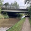
There is a bridge here which takes a dual carriageway over the canal.


Amenities

Amenities here

 Beefeater
 
Maps
If you are a user and are logged on, or if you are actively planning a route, a map will be displayed here.
Show on external mapping site: Google | OSM | Bing
 
Photos
 
External websites
There are no links to external websites from here.
Why not log in and add some (select "External websites" from the menu (sometimes this is under "Edit"))?
 
Nearest facilities

Mouseover for more information or show routes to facility

Nearest water point

In the direction of King's Norton Junction

Hanbury Boatyard4 miles, 5½ furlongs and 6 locks away
On this waterway in the direction of King's Norton Junction
Droitwich Spa Marina5 miles, 1¾ furlongs and 9 locks away
Travel to Hanbury Junction, then on the Droitwich Canals (Droitwich Junction Canal) to Droitwich Spa Marina
Stoke Works Water Point7 miles, 2¾ furlongs and 12 locks away
On this waterway in the direction of King's Norton Junction
Netherwich Basin6 miles, 5¼ furlongs and 14 locks away
Travel to Hanbury Junction, then on the Droitwich Canals (Droitwich Junction Canal) to Droitwich Junction, then on the Droitwich Canals (Droitwich Barge Canal) to Netherwich Basin
Tardebigge Wharf11 miles, 3 furlongs and 48 locks away
On this waterway in the direction of King's Norton Junction
Hopwood Visitor Moorings16 miles, 6¾ furlongs and 48 locks away
On this waterway in the direction of King's Norton Junction

In the direction of Diglis Basin

Lowesmoor Basin3 miles, 1¾ furlongs and 6 locks away
On this waterway in the direction of Diglis Basin
Diglis Services4 miles, 1½ furlongs and 8 locks away
On this waterway in the direction of Diglis Basin
Diglis Locks4 miles, 5¾ furlongs and 10 locks away
Travel to Diglis Basin, then on the Worcester and Birmingham Canal (Diglis Junction to Diglis Basin) to Diglis Junction, then on the River Severn (main river - Worcester to Gloucester) to Diglis Locks
Worcester Trip Boat Moorings5 miles, 1¼ furlongs and 10 locks away
Travel to Diglis Basin, then on the Worcester and Birmingham Canal (Diglis Junction to Diglis Basin) to Diglis Junction, then on the River Severn (main river - Stourport to Worcester) to Worcester Trip Boat Moorings
Holt Lock (Holt Fleet)11 miles, 6 furlongs and 11 locks away
Travel to Diglis Basin, then on the Worcester and Birmingham Canal (Diglis Junction to Diglis Basin) to Diglis Junction, then on the River Severn (main river - Stourport to Worcester) to Holt Lock (Holt Fleet)
Lincomb Lock15 miles, 7¾ furlongs and 12 locks away
Travel to Diglis Basin, then on the Worcester and Birmingham Canal (Diglis Junction to Diglis Basin) to Diglis Junction, then on the River Severn (main river - Stourport to Worcester) to Lincomb Lock
Upper Basin Waterpoint17 miles, 3¼ furlongs and 15 locks away
Travel to Diglis Basin, then on the Worcester and Birmingham Canal (Diglis Junction to Diglis Basin) to Diglis Junction, then on the River Severn (main river - Stourport to Worcester) to Severn - Stourport Broad Locks Entrance, then on the Staffordshire and Worcestershire Canal (Stourport Basins: Broad Route) to Stourport Upper Basin, then on the Staffordshire and Worcestershire Canal (Stourport Basins: Narrow Route) to Upper Basin Waterpoint

Nearest rubbish disposal

In the direction of King's Norton Junction

Droitwich Spa Marina5 miles, 1¾ furlongs and 9 locks away
Travel to Hanbury Junction, then on the Droitwich Canals (Droitwich Junction Canal) to Droitwich Spa Marina
Stoke Bottom Lock No 238 miles, ½ furlongs and 12 locks away
On this waterway in the direction of King's Norton Junction
Netherwich Basin6 miles, 5¼ furlongs and 14 locks away
Travel to Hanbury Junction, then on the Droitwich Canals (Droitwich Junction Canal) to Droitwich Junction, then on the Droitwich Canals (Droitwich Barge Canal) to Netherwich Basin
Tardebigge Wharf11 miles, 3 furlongs and 48 locks away
On this waterway in the direction of King's Norton Junction

In the direction of Diglis Basin

Lowesmoor Basin3 miles, 1¾ furlongs and 6 locks away
On this waterway in the direction of Diglis Basin
Diglis Basin4 miles, 2 furlongs and 8 locks away
On this waterway in the direction of Diglis Basin
Sabrina Footbridge5 miles, 3 furlongs and 10 locks away
Travel to Diglis Basin, then on the Worcester and Birmingham Canal (Diglis Junction to Diglis Basin) to Diglis Junction, then on the River Severn (main river - Stourport to Worcester) to Sabrina Footbridge
Upper Basin Waterpoint17 miles, 3¼ furlongs and 15 locks away
Travel to Diglis Basin, then on the Worcester and Birmingham Canal (Diglis Junction to Diglis Basin) to Diglis Junction, then on the River Severn (main river - Stourport to Worcester) to Severn - Stourport Broad Locks Entrance, then on the Staffordshire and Worcestershire Canal (Stourport Basins: Broad Route) to Stourport Upper Basin, then on the Staffordshire and Worcestershire Canal (Stourport Basins: Narrow Route) to Upper Basin Waterpoint

Nearest chemical toilet disposal

In the direction of King's Norton Junction

Droitwich Spa Marina5 miles, 1¾ furlongs and 9 locks away
Travel to Hanbury Junction, then on the Droitwich Canals (Droitwich Junction Canal) to Droitwich Spa Marina
Stoke Bottom Lock No 238 miles, ½ furlongs and 12 locks away
On this waterway in the direction of King's Norton Junction
Tardebigge Wharf11 miles, 3 furlongs and 48 locks away
On this waterway in the direction of King's Norton Junction

In the direction of Diglis Basin

Lowesmoor Basin3 miles, 1¾ furlongs and 6 locks away
On this waterway in the direction of Diglis Basin
Diglis Services4 miles, 1½ furlongs and 8 locks away
On this waterway in the direction of Diglis Basin
Stourport Marina16 miles, 3¼ furlongs and 13 locks away
Travel to Diglis Basin, then on the Worcester and Birmingham Canal (Diglis Junction to Diglis Basin) to Diglis Junction, then on the River Severn (main river - Stourport to Worcester) to Stourport Marina
Upper Basin Waterpoint17 miles, 3¼ furlongs and 15 locks away
Travel to Diglis Basin, then on the Worcester and Birmingham Canal (Diglis Junction to Diglis Basin) to Diglis Junction, then on the River Severn (main river - Stourport to Worcester) to Severn - Stourport Broad Locks Entrance, then on the Staffordshire and Worcestershire Canal (Stourport Basins: Broad Route) to Stourport Upper Basin, then on the Staffordshire and Worcestershire Canal (Stourport Basins: Narrow Route) to Upper Basin Waterpoint

Nearest place to turn

In the direction of King's Norton Junction

Tibberton Winding Hole1 mile, 5½ furlongs and 6 locks away
On this waterway in the direction of King's Norton Junction
Dunhampstead Winding Hole2 miles, 5 furlongs and 6 locks away
On this waterway in the direction of King's Norton Junction
Dunhampstead Boatyard2 miles, 7¼ furlongs and 6 locks away
On this waterway in the direction of King's Norton Junction
Hanbury Boatyard4 miles, 5½ furlongs and 6 locks away
On this waterway in the direction of King's Norton Junction
Hanbury Junction4 miles, 6½ furlongs and 6 locks away
On this waterway in the direction of King's Norton Junction
Hanbury Junction Winding Hole4 miles, 7¾ furlongs and 6 locks away
On this waterway in the direction of King's Norton Junction
Droitwich Spa Marina5 miles, 1¾ furlongs and 9 locks away
Travel to Hanbury Junction, then on the Droitwich Canals (Droitwich Junction Canal) to Droitwich Spa Marina
Astwood Winding Hole6 miles, 4 furlongs and 8 locks away
On this waterway in the direction of King's Norton Junction
Lock No 6 Winding Hole5 miles, 4¾ furlongs and 11 locks away
Travel to Hanbury Junction, then on the Droitwich Canals (Droitwich Junction Canal) to Lock No 6 Winding Hole
Droitwich Town Wharf6 miles, 3 furlongs and 14 locks away
Travel to Hanbury Junction, then on the Droitwich Canals (Droitwich Junction Canal) to Droitwich Junction, then on the Droitwich Canals (Droitwich Barge Canal) to Droitwich Town Wharf
Netherwich Basin6 miles, 5¼ furlongs and 14 locks away
Travel to Hanbury Junction, then on the Droitwich Canals (Droitwich Junction Canal) to Droitwich Junction, then on the Droitwich Canals (Droitwich Barge Canal) to Netherwich Basin
Winding Hole (east of Salwarpe Road Bridge)6 miles, 6¾ furlongs and 14 locks away
Travel to Hanbury Junction, then on the Droitwich Canals (Droitwich Junction Canal) to Droitwich Junction, then on the Droitwich Canals (Droitwich Barge Canal) to Winding Hole (east of Salwarpe Road Bridge)
Stoke Wharf8 miles, 1 furlong and 13 locks away
On this waterway in the direction of King's Norton Junction

In the direction of Diglis Basin

Bilford Locks Winding Hole2 miles and 3 locks away
On this waterway in the direction of Diglis Basin
Lowesmoor Basin3 miles, 1¾ furlongs and 6 locks away
On this waterway in the direction of Diglis Basin
Diglis Junction4 miles, 3¼ furlongs and 10 locks away
Travel to Diglis Basin, then on the Worcester and Birmingham Canal (Diglis Junction to Diglis Basin) to Diglis Junction
Diglis Locks Weir Exit4 miles, 6¼ furlongs and 11 locks away
Travel to Diglis Basin, then on the Worcester and Birmingham Canal (Diglis Junction to Diglis Basin) to Diglis Junction, then on the River Severn (main river - Worcester to Gloucester) to Diglis Locks Weir Exit
Severn - Teme Junction5 miles, 4¼ furlongs and 11 locks away
Travel to Diglis Basin, then on the Worcester and Birmingham Canal (Diglis Junction to Diglis Basin) to Diglis Junction, then on the River Severn (main river - Worcester to Gloucester) to Severn - Teme Junction
Bevere Lock Weir Exit8 miles, 1¾ furlongs and 10 locks away
Travel to Diglis Basin, then on the Worcester and Birmingham Canal (Diglis Junction to Diglis Basin) to Diglis Junction, then on the River Severn (main river - Stourport to Worcester) to Bevere Lock Weir Exit
Bevere Lock Weir Entrance8 miles, 4¼ furlongs and 11 locks away
Travel to Diglis Basin, then on the Worcester and Birmingham Canal (Diglis Junction to Diglis Basin) to Diglis Junction, then on the River Severn (main river - Stourport to Worcester) to Bevere Lock Weir Entrance

Nearest self-operated pump-out

In the direction of King's Norton Junction

Droitwich Spa Marina5 miles, 1¾ furlongs and 9 locks away
Travel to Hanbury Junction, then on the Droitwich Canals (Droitwich Junction Canal) to Droitwich Spa Marina

In the direction of Diglis Basin

Diglis Services4 miles, 1½ furlongs and 8 locks away
On this waterway in the direction of Diglis Basin

Nearest boatyard pump-out

In the direction of King's Norton Junction

Dunhampstead Boatyard2 miles, 7¼ furlongs and 6 locks away
On this waterway in the direction of King's Norton Junction
Hanbury Boatyard4 miles, 5½ furlongs and 6 locks away
On this waterway in the direction of King's Norton Junction

In the direction of Diglis Basin

Lowesmoor Basin3 miles, 1¾ furlongs and 6 locks away
On this waterway in the direction of Diglis Basin
Stourport Marina16 miles, 3¼ furlongs and 13 locks away
Travel to Diglis Basin, then on the Worcester and Birmingham Canal (Diglis Junction to Diglis Basin) to Diglis Junction, then on the River Severn (main river - Stourport to Worcester) to Stourport Marina
Stourport Upper Basin17 miles, 3 furlongs and 15 locks away
Travel to Diglis Basin, then on the Worcester and Birmingham Canal (Diglis Junction to Diglis Basin) to Diglis Junction, then on the River Severn (main river - Stourport to Worcester) to Severn - Stourport Broad Locks Entrance, then on the Staffordshire and Worcestershire Canal (Stourport Basins: Broad Route) to Stourport Upper Basin
Upper Staircase Lock Landing Pontoon17 miles, 3¾ furlongs and 15 locks away
Travel to Diglis Basin, then on the Worcester and Birmingham Canal (Diglis Junction to Diglis Basin) to Diglis Junction, then on the River Severn (main river - Stourport to Worcester) to Severn - Stourport Broad Locks Entrance, then on the Staffordshire and Worcestershire Canal (Stourport Basins: Broad Route) to Stourport Upper Basin, then on the Staffordshire and Worcestershire Canal (Stourport Basins: Narrow Route) to Upper Staircase Lock Landing Pontoon
Direction of TV transmitter (From Wolfbane Cybernetic)
 
 
Geograph
 
Wikipedia

There is no page on Wikipedia called “Northern Link Road Bridge No 22A”

Wikipedia pages that might relate to Northern Link Road Bridge No 22A
[Bridge] A bridge is a structure built to span a physical obstacle, such as a body of water, valley, or road, without closing the way underneath. It is constructed [Bandra–Worli Sea Link] The Bandra–Worli Sea Link (officially known as Rajiv Gandhi Sea Link) is a bridge that links Bandra in the Western Suburbs of Mumbai with Worli in South [Great Belt Fixed Link] a road suspension bridge and a railway tunnel between Zealand and the small island Sprogø in the middle of the Great Belt, and a box-girder bridge for [Øresund Bridge] railway and motorway bridge across the Øresund strait between Sweden and Denmark. It is the longest combined road and rail bridge in Europe, running nearly [Padma Bridge] Shariatpur and Madaripur, linking the south-west of the country, to northern and eastern regions. Padma Multipurpose Bridge is considered to be the most [Proposed British Isles fixed sea link connections] There have been a number of proposed fixed connections—road or rail, bridge or tunnel—connecting the islands of Ireland and Great Britain, as well as other [List of longest bridges] without any ground support. Note: There is no standard way to measure the total length of a bridge. Some bridges are measured from the beginning of the entrance [Forth Road Bridge] Forth Road Bridge is a suspension bridge in east central Scotland. The bridge opened in 1964 and at the time was the longest suspension bridge in the [Irish Sea Bridge] The Irish Sea Bridge, sometimes called the Celtic Crossing by the media, is a rail and road bridge that is under proposal by the UK government, that would [Fehmarn Belt Fixed Link] direct link between northern Germany and Lolland, and from there to the Danish island of Zealand and Copenhagen, becoming the world's longest road and rail
 
Google