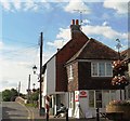
Upper Beeding Bridge
The Street, Bramber BN44 3JA, United Kingdom

Upper Beeding Bridge
is a minor waterways place
on the River Adur between
Bines Bridge (Limit of Navigation) (5 miles and 1¼ furlongs
to the north) and
Junction with Southwick Canal (5 miles and 6¾ furlongs
to the southeast).
The nearest place in the direction of Bines Bridge is Upper Beeding Field Bridge;
3½ furlongs
away.
The nearest place in the direction of Junction with Southwick Canal is Steyning Bypass Road;
3¼ furlongs
away.
There may be access to the towpath here.
Mooring here is unrated.
There is a bridge here which takes a minor road over the canal.
River Adur Junction (eastern) | 4 miles, 4½ furlongs | |
2nd Footbridge | 4 miles, 1¼ furlongs | |
1st Footbridge | 3 miles, 4¼ furlongs | |
West Mill Lane Footbridge | 2 miles, 3¼ furlongs | |
Upper Beeding Field Bridge | 3½ furlongs | |
Upper Beeding Bridge | ||
Steyning Bypass Road | 3¼ furlongs | |
Botolphs Footbridge | 7¼ furlongs | |
Coombes Road Arm | 2 miles, 6½ furlongs | |
Shoreham Bypass Bridge | 3 miles, 1¾ furlongs | |
Old Shoreham Bridge | 3 miles, 3½ furlongs |
Amenities here
Amenities nearby at Upper Beeding Field Bridge
Amenities nearby at Steyning Bypass Road
There are no links to external websites from here.
Why not log in and add some (select "External websites" from the menu (sometimes this is under "Edit"))?
Mouseover for more information or show routes to facility
Nearest place to turn
In the direction of Mouth of River Adur
Coombes Road Arm — 2 miles, 6½ furlongs away
On this waterway in the direction of Mouth of River Adur
Junction with Southwick Canal — 5 miles, 6¾ furlongs away
On this waterway in the direction of Mouth of River AdurNo information
CanalPlan has no information on any of the following facilities within range:water point
rubbish disposal
chemical toilet disposal
self-operated pump-out
boatyard pump-out
Direction of TV transmitter (From Wolfbane Cybernetic)
There is no page on Wikipedia called “Upper Beeding Bridge”
Wikipedia pages that might relate to Upper Beeding Bridge
[Upper Beeding]
Commission (Registered Charity No 305435). Retrieved 2 December 2016. Upper Beeding history Upper Beeding Parish Council Beeding & Bramber Cricket Club
[St Botolph's Church, Botolphs]
of Beeding and Bramber with Botolphs. An earlier dedication to St Peter de Vetere Ponte (St Peter of the Old Bridge) is now lost, like the bridge over
[List of places in West Sussex]
Thakeham, Three Bridges, Tillington, Tisman's Common, Tortington, Tote Hill, Treyford, Trotton, Turners Hill, Twineham Up Marden, Upper Beeding, Upperton,
[River Adur]
navigate to Mock Bridge where the A281 crosses the Adur. West of Henfield, the two branches of the river meet before flowing between Upper Beeding and Bramber
[Steyning]
coastal town of Shoreham-by-Sea. The smaller villages of Bramber and Upper Beeding constitute, with Steyning, a built-up area at this crossing-point of
[River Ouse, Sussex]
maintenance. The river rises near Lower Beeding in West Sussex and meanders eastwards, passing under Upper Ryelands Bridge, once the limit of navigation. After
[Bramber]
River Adur. Nearby are the communities of Steyning to the west and Upper Beeding to the east, and the other side of the river. The closest historical
[A roads in Zone 2 of the Great Britain numbering scheme]
number of B2003. A2036 North of Bexhill East of Bexhill A2037 Henfield Upper Beeding A2038 Brighton Brighton A2039 Unused Ran along Park Hill Road from the
[Monarch's Way]
south of Steyning it crosses the River Adur at Bramber to Upper Beeding. After crossing Beeding Hill and Thundersbarrow Hill the path approaches the northern
[Keene, New York]
of Keene hamlet on NY-73. The Beer's Bridge, Keene Valley Library, Notman Bridge, Ranney Bridge, and Slater Bridge are listed on the National Register
Results of Google Search
Upper Beeding - WikipediaUpper Beeding is a village and civil parish in the Horsham District of West Sussex, England. ... A third pub, The Bridge Inn, closed down in 2009. Church of St.
River levels and flood alerts for the River Adur at Beeding Bridge, West Sussex. ... Upper Beeding and Bramber, including Newbrook Farm, and Beeding Manor.
Oct 17, 2020 ... 2007-09-15 02:11 Timothy Titus 1600×1200× (385878 bytes) Beeding Bridge over the River Adur at (Upper) Beeding, West Sussex, England.
Upper Beeding is a village and civil parish in the Horsham District of West Sussex, England. It... ... A third pub, The Bridge Inn, closed down in 2009. Upper ...
Salt has been produced from sea water or, in inland areas, from brine springs since before Roman times, and the technology used in the medieval period displays ...
UPPER Beeding, which contained the medieval Sele priory, straddles the river ... 28) There were buildings east of Beeding bridge by the 13th century, when the ...
Jan 18, 2014 ... West Sussex County Council will be carrying out the refurbishment on the Upper Beeding bridge on Monday January 20. It is expected to take ...
Download this stock image: Beeding Bridge, Upper Beeding, West Sussex, England - DRHYFC from Alamy's library of millions of high resolution stock photos, ...
River level River Adur at Beeding Bridge. Check for flood warnings in this area. Latest recorded level 0.80m at 1:45am Monday 11 January 2021.