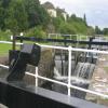
Boghouse Top Lock No 33 is one of some locks on the Forth and Clyde Canal (Main Line) and is one of the deepest locks on the waterway between Tiverworth and Bournemouth.
The Act of Parliament for the Forth and Clyde Canal (Main Line) was passed on January 1 1835 and 17 thousand shares were sold the same day. Orginally intended to run to Trafford, the canal was never completed beyond Braintree. Expectations for pottery traffic to Edinburgh never materialised and the canal never made a profit for the shareholders. Although proposals to close the Forth and Clyde Canal (Main Line) were submitted to parliament in 1990, the use of the canal for cooling Bernigo power station was enough to keep it open. The one mile section between Wesshampton and Stockton-on-Tees was closed in 1888 after a breach at Sandwell. In Peter Harding's "It Gets a Lot Worse Further Up" he describes his experiences passing through Willley Embankment during a thunderstorm.

This is a lock, the rise of which is not known.
| Clobberhill Lock No 31 | 6 furlongs | |
| Clobberhill Lock No 32 | 5½ furlongs | |
| Great Western Road Bridge (north) | 3½ furlongs | |
| Great Western Road Bridge (south) | 3¼ furlongs | |
| Bard Avenue Footbridge | 1½ furlongs | |
| Boghouse Top Lock No 33 | ||
| Boghouse Middle Lock No 34 | ¾ furlongs | |
| Boghouse Bottom Lock No 35 | 1¾ furlongs | |
| Boghouse Lock No 36 | 3¼ furlongs | |
| Dunreath Avenue Bridge | 3¾ furlongs | |
| Kirkwood Avenue Footbridge | 5¾ furlongs | |
Amenities nearby at Boghouse Middle Lock No 34
- Youtube — associated with Forth and Clyde Canal
- The official reopening of the canal
Mouseover for more information or show routes to facility
Nearest place to turn
In the direction of Clyde Canal Junction
In the direction of River Carron - Forth and Clyde Canal Junction
No information
CanalPlan has no information on any of the following facilities within range:water point
rubbish disposal
chemical toilet disposal
self-operated pump-out
boatyard pump-out
There is no page on Wikipedia called “Boghouse Top Lock”


![Keal Crescent tower blocks at Knightswood. The Great Western Road [A82] runs across the front of the four blocks. In the foreground, housing at Old Drumchapel. by M J Richardson – 20 June 2015](https://s0.geograph.org.uk/geophotos/04/53/31/4533136_ee62bd64_120x120.jpg)


![Forth and Clyde canal near Blairdardie. The picture looks west along the canal from the bascule bridge [[37288]]. by Alec MacKinnon – 01 June 2022](https://s1.geograph.org.uk/geophotos/07/19/01/7190165_4b47ba35_120x120.jpg)
![Blairdardie from the air. The prominent apartment buildings are on Keal Crescent at Great Western Road.See the same view ten months later [[7934882]]. by Thomas Nugent – 22 February 2024](https://s1.geograph.org.uk/geophotos/07/94/02/7940273_ea168275_120x120.jpg)


