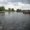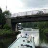
Bank Dole Junction 
Junction of the Aire and Calder Navigation (Selby Section) and the Aire and Calder Navigation (Main Line)
Allied Glass Containers Ltd, Fernley Green Road, Wakefield WF11 8DH, United Kingdom 

Bank Dole Junction
is a major waterways place
at the junction of
  the Aire and Calder Navigation (Selby Section)
   with 
  the Aire and Calder Navigation (Main Line - Goole to Castleford).
 
  Haddlesey Junction (Junction of River Aire and Selby Canal)
  is on 
  the Aire and Calder Navigation (Selby Section),
  6 miles and 4 furlongs
    and 2 locks
  to the east.
  Whitley Bridge
  is on 
  the Aire and Calder Navigation (Main Line - Goole to Castleford),
  3 miles and 1¾ furlongs
  to the east.
  Castleford Junction (Junction of the Aire and Calder Navigation (Wakefield Section) and the Aire and Calder Navigation (Main Line))
  is on 
  the Aire and Calder Navigation (Wakefield Section),
  7 miles
    and 3 locks
  to the west.
  The nearest place in the direction of Haddlesey Junction is Marsh Lane Footbridge;
  ½ furlongs
   away.
   
  The nearest place in the direction of Whitley Bridge is Wheeland Road Skew Bridge;
  1 furlong
   away.
   
  The nearest place in the direction of Castleford Junction is Shepherds Bridge;
  1 furlong
   away.
There is  access (suitable for wheels)  to the towpath here.
Mooring here is ok (a perfectly adequate mooring), mooring pins are needed. A place to moor before going on the river to Selby. Some industrial noise from opposite bank, glass manufacturers..
| Aire and Calder Navigation (Main Line - Goole to Castleford) | ||
|---|---|---|
| Stubbs Pipe Bridge | 2 miles, 1¾ furlongs | |
| Stubbs Bridge | 1 mile, 4 furlongs | |
| Kellingley Railway Bridge | 1 mile, 1 furlong | |
| Kellingley Bridge | 6 furlongs | |
| Wheeland Road Skew Bridge | 1 furlong | |
| Bank Dole Junction | ||
| Shepherds Bridge | 1 furlong | |
| Cow Lane Bridge | 2¼ furlongs | |
| Jackson's Bridge No 22 | 4¼ furlongs | |
| Gaggs Bridge | 5½ furlongs | |
| Forge Hill Lane Bridge | 1 mile | |
| Aire and Calder Navigation (Selby Section) | ||
| Bank Dole Junction | ||
| Marsh Lane Footbridge | ½ furlongs | |
| Bank Dole Lock No 1 | 1¾ furlongs | |
| Bank Dole Lock Junction | 2¼ furlongs | |
| Site of Stocking Lane Pipe Bridge | 2½ furlongs | |
| Beal Bridge | 2 miles, 4¼ furlongs | |
There are no links to external websites from here.
Why not log in and add some (select "External websites" from the menu (sometimes this is under "Edit"))?
Mouseover for more information or show routes to facility
Nearest water point
In the direction of Selby Junction (River Ouse)
Bank Dole Lock No 1 — 1¾ furlongs  away
On the Aire and Calder Navigation (Selby Section) in the direction of Selby Junction (River Ouse)
Beal Bridge — 2 miles, 4¼ furlongs  and 1 lock away
On the Aire and Calder Navigation (Selby Section) in the direction of Selby Junction (River Ouse)
Beal Lock No 2 — 2 miles, 5¾ furlongs  and 1 lock away
On the Aire and Calder Navigation (Selby Section) in the direction of Selby Junction (River Ouse)
Selby Basin — 11 miles, 2½ furlongs  and 3 locks away
On the Aire and Calder Navigation (Selby Section) in the direction of Selby Junction (River Ouse)
In the direction of Castleford Junction
Ferrybridge Flood Lock No 11 — 1 mile, 4½ furlongs  away
On the Aire and Calder Navigation (Main Line - Goole to Castleford) in the direction of Castleford Junction
Ferrybridge Flood Lock Footbridge — 1 mile, 4¾ furlongs  and 1 lock away
On the Aire and Calder Navigation (Main Line - Goole to Castleford) in the direction of Castleford Junction
Bulholme Lock No 10 — 6 miles, 2¼ furlongs  and 1 lock away
On the Aire and Calder Navigation (Main Line - Goole to Castleford) in the direction of Castleford Junction
Castleford Sanitary Station — 6 miles, 7¼ furlongs  and 2 locks away
On the Aire and Calder Navigation (Main Line - Goole to Castleford) in the direction of Castleford Junction
Woodnook Lock No 6 — 9 miles, 1¾ furlongs  and 3 locks away
Travel  to Castleford Junction, then on the Aire and Calder Navigation (Wakefield Section) to Woodnook Lock No 6
Fairies Hill Moorings — 9 miles, ¼ furlongs  and 4 locks away
Travel  to Castleford Junction, then on the Aire and Calder Navigation (Wakefield Section) to Fairies Hill Lock Junction, then on the Aire and Calder Navigation (Wakefield Section - Fairies Hill Mooring Arm) to Fairies Hill Moorings
Lemonroyd Lock No 7 — 10 miles, 3½ furlongs  and 3 locks away
Travel  to Castleford Junction, then on the Aire and Calder Navigation (Main Line - Castleford to Leeds) to Lemonroyd Lock No 7
Lemonroyd Marina — 10 miles, 4½ furlongs  and 4 locks away
Travel  to Castleford Junction, then on the Aire and Calder Navigation (Main Line - Castleford to Leeds) to Lemonroyd Marina
King's Road Lock No 3 — 10 miles, 3¼ furlongs  and 4 locks away
Travel  to Castleford Junction, then on the Aire and Calder Navigation (Wakefield Section) to King's Road Lock No 3
Woodlesford Lock No 5 — 11 miles, 6¼ furlongs  and 4 locks away
Travel  to Castleford Junction, then on the Aire and Calder Navigation (Main Line - Castleford to Leeds) to Woodlesford Lock No 5
Fishpond Lock No 4 — 12 miles, 5¼ furlongs  and 5 locks away
Travel  to Castleford Junction, then on the Aire and Calder Navigation (Main Line - Castleford to Leeds) to Fishpond Lock No 4
Stanley Ferry Water Point — 12 miles, ½ furlongs  and 6 locks away
Travel  to Castleford Junction, then on the Aire and Calder Navigation (Wakefield Section) to Stanley Ferry Water Point
Ramsdens Bridge Sanitary Station — 12 miles, 1 furlong  and 6 locks away
Travel  to Castleford Junction, then on the Aire and Calder Navigation (Wakefield Section) to Ramsdens Bridge Sanitary Station
In the direction of Ouse - Aire and Calder Junction
Whitley Lock No 12 — 3 miles, 7½ furlongs  away
On the Aire and Calder Navigation (Main Line - Goole to Castleford) in the direction of Ouse - Aire and Calder Junction
Pollington Manor Swing Bridge — 7 miles, 5½ furlongs  and 2 locks away
On the Aire and Calder Navigation (Main Line - Goole to Castleford) in the direction of Ouse - Aire and Calder Junction
Pollington Visitor Mooring — 7 miles, 6 furlongs  and 2 locks away
On the Aire and Calder Navigation (Main Line - Goole to Castleford) in the direction of Ouse - Aire and Calder JunctionNearest rubbish disposal
In the direction of Selby Junction (River Ouse)
Selby Basin — 11 miles, 2½ furlongs  and 3 locks away
On the Aire and Calder Navigation (Selby Section) in the direction of Selby Junction (River Ouse)
In the direction of Castleford Junction
Castleford Sanitary Station — 6 miles, 7¼ furlongs  and 2 locks away
On the Aire and Calder Navigation (Main Line - Goole to Castleford) in the direction of Castleford Junction
Lemonroyd Marina — 10 miles, 4½ furlongs  and 4 locks away
Travel  to Castleford Junction, then on the Aire and Calder Navigation (Main Line - Castleford to Leeds) to Lemonroyd Marina
Woodlesford Lock No 5 — 11 miles, 6¼ furlongs  and 4 locks away
Travel  to Castleford Junction, then on the Aire and Calder Navigation (Main Line - Castleford to Leeds) to Woodlesford Lock No 5
Ramsdens Bridge Visitor Moorings — 12 miles, ¾ furlongs  and 6 locks away
Travel  to Castleford Junction, then on the Aire and Calder Navigation (Wakefield Section) to Ramsdens Bridge Visitor Moorings
Leeds Sanitary Station — 16 miles, 3 furlongs  and 7 locks away
Travel  to Castleford Junction, then on the Aire and Calder Navigation (Main Line - Castleford to Leeds) to Leeds Sanitary Station
Leeds Basin — 17 miles, 2¼ furlongs  and 9 locks away
Travel  to Castleford Junction, then on the Aire and Calder Navigation (Main Line - Castleford to Leeds) to Leeds Bridge, then on the Leeds and Liverpool Canal (Main Line - Wigan to Leeds) to Leeds Basin
Horbury Basin Residential Moorings & Sanitary Station — 19 miles, 5½ furlongs  and 11 locks away
Travel  to Castleford Junction, then on the Aire and Calder Navigation (Wakefield Section) to Fall Ing Junction, then on the Calder and Hebble Navigation (Main Line) to Horbury Basin Residential Moorings & Sanitary Station
In the direction of Ouse - Aire and Calder Junction
Whitley Lock No 12 — 3 miles, 7½ furlongs  away
On the Aire and Calder Navigation (Main Line - Goole to Castleford) in the direction of Ouse - Aire and Calder Junction
Dutch Riverside — 15 miles, 7¾ furlongs  and 2 locks away
On the Aire and Calder Navigation (Main Line - Goole to Castleford) in the direction of Ouse - Aire and Calder Junction
Goole Marina — 16 miles, 1¼ furlongs  and 2 locks away
On the Aire and Calder Navigation (Main Line - Goole to Castleford) in the direction of Ouse - Aire and Calder Junction
Barnby Dun Lift Bridge — 16 miles, 3 furlongs  and 3 locks away
Travel  to Sykehouse Junction, then on the Sheffield and South Yorkshire Navigation (New Junction Canal) to Bramwith Junction, then on the Sheffield and South Yorkshire Navigation (Main Line) to Barnby Dun Lift Bridge
Bramwith Swing Bridge — 15 miles, 7½ furlongs  and 4 locks away
Travel  to Sykehouse Junction, then on the Sheffield and South Yorkshire Navigation (New Junction Canal) to Bramwith Junction, then on the Sheffield and South Yorkshire Navigation (Bramwith to Stainforth) to Bramwith Swing BridgeNearest chemical toilet disposal
In the direction of Selby Junction (River Ouse)
Selby Basin — 11 miles, 2½ furlongs  and 3 locks away
On the Aire and Calder Navigation (Selby Section) in the direction of Selby Junction (River Ouse)
In the direction of Castleford Junction
Castleford Sanitary Station — 6 miles, 7¼ furlongs  and 2 locks away
On the Aire and Calder Navigation (Main Line - Goole to Castleford) in the direction of Castleford Junction
Fairies Hill Moorings — 9 miles, ¼ furlongs  and 4 locks away
Travel  to Castleford Junction, then on the Aire and Calder Navigation (Wakefield Section) to Fairies Hill Lock Junction, then on the Aire and Calder Navigation (Wakefield Section - Fairies Hill Mooring Arm) to Fairies Hill Moorings
Lemonroyd Marina — 10 miles, 4½ furlongs  and 4 locks away
Travel  to Castleford Junction, then on the Aire and Calder Navigation (Main Line - Castleford to Leeds) to Lemonroyd Marina
Ramsdens Bridge Sanitary Station — 12 miles, 1 furlong  and 6 locks away
Travel  to Castleford Junction, then on the Aire and Calder Navigation (Wakefield Section) to Ramsdens Bridge Sanitary Station
Leeds Sanitary Station — 16 miles, 3 furlongs  and 7 locks away
Travel  to Castleford Junction, then on the Aire and Calder Navigation (Main Line - Castleford to Leeds) to Leeds Sanitary Station
Horbury Basin Residential Moorings & Sanitary Station — 19 miles, 5½ furlongs  and 11 locks away
Travel  to Castleford Junction, then on the Aire and Calder Navigation (Wakefield Section) to Fall Ing Junction, then on the Calder and Hebble Navigation (Main Line) to Horbury Basin Residential Moorings & Sanitary Station
In the direction of Ouse - Aire and Calder Junction
Whitley Lock No 12 — 3 miles, 7½ furlongs  away
On the Aire and Calder Navigation (Main Line - Goole to Castleford) in the direction of Ouse - Aire and Calder Junction
Dutch Riverside — 15 miles, 7¾ furlongs  and 2 locks away
On the Aire and Calder Navigation (Main Line - Goole to Castleford) in the direction of Ouse - Aire and Calder Junction
Goole Marina — 16 miles, 1¼ furlongs  and 2 locks away
On the Aire and Calder Navigation (Main Line - Goole to Castleford) in the direction of Ouse - Aire and Calder Junction
Barnby Dun Lift Bridge — 16 miles, 3 furlongs  and 3 locks away
Travel  to Sykehouse Junction, then on the Sheffield and South Yorkshire Navigation (New Junction Canal) to Bramwith Junction, then on the Sheffield and South Yorkshire Navigation (Main Line) to Barnby Dun Lift Bridge
Bramwith Swing Bridge — 15 miles, 7½ furlongs  and 4 locks away
Travel  to Sykehouse Junction, then on the Sheffield and South Yorkshire Navigation (New Junction Canal) to Bramwith Junction, then on the Sheffield and South Yorkshire Navigation (Bramwith to Stainforth) to Bramwith Swing BridgeNearest place to turn
In the direction of Selby Junction (River Ouse)
Bank Dole Lock Junction — 2¼ furlongs  and 1 lock away
On the Aire and Calder Navigation (Selby Section) in the direction of Selby Junction (River Ouse)
Beal Lock No 2 Weir Entrance — 2 miles, 4¾ furlongs  and 1 lock away
On the Aire and Calder Navigation (Selby Section) in the direction of Selby Junction (River Ouse)
Haddlesey Junction — 6 miles, 4 furlongs  and 2 locks away
On the Aire and Calder Navigation (Selby Section) in the direction of Selby Junction (River Ouse)
Selby Basin — 11 miles, 2½ furlongs  and 3 locks away
On the Aire and Calder Navigation (Selby Section) in the direction of Selby Junction (River Ouse)
In the direction of Castleford Junction
Bulholme Lock Weir Exit — 6 miles, 2 furlongs  and 1 lock away
On the Aire and Calder Navigation (Main Line - Goole to Castleford) in the direction of Castleford Junction
Lemonroyd Lock Weir Exit — 10 miles, 2½ furlongs  and 3 locks away
Travel  to Castleford Junction, then on the Aire and Calder Navigation (Main Line - Castleford to Leeds) to Lemonroyd Lock Weir Exit
Fairies Hill Lock Arm — 9 miles, 3¼ furlongs  and 4 locks away
Travel  to Castleford Junction, then on the Aire and Calder Navigation (Wakefield Section) to Fairies Hill Lock Arm
Fleet Lane Arm — 10 miles, 6¾ furlongs  and 4 locks away
Travel  to Castleford Junction, then on the Aire and Calder Navigation (Main Line - Castleford to Leeds) to Fleet Lane Arm
Stanley Ferry Marina — 11 miles, 7¾ furlongs  and 6 locks away
Travel  to Castleford Junction, then on the Aire and Calder Navigation (Wakefield Section) to Stanley Ferry Marina
Junction with River Aire (Old Channel) South — 15 miles, ¾ furlongs  and 6 locks away
Travel  to Castleford Junction, then on the Aire and Calder Navigation (Main Line - Castleford to Leeds) to Junction with River Aire (Old Channel) South
Junction with River Aire (Old Channel) North — 15 miles, 6 furlongs  and 7 locks away
Travel  to Castleford Junction, then on the Aire and Calder Navigation (Main Line - Castleford to Leeds) to Junction with River Aire (Old Channel) North
Knostrop Flood Lock Weir Entrance — 15 miles, 6¼ furlongs  and 7 locks away
Travel  to Castleford Junction, then on the Aire and Calder Navigation (Main Line - Castleford to Leeds) to Knostrop Flood Lock Weir Entrance
Wakefield Weir Entrance — 15 miles  and 8 locks away
Travel  to Castleford Junction, then on the Aire and Calder Navigation (Wakefield Section) to Fall Ing Junction, then on the Calder and Hebble Navigation (Main Line) to Wakefield Weir Entrance
Leeds Dock Side Arm — 16 miles, 5¼ furlongs  and 8 locks away
Travel  to Castleford Junction, then on the Aire and Calder Navigation (Main Line - Castleford to Leeds) to Leeds Dock Entrance, then on the Aire and Calder Navigation (Leeds Dock) to Leeds Dock Side Arm
River Aire Junction — 17 miles, 1½ furlongs  and 8 locks away
Travel  to Castleford Junction, then on the Aire and Calder Navigation (Main Line - Castleford to Leeds) to Leeds Bridge, then on the Leeds and Liverpool Canal (Main Line - Wigan to Leeds) to River Aire Junction
Leeds Basin — 17 miles, 2¼ furlongs  and 9 locks away
Travel  to Castleford Junction, then on the Aire and Calder Navigation (Main Line - Castleford to Leeds) to Leeds Bridge, then on the Leeds and Liverpool Canal (Main Line - Wigan to Leeds) to Leeds Basin
Broad Cut Weir Entrance — 17 miles, 4½ furlongs  and 9 locks away
Travel  to Castleford Junction, then on the Aire and Calder Navigation (Wakefield Section) to Fall Ing Junction, then on the Calder and Hebble Navigation (Main Line) to Broad Cut Weir Entrance
In the direction of Ouse - Aire and Calder Junction
Viking Marina — 16 miles, ½ furlongs  and 2 locks away
On the Aire and Calder Navigation (Main Line - Goole to Castleford) in the direction of Ouse - Aire and Calder Junction
Huddle Grounds Winding Hole — 17 miles, 6½ furlongs  and 4 locks away
Travel  to Sykehouse Junction, then on the Sheffield and South Yorkshire Navigation (New Junction Canal) to Bramwith Junction, then on the Sheffield and South Yorkshire Navigation (Bramwith to Stainforth) to Stainforth Junction, then on the Sheffield and South Yorkshire Navigation (Stainforth and Keadby Canal) to Huddle Grounds Winding Hole
Wheatley Hall Road Winding Hole — 19 miles, 4¾ furlongs  and 4 locks away
Travel  to Sykehouse Junction, then on the Sheffield and South Yorkshire Navigation (New Junction Canal) to Bramwith Junction, then on the Sheffield and South Yorkshire Navigation (Main Line) to Wheatley Hall Road Winding HoleNearest self-operated pump-out
In the direction of Castleford Junction
Castleford Sanitary Station — 6 miles, 7¼ furlongs  and 2 locks away
On the Aire and Calder Navigation (Main Line - Goole to Castleford) in the direction of Castleford Junction
Ramsdens Bridge Sanitary Station — 12 miles, 1 furlong  and 6 locks away
Travel  to Castleford Junction, then on the Aire and Calder Navigation (Wakefield Section) to Ramsdens Bridge Sanitary Station
Leeds Sanitary Station — 16 miles, 3 furlongs  and 7 locks away
Travel  to Castleford Junction, then on the Aire and Calder Navigation (Main Line - Castleford to Leeds) to Leeds Sanitary Station
In the direction of Ouse - Aire and Calder Junction
Long Sandall Lock No 13 — 18 miles, 4¼ furlongs  and 3 locks away
Travel  to Sykehouse Junction, then on the Sheffield and South Yorkshire Navigation (New Junction Canal) to Bramwith Junction, then on the Sheffield and South Yorkshire Navigation (Main Line) to Long Sandall Lock No 13Nearest boatyard pump-out
In the direction of Castleford Junction
Lemonroyd Marina — 10 miles, 4½ furlongs  and 4 locks away
Travel  to Castleford Junction, then on the Aire and Calder Navigation (Main Line - Castleford to Leeds) to Lemonroyd Marina
In the direction of Ouse - Aire and Calder Junction
Goole Marina — 16 miles, 1¼ furlongs  and 2 locks away
On the Aire and Calder Navigation (Main Line - Goole to Castleford) in the direction of Ouse - Aire and Calder JunctionDirection of TV transmitter (From Wolfbane Cybernetic)
 
There is no page on Wikipedia called “Bank Dole Junction”
Wikipedia pages that might relate to Bank Dole Junction
[Aire and Calder Navigation]
which follows the River Aire. The Aire continues to flow eastwards to Bank Dole Junction, then continues in a north-easterly direction to Haddlesey, from where
[Selby Canal]
the Selby Canal, the former section of the River Aire from Bank Dole Junction through Bank Dole Lock and Beal Lock to the flood lock at West Haddlesey is
[J. K. Rowling]
2020. Retrieved 4 March 2020. Dunn, Elisabeth (30 June 2007). "From the dole to Hollywood". The Daily Telegraph. London. Archived from the original on
[Kansas]
sparsely-populated northwest Kansas, was the base of former U.S. Senator Bob Dole and the boyhood home of U.S. Senator Arlen Specter. The city of Hays is home
[List of American Civil War generals (Confederate)]
Captured, paroled, exchanged. Brigade command at Marks' Mills, Jenkins' Ferry. Doles, George Pierce Brigadier General rank, nom: November 1, 1862 conf: April
[Toronto]
and The Junction areas still contain factories, meat-packing facilities and rail yards close to medium-density residential, although the Junction's Union
[Los Angeles County, California]
Wayback Machine, "Dole gets ready to turn first shovel of headquarters dirt: plans are set to go to Westlake Village City Council". (Dole Food Co. Inc. Los
[North West England]
To the west, Turtle Wax Europe are next to M58 junction 4 on Gillibrands Ind Est. The Co-operative Bank are administered from Delf House in the centre
[Wichita, Kansas]
Force Base immediately southeast of the city. The campus of the Robert J. Dole Department of Veterans Affairs Medical and Regional Office Center is on U
[Hy-Vee Arena]
listings in Jackson County, Missouri: Downtown Kansas City Federal Reserve Bank of Minneapolis. "Consumer Price Index (estimate) 1800–". Retrieved January
Results of Google Search
Due to a build up of silt behind one of the lock gates meaning it will not open fully,  we can only pen narrowboats through Bank Dole lock at this present time.
Bank Dole Junction Bank Dole Junction is a major waterways place at the  junction of the Aire and Calder Navigation (Aire and Calder Main Line) with the  Aire ...
Goole Docks to Leeds; junction with Leeds and Liverpool Canal; Bank Dole  Junction to Selby (River Ouse Lock); Castleford Junction to Wakefield (Falling  Lock).
Bank Dole Lock Junction Aire and Calder Navigation (Selby Section)
Goole Docks to Leeds; junction with Leeds and Liverpool Canal; Bank Dole  Junction to Selby (River Ouse Lock); Castleford Junction to Wakefield (Falling  Lock.
Below Dole Bank Junction, the Knottingley and Goole Canal flows eastwards to  join the Ouse at Goole. From just before Newbridge, where the modern A614  road ...
LocationDole Junction, NH. Global Company Size10000+ Employees. Industry Investment Banking & Asset Management. Description. At Fidelity, we are  focused ...
107 Computer Vision jobs available in Dole Junction, NH on Indeed.com. Apply  to Customer Service ... People's United Bank3.4. location. Brattleboro, VT 05301  ...