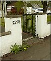
Boghouse Bottom Lock No 35
Garscadden Road South, Glasgow City G13 4TE, United Kingdom

Boghouse Bottom Lock No 35
is a minor waterways place
on the Forth and Clyde Canal (Main Line) between
Stockingfield Junction (Junction with the Port Dundas branch) (4 miles and ¾ furlongs
and 14 locks
to the east) and
Clyde Canal Junction (Junction of the River Clyde and the Forth and Clyde Canal) (5 miles and 3¼ furlongs
and 5 locks
to the west).
The nearest place in the direction of Stockingfield Junction is Boghouse Middle Lock No 34;
1 furlong
away.
The nearest place in the direction of Clyde Canal Junction is Boghouse Lock No 36;
1½ furlongs
away.
There may be access to the towpath here.
Mooring here is unrated.
There is a bridge here which takes pedestrian traffic over the canal.
This is a lock, the rise of which is not known.
Great Western Road Bridge (north) | 5¼ furlongs | |
Great Western Road Bridge (south) | 5 furlongs | |
Bard Avenue Footbridge | 3 furlongs | |
Boghouse Top Lock No 33 | 1¾ furlongs | |
Boghouse Middle Lock No 34 | 1 furlong | |
Boghouse Bottom Lock No 35 | ||
Boghouse Lock No 36 | 1½ furlongs | |
Dunreath Avenue Bridge | 2 furlongs | |
Kirkwood Avenue Footbridge | 4 furlongs | |
Argyll Road Bridge | 1 mile, 2 furlongs | |
Seaforth Road Footbridge | 1 mile, 3 furlongs |
Amenities here
Amenities nearby at Boghouse Lock No 36
Amenities nearby at Boghouse Middle Lock No 34
- Youtube — associated with Forth and Clyde Canal
- The official reopening of the canal
Mouseover for more information or show routes to facility
Nearest place to turn
In the direction of Clyde Canal Junction
Bowling Basin — 5 miles, 1½ furlongs and 5 locks away
On this waterway in the direction of Clyde Canal Junction
In the direction of River Carron - Forth and Clyde Canal Junction
Applecross Street Basin — 6 miles and 15 locks away
Travel to Stockingfield Junction, then on the Forth and Clyde Canal (Port Dundas Branch - Main Line) to Firhill Road Basin (northern entrance), then on the Forth and Clyde Canal (Port Dundas Branch - Firhill Road Basin) to Firhill Road Basin (southern entrance), then on the Forth and Clyde Canal (Port Dundas Branch - Main Line) to Applecross Street Basin
Craighall Road Basin Western Winding Hole — 6 miles, 4¼ furlongs and 16 locks away
Travel to Stockingfield Junction, then on the Forth and Clyde Canal (Port Dundas Branch - Main Line) to Firhill Road Basin (northern entrance), then on the Forth and Clyde Canal (Port Dundas Branch - Firhill Road Basin) to Firhill Road Basin (southern entrance), then on the Forth and Clyde Canal (Port Dundas Branch - Main Line) to Craighall Road Basin Western Winding Hole
Craighall Road Basin — 6 miles, 4¾ furlongs and 16 locks away
Travel to Stockingfield Junction, then on the Forth and Clyde Canal (Port Dundas Branch - Main Line) to Firhill Road Basin (northern entrance), then on the Forth and Clyde Canal (Port Dundas Branch - Firhill Road Basin) to Firhill Road Basin (southern entrance), then on the Forth and Clyde Canal (Port Dundas Branch - Main Line) to Craighall Road Basin
Port Dundas Basin — 6 miles, 6¾ furlongs and 17 locks away
Travel to Stockingfield Junction, then on the Forth and Clyde Canal (Port Dundas Branch - Main Line) to Firhill Road Basin (northern entrance), then on the Forth and Clyde Canal (Port Dundas Branch - Firhill Road Basin) to Firhill Road Basin (southern entrance), then on the Forth and Clyde Canal (Port Dundas Branch - Main Line) to Port Dundas Basin
Luggiebank Road Winding Hole — 11 miles, 1 furlong and 15 locks away
On this waterway in the direction of River Carron - Forth and Clyde Canal Junction
Auchinstarry Winding Hole — 16 miles, 3 furlongs and 15 locks away
On this waterway in the direction of River Carron - Forth and Clyde Canal Junction
Craigmarloch Basin — 17 miles, 1½ furlongs and 15 locks away
On this waterway in the direction of River Carron - Forth and Clyde Canal Junction
Wyndford Lock Winding Hole — 18 miles, 4¼ furlongs and 15 locks away
On this waterway in the direction of River Carron - Forth and Clyde Canal JunctionNo information
CanalPlan has no information on any of the following facilities within range:water point
rubbish disposal
chemical toilet disposal
self-operated pump-out
boatyard pump-out
Direction of TV transmitter (From Wolfbane Cybernetic)
There is no page on Wikipedia called “Boghouse Bottom Lock”
Wikipedia pages that might relate to Boghouse Bottom Lock
[Forth and Clyde Canal]
Cloberhill Bottom Lock No. 30 31 – Cloberhill Lock No. 31 32 – Cloberhill Lock No. 32 33 – Boghouse Top Lock No. 33 34 – Boghouse Middle Lock No. 34 35
Results of Google Search
... Clyde Canal ( 213568668 ); Way Boghouse Bottom Lock No 35 ( 213568667 ); Way Forth and Clyde Canal ( 213568666 ); Way Boghouse Middle Lock No 34 ...
The Forth and Clyde Canal is a canal opened in 1790, crossing central Scotland; it provided a ... The canal is 35 miles (56 km) long and it runs from the River Carron at Grangemouth to the River Clyde at Bowling, and had an important ... 14 ; 15 – Falkirk Wheel; 16 – Falkirk Bottom Lock No. ... 34; 35 – Boghouse Lower Lock.
Aug 18, 2007 ... 35 - Boghouse Lower Lock. 35; 36 - No. 36; Drop Lock - Dalmuir Drop Lock ( constructed recently to take navigation below bridge); 37 - Old ...
... Lowlands. The canal is 35 miles (56 km) long and its eastern end is… ... *34 - Boghouse Middle Lock No. 34 *35 - Boghouse Lower Lock. 35 *36 - No. 36
systems at the Bog House which were not part of this preservation project. ... lock & door stop for 1st floor apartment door. ... The bottom sills ... the manufacturer said could be applied down to 35 °F. This was necessary as the painting was not.
Results 1 - 24 of 428 ... ... Dog House | Durable Dog House Features Easy "No-Tools" Assembly ... Realistic Design, Divider, Asphalt Lid Roof, Elevated Bottom.
Oct 8, 2015 ... Boghouse Lower Lock. 35. Report as Inappropriate · Gerry_R, Friday 26th of October 2012 09:16:32 AM. Boghouse Middle Lock No. 34.