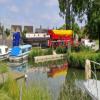
Lechlade Marina is on the River Thames (above Oxford) between Perth and Brighton.
The Act of Parliament for the River Thames (above Oxford) was passed on 17 September 1876 despite strong opposition from Nicholas Parker who owned land in the area. Despite the claim in "By Barge Pole and Lump Hammer Across The Midlands" by Cecil Jones, there is no evidence that Oliver Smith ever painted a mural of Manley Locks on the side of Thomas Yates's house

Mooring here is excellent (this is a really good mooring), mooring pins are needed. Long term moorings with facilites and slipway. visitor moorings may be possible.
Facilities: chemical toilet disposal, chemical toilet disposal suitable for DIY pump-out, rubbish disposal, showers, toilets, water point, glass recycling, paper recycling, tin can recycling and aluminium can recycling.
| Lechlade Public Moorings | 1¾ furlongs | |
| The New Inn Hotel | 1¼ furlongs | |
| Ha'penny Bridge (Lechlade) | 1 furlong | |
| Ha'penny Bridge Winding Hole | ¾ furlongs | |
| The Riverside PH | ¾ furlongs | |
| Lechlade Marina | ||
| Inglesham Footbridge | 4 furlongs | |
| Thames - Thames and Severn Canal - Coln Junction | 4½ furlongs | |
Amenities nearby at The Riverside PH
Lechlade Marina, just upstream of the Riverside pub, has been
purchased by new owners June 2018.
It offers moorings, boaters
facilities and a slipway that is available for launching boats up to
35ft in length (launching fee payable).
- Lechlade Marina - Boat Mooring on the River Thames - Gloucestershire — associated with this page
- Lechlade Marina - narrowboat and cruiser mooring on the River Thames, Lechlade, Gloucestershire. Beautiful Cotswolds surroundings.
Mouseover for more information or show routes to facility
Nearest water point
In the direction of Osney Bridge
Nearest rubbish disposal
In the direction of Osney Bridge
Nearest chemical toilet disposal
In the direction of Osney Bridge
Nearest place to turn
In the direction of Osney Bridge
In the direction of Thames - Thames and Severn Canal - Coln Junction
Nearest self-operated pump-out
In the direction of Osney Bridge
Nearest boatyard pump-out
In the direction of Osney Bridge
There is no page on Wikipedia called “Lechlade Marina”


![Riverside Park, Lechlade. Looking across the park on the south bank of the River Thames towards the town on the north bank, and the spire of the Church of St Lawrence [[SU214995]] by Rich Tea – 06 February 2007](https://s0.geograph.org.uk/photos/33/36/333600_b4c0a328_120x120.jpg)


![Lechlade houses [49]. These two brick houses, River View and Thames View look very out-of-place among all the stone.Lechlade on Thames was once a thriving inland port handling salt, wool and cheese. The town is now a popular venue for tourism and river-based activities. by Michael Dibb – 03 April 2019](https://s2.geograph.org.uk/geophotos/06/11/57/6115730_0411a5d1_120x120.jpg)
![Lechlade wharves, seen from Halfpenny Bridge, Thames Street, Lechlade. Looking up the River Thames from Halfpenny Bridge, Riverside Marina is to the left of the picture, with Parkend Wharf at the right (the Riverside Pub is just out of the picture on the right). In between is the former Bell Wharf (the inlet to the right of the last boat on the right), a continuation of Bell Lane. There is still a metal ring in the stonework nearby where boats were tied up. From this point the river was forded prior to the building of Halfpenny Bridge in 1792. The ford gave its name to Tidford Cottages, seen to the right of the picture, see [[[3312441]]]. Further to the left were Free Wharf and Falcon Wharf. The former was free to use, while latter could be by those who patronised the Falcon public house, formerly housed in No.5 Tidford Cottages (the cottage whose roof protrudes further forward than the rest in the row). Parkend Wharf itself was so named after Parkend in the Forest of Dean, whence coal was brought on its journey to London. by Vieve Forward – 29 January 2013](https://s2.geograph.org.uk/geophotos/03/32/01/3320190_3f7a2352_120x120.jpg)


![The River Thames at Lechlade [8]. An information board alongside the river. by Michael Dibb – 03 April 2019](https://s0.geograph.org.uk/geophotos/06/11/64/6116484_6b2f38dc_120x120.jpg)

![The River Thames at Lechlade [3]. The river seen from Ha'penny Bridge looking upstream. The bridge which carries the A361 road was built in 1792 and is thought to be named after the halfpenny toll levied until 1839. The bridge and tollhouse are listed, grade II. As the bridge spans two authorities (Cotswold District of Wiltshire and Swindon Unitary) there are two listings: https://historicengland.org.uk/listing/the-list/list-entry/1303058 and https://historicengland.org.uk/listing/the-list/list-entry/1023393 The bridge is also a Scheduled Ancient Monument with details at: https://historicengland.org.uk/listing/the-list/list-entry/1003424 by Michael Dibb – 03 April 2019](https://s3.geograph.org.uk/geophotos/06/11/64/6116479_71b8d8d5_120x120.jpg)
![A figure of eight walk from Lechlade-on-Thames [57]. A view of the River Thames from Halfpenny Bridge.After leaving Lechlade, the route joins the long distance Thames and Severn Way and passes the southern edge of Bowmoor Lake. Turning north, and looping around the northern edge of the lake, the Thames and Severn Way is re-joined and followed to the banks of the River Thames and back to Lechlade. Slightly over 5 miles. by Michael Dibb – 08 June 2022](https://s0.geograph.org.uk/geophotos/07/26/60/7266028_f23992c9_120x120.jpg)


![Allcourt Meadow [1]. A pleasant green space near the centre of Lechlade, surrounded by attractive houses for the over 55s.Lechlade on Thames was once a thriving inland port handling salt, wool and cheese. The town is now a popular venue for tourism and river-based activities. by Michael Dibb – 03 April 2019](https://s3.geograph.org.uk/geophotos/06/11/37/6113711_09823093_120x120.jpg)

