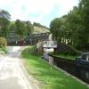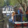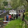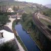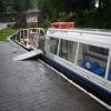
Tunnel End Footbridge No 62
is a major waterways place
on the Huddersfield Narrow Canal between
Diggle (3 miles and 3¼ furlongs
to the southwest) and
Railway Lock No 42E (Marsden. Eastern summit lock) (4¾ furlongs
to the east).
The nearest place in the direction of Diggle is Standedge Visitor Centre;
¼ furlongs
away.
The nearest place in the direction of Railway Lock No 42E is Standedge Tunnel End Winding Hole;
¼ furlongs
away.
There may be access to the towpath here.
Mooring here is unrated.
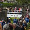
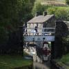
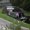
There is a bridge here which takes pedestrian traffic over the canal.
| Diggle | 3 miles, 3¼ furlongs | |
| Spring Grove Aqueduct | 3 miles, 2¾ furlongs | |
| Standedge Tunnel (western entrance) | 3 miles, 2½ furlongs | |
| Standedge Tunnel (eastern entrance) | ½ furlongs | |
| Standedge Visitor Centre | ¼ furlongs | |
| Tunnel End Footbridge No 62 | ||
| Standedge Tunnel End Winding Hole | ¼ furlongs | |
| Tunnel End Railway Bridge No 61 | ¾ furlongs | |
| Narrows by bridge No 61 | 1¼ furlongs | |
| High Lea Narrows | 3¾ furlongs | |
| Marsden Pipe Bridge | 4¼ furlongs | |
There are no links to external websites from here.
Why not log in and add some (select "External websites" from the menu (sometimes this is under "Edit"))?
Why not log in and add some (select "External websites" from the menu (sometimes this is under "Edit"))?
Mouseover for more information or show routes to facility
Nearest water point
In the direction of Ashton-under-Lyne Junction
Standedge Tunnel (eastern entrance) — ½ furlongs away
On this waterway in the direction of Ashton-under-Lyne Junction
Standedge Tunnel (western entrance) — 3 miles, 2½ furlongs away
On this waterway in the direction of Ashton-under-Lyne Junction
Wool Road Bridge No 70 — 5 miles, 2¼ furlongs and 9 locks away
On this waterway in the direction of Ashton-under-Lyne Junction
Grove Road Bridge No 96 — 11 miles, 2½ furlongs and 24 locks away
On this waterway in the direction of Ashton-under-Lyne Junction
Fairfield Junction — 18 miles, 6½ furlongs and 32 locks away
Travel to Ashton-under-Lyne Junction, then on the Ashton Canal (Main Line) to Fairfield Junction
In the direction of Aspley Basin (Huddersfield)
Slaithwaite Winding Hole — 3 miles, 2½ furlongs and 21 locks away
On this waterway in the direction of Aspley Basin (Huddersfield)
Waterside Lock No 21E — 3 miles, 3 furlongs and 21 locks away
On this waterway in the direction of Aspley Basin (Huddersfield)
Aspley Basin (Huddersfield) — 8 miles, ¾ furlongs and 42 locks away
On this waterway in the direction of Aspley Basin (Huddersfield)
Shepley Bridge Sanitary Station — 14 miles, 5¼ furlongs and 53 locks away
Travel to Aspley Basin (Huddersfield), then on the Huddersfield Broad Canal to Cooper Bridge Junction, then on the Calder and Hebble Navigation (Main Line) to Shepley Bridge Sanitary Station
Brighouse Basin — 13 miles, 7 furlongs and 55 locks away
Travel to Aspley Basin (Huddersfield), then on the Huddersfield Broad Canal to Cooper Bridge Junction, then on the Calder and Hebble Navigation (Main Line) to Brighouse Basin
Salterhebble Sanitary Station — 18 miles, 1 furlong and 64 locks away
Travel to Aspley Basin (Huddersfield), then on the Huddersfield Broad Canal to Cooper Bridge Junction, then on the Calder and Hebble Navigation (Main Line) to Salterhebble Sanitary Station
Salterhebble Junction — 18 miles, 1½ furlongs and 65 locks away
Travel to Aspley Basin (Huddersfield), then on the Huddersfield Broad Canal to Cooper Bridge Junction, then on the Calder and Hebble Navigation (Main Line) to Salterhebble JunctionNearest rubbish disposal
In the direction of Ashton-under-Lyne Junction
Wool Road Visitor Mooring — 5 miles, 2½ furlongs and 9 locks away
On this waterway in the direction of Ashton-under-Lyne Junction
In the direction of Aspley Basin (Huddersfield)
Pickle Lock No 22E — 3 miles, 1¾ furlongs and 20 locks away
On this waterway in the direction of Aspley Basin (Huddersfield)
Aspley Basin (Huddersfield) — 8 miles, ¾ furlongs and 42 locks away
On this waterway in the direction of Aspley Basin (Huddersfield)
Shepley Bridge Sanitary Station — 14 miles, 5¼ furlongs and 53 locks away
Travel to Aspley Basin (Huddersfield), then on the Huddersfield Broad Canal to Cooper Bridge Junction, then on the Calder and Hebble Navigation (Main Line) to Shepley Bridge Sanitary Station
Brighouse Lower Basin Visitor Moorings — 13 miles, 6¾ furlongs and 54 locks away
Travel to Aspley Basin (Huddersfield), then on the Huddersfield Broad Canal to Cooper Bridge Junction, then on the Calder and Hebble Navigation (Main Line) to Brighouse Lower Basin Visitor Moorings
Horbury Basin Residential Moorings & Sanitary Station — 19 miles, 1¾ furlongs and 60 locks away
Travel to Aspley Basin (Huddersfield), then on the Huddersfield Broad Canal to Cooper Bridge Junction, then on the Calder and Hebble Navigation (Main Line) to Horbury Basin Residential Moorings & Sanitary Station
Salterhebble Sanitary Station — 18 miles, 1 furlong and 64 locks away
Travel to Aspley Basin (Huddersfield), then on the Huddersfield Broad Canal to Cooper Bridge Junction, then on the Calder and Hebble Navigation (Main Line) to Salterhebble Sanitary StationNearest chemical toilet disposal
In the direction of Ashton-under-Lyne Junction
Wool Road Bridge No 70 — 5 miles, 2¼ furlongs and 9 locks away
On this waterway in the direction of Ashton-under-Lyne Junction
Grove Road Bridge No 96 — 11 miles, 2½ furlongs and 24 locks away
On this waterway in the direction of Ashton-under-Lyne Junction
Fairfield Junction — 18 miles, 6½ furlongs and 32 locks away
Travel to Ashton-under-Lyne Junction, then on the Ashton Canal (Main Line) to Fairfield Junction
In the direction of Aspley Basin (Huddersfield)
Pickle Lock No 22E — 3 miles, 1¾ furlongs and 20 locks away
On this waterway in the direction of Aspley Basin (Huddersfield)
Waterside Lock No 21E — 3 miles, 3 furlongs and 21 locks away
On this waterway in the direction of Aspley Basin (Huddersfield)
Aspley Basin (Huddersfield) — 8 miles, ¾ furlongs and 42 locks away
On this waterway in the direction of Aspley Basin (Huddersfield)
Shepley Bridge Sanitary Station — 14 miles, 5¼ furlongs and 53 locks away
Travel to Aspley Basin (Huddersfield), then on the Huddersfield Broad Canal to Cooper Bridge Junction, then on the Calder and Hebble Navigation (Main Line) to Shepley Bridge Sanitary Station
Brighouse Basin — 13 miles, 7 furlongs and 55 locks away
Travel to Aspley Basin (Huddersfield), then on the Huddersfield Broad Canal to Cooper Bridge Junction, then on the Calder and Hebble Navigation (Main Line) to Brighouse Basin
Savile Town Wharf and Basin (Dewsbury) — 18 miles, ¾ furlongs and 57 locks away
Travel to Aspley Basin (Huddersfield), then on the Huddersfield Broad Canal to Cooper Bridge Junction, then on the Calder and Hebble Navigation (Main Line) to Dewsbury Arm Junction, then on the Calder and Hebble Navigation (Dewsbury Old Cut) to Savile Town Wharf and Basin (Dewsbury)
Horbury Basin Residential Moorings & Sanitary Station — 19 miles, 1¾ furlongs and 60 locks away
Travel to Aspley Basin (Huddersfield), then on the Huddersfield Broad Canal to Cooper Bridge Junction, then on the Calder and Hebble Navigation (Main Line) to Horbury Basin Residential Moorings & Sanitary Station
Salterhebble Sanitary Station — 18 miles, 1 furlong and 64 locks away
Travel to Aspley Basin (Huddersfield), then on the Huddersfield Broad Canal to Cooper Bridge Junction, then on the Calder and Hebble Navigation (Main Line) to Salterhebble Sanitary StationNearest place to turn
In the direction of Ashton-under-Lyne Junction
Diggle Winding Hole — 3 miles, 5 furlongs away
On this waterway in the direction of Ashton-under-Lyne Junction
Wool Road Winding Hole — 5 miles, 3 furlongs and 9 locks away
On this waterway in the direction of Ashton-under-Lyne Junction
Saddleworth Visitor Centre Winding Hole — 6 miles, 1 furlong and 11 locks away
On this waterway in the direction of Ashton-under-Lyne Junction
Manns Wharf Bridge Winding Hole — 7 miles, 3¾ furlongs and 13 locks away
On this waterway in the direction of Ashton-under-Lyne Junction
Roughtown Court Winding Hole — 8 miles, 5¼ furlongs and 18 locks away
On this waterway in the direction of Ashton-under-Lyne Junction
Mossley Bottoms Winding Hole — 9 miles, 4¾ furlongs and 20 locks away
On this waterway in the direction of Ashton-under-Lyne Junction
Knowle Street Winding Hole — 13 miles, 5 furlongs and 25 locks away
On this waterway in the direction of Ashton-under-Lyne Junction
Staley Wharf Winding Hole — 14 miles, 6¾ furlongs and 29 locks away
On this waterway in the direction of Ashton-under-Lyne Junction
Ashton-under-Lyne Junction — 15 miles, 6½ furlongs and 32 locks away
On this waterway in the direction of Ashton-under-Lyne Junction
Dukinfield Junction — 16 miles, 2½ furlongs and 32 locks away
Travel to Ashton-under-Lyne Junction, then on the Ashton Canal (Main Line) to Dukinfield Junction
Portland Basin Arm — 16 miles, 3 furlongs and 32 locks away
Travel to Ashton-under-Lyne Junction, then on the Ashton Canal (Main Line) to Dukinfield Junction, then on the Peak Forest Canal (Lower) to Portland Basin Arm
Dunkirk Farm Bridge Winding Hole — 17 miles, 7¾ furlongs and 32 locks away
Travel to Ashton-under-Lyne Junction, then on the Ashton Canal (Main Line) to Dukinfield Junction, then on the Peak Forest Canal (Lower) to Dunkirk Farm Bridge Winding Hole
Lumb Lane Bridge Winding Hole — 18 miles and 32 locks away
Travel to Ashton-under-Lyne Junction, then on the Ashton Canal (Main Line) to Lumb Lane Bridge Winding Hole
In the direction of Aspley Basin (Huddersfield)
Standedge Tunnel End Winding Hole — ¼ furlongs away
On this waterway in the direction of Aspley Basin (Huddersfield)
Booth Lock Winding Hole — 1 mile, 5½ furlongs and 11 locks away
On this waterway in the direction of Aspley Basin (Huddersfield)
Slaithwaite Winding Hole — 3 miles, 2½ furlongs and 21 locks away
On this waterway in the direction of Aspley Basin (Huddersfield)
Linthwaite Winding Hole — 4 miles, 3 furlongs and 26 locks away
On this waterway in the direction of Aspley Basin (Huddersfield)
Isis Lock Winding Hole — 5 miles, 7¼ furlongs and 34 locks away
On this waterway in the direction of Aspley Basin (Huddersfield)
University Arm — 8 miles and 42 locks away
On this waterway in the direction of Aspley Basin (Huddersfield)
Aspley Basin (Huddersfield) — 8 miles, ¾ furlongs and 42 locks away
On this waterway in the direction of Aspley Basin (Huddersfield)Nearest self-operated pump-out
In the direction of Ashton-under-Lyne Junction
Wool Road Bridge No 70 — 5 miles, 2¼ furlongs and 9 locks away
On this waterway in the direction of Ashton-under-Lyne Junction
In the direction of Aspley Basin (Huddersfield)
Slaithwaite Winding Hole — 3 miles, 2½ furlongs and 21 locks away
On this waterway in the direction of Aspley Basin (Huddersfield)Nearest boatyard pump-out
In the direction of Ashton-under-Lyne Junction
Portland Basin Arm — 16 miles, 3 furlongs and 32 locks away
Travel to Ashton-under-Lyne Junction, then on the Ashton Canal (Main Line) to Dukinfield Junction, then on the Peak Forest Canal (Lower) to Portland Basin Arm
In the direction of Aspley Basin (Huddersfield)
Aspley Basin (Huddersfield) — 8 miles, ¾ furlongs and 42 locks away
On this waterway in the direction of Aspley Basin (Huddersfield)
Shepley Bridge Marina — 14 miles, 5½ furlongs and 53 locks away
Travel to Aspley Basin (Huddersfield), then on the Huddersfield Broad Canal to Cooper Bridge Junction, then on the Calder and Hebble Navigation (Main Line) to Shepley Bridge MarinaDirection of TV transmitter (From Wolfbane Cybernetic)
There is no page on Wikipedia called “Tunnel End Footbridge”
Wikipedia pages that might relate to Tunnel End Footbridge
[List of crossings of the River Thames]
Two road tunnels were built in East London at the end of the 19th century, the Blackwall Tunnel and the Rotherhithe Tunnel; and the latest tunnel is the
[List of Dublin bridges and tunnels]
end of North Bull Island Dublin Port Tunnel Phoenix Park Tunnel Railway tunnel under the Royal Canal Grand Canal Sewer Tunnel Liffey Service Tunnel List
[Tyne Tunnel]
The Tyne Tunnel is the name given to two 2-lane vehicular toll tunnels under the River Tyne in North East England. Originally opened in 1967 and expanded
[Multnomah Falls]
bridge at the falls to allow visitor access. This bridge, named the Benson Footbridge, spans the lower falls at a height of 105 feet (32 m), and provides an
[Tunnel]
A tunnel is an underground passageway, dug through the surrounding soil/earth/rock and enclosed except for entrance and exit, commonly at each end. A pipeline
[Eagle's Nest Tunnel and Sha Tin Heights Tunnel]
toll collection facilities (in addition to a footbridge, subway and canopy at the toll plaza) 500m tunnel approach road Miscellaneous earthworks, road
[Hungerford Bridge and Golden Jubilee Bridges]
designed by Isambard Kingdom Brunel, opened in 1845 as a suspension footbridge. It was named after the then Hungerford Market, because it went from the
[Wood End railway station]
Wood End Platform, the suffix was later dropped. The station is located in a deep cutting. Immediately to the south of the station is Wood End tunnel, which
[Sedgwick Avenue station]
The west end of the platforms on the steel structure were constructed of wood. The east end of the concrete platforms extended into the tunnel for about
[West Portal station]
the Twin Peaks Tunnel. The station consists of two side platforms, with the entrance at the western end. A non-accessible footbridge connects the platforms

