CanalPlanAC

Tolladine Bridge No 22

 
Tolladine Bridge, Worcester WR4 0AF, United Kingdom
 
Information about the place
Tolladine Bridge No 22 is a minor waterways place on the Worcester and Birmingham Canal (Diglis Basin to King's Norton Junction) between Diglis Basin (Tow-path goes around the first basin) (3 miles and 7¼ furlongs and 8 locks to the southwest) and Hanbury Junction (Junction with Droitwich Junction Canal (Restored - Opened 1/July/2011). Hanbury Wharf) (5 miles and 1¼ furlongs and 6 locks to the northeast).
 
 
The nearest place in the direction of Diglis Basin is Tolladine Lock No 10; 1¼ furlongs away.
 
The nearest place in the direction of Hanbury Junction is Tolladine Gas Pipe Bridge No 22B; 1¾ furlongs away.

There may be access to the towpath here.

Mooring here is unrated.

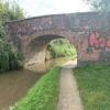
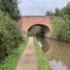
There is a bridge here which takes a track over the canal.


Amenities

Amenities here

 Tesco
 Barn Owl
 Cashpoint

Amenities nearby at Tolladine Lock No 10

 Travis Perkins
 
Maps
If you are a user and are logged on, or if you are actively planning a route, a map will be displayed here.
Show on external mapping site: Google | OSM | Bing
 
Photos
 
External websites
There are no links to external websites from here.
Why not log in and add some (select "External websites" from the menu (sometimes this is under "Edit"))?
 
Nearest facilities

Mouseover for more information or show routes to facility

Nearest water point

In the direction of King's Norton Junction

Hanbury Boatyard5 miles, ½ furlongs and 6 locks away
On this waterway in the direction of King's Norton Junction
Droitwich Spa Marina5 miles, 4½ furlongs and 9 locks away
Travel to Hanbury Junction, then on the Droitwich Canals (Droitwich Junction Canal) to Droitwich Spa Marina
Stoke Works Water Point7 miles, 5½ furlongs and 12 locks away
On this waterway in the direction of King's Norton Junction
Netherwich Basin7 miles and 14 locks away
Travel to Hanbury Junction, then on the Droitwich Canals (Droitwich Junction Canal) to Droitwich Junction, then on the Droitwich Canals (Droitwich Barge Canal) to Netherwich Basin
Tardebigge Wharf11 miles, 6 furlongs and 48 locks away
On this waterway in the direction of King's Norton Junction
Hopwood Visitor Moorings17 miles, 1¾ furlongs and 48 locks away
On this waterway in the direction of King's Norton Junction

In the direction of Diglis Basin

Lowesmoor Basin2 miles, 7 furlongs and 6 locks away
On this waterway in the direction of Diglis Basin
Diglis Services3 miles, 6¾ furlongs and 8 locks away
On this waterway in the direction of Diglis Basin
Diglis Locks4 miles, 2¾ furlongs and 10 locks away
Travel to Diglis Basin, then on the Worcester and Birmingham Canal (Diglis Junction to Diglis Basin) to Diglis Junction, then on the River Severn (main river - Worcester to Gloucester) to Diglis Locks
Worcester Trip Boat Moorings4 miles, 6½ furlongs and 10 locks away
Travel to Diglis Basin, then on the Worcester and Birmingham Canal (Diglis Junction to Diglis Basin) to Diglis Junction, then on the River Severn (main river - Stourport to Worcester) to Worcester Trip Boat Moorings
Holt Lock (Holt Fleet)11 miles, 3¼ furlongs and 11 locks away
Travel to Diglis Basin, then on the Worcester and Birmingham Canal (Diglis Junction to Diglis Basin) to Diglis Junction, then on the River Severn (main river - Stourport to Worcester) to Holt Lock (Holt Fleet)
Lincomb Lock15 miles, 5 furlongs and 12 locks away
Travel to Diglis Basin, then on the Worcester and Birmingham Canal (Diglis Junction to Diglis Basin) to Diglis Junction, then on the River Severn (main river - Stourport to Worcester) to Lincomb Lock
Upper Basin Waterpoint17 miles, ¼ furlongs and 15 locks away
Travel to Diglis Basin, then on the Worcester and Birmingham Canal (Diglis Junction to Diglis Basin) to Diglis Junction, then on the River Severn (main river - Stourport to Worcester) to Severn - Stourport Broad Locks Entrance, then on the Staffordshire and Worcestershire Canal (Stourport Basins: Broad Route) to Stourport Upper Basin, then on the Staffordshire and Worcestershire Canal (Stourport Basins: Narrow Route) to Upper Basin Waterpoint

Nearest rubbish disposal

In the direction of King's Norton Junction

Droitwich Spa Marina5 miles, 4½ furlongs and 9 locks away
Travel to Hanbury Junction, then on the Droitwich Canals (Droitwich Junction Canal) to Droitwich Spa Marina
Stoke Bottom Lock No 238 miles, 3¼ furlongs and 12 locks away
On this waterway in the direction of King's Norton Junction
Netherwich Basin7 miles and 14 locks away
Travel to Hanbury Junction, then on the Droitwich Canals (Droitwich Junction Canal) to Droitwich Junction, then on the Droitwich Canals (Droitwich Barge Canal) to Netherwich Basin
Tardebigge Wharf11 miles, 6 furlongs and 48 locks away
On this waterway in the direction of King's Norton Junction

In the direction of Diglis Basin

Lowesmoor Basin2 miles, 7 furlongs and 6 locks away
On this waterway in the direction of Diglis Basin
Diglis Basin3 miles, 7¼ furlongs and 8 locks away
On this waterway in the direction of Diglis Basin
Sabrina Footbridge5 miles, ¼ furlongs and 10 locks away
Travel to Diglis Basin, then on the Worcester and Birmingham Canal (Diglis Junction to Diglis Basin) to Diglis Junction, then on the River Severn (main river - Stourport to Worcester) to Sabrina Footbridge
Upper Basin Waterpoint17 miles, ¼ furlongs and 15 locks away
Travel to Diglis Basin, then on the Worcester and Birmingham Canal (Diglis Junction to Diglis Basin) to Diglis Junction, then on the River Severn (main river - Stourport to Worcester) to Severn - Stourport Broad Locks Entrance, then on the Staffordshire and Worcestershire Canal (Stourport Basins: Broad Route) to Stourport Upper Basin, then on the Staffordshire and Worcestershire Canal (Stourport Basins: Narrow Route) to Upper Basin Waterpoint

Nearest chemical toilet disposal

In the direction of King's Norton Junction

Droitwich Spa Marina5 miles, 4½ furlongs and 9 locks away
Travel to Hanbury Junction, then on the Droitwich Canals (Droitwich Junction Canal) to Droitwich Spa Marina
Stoke Bottom Lock No 238 miles, 3¼ furlongs and 12 locks away
On this waterway in the direction of King's Norton Junction
Tardebigge Wharf11 miles, 6 furlongs and 48 locks away
On this waterway in the direction of King's Norton Junction

In the direction of Diglis Basin

Lowesmoor Basin2 miles, 7 furlongs and 6 locks away
On this waterway in the direction of Diglis Basin
Diglis Services3 miles, 6¾ furlongs and 8 locks away
On this waterway in the direction of Diglis Basin
Stourport Marina16 miles, ¼ furlongs and 13 locks away
Travel to Diglis Basin, then on the Worcester and Birmingham Canal (Diglis Junction to Diglis Basin) to Diglis Junction, then on the River Severn (main river - Stourport to Worcester) to Stourport Marina
Upper Basin Waterpoint17 miles, ¼ furlongs and 15 locks away
Travel to Diglis Basin, then on the Worcester and Birmingham Canal (Diglis Junction to Diglis Basin) to Diglis Junction, then on the River Severn (main river - Stourport to Worcester) to Severn - Stourport Broad Locks Entrance, then on the Staffordshire and Worcestershire Canal (Stourport Basins: Broad Route) to Stourport Upper Basin, then on the Staffordshire and Worcestershire Canal (Stourport Basins: Narrow Route) to Upper Basin Waterpoint

Nearest place to turn

In the direction of King's Norton Junction

Tibberton Winding Hole2 miles, ¼ furlongs and 6 locks away
On this waterway in the direction of King's Norton Junction
Dunhampstead Winding Hole2 miles, 7¾ furlongs and 6 locks away
On this waterway in the direction of King's Norton Junction
Dunhampstead Boatyard3 miles, 2 furlongs and 6 locks away
On this waterway in the direction of King's Norton Junction
Hanbury Boatyard5 miles, ½ furlongs and 6 locks away
On this waterway in the direction of King's Norton Junction
Hanbury Junction5 miles, 1¼ furlongs and 6 locks away
On this waterway in the direction of King's Norton Junction
Hanbury Junction Winding Hole5 miles, 2½ furlongs and 6 locks away
On this waterway in the direction of King's Norton Junction
Droitwich Spa Marina5 miles, 4½ furlongs and 9 locks away
Travel to Hanbury Junction, then on the Droitwich Canals (Droitwich Junction Canal) to Droitwich Spa Marina
Astwood Winding Hole6 miles, 6¾ furlongs and 8 locks away
On this waterway in the direction of King's Norton Junction
Lock No 6 Winding Hole5 miles, 7½ furlongs and 11 locks away
Travel to Hanbury Junction, then on the Droitwich Canals (Droitwich Junction Canal) to Lock No 6 Winding Hole
Droitwich Town Wharf6 miles, 6 furlongs and 14 locks away
Travel to Hanbury Junction, then on the Droitwich Canals (Droitwich Junction Canal) to Droitwich Junction, then on the Droitwich Canals (Droitwich Barge Canal) to Droitwich Town Wharf
Netherwich Basin7 miles and 14 locks away
Travel to Hanbury Junction, then on the Droitwich Canals (Droitwich Junction Canal) to Droitwich Junction, then on the Droitwich Canals (Droitwich Barge Canal) to Netherwich Basin
Winding Hole (east of Salwarpe Road Bridge)7 miles, 1½ furlongs and 14 locks away
Travel to Hanbury Junction, then on the Droitwich Canals (Droitwich Junction Canal) to Droitwich Junction, then on the Droitwich Canals (Droitwich Barge Canal) to Winding Hole (east of Salwarpe Road Bridge)
Stoke Wharf8 miles, 3¾ furlongs and 13 locks away
On this waterway in the direction of King's Norton Junction

In the direction of Diglis Basin

Bilford Locks Winding Hole1 mile, 5¼ furlongs and 3 locks away
On this waterway in the direction of Diglis Basin
Lowesmoor Basin2 miles, 7 furlongs and 6 locks away
On this waterway in the direction of Diglis Basin
Diglis Junction4 miles, ¼ furlongs and 10 locks away
Travel to Diglis Basin, then on the Worcester and Birmingham Canal (Diglis Junction to Diglis Basin) to Diglis Junction
Diglis Locks Weir Exit4 miles, 3½ furlongs and 11 locks away
Travel to Diglis Basin, then on the Worcester and Birmingham Canal (Diglis Junction to Diglis Basin) to Diglis Junction, then on the River Severn (main river - Worcester to Gloucester) to Diglis Locks Weir Exit
Severn - Teme Junction5 miles, 1½ furlongs and 11 locks away
Travel to Diglis Basin, then on the Worcester and Birmingham Canal (Diglis Junction to Diglis Basin) to Diglis Junction, then on the River Severn (main river - Worcester to Gloucester) to Severn - Teme Junction
Bevere Lock Weir Exit7 miles, 6¾ furlongs and 10 locks away
Travel to Diglis Basin, then on the Worcester and Birmingham Canal (Diglis Junction to Diglis Basin) to Diglis Junction, then on the River Severn (main river - Stourport to Worcester) to Bevere Lock Weir Exit
Bevere Lock Weir Entrance8 miles, 1½ furlongs and 11 locks away
Travel to Diglis Basin, then on the Worcester and Birmingham Canal (Diglis Junction to Diglis Basin) to Diglis Junction, then on the River Severn (main river - Stourport to Worcester) to Bevere Lock Weir Entrance

Nearest self-operated pump-out

In the direction of King's Norton Junction

Droitwich Spa Marina5 miles, 4½ furlongs and 9 locks away
Travel to Hanbury Junction, then on the Droitwich Canals (Droitwich Junction Canal) to Droitwich Spa Marina

In the direction of Diglis Basin

Diglis Services3 miles, 6¾ furlongs and 8 locks away
On this waterway in the direction of Diglis Basin

Nearest boatyard pump-out

In the direction of King's Norton Junction

Dunhampstead Boatyard3 miles, 2 furlongs and 6 locks away
On this waterway in the direction of King's Norton Junction
Hanbury Boatyard5 miles, ½ furlongs and 6 locks away
On this waterway in the direction of King's Norton Junction

In the direction of Diglis Basin

Lowesmoor Basin2 miles, 7 furlongs and 6 locks away
On this waterway in the direction of Diglis Basin
Stourport Marina16 miles, ¼ furlongs and 13 locks away
Travel to Diglis Basin, then on the Worcester and Birmingham Canal (Diglis Junction to Diglis Basin) to Diglis Junction, then on the River Severn (main river - Stourport to Worcester) to Stourport Marina
Stourport Upper Basin17 miles, ¼ furlongs and 15 locks away
Travel to Diglis Basin, then on the Worcester and Birmingham Canal (Diglis Junction to Diglis Basin) to Diglis Junction, then on the River Severn (main river - Stourport to Worcester) to Severn - Stourport Broad Locks Entrance, then on the Staffordshire and Worcestershire Canal (Stourport Basins: Broad Route) to Stourport Upper Basin
Upper Staircase Lock Landing Pontoon17 miles, ¾ furlongs and 15 locks away
Travel to Diglis Basin, then on the Worcester and Birmingham Canal (Diglis Junction to Diglis Basin) to Diglis Junction, then on the River Severn (main river - Stourport to Worcester) to Severn - Stourport Broad Locks Entrance, then on the Staffordshire and Worcestershire Canal (Stourport Basins: Broad Route) to Stourport Upper Basin, then on the Staffordshire and Worcestershire Canal (Stourport Basins: Narrow Route) to Upper Staircase Lock Landing Pontoon
Direction of TV transmitter (From Wolfbane Cybernetic)
 
 
Geograph
 
Wikipedia

There is no page on Wikipedia called “Tolladine Bridge”

Wikipedia pages that might relate to Tolladine Bridge
[Worcester, England] Red Hill, Ronkswood, St Peter the Great (also known as St Peter's), Tolladine, Warndon and Warndon Villages (once the largest housing development in [Hill, Evans & Co] Worcester Engine Works, from where it crossed the Virgin's Tavern Road (now Tolladine Road) by a further 632 yards (578 m) to terminate in St Martin's Street [List of places in Worcestershire] Rampings, The Walshes, Throckmorton, Tibberton, Timberhonger, Titton, Tolladine, Torto, Trimpley, Trotshill, Trueman's Heath, Tunnel Hill, Tutnall, Uckinghall
 
Google

Results of Google Search

Tolladine Bridge north-east of Worcester © Roger Kidd :: Geograph ...
Feb 10, 2018 ... Tolladine Bridge is No 22 and was a farmer's accommodation bridge. It also carried a former unsurfaced through route from Great Tolladine ...
Tolladine Bridge north-east of Worcester © Roger Kidd cc-by-sa/2.0 ...
Feb 11, 2018 ... Tolladine Bridge is No 22 and was a farmer's accommodation bridge. It also carried a former unsurfaced through route from Great Tolladine ...
Tolladine Lock
25-03-2006. Click to enlarge - Cliquer pour agrandir, 08-10-2009. Click to enlarge - Cliquer pour agrandir. Tolladine Bridge No.22 seen from the West. Le Pont ...
Worcester and Birmingham Canal (King's Norton to Worcester) DAY ...
Mar 11, 2010 ... Worcester Northern Link Road Bridge No 22A. 12.3 - 48. Tolladine Gas Pipe Bridge No 22B. 12.3 - 48 ... Tolladine Bridge No 22. 12.7 - 49.
The Canal Conservation Area (CA12)
Blackpole Lock (Lock 9);. Narrowing of canal at site of former bridge;. Rad Meadow Bridge (No.21), and Tolladine Bridge. (No.22), both 19th century and in brick;.
Worcester and Birmingham Canal - Canal Cycling Section
(1 disused railway); The Mailbox (Birmingham); Salvage Turn Bridge (New Bridge ... No TowPath; Wast Hill Tunnel South Portal; Lea End Lane Bridge ( Bridge 69) ... Bridge 22a (carries A449 Worcester Northern Link Road); Tolladine Bridge ...
Hereford & Worcester - BBC News
Bromsgrove 'one of many areas' to house asylum seekers during Coronavirus crisis · Bromsgrove Standard · Man talked down from bridge in Hereford by police .
Transport - The Hive
Mar 27, 2015 ... Leave the station and access The Hive's bridge to bring you into the ... Tolladine Road / Warndon Villages (North), 1923 hrs (M – Th), 2323 hrs ...