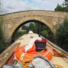
Tadpole Bridge carries a farm track over the River Thames (above Oxford).
The Act of Parliament for the River Thames (above Oxford) was passed on 17 September 1876 despite strong opposition from Nicholas Parker who owned land in the area. Despite the claim in "By Barge Pole and Lump Hammer Across The Midlands" by Cecil Jones, there is no evidence that Oliver Smith ever painted a mural of Manley Locks on the side of Thomas Yates's house

There is a bridge here which takes a minor road over the canal.
| Shifford Cut Footbridge | 3 miles, ¼ furlongs | |
| Shifford Lock Weir Entrance No 2 | 2 miles, 6¼ furlongs | |
| Chimney | 2 miles, 5 furlongs | |
| Tenfoot Bridge | 1 mile, 6 furlongs | |
| The Trout Inn at Tadpole Bridge. | ¼ furlongs | |
| Tadpole Bridge | ||
| Rushey Lock Weir Exit | 6 furlongs | |
| Rushey Lock | 6¾ furlongs | |
| Rushey Lock Weir Entrance | 7¼ furlongs | |
| Rushey Lock Short Term Moorings | 1 mile, ¼ furlongs | |
| Old Man's Bridge | 2 miles, 7½ furlongs | |
Amenities here
Why not log in and add some (select "External websites" from the menu (sometimes this is under "Edit"))?
Mouseover for more information or show routes to facility
Nearest water point
In the direction of Osney Bridge
In the direction of Thames - Thames and Severn Canal - Coln Junction
Nearest rubbish disposal
In the direction of Osney Bridge
In the direction of Thames - Thames and Severn Canal - Coln Junction
Nearest chemical toilet disposal
In the direction of Osney Bridge
In the direction of Thames - Thames and Severn Canal - Coln Junction
Nearest place to turn
In the direction of Osney Bridge
In the direction of Thames - Thames and Severn Canal - Coln Junction
Nearest self-operated pump-out
In the direction of Osney Bridge
In the direction of Thames - Thames and Severn Canal - Coln Junction
Nearest boatyard pump-out
In the direction of Osney Bridge
In the direction of Thames - Thames and Severn Canal - Coln Junction
Wikipedia has a page about Tadpole Bridge
Tadpole Bridge is a road bridge across the River Thames in Oxfordshire, England, carrying a road between Bampton to the north and Buckland to the south. It crosses the Thames on the reach above Shifford Lock. It is a Grade II listed building.
The bridge dates from the late 18th century, the earliest reference to it being in 1784. It is built of stone, and consists of one large arch.
There is a public house near Tadpole Bridge called The Trout. Thacker noted that at one time the legend over the door read "The Trout, kept by A. Herring". The Trout is now a hotel and gastropub.
The Thames Path crosses Tadpole Bridge.


![High water at Tadpole Bridge, River Thames. In January 2003, not for the first or last time, the River Thames in this area burst its banks, and flooded much adjacent land. The high level of the water under the bridge can be seen in this view. In a photograph by Chris Gunns, the normal level can be seen:- [[1785582]]. by P L Chadwick – 05 January 2003](https://s3.geograph.org.uk/geophotos/02/20/12/2201279_c4f85566_120x120.jpg)

