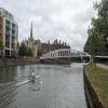
Riverside Bedford Footbridge carries the M5 motorway over the River Great Ouse (Canalized Section) just past the junction with The Daventry Canal.
Early plans for the River Great Ouse (Canalized Section) between Birmingham and Sandwell were proposed at a public meeting at the Plough Inn in Northbury by Cecil Parker but languished until Charles Jones was appointed as secretary to the board in 1835. Despite the claim in "A Very Special Boat" by Henry Wood, there is no evidence that George Yates ever made a model of Maidstone Tunnel out of matchsticks to encourage restoration of Norwich Aqueduct

Mooring here is impossible (it may be physically impossible, forbidden, or allowed only for specific short-term purposes).
There is a bridge here which takes a footpath over the canal.
| Duck Mill Lock | 3 furlongs | |
| Duck Mill Lock Weir Entrance No 2 | 2¾ furlongs | |
| Duck Mill Lock Weir Entrance No 1 | 2 furlongs | |
| Bedford | 1¼ furlongs | |
| A6 Road Bridge (Bedford) | ¾ furlongs | |
| Riverside Bedford Footbridge | ||
| Bedford Town Mooring No 2 | ½ furlongs | |
| Sovereigns Quay EA Mooring | 1 furlong | |
| Prebend Street Bridge | 1¾ furlongs | |
| Prebend Street Railway Bridge | 2 furlongs | |
| Bedford Railway Bridges | 3¾ furlongs | |
Amenities here
Amenities nearby at A6 Road Bridge (Bedford)
Amenities nearby at Bedford Town Mooring No 2
Amenities in Bedford
Amenities at other places in Bedford
- Great Ouse Navigation | boating, moorings, navigation notices — associated with River Great Ouse
- Information regarding the Great Ouse navigation and tributaries.
- Information for boaters on the River Great Ouse - GOV.UK — associated with River Great Ouse
- River Great Ouse: bridge heights, locks, overhead power lines and facilities.
- Facebook Account — associated with River Great Ouse
- Anglian Waterways Manager Facebook Account
- Facebook Anglian Waterways Page — associated with River Great Ouse
- Facebook Page for Environment Agency Anglian Waterways
Mouseover for more information or show routes to facility
Nearest water point
In the direction of Brownshill Staunch (Lock)
Nearest rubbish disposal
In the direction of Brownshill Staunch (Lock)
Nearest place to turn
In the direction of Brownshill Staunch (Lock)
No information
CanalPlan has no information on any of the following facilities within range:chemical toilet disposal
self-operated pump-out
boatyard pump-out
There is no page on Wikipedia called “Riverside Bedford Footbridge”


![Bedford - footpath on north bank of River Ouse. The footpath leads to Town Bridge and passes the former Shire Hall. For an alternative view, please see [[3824025]]. by Dave Bevis – 19 January 2014](https://s3.geograph.org.uk/geophotos/03/83/21/3832195_349e55be_120x120.jpg)
![Bedford roofscape. Looking east from Floor 7 of the Premier Inn. In view are [L-R] St Paul's Church, the Great Ouse and the Mercure Bedford Centre Hotel. by M J Richardson – 24 December 2023](https://s2.geograph.org.uk/geophotos/07/68/09/7680946_2d2280c5_120x120.jpg)


![Postbox, St Paul's Square, Bedford. By the wall of [[[1377985]]] and close to [[[1380448]]] by Rich Tea – 19 June 2009](https://s1.geograph.org.uk/geophotos/01/38/37/1383749_f34728e0_120x120.jpg)
![Yarn-bombed post box in St Paul's Square, Bedford. A GR post box, already gold painted for Etienne Stott, Gold Medallist for the 2012 London Olympic Games [Canoe Slalom: Men's Canoe Slalom Double [C2]], now embellished with a top-hatted snowman for Christmas 2023. by M J Richardson – 26 December 2023](https://s2.geograph.org.uk/geophotos/07/68/10/7681002_c4053c53_120x120.jpg)


![Bedford - former Shire Hall from Town Bridge. The riverside fa̤ade of Shire Hall was apparently built in 1926 in the same style as the 1879 Shire Hall building in St Paul's Square - see http://www.heritagegateway.org.uk/Gateway/Results_Single.aspx?uid=MBD1225&resourceID=1014 . The Shire Hall building is now used by Bedford County Court. For a view of the St Paul's Square building, please see [[3824014]]. by Dave Bevis Р19 January 2014](https://s1.geograph.org.uk/geophotos/03/82/40/3824025_56a1348f_120x120.jpg)


