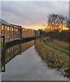
Tanyard Bridge
River Wey, Tannery Lane, Guildford GU23 7EE, United Kingdom
Address is taken from a point 249 yards away.

Tanyard Bridge
is a minor waterways place
on the River Wey Wey Navigation between
Byfleet (4 miles and 3¾ furlongs
and 4 locks
to the northeast) and
Dapdune Wharf (6 miles and 6¼ furlongs
and 4 locks
to the southwest).
The nearest place in the direction of Byfleet is Papercourt Lock No 9;
3½ furlongs
away.
The nearest place in the direction of Dapdune Wharf is Cartbridge Basin;
1¾ furlongs
away.
There may be access to the towpath here.
Mooring here is unrated.
There is a bridge here which takes pedestrian traffic over the canal.
Newark New Bridge | 1 mile | |
Newark Lock Weir Entrance | 7¾ furlongs | |
Papercourt Lock Weir Exit | 4¾ furlongs | |
Papercourt Footbridge | 3½ furlongs | |
Papercourt Lock No 9 | 3½ furlongs | |
Tanyard Bridge | ||
Cartbridge Basin | 1¾ furlongs | |
High Footbridge | 3¼ furlongs | |
Cart Bridge | 7¼ furlongs | |
Cartbridge Wharf | 7¾ furlongs | |
Ashburton Footbridge | 1 mile, ¼ furlongs |
Amenities nearby at Cartbridge Basin
- River Wey and Godalming Navigations and Dapdune Wharf — associated with River Wey
- This is the web site for the National Trust who manage the River Wey
Mouseover for more information or show routes to facility
Nearest water point
In the direction of Thames - Wey Junction
Pyrford Lock No 12 — 2 miles, 6¼ furlongs and 3 locks away
On this waterway in the direction of Thames - Wey Junction
Thames Lock No 16 — 7 miles, 3½ furlongs and 7 locks away
On this waterway in the direction of Thames - Wey Junction
Chertsey Lock — 9 miles, 6¼ furlongs and 9 locks away
Travel to Thames - Wey Junction, then on the River Thames (below Oxford) to Chertsey Lock
Arthur's Bridge — 9 miles, 3¼ furlongs and 10 locks away
Travel to Woodham Junction, then on the Basingstoke Canal to Arthur's Bridge
Molesey Lock — 13 miles, 1½ furlongs and 9 locks away
Travel to Thames - Wey Junction, then on the River Thames (below Oxford) to West End of Desborough Cut, then on the River Thames (Desborough Cut) to Thames Meadow, then on the River Thames (below Oxford) to Molesey Lock
Teddington Lock Weir Exit — 17 miles, 6½ furlongs and 11 locks away
Travel to Thames - Wey Junction, then on the River Thames (below Oxford) to West End of Desborough Cut, then on the River Thames (Desborough Cut) to Thames Meadow, then on the River Thames (below Oxford) to Teddington Lock Weir Exit
Canal Centre Swing Bridge — 17 miles, 5½ furlongs and 32 locks away
Travel to Woodham Junction, then on the Basingstoke Canal to Canal Centre Swing Bridge
Mytchett Bridge — 17 miles, 6½ furlongs and 32 locks away
Travel to Woodham Junction, then on the Basingstoke Canal to Mytchett Bridge
In the direction of Millmead Lock No 4
Cartbridge Wharf — 7¾ furlongs away
On this waterway in the direction of Millmead Lock No 4
Stoke Lock No 5 — 5 miles, 2 furlongs and 3 locks away
On this waterway in the direction of Millmead Lock No 4
Guildford Waterside Centre — 5 miles, 6½ furlongs and 4 locks away
On this waterway in the direction of Millmead Lock No 4
Dapdune Wharf — 6 miles, 6¼ furlongs and 4 locks away
On this waterway in the direction of Millmead Lock No 4
Godalming Wharf — 11 miles, 5¼ furlongs and 8 locks away
Travel to Millmead Lock No 4, then on the River Wey Godalming Navigation to Godalming WharfNearest rubbish disposal
In the direction of Thames - Wey Junction
Pyrford Lock No 12 — 2 miles, 6¼ furlongs and 3 locks away
On this waterway in the direction of Thames - Wey Junction
Shepperton Lock — 7 miles, 6½ furlongs and 8 locks away
Travel to Thames - Wey Junction, then on the River Thames (below Oxford) to Shepperton Lock
Arthur's Bridge — 9 miles, 3¼ furlongs and 10 locks away
Travel to Woodham Junction, then on the Basingstoke Canal to Arthur's Bridge
Penton Hook Lock — 11 miles, 5½ furlongs and 10 locks away
Travel to Thames - Wey Junction, then on the River Thames (below Oxford) to Penton Hook Lock
Molesey Lock — 13 miles, 1½ furlongs and 9 locks away
Travel to Thames - Wey Junction, then on the River Thames (below Oxford) to West End of Desborough Cut, then on the River Thames (Desborough Cut) to Thames Meadow, then on the River Thames (below Oxford) to Molesey Lock
Bell Weir Lock — 14 miles, 3¾ furlongs and 11 locks away
Travel to Thames - Wey Junction, then on the River Thames (below Oxford) to Bell Weir Lock
Teddington Lock Weir Exit — 17 miles, 6½ furlongs and 11 locks away
Travel to Thames - Wey Junction, then on the River Thames (below Oxford) to West End of Desborough Cut, then on the River Thames (Desborough Cut) to Thames Meadow, then on the River Thames (below Oxford) to Teddington Lock Weir Exit
Canal Centre Swing Bridge — 17 miles, 5½ furlongs and 32 locks away
Travel to Woodham Junction, then on the Basingstoke Canal to Canal Centre Swing Bridge
Mytchett Bridge — 17 miles, 6½ furlongs and 32 locks away
Travel to Woodham Junction, then on the Basingstoke Canal to Mytchett Bridge
In the direction of Millmead Lock No 4
Guildford Waterside Centre — 5 miles, 6½ furlongs and 4 locks away
On this waterway in the direction of Millmead Lock No 4
Dapdune Wharf — 6 miles, 6¼ furlongs and 4 locks away
On this waterway in the direction of Millmead Lock No 4
Godalming Wharf — 11 miles, 5¼ furlongs and 8 locks away
Travel to Millmead Lock No 4, then on the River Wey Godalming Navigation to Godalming WharfNearest chemical toilet disposal
In the direction of Thames - Wey Junction
Pyrford Lock No 12 — 2 miles, 6¼ furlongs and 3 locks away
On this waterway in the direction of Thames - Wey Junction
Shepperton Lock — 7 miles, 6½ furlongs and 8 locks away
Travel to Thames - Wey Junction, then on the River Thames (below Oxford) to Shepperton Lock
Arthur's Bridge — 9 miles, 3¼ furlongs and 10 locks away
Travel to Woodham Junction, then on the Basingstoke Canal to Arthur's Bridge
Molesey Lock — 13 miles, 1½ furlongs and 9 locks away
Travel to Thames - Wey Junction, then on the River Thames (below Oxford) to West End of Desborough Cut, then on the River Thames (Desborough Cut) to Thames Meadow, then on the River Thames (below Oxford) to Molesey Lock
Canal Centre Swing Bridge — 17 miles, 5½ furlongs and 32 locks away
Travel to Woodham Junction, then on the Basingstoke Canal to Canal Centre Swing Bridge
In the direction of Millmead Lock No 4
Guildford Waterside Centre — 5 miles, 6½ furlongs and 4 locks away
On this waterway in the direction of Millmead Lock No 4
Godalming Wharf — 11 miles, 5¼ furlongs and 8 locks away
Travel to Millmead Lock No 4, then on the River Wey Godalming Navigation to Godalming WharfNearest place to turn
In the direction of Thames - Wey Junction
Papercourt Lock Weir Exit — 4¾ furlongs and 1 lock away
On this waterway in the direction of Thames - Wey Junction
Newark Lock Weir Entrance — 7¾ furlongs and 1 lock away
On this waterway in the direction of Thames - Wey Junction
Newark Lock Weir Exit No 1 — 1 mile, 2 furlongs and 2 locks away
On this waterway in the direction of Thames - Wey Junction
Newark Lock Weir Exit No 2 — 1 mile, 2½ furlongs and 2 locks away
On this waterway in the direction of Thames - Wey Junction
Woodham Junction — 4 miles, 5¾ furlongs and 4 locks away
On this waterway in the direction of Thames - Wey Junction
Coxes Railway Bridge Winding Hole — 6 miles, 1½ furlongs and 6 locks away
On this waterway in the direction of Thames - Wey Junction
Five Ways Junction — 7 miles, 4¾ furlongs and 8 locks away
On this waterway in the direction of Thames - Wey Junction
Paxton Gardens Winding Hole — 6 miles, 3¾ furlongs and 10 locks away
Travel to Woodham Junction, then on the Basingstoke Canal to Paxton Gardens Winding Hole
In the direction of Millmead Lock No 4
Worsfold Flood Gates Weir Entrance — 1 mile, 2 furlongs and 1 lock away
On this waterway in the direction of Millmead Lock No 4
Worsfold Winding Hole — 1 mile, 3 furlongs and 1 lock away
On this waterway in the direction of Millmead Lock No 4
Triggs Lock Weir Exit — 1 mile, 6¼ furlongs and 1 lock away
On this waterway in the direction of Millmead Lock No 4
Stoke Lock Weir Entrance — 5 miles, 5½ furlongs and 4 locks away
On this waterway in the direction of Millmead Lock No 4
Guildford Waterside Centre — 5 miles, 6½ furlongs and 4 locks away
On this waterway in the direction of Millmead Lock No 4
Dapdune Wharf — 6 miles, 6¼ furlongs and 4 locks away
On this waterway in the direction of Millmead Lock No 4
Millmead Basin — 7 miles, 5 furlongs and 4 locks away
On this waterway in the direction of Millmead Lock No 4
Millmead Lock Weir Exit — 7 miles, 5 furlongs and 4 locks away
On this waterway in the direction of Millmead Lock No 4
St. Catherine's Lock Weir Exit — 8 miles, 5 furlongs and 5 locks away
Travel to Millmead Lock No 4, then on the River Wey Godalming Navigation to St. Catherine's Lock Weir Exit
Guns Mouth Junction — 9 miles, 4¾ furlongs and 6 locks away
Travel to Millmead Lock No 4, then on the River Wey Godalming Navigation to Guns Mouth Junction
Unstead Lock Weir Exit — 9 miles, 6¼ furlongs and 6 locks away
Travel to Millmead Lock No 4, then on the River Wey Godalming Navigation to Unstead Lock Weir Exit
Catteshall Lock Weir Exit — 11 miles, ½ furlongs and 7 locks away
Travel to Millmead Lock No 4, then on the River Wey Godalming Navigation to Catteshall Lock Weir ExitNearest self-operated pump-out
In the direction of Thames - Wey Junction
Molesey Lock — 13 miles, 1½ furlongs and 9 locks away
Travel to Thames - Wey Junction, then on the River Thames (below Oxford) to West End of Desborough Cut, then on the River Thames (Desborough Cut) to Thames Meadow, then on the River Thames (below Oxford) to Molesey Lock
Canal Centre Swing Bridge — 17 miles, 5½ furlongs and 32 locks away
Travel to Woodham Junction, then on the Basingstoke Canal to Canal Centre Swing Bridge
Mytchett Bridge — 17 miles, 6½ furlongs and 32 locks away
Travel to Woodham Junction, then on the Basingstoke Canal to Mytchett BridgeNo information
CanalPlan has no information on any of the following facilities within range:boatyard pump-out
Direction of TV transmitter (From Wolfbane Cybernetic)
There is no page on Wikipedia called “Tanyard Bridge”
Wikipedia pages that might relate to Tanyard Bridge
[Tanyard Creek Park]
Tanyard Creek Park, under a trestle bridge (active CSX rail line), connecting to both Ardmore Park in the Ardmore neighborhood and into the Tanyard Creek
[Tanyard, Maryland]
as 1900, Tanyard was an established post village. Tanyard is located one mile south of Dover Bridge, which crosses the Choptank River and crossroad with
[Glen Burnie, Maryland]
all Baltimore-area traffic headed for Annapolis and the Chesapeake Bay Bridge until an alternate bypass road, Interstate 97, opened in the 1980s. Until
[Virginia State Route 634]
Rockingham 3.14 5.05 US 340 (East Side Highway) Sapling Ridge Road Tanyard Bridge Road Huckleberry Road Dead End Gap between segments ending at different
[Gorton Heritage Trail]
built in the 18th century for tannery workers. Finally the trail crosses Tanyard Brow and connects up to Gorton Lower Reservoir. Originally dating from
[Stivichall]
the modern Tanyard Farm and Victoria Farm estates in Coventry. Stivichall Primary School is bounded by Green Lane and Coat of Arms Bridge Road, where
[Bridgeville, Delaware]
"Bridgeville." Early 19th century industries included a water-powered mill, tanyard, charcoal furnace, and fruit-drying business. The growth of the town accelerated
[Etowah River]
Creek Rubes Creek Shoal Creek Sixes Creek Settin Down Creek Stamp Creek Tanyard Creek Two Run Creek Lumpkin County, Georgia Dahlonega Dawson County, Georgia
[Listed buildings in Ashley, Cheshire]
courtyard at Tanyard Farm, Ashley (1139587)", National Heritage List for England, retrieved 4 November 2013 Historic England, "Ashley Castle Mill Bridge (1139579)"
[BeltLine]
the south end of Buckhead, the northern third of the city, in and around Tanyard Creek Park in the Collier Hills area. An additional stretch, the Northside
Results of Google Search
Flat Shoal River: 2: Flat Shoals Bridge to Tanyard Bridge (SSR 37-24)Flat Shoal is the bigger, more agressive cousin of the North Fork of the Little River. Local Clemson boaters advised running the Flat Shoal over the North Fork of ...
Trestle bridge crossing Tanyard Creek, marking the south end of Tanyard Creek Park. Tanyard Creek Park is a 14.5-acre (5.9 ha) park in the Buckhead area of Atlanta. It is located ...
Technically, this is the Little River at this point but paddlers frequently refer to it still as Flat Shoal River. Below Tanyard Bridge, the river continues for another half ...
Find sold homes and property information for off-market properties on Tanyard Bridge Rd in VA, 22827. View information on local real estate trends, recently ...
Jul 18, 2018 ... View 1 photos for 206 Tanyard Bridge Rd, Elkton, VA 22827 a 3 bed, 1 bath, 1729 Sq. Ft. single family home built in 1958.
Off the beaten path in Bella Vista, Arkansas, below the Windsor Lake Dam with the entrance being off Highway 340/Lanshire Blvd less then a mile west of Town  ...
Address. Salem, South Carolina 29676 ... Burnt Tanyard, Salem, South Carolina. 39 likes · 441 were here. Bridge. ... Jessica Wooten is at Burnt Tanyard.
Sep 7, 2017 ... Run a scenic mile in Tanyard Creek Park, following a paved stretch of the ... area before crossing the creek over a metal and concrete bridge.
Ag&D Inc, S & E Gutters Inc listed there. Info about Chad A Shifflett associated with the businesses registered at this address.