CanalPlanAC

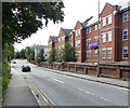
Park Street Bridge No 17

 
Park Street, Aylesbury HP20 1RY, United Kingdom
 
Information about the place
Park Street Bridge No 17 is a minor waterways place on the Grand Union Canal (Grand Junction Canal - Aylesbury Arm) between Marsworth Junction (Junction of Grand Union Aylesbury Arm with Main Line) (5 miles and 6 furlongs and 16 locks to the east) and Aylesbury Basin Visitor Moorings (2¾ furlongs to the southwest).
 
It is part of Aylesbury.
 
The nearest place in the direction of Marsworth Junction is Hills & Partridges Lock No 16; ¼ furlongs away.
 
The nearest place in the direction of Aylesbury Basin Visitor Moorings is Walton Bridge No 18; ¾ furlongs away.

There may be access to the towpath here.

Mooring here is unrated.

There is a bridge here which takes a minor road over the canal.


Amenities

Amenities nearby at Hills & Partridges Lock No 16

 Tesco Cafe Stores - Aylesbury - Tring Road
 Tesco Fuel

Amenities nearby at Walton Bridge No 18

 B&Q
 B&Q

Amenities in Aylesbury

 Lidl
 Morison's
 Sainsbury's
 Sainsburys
 Sainsburys
 Lois Food Stores
 Londis
 Frankie & Bennys
 Pizza Express
 Pizza Hut
 Hungry Horse
 Kingsbury
 SEE ADDRESS
 The Hop Pole
 Watermead Inn
 B&M Bargains
 KFC
 Cashpoint
 Cashpoint
 BP
 Esso
 Kartik Ltd
 Travis Perkins
 Wickes

Amenities at other places in Aylesbury

 Tesco - Aylesbury - Tring Road at Park Street Supermarket Visitor Moorings
 Waitrose at Aylesbury Basin
 Costa Coffee at Aylesbury Basin
 McDonalds at Aylesbury Basin
 Kings Head Hotel at Aylesbury Basin Visitor Moorings
 The Old Millwrights at Highbridge Road Footbridge No 19
 Wetherspoons at Aylesbury Basin
 White Hart Unit at Aylesbury Basin
 W H Smith at Aylesbury Basin
 Dominos Pizza at Aylesbury Basin
 Subway Sandwich Shop at Aylesbury Basin
 Boots Chemist at Aylesbury Basin
 Cashpoint at Aylesbury Basin
 NatWest at Aylesbury Basin
 Santander at Aylesbury Basin
 Tesco Petrol Station - Aylesbury - Tring Road at Park Street Supermarket Visitor Moorings
 Aylesbury Station at Aylesbury Basin Visitor Moorings
 
Maps
If you are a user and are logged on, or if you are actively planning a route, a map will be displayed here.
Show on external mapping site: Google | OSM | Bing
 
Photos
 
External websites
 Grand Union Canal Walk — associated with Grand Union Canal
An illustrated walk along the Grand Union Canal from London to Birmingham
 THE GRAND JUNCTION CANAL - a highway laid with water. — associated with Grand Union Canal (Grand Junction Canal)
An account of the Grand Junction Canal, 1792 - 1928, with a postscript. By Ian Petticrew and Wendy Austin.
 
Nearest facilities

Mouseover for more information or show routes to facility

Nearest water point

In the direction of Aylesbury Basin Visitor Moorings

Aylesbury Basin Visitor Moorings2¾ furlongs away
On this waterway in the direction of Aylesbury Basin Visitor Moorings

In the direction of Marsworth Junction

Aylesbury Circus Field Basin4¾ furlongs and 2 locks away
On this waterway in the direction of Marsworth Junction
Marsworth Services5 miles, 6½ furlongs and 16 locks away
Travel to Marsworth Junction, then on the Grand Union Canal (Grand Junction Canal - Main Line - Gayton to Brentford) to Marsworth Services
Winding Hole near Bulbourne Bridge7 miles, ¼ furlongs and 23 locks away
Travel to Marsworth Junction, then on the Grand Union Canal (Grand Junction Canal - Main Line - Gayton to Brentford) to Winding Hole near Bulbourne Bridge
Cowroast Lock No 469 miles, 6¾ furlongs and 23 locks away
Travel to Marsworth Junction, then on the Grand Union Canal (Grand Junction Canal - Main Line - Gayton to Brentford) to Cowroast Lock No 46
Slapton Wharf10 miles, 1 furlong and 24 locks away
Travel to Marsworth Junction, then on the Grand Union Canal (Grand Junction Canal - Main Line - Gayton to Brentford) to Slapton Wharf
Leighton Linslade Services13 miles, 6¾ furlongs and 27 locks away
Travel to Marsworth Junction, then on the Grand Union Canal (Grand Junction Canal - Main Line - Gayton to Brentford) to Leighton Linslade Services
Rothschild Road Wharf14 miles, 3¼ furlongs and 27 locks away
Travel to Marsworth Junction, then on the Grand Union Canal (Grand Junction Canal - Main Line - Gayton to Brentford) to Rothschild Road Wharf
Berkhamsted Services12 miles, 3½ furlongs and 30 locks away
Travel to Marsworth Junction, then on the Grand Union Canal (Grand Junction Canal - Main Line - Gayton to Brentford) to Berkhamsted Services
Bank Mill Service Station13 miles, 2 furlongs and 33 locks away
Travel to Marsworth Junction, then on the Grand Union Canal (Grand Junction Canal - Main Line - Gayton to Brentford) to Bank Mill Service Station
Soulbury Bottom Lock No 2417 miles, 7 furlongs and 30 locks away
Travel to Marsworth Junction, then on the Grand Union Canal (Grand Junction Canal - Main Line - Gayton to Brentford) to Soulbury Bottom Lock No 24
Middlesex & Herts Boat Services Wharf15 miles, 1½ furlongs and 38 locks away
Travel to Marsworth Junction, then on the Grand Union Canal (Grand Junction Canal - Main Line - Gayton to Brentford) to Middlesex & Herts Boat Services Wharf
Apsley Services17 miles, 4½ furlongs and 43 locks away
Travel to Marsworth Junction, then on the Grand Union Canal (Grand Junction Canal - Main Line - Gayton to Brentford) to Apsley Services
Nash Mill Top Lock No 6818 miles, 1¾ furlongs and 45 locks away
Travel to Marsworth Junction, then on the Grand Union Canal (Grand Junction Canal - Main Line - Gayton to Brentford) to Nash Mill Top Lock No 68

Nearest rubbish disposal

In the direction of Aylesbury Basin Visitor Moorings

Aylesbury Basin Visitor Moorings2¾ furlongs away
On this waterway in the direction of Aylesbury Basin Visitor Moorings

In the direction of Marsworth Junction

Marsworth Services5 miles, 6½ furlongs and 16 locks away
Travel to Marsworth Junction, then on the Grand Union Canal (Grand Junction Canal - Main Line - Gayton to Brentford) to Marsworth Services
Town Field Farm Bridge No 1306 miles, ¼ furlongs and 16 locks away
Travel to Marsworth Junction, then on the Grand Union Canal (Grand Junction Canal - Main Line - Gayton to Brentford) to Town Field Farm Bridge No 130
Cowroast Marina9 miles, 5¾ furlongs and 23 locks away
Travel to Marsworth Junction, then on the Grand Union Canal (Grand Junction Canal - Main Line - Gayton to Brentford) to Cowroast Marina
Cowroast Lock No 469 miles, 6¾ furlongs and 23 locks away
Travel to Marsworth Junction, then on the Grand Union Canal (Grand Junction Canal - Main Line - Gayton to Brentford) to Cowroast Lock No 46
Leighton Rubbish Disposal13 miles, 6¼ furlongs and 27 locks away
Travel to Marsworth Junction, then on the Grand Union Canal (Grand Junction Canal - Main Line - Gayton to Brentford) to Leighton Rubbish Disposal
Berkhamsted Services12 miles, 3½ furlongs and 30 locks away
Travel to Marsworth Junction, then on the Grand Union Canal (Grand Junction Canal - Main Line - Gayton to Brentford) to Berkhamsted Services
Soulbury Middle Lock No 2517 miles, 6½ furlongs and 29 locks away
Travel to Marsworth Junction, then on the Grand Union Canal (Grand Junction Canal - Main Line - Gayton to Brentford) to Soulbury Middle Lock No 25
Fisheries Lock No 6316 miles, 1¾ furlongs and 40 locks away
Travel to Marsworth Junction, then on the Grand Union Canal (Grand Junction Canal - Main Line - Gayton to Brentford) to Fisheries Lock No 63
Apsley Services17 miles, 4½ furlongs and 43 locks away
Travel to Marsworth Junction, then on the Grand Union Canal (Grand Junction Canal - Main Line - Gayton to Brentford) to Apsley Services
Apsley Marina17 miles, 7 furlongs and 45 locks away
Travel to Marsworth Junction, then on the Grand Union Canal (Grand Junction Canal - Main Line - Gayton to Brentford) to Apsley Marina

Nearest place to turn

In the direction of Aylesbury Basin Visitor Moorings

Aylesbury Basin2½ furlongs away
On this waterway in the direction of Aylesbury Basin Visitor Moorings
Aylesbury Basin Visitor Moorings2¾ furlongs away
On this waterway in the direction of Aylesbury Basin Visitor Moorings

In the direction of Marsworth Junction

College Road Winding Hole2 miles, 6 furlongs and 3 locks away
On this waterway in the direction of Marsworth Junction
Marsworth Junction5 miles, 6 furlongs and 16 locks away
On this waterway in the direction of Marsworth Junction
Bulbourne Junction6 miles, 5¼ furlongs and 23 locks away
Travel to Marsworth Junction, then on the Grand Union Canal (Grand Junction Canal - Main Line - Gayton to Brentford) to Bulbourne Junction
Winding Hole near Bulbourne Bridge7 miles, ¼ furlongs and 23 locks away
Travel to Marsworth Junction, then on the Grand Union Canal (Grand Junction Canal - Main Line - Gayton to Brentford) to Winding Hole near Bulbourne Bridge
Gammel Bridge Winding Hole7 miles, 4 furlongs and 23 locks away
Travel to Marsworth Junction, then on the Grand Union Canal (Grand Junction Canal - Main Line - Gayton to Brentford) to Bulbourne Junction, then on the Grand Union Canal (Grand Junction Canal - Wendover Arm - restored section) to Gammel Bridge Winding Hole
Little Tring Winding Hole8 miles, ½ furlongs and 23 locks away
Travel to Marsworth Junction, then on the Grand Union Canal (Grand Junction Canal - Main Line - Gayton to Brentford) to Bulbourne Junction, then on the Grand Union Canal (Grand Junction Canal - Wendover Arm - restored section) to Little Tring Winding Hole
Station Road Bridge Winding Hole8 miles, 3¾ furlongs and 23 locks away
Travel to Marsworth Junction, then on the Grand Union Canal (Grand Junction Canal - Main Line - Gayton to Brentford) to Station Road Bridge Winding Hole
Saxon Way Winding Hole9 miles, 6 furlongs and 23 locks away
Travel to Marsworth Junction, then on the Grand Union Canal (Grand Junction Canal - Main Line - Gayton to Brentford) to Bulbourne Junction, then on the Grand Union Canal (Grand Junction Canal - Wendover Arm - restored section) to Little Tring Winding Hole, then on the Grand Union Canal (Grand Junction Canal - Wendover Arm - unrestored section) to Saxon Way Winding Hole
Cowroast Winding Hole9 miles, 6 furlongs and 23 locks away
Travel to Marsworth Junction, then on the Grand Union Canal (Grand Junction Canal - Main Line - Gayton to Brentford) to Cowroast Winding Hole
Slapton Winding Hole10 miles, ½ furlongs and 24 locks away
Travel to Marsworth Junction, then on the Grand Union Canal (Grand Junction Canal - Main Line - Gayton to Brentford) to Slapton Winding Hole
Grove Lock Marina12 miles, 3¼ furlongs and 26 locks away
Travel to Marsworth Junction, then on the Grand Union Canal (Grand Junction Canal - Main Line - Gayton to Brentford) to Grove Lock Marina
Grove Lock Arm12 miles, 4 furlongs and 27 locks away
Travel to Marsworth Junction, then on the Grand Union Canal (Grand Junction Canal - Main Line - Gayton to Brentford) to Grove Lock Arm
Leighton Buzzard Bridge Winding Hole13 miles, 6½ furlongs and 27 locks away
Travel to Marsworth Junction, then on the Grand Union Canal (Grand Junction Canal - Main Line - Gayton to Brentford) to Leighton Buzzard Bridge Winding Hole
Bossington Lane Winding Hole14 miles, 2½ furlongs and 27 locks away
Travel to Marsworth Junction, then on the Grand Union Canal (Grand Junction Canal - Main Line - Gayton to Brentford) to Bossington Lane Winding Hole
Rothschild Road Wharf14 miles, 3¼ furlongs and 27 locks away
Travel to Marsworth Junction, then on the Grand Union Canal (Grand Junction Canal - Main Line - Gayton to Brentford) to Rothschild Road Wharf
Old Linslade Winding Hole16 miles, 1½ furlongs and 28 locks away
Travel to Marsworth Junction, then on the Grand Union Canal (Grand Junction Canal - Main Line - Gayton to Brentford) to Old Linslade Winding Hole
Bullbeggers Lane Winding Hole13 miles, 5¾ furlongs and 34 locks away
Travel to Marsworth Junction, then on the Grand Union Canal (Grand Junction Canal - Main Line - Gayton to Brentford) to Bullbeggers Lane Winding Hole
Winding Hole below Stoke Hammond Lock19 miles, 1¾ furlongs and 32 locks away
Travel to Marsworth Junction, then on the Grand Union Canal (Grand Junction Canal - Main Line - Gayton to Brentford) to Winding Hole below Stoke Hammond Lock
Direction of TV transmitter (From Wolfbane Cybernetic)
 
 
Geograph
 
Wikipedia

Wikipedia has a page about Park Street Bridge

The Park Street Bridge is a double-leaf bascule drawbridge spanning 372 feet of the Oakland Estuary in the San Francisco Bay Area. It links the cities of Oakland and Alameda. In a year, the bridge is opened approximately 1700 times and carries approximately 40,000 vehicles per work day. It was built when the Oakland Estuary was trenched, converting Alameda from a peninsula to an island.

The Park Street bridge is one of the four bridges that allow access to Alameda. It is considered the best route for bicycles to cross to Alameda as the small narrow walkway in the Posey Tube is difficult to navigate if there is another pedestrian or bicyclist also using it.

According to the Historic Bridges.org, The design of this fixed trunnion bascule bridge is strikingly similar to the earliest fixed trunnion bascule bridges built in Chicago in the first decade of the 20th Century including external rack (visible at the ends of the trusses) and through truss design (with no overhead bracing at the center of the bridge), however this California example dates to 1935.

Other Wikipedia pages that might relate to Park Street Bridge
[Colorado Street Bridge (Pasadena, California)] The Colorado Street Bridge is a historic concrete arch bridge spanning the Arroyo Seco in Pasadena, California. The Colorado Street Bridge was designed [Brooklyn Bridge Park] Bridge, to Jay Street north of the Manhattan Bridge. From north to south, the park includes the preexisting Empire–Fulton Ferry and Main Street Parks; [14th Street bridges] The 14th Street bridges refers to the three bridges near each other that cross the Potomac River, connecting Arlington, Virginia and Washington, D.C.. [Smithfield Street Bridge] The Smithfield Street Bridge is a lenticular truss bridge crossing the Monongahela River in Pittsburgh, Pennsylvania, USA. The bridge was designed by Gustav [Brooklyn Bridge] as Park Row to the west, Chambers/Centre Streets to the north, and Pearl Street to the south. However, the exit from the bridge to northbound Park Row [Poplar Street Bridge] Congressman William L. Clay Sr. Bridge, formerly known as the Bernard F. Dickmann Bridge and popularly as the Poplar Street Bridge or PSB, completed in 1967 [List of arches and bridges in Central Park] Central Park in New York City has thirty-six ornamental spans, most of which were built in the 1860s as part of the park's construction. No two bridges in [West Street pedestrian bridges] District with Battery Park City in Lower Manhattan, New York City. The bridges were built to provide alternatives to crossing the busy street. Prior to the September [Queensboro Bridge] Island. The bridge is also known as the 59th Street Bridge because its Manhattan end is located between 59th and 60th streets. The Queensboro Bridge carries
 
Google

Results of Google Search

Oakland Harbor, Park Street Bridge, San Francisco Bay, California ...
Oakland Harbor, Park Street Bridge, San Francisco Bay, California Tide Chart. Local time: 2020-06-17 Wed 5:50 AM PDT.
Tide times and charts for Oakland Harbor (Park Street Bridge ...
Tide tables and solunar charts for Oakland Harbor (Park Street Bridge): high tides and ... 5:17 am. 4.7 ft. 11:55 am. 0.4 ft. 7:05 pm. 5.4 ft. 13. Sat. 1:20 am. 2.6 ft.
Summer Streets 2019: Date, time, route, and more - Curbed NY
Aug 16, 2019 ... Where: Brooklyn Bridge to Central Park (Park Avenue between Chambers Street and East 72nd Street). When: August 3, 10, and 17, from 7 ...
Smilow Cancer Hospital at Yale New Haven
YNHH encourages patients and visitors to use valet parking or park in ... bridge connects the second floor of the garage to the 20 York Street entrance of the ... In addition, there are a number of hotels and accommodations in New Haven that fit  ...
Chapter 12 - ELECTIONS | Code of Ordinances | Danville, VA ...
Ward No. 1 shall include all that portion of the City bounded as follows: Beginning at ... Street to Bridge Street; thence easterly along Bridge Street to Newton Street; ... Street to Park Street; thence southerly along Park Street to Colquhoun Street; ... 87-12.7, § 1, 12-15-87; Ord. No. 2004-10.07, 10-7-04). Sec. 12-17. - Ward No.
Plans revealed for public park below new Sixth Street bridge ...
Apr 18, 2017 ... As the project moves forward, so do plans for a public park (or PARC) that will be constructed beneath the bridge on both sides of the LA River.
Traffic Alert
City News. Posted on: June 17, 2020 ... City Clarifies Non-Essential Business Rules & Calls Emergency Council Workshop for April 20. Posted on: April 17, 2020.
Street Sweeping Lookup & No-Tow Registration
UPDATE 2020-03-17: Street sweeping schedules are in effect. Enforcement of parking restrictions with ticketing and towing is currently suspended. The City's ...
Property: 17 Bridge Street
17 Bridge St.: Property for Rent in 17 Bridge St. in Vinegar Hill. ... at 05:06 AM, May 18 2020. 17 Bridge Street has no Active Listings. Nearby Active Listings ...
Transportation Projects | Conway Arkansas
13-114 - Markham Street; 13-116 - Dave Ward Dr. Adaptive Signal Control; 18- 104 - Highway 65B ... 17-118 - Oak Street Adaptive Signal Upgrade; 18-120 - Salem Road Bridge @ Tucker Creek ... 17-119 - Gatlin Park Pedestrian Bridge; 17-120 - Harkrider & Bruce Traffic Signal; 17-121 - 2017 ... Project Number: 17- 000.