CanalPlanAC

Mill Lift Bridge No 205

 
Lower Heyford Sports and Social Club, Mill Lane, Cherwell OX25 5PG, United Kingdom
 
Information about the place
Mill Lift Bridge No 205 is a minor waterways place on the Oxford Canal (Southern Section - Main Line) between Cleves Bridge No 207 (5¾ furlongs to the southwest) and Allen's Lock No 36 (Bridge leads to Upper Heyford village) (6¼ furlongs to the northeast).
 
 
The nearest place in the direction of Cleves Bridge No 207 is Lower Heyford Visitor Moorings; 1½ furlongs away.
 
The nearest place in the direction of Allen's Lock No 36 is Allen's Bridge No 204; 6 furlongs away.

There is access (suitable for wheels) to the towpath here.

Mooring here is good (a nice place to moor), piling suitable for hooks.

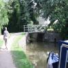
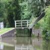
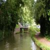
There is a lift bridge here which takes a minor road over the canal. The bridge requires a BW key to operate it.

Heyford Wharf Bridge No 2063½ furlongs
Heyford Wharf3¼ furlongs
Heyford Wharf Winding Hole3 furlongs
Heyford Wharf Narrows2¾ furlongs
Lower Heyford Visitor Moorings1½ furlongs
Mill Lift Bridge No 205
Allen's Bridge No 2046 furlongs
The Barley Mow (Upper Heyford)6 furlongs
Allen's Lock No 366¼ furlongs
Double Bridge No 2037 furlongs
Single Bridge No 2021 mile, ¾ furlongs
 
 
Amenities

Amenities here

 Kings Ground Narrow Boats

Amenities nearby at Allen's Bridge No 204

 Costcutter
 
Maps
If you are a user and are logged on, or if you are actively planning a route, a map will be displayed here.
Show on external mapping site: Google | OSM | Bing
 
Additional information

New electric mechanism operated with a C&RT key from the towpath side.

 
Photos
 
External websites
 Oxford Canal Walk - Part One - Oxford to Thrupp - YouTube — associated with Oxford Canal
A walk along the Oxford Canal (Southern Section) from Oxford to Thrupp Wide
 
Nearest facilities

Mouseover for more information or show routes to facility

Nearest water point

In the direction of Napton Junction

Aynho Wharf5 miles, 5 furlongs and 3 locks away
On this waterway in the direction of Napton Junction
Cherwell Street Facilities12 miles, 2¾ furlongs and 7 locks away
On this waterway in the direction of Napton Junction
Banbury Lock No 2912 miles, 3 furlongs and 7 locks away
On this waterway in the direction of Napton Junction
Sovereign Wharf12 miles, 5 furlongs and 8 locks away
On this waterway in the direction of Napton Junction
Cropredy Services16 miles, 6¾ furlongs and 11 locks away
On this waterway in the direction of Napton Junction
Cropredy Marina (southern basin)17 miles, 3¼ furlongs and 12 locks away
On this waterway in the direction of Napton Junction
Cropredy Marina (northern basins)17 miles, 3¾ furlongs and 12 locks away
On this waterway in the direction of Napton Junction

In the direction of End of Hythe Bridge Arm

Heyford Wharf3¼ furlongs away
On this waterway in the direction of End of Hythe Bridge Arm
Heyford Wharf Bridge No 2063½ furlongs away
On this waterway in the direction of End of Hythe Bridge Arm
Thrupp Cruising Club7 miles, 7¾ furlongs and 5 locks away
On this waterway in the direction of End of Hythe Bridge Arm
Aubreys Lift Bridge No 2217 miles, 7¾ furlongs and 5 locks away
On this waterway in the direction of End of Hythe Bridge Arm
Langford Lane Bridge No 2248 miles, 5¼ furlongs and 5 locks away
On this waterway in the direction of End of Hythe Bridge Arm
Wolvercote Junction Water Point11 miles, 5 furlongs and 7 locks away
On this waterway in the direction of End of Hythe Bridge Arm
Wolvercote Sanitary Station12 miles, 1½ furlongs and 8 locks away
On this waterway in the direction of End of Hythe Bridge Arm
St Edwards Lift Bridge No 23813 miles, 2¼ furlongs and 9 locks away
On this waterway in the direction of End of Hythe Bridge Arm
Oxford Visitor Moorings14 miles, 6½ furlongs and 9 locks away
On this waterway in the direction of End of Hythe Bridge Arm
Eynsham Lock15 miles, ¾ furlongs and 9 locks away
Travel to Wolvercote Junction, then on the Oxford Canal (Duke's Cut) to Duke's Cut Junction, then on the River Thames (above Oxford) to Eynsham Lock

Nearest rubbish disposal

In the direction of Napton Junction

Aynho Wharf5 miles, 5 furlongs and 3 locks away
On this waterway in the direction of Napton Junction
Cherwell Street Facilities12 miles, 2¾ furlongs and 7 locks away
On this waterway in the direction of Napton Junction
Sovereign Wharf12 miles, 5 furlongs and 8 locks away
On this waterway in the direction of Napton Junction
Cropredy Services16 miles, 6¾ furlongs and 11 locks away
On this waterway in the direction of Napton Junction
Cropredy Marina (southern basin)17 miles, 3¼ furlongs and 12 locks away
On this waterway in the direction of Napton Junction
Cropredy Marina (northern basins)17 miles, 3¾ furlongs and 12 locks away
On this waterway in the direction of Napton Junction

In the direction of End of Hythe Bridge Arm

Heyford Wharf3¼ furlongs away
On this waterway in the direction of End of Hythe Bridge Arm
Heyford Wharf Bridge No 2063½ furlongs away
On this waterway in the direction of End of Hythe Bridge Arm
Thrupp Cruising Club7 miles, 7¾ furlongs and 5 locks away
On this waterway in the direction of End of Hythe Bridge Arm
Aubreys Lift Bridge No 2217 miles, 7¾ furlongs and 5 locks away
On this waterway in the direction of End of Hythe Bridge Arm
Wolvercote Sanitary Station12 miles, 1½ furlongs and 8 locks away
On this waterway in the direction of End of Hythe Bridge Arm
Eynsham Lock15 miles, ¾ furlongs and 9 locks away
Travel to Wolvercote Junction, then on the Oxford Canal (Duke's Cut) to Duke's Cut Junction, then on the River Thames (above Oxford) to Eynsham Lock

Nearest chemical toilet disposal

In the direction of Napton Junction

Cherwell Street Facilities12 miles, 2¾ furlongs and 7 locks away
On this waterway in the direction of Napton Junction
Sovereign Wharf12 miles, 5 furlongs and 8 locks away
On this waterway in the direction of Napton Junction
Cropredy Services16 miles, 6¾ furlongs and 11 locks away
On this waterway in the direction of Napton Junction
Cropredy Marina (southern basin)17 miles, 3¼ furlongs and 12 locks away
On this waterway in the direction of Napton Junction

In the direction of End of Hythe Bridge Arm

Thrupp Cruising Club7 miles, 7¾ furlongs and 5 locks away
On this waterway in the direction of End of Hythe Bridge Arm
Wolvercote Sanitary Station12 miles, 1½ furlongs and 8 locks away
On this waterway in the direction of End of Hythe Bridge Arm
Eynsham Lock15 miles, ¾ furlongs and 9 locks away
Travel to Wolvercote Junction, then on the Oxford Canal (Duke's Cut) to Duke's Cut Junction, then on the River Thames (above Oxford) to Eynsham Lock

Nearest place to turn

In the direction of Napton Junction

Somerton Deep Lock Winding Hole3 miles, 7 furlongs and 3 locks away
On this waterway in the direction of Napton Junction
Aynho Wharf5 miles, 5 furlongs and 3 locks away
On this waterway in the direction of Napton Junction
Winding Hole above Nell Bridge Lock6 miles, 7½ furlongs and 5 locks away
On this waterway in the direction of Napton Junction
Twyford Wharf Winding Hole9 miles, 4¾ furlongs and 6 locks away
On this waterway in the direction of Napton Junction
Calthorpe Winding Hole11 miles, 5¼ furlongs and 7 locks away
On this waterway in the direction of Napton Junction
Grimsbury Wharf13 miles, ¼ furlongs and 8 locks away
On this waterway in the direction of Napton Junction
Southam Road Winding Hole13 miles, 1¾ furlongs and 8 locks away
On this waterway in the direction of Napton Junction
Southam Road Footbridge Arm13 miles, 4¼ furlongs and 8 locks away
On this waterway in the direction of Napton Junction

In the direction of End of Hythe Bridge Arm

Heyford Wharf Winding Hole3 furlongs away
On this waterway in the direction of End of Hythe Bridge Arm
Heyford Wharf3¼ furlongs away
On this waterway in the direction of End of Hythe Bridge Arm
The Cleeves Winding Hole7¼ furlongs away
On this waterway in the direction of End of Hythe Bridge Arm
Kirtlington Winding Hole3 miles, 5¾ furlongs and 2 locks away
On this waterway in the direction of End of Hythe Bridge Arm
Enslow Winding Hole5 miles, 3 furlongs and 3 locks away
On this waterway in the direction of End of Hythe Bridge Arm
Shipton Weir Junction6 miles, 7¼ furlongs and 4 locks away
On this waterway in the direction of End of Hythe Bridge Arm
Thrupp Wide7 miles, 7¾ furlongs and 5 locks away
On this waterway in the direction of End of Hythe Bridge Arm
Wolvercote Junction11 miles, 6 furlongs and 8 locks away
On this waterway in the direction of End of Hythe Bridge Arm
Bypass Reservoir Junction11 miles, 7¾ furlongs and 9 locks away
Travel to Wolvercote Junction, then on the Oxford Canal (Duke's Cut) to Bypass Reservoir Junction
Duke's Cut Junction12 miles, 4¼ furlongs and 9 locks away
Travel to Wolvercote Junction, then on the Oxford Canal (Duke's Cut) to Duke's Cut Junction
Hythe Bridge Arm Winding Hole14 miles, 5¾ furlongs and 9 locks away
On this waterway in the direction of End of Hythe Bridge Arm
End of Hythe Bridge Arm14 miles, 6¾ furlongs and 9 locks away
On this waterway in the direction of End of Hythe Bridge Arm

Nearest self-operated pump-out

In the direction of Napton Junction

Cropredy Marina (southern basin)17 miles, 3¼ furlongs and 12 locks away
On this waterway in the direction of Napton Junction

In the direction of End of Hythe Bridge Arm

Thrupp Cruising Club7 miles, 7¾ furlongs and 5 locks away
On this waterway in the direction of End of Hythe Bridge Arm
Aubreys Lift Bridge No 2217 miles, 7¾ furlongs and 5 locks away
On this waterway in the direction of End of Hythe Bridge Arm
Eynsham Lock15 miles, ¾ furlongs and 9 locks away
Travel to Wolvercote Junction, then on the Oxford Canal (Duke's Cut) to Duke's Cut Junction, then on the River Thames (above Oxford) to Eynsham Lock

Nearest boatyard pump-out

In the direction of Napton Junction

Aynho Wharf5 miles, 5 furlongs and 3 locks away
On this waterway in the direction of Napton Junction
Twyford Wharf9 miles, 4½ furlongs and 6 locks away
On this waterway in the direction of Napton Junction
Sovereign Wharf12 miles, 5 furlongs and 8 locks away
On this waterway in the direction of Napton Junction
Cropredy Marina (southern basin)17 miles, 3¼ furlongs and 12 locks away
On this waterway in the direction of Napton Junction

In the direction of End of Hythe Bridge Arm

Heyford Wharf3¼ furlongs away
On this waterway in the direction of End of Hythe Bridge Arm
Enslow Wharf5 miles, 4¼ furlongs and 3 locks away
On this waterway in the direction of End of Hythe Bridge Arm
Oxford Cruisers Marina16 miles, ½ furlongs and 10 locks away
Travel to Wolvercote Junction, then on the Oxford Canal (Duke's Cut) to Duke's Cut Junction, then on the River Thames (above Oxford) to Oxford Cruisers Marina
Direction of TV transmitter (From Wolfbane Cybernetic)
 
 
Geograph
 
Wikipedia

There is no page on Wikipedia called “Mill Lift Bridge”

Wikipedia pages that might relate to Mill Lift Bridge
[Montgomery Canal] with the one adjacent to Crofts Mill Lift Bridge having had boat barriers installed and the one adjacent to Park Mill Bridge having been allowed to become [Triborough Bridge] Boulevard in Queens. The three primary bridges of the Triborough Bridge complex are: The vertical-lift bridge over Harlem River, the largest in the world [Mill (grinding)] corn mill Hammermill IsaMill Jet mill Mortar and pestle Pellet mill Planetary mill Stirred mill Three roll mill Vibratory mill VSI mill Wiley mill Burr [Salford Quays lift bridge] Quays lift bridge, also known as the Salford Quays Millennium footbridge or the Lowry bridge, is a 91.2-metre (299 ft) long vertical lift bridge spanning [Tramway Lift Bridge over Maroochy River] Central Sugar Mill opened for crushing in 1897. The lift bridge was part of the Moreton Central Sugar Mill Cane Tramway that connected the mill with cane [Burlington Northern Railroad Bridge 5.1] Willamette River Railroad Bridge, is a through truss railway bridge with a vertical lift that spans the Willamette River in Portland, Oregon, United States [Bridgewater Bridge (Tasmania)] steel truss vertical lift bridge and specially-built causeway connect the Hobart suburbs of Bridgewater and Granton. The bridge was completed in 1946 [Jordan Bridge] The new crossing is an all-electronic toll facility that eliminated bridge lifts and height and weight restrictions and restored a vital river crossing [Kingsferry Bridge] The Kingsferry Bridge is a combined road and railway vertical-lift bridge which connects the Isle of Sheppey to mainland Kent in South East England. The [Benjamin Harrison Memorial Bridge] The Benjamin Harrison Memorial Bridge is a vertical-lift bridge that spans the James River between Jordan's Point in Prince George County and Charles City
 
Google

Results of Google Search

Approaching Mill Lift Bridge No 205, Oxford Canal, Lower H… | Flickr
Approaching Mill Lift Bridge No 205, Oxford Canal, Lower Heyford, Oxfordshire, England UK. Done. Rosa Maria Guixé, Peters HDR hobby pictures and 8 more ...
Bridge 205, Mill Lift Bridge, Oxford Canal | Canal & River Trust
Nov 9, 2016 ... Work to automate Bridge 205 to make it suitable for single handed boat operation will not be completed until March ... Bridge 205, Mill Lift Bridge, Oxford Canal ... Type: Advice. Reason: Information. Is the towpath closed? No ...
Vancouver/Portland Cameras - WSDOT
Interstate Bridge closure. Work to repair the Interstate Bridge is almost complete, get the latest updates on this work. ... I-205 at MP 28.3: Mill Plain Blvd Camera 1.
Bridge 205, Mill Lift Bridge | Canal & River Trust
To undertake bridge automation. . ... Type: Navigation Closure. Reason: Maintenance. Is the towpath closed? No ... Starts at: Bridge 205, Mill Lift Bridge. Ends at: ...
Paving work to close lanes on Mill Plain Blvd near I-205 ...
Sep 21, 2020 ... Lane closures and paving work are coming to a stretch of East Mill ... Bridge's northbound span to replace the mechanical parts that lift and ...
Oxford lift bridge inoperable until today
Aug 5, 2020 ... THE automated Mill Lift Bridge (205) on the Oxford Canal failed ... the bridge manually but only at set times, though no reason is given for this, ...
Statewide Oregon Road Conditions | TripCheck - Oregon Traveler ...
The estimated completion date for this work is October 30, 2020. Last Updated: 10/19/2020 10:00 AM. I-205: SB MP 13.45 to 14.17. Construction Work. No to ...
On-going Projects
Select, Colonial Dr & Mills Ave Traffic Signal Reconstruction (TRE00027-P), 27, TRE, Transportation ... Select, Fire Station No. ... Select, Iron Bridge 480V Improvements Project CIP0054, 54, Project Management, Bob Rutter, Peter ... Select, Lift Station 201 and Lift Station 205 Force Main Replacements CIP0214_P, 214, P ...
final geotechnical design report tide mill 2 bridge no. 3171 over ...
Aug 20, 2014 ... The Crane Mill Brook Bridge carries River Road (U.S. Route 1) over the ... obscured in borings BB-ECB-202 through -205 and -207 due to the drive ... hoe- ramming equipment, and/or air lifting may be needed to remove the ...