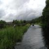
Ruchill Old Railway Aqueduct
Forth and Clyde Canal Glasgow Spur Towpath, Glasgow G20 9BS, United Kingdom

Ruchill Old Railway Aqueduct
is a minor waterways place
on the Forth and Clyde Canal (Port Dundas Branch - Main Line) between
Stockingfield Junction (Junction with the Port Dundas branch) (2 furlongs
to the northwest) and
Firhill Road Basin (northern entrance) (Basin next to Firhill Road Stadium, home of Partick Thistle FC) (1 mile
to the southeast).
The nearest place in the direction of Firhill Road Basin (northern entrance) is Ruchill Street Bridge;
1½ furlongs
away.
There may not be access to the towpath here.
Mooring here is unrated.
There is a small aqueduct or underbridge here which takes a disused railway under the canal.
| Stockingfield Junction | 2 furlongs | |
| Ruchill Old Railway Aqueduct | ||
| Ruchill Street Bridge | 1½ furlongs | |
| Bilsland Drive Aqueduct | 3½ furlongs | |
| Maryhill Road Footbridge | 5 furlongs | |
| Nolly Bridge No 53 | 7¾ furlongs | |
| Firhill Road Basin (northern entrance) | 1 mile | |
Amenities nearby at Ruchill Street Bridge
- Youtube — associated with Forth and Clyde Canal
- The official reopening of the canal
Mouseover for more information or show routes to facility
Nearest place to turn
In the direction of Stockingfield Junction
Luggiebank Road Winding Hole — 7 miles, 2 furlongs away
Travel to Stockingfield Junction, then on the Forth and Clyde Canal (Main Line) to Luggiebank Road Winding Hole
Auchinstarry Winding Hole — 12 miles, 4 furlongs away
Travel to Stockingfield Junction, then on the Forth and Clyde Canal (Main Line) to Auchinstarry Winding Hole
Craigmarloch Basin — 13 miles, 2¾ furlongs away
Travel to Stockingfield Junction, then on the Forth and Clyde Canal (Main Line) to Craigmarloch Basin
Wyndford Lock Winding Hole — 14 miles, 5¼ furlongs away
Travel to Stockingfield Junction, then on the Forth and Clyde Canal (Main Line) to Wyndford Lock Winding Hole
Bowling Basin — 9 miles, 4¼ furlongs and 19 locks away
Travel to Stockingfield Junction, then on the Forth and Clyde Canal (Main Line) to Bowling Basin
In the direction of Port Dundas Basin
Applecross Street Basin — 1 mile, 5¼ furlongs away
Travel to Firhill Road Basin (northern entrance), then on the Forth and Clyde Canal (Port Dundas Branch - Firhill Road Basin) to Firhill Road Basin (southern entrance), then on the Forth and Clyde Canal (Port Dundas Branch - Main Line) to Applecross Street Basin
Craighall Road Basin Western Winding Hole — 2 miles, 1½ furlongs and 1 lock away
Travel to Firhill Road Basin (northern entrance), then on the Forth and Clyde Canal (Port Dundas Branch - Firhill Road Basin) to Firhill Road Basin (southern entrance), then on the Forth and Clyde Canal (Port Dundas Branch - Main Line) to Craighall Road Basin Western Winding Hole
Craighall Road Basin — 2 miles, 2 furlongs and 1 lock away
Travel to Firhill Road Basin (northern entrance), then on the Forth and Clyde Canal (Port Dundas Branch - Firhill Road Basin) to Firhill Road Basin (southern entrance), then on the Forth and Clyde Canal (Port Dundas Branch - Main Line) to Craighall Road Basin
Port Dundas Basin — 2 miles, 4 furlongs and 2 locks away
Travel to Firhill Road Basin (northern entrance), then on the Forth and Clyde Canal (Port Dundas Branch - Firhill Road Basin) to Firhill Road Basin (southern entrance), then on the Forth and Clyde Canal (Port Dundas Branch - Main Line) to Port Dundas BasinNo information
CanalPlan has no information on any of the following facilities within range:water point
rubbish disposal
chemical toilet disposal
self-operated pump-out
boatyard pump-out
Direction of TV transmitter (From Wolfbane Cybernetic)
There is no page on Wikipedia called “Ruchill Old Railway Aqueduct”
Wikipedia pages that might relate to Ruchill Old Railway Aqueduct
[Maryhill]
oldest athletic club (Maryhill Harriers) are also located in Maryhill. Ruchill Church Hall was designed by Charles Rennie Mackintosh. The Forth and Clyde
[Forth and Clyde Canal]
section of the canal passes close to Kilsyth and it is fed there by an aqueduct which gathers water from (the purpose built) Birkenburn Reservoir in the
[Glasgow]
stock in north Glasgow, and the wider regeneration of many areas, such as Ruchill, which have been transformed; many run-down tenements have now been refurbished
[List of Category A listed buildings in Glasgow]
villas and cottages in a number of styles. Similarly, the coming of the railways and trams permitted the development of the suburbs of Pollokshields and
Results of Google Search
Apr 22, 1997 ... [1] The Ruchill Railway Tunnel Aqueduct carrying a (now disused) railway line under the canal;. [2] An overflow for water at Ruchill, with 3 ...
Sep 25, 2017 ... I know that there are many old railway cuttings and tunnels in the east ... and Clyde Canal behind the bingo and into Ruchill, you can only see ...
Jul 23, 2020 ... ... tunnel runs underneath the Forth and Clyde Canal between Lochburn Road and Ruchill Golf Course near to the Lambhill Railway Aqueduct.
Maryhill (Scottish Gaelic: Cnoc Màiri) is an area of the City of Glasgow in Scotland. Maryhill is a former burgh. ... and Wyndford. The far north west of the area is served by Maryhill railway station. ... Five locks, the great Kelvin Aqueduct and, between two of the locks, a dry dock boatyard were built. A village too began to ...
stupendous bridge, the great aqueduct over the. Kelvin, 400 feet ... remains of old railway bridges. These stone ... flagpole marking the viewpoint at Ruchill Park.
Feb 18, 2014 ... The disused piers in the river once carried railway lines across it. River Kelvin from the aqueduct. Next, we reached Maryhill Locks –. Maryhill ...




![Forth and Clyde Canal [26]. The traffic cones in the canal ensure that the fish keep in the correct lane.The Forth and Clyde Canal was completed in 1790 and it provided a route for vessels between the Firth of Forth and the Firth of Clyde at the narrowest part (35 miles, 56km) of the Scottish Lowlands. Closed in 1963, the canal became semi-derelict. Millennium funds were used to regenerate the canal. The Glasgow Branch of the canal is a Scheduled Monument with details at: http://portal.historicenvironment.scot/designation/SM6771 by Michael Dibb – 25 June 2019](https://s0.geograph.org.uk/geophotos/06/24/92/6249248_56600f30_120x120.jpg)


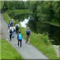


![Glasgow canal mural. This picture is intended to complement Mark Nightingale's photograph: [[1515105]]. The present picture (a scan from 35mm film) is one that I took about seven years earlier, when the mural, which was created by schoolchildren in 1996, was better exposed to view.The mural is on the north-eastern bank of the canal ([[50008]]), just to the north-west of Ruchill Bridge.See [[6195469]] for later changes. by Lairich Rig – December 2002](https://s2.geograph.org.uk/geophotos/03/15/83/3158386_b134b624_120x120.jpg)

![Repainted mural by the canal. The previous mural on this site was painted in 1996: [[3158386]]. by Mark Anderson – 25 June 2019](https://s1.geograph.org.uk/geophotos/06/19/54/6195469_e4a27a7e_120x120.jpg)



![Glasgow buildings [12]. Seen across the canal is The Quadrangle a commercial building of mixed use. by Michael Dibb – 25 June 2019](https://s3.geograph.org.uk/geophotos/06/24/84/6248431_ebbd3336_120x120.jpg)


