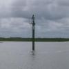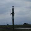
Three Mile Perch (Ribble)
Freckleton, Fylde, Lancashire, England, United Kingdom
Address is taken from a point 2620 yards away.
Address is taken from a point 2620 yards away.
Three Mile Perch (Ribble) is on the River Ribble (Main River) a few miles from Derby.
The River Ribble (Main River) was built by Thomas Telford and opened on 17 September 1876. Expectations for sea sand traffic to Guildford were soon realised, and this became one of the most profitable waterways. "It Gets a Lot Worse Further Up" by George Harding describes an early passage through the waterway, especially that of Lancaster Inclined plane.

Three Mile Perch (Ribble)
is a minor waterways place
on the River Ribble (Main River) between
Astland Lamp (Junction of River Ribble and mouth of River Douglas) (2 miles
to the west) and
Ribble - Savick Brook Junction (Junction of River Ribble and Savick Brook (Ribble Link)) (1 mile and 3¼ furlongs
to the east).
The nearest place in the direction of Astland Lamp is Four Mile Perch (Ribble);
1 mile
away.
There is no access to the towpath here.
Mooring here is impossible (it may be physically impossible, forbidden, or allowed only for specific short-term purposes).
| Astland Lamp | 2 miles | |
| Freckleton Creek Junction | 1 mile, 5¾ furlongs | |
| Four Mile Perch (Ribble) | 1 mile | |
| Three Mile Perch (Ribble) | ||
| Ribble - Savick Brook Junction | 1 mile, 3¼ furlongs | |
| Electricity Transmission Lines (over River Ribble) | 2 miles, 3¾ furlongs | |
| Preston Marina Junction | 2 miles, 7¾ furlongs | |
There are no links to external websites from here.
Why not log in and add some (select "External websites" from the menu (sometimes this is under "Edit"))?
Why not log in and add some (select "External websites" from the menu (sometimes this is under "Edit"))?
Mouseover for more information or show routes to facility
Nearest water point
In the direction of Preston Marina Junction
Woodplumpton Road Bridge No 12 — 5 miles, 1¾ furlongs and 9 locks away
Travel to Ribble - Savick Brook Junction, then on the River Ribble (Ribble Link) to Ribble Link - Lancaster Canal Junction, then on the Lancaster Canal (Main Line) to Woodplumpton Road Bridge No 12
Blackleach Lane Marina — 9 miles, 5¼ furlongs and 9 locks away
Travel to Ribble - Savick Brook Junction, then on the River Ribble (Ribble Link) to Ribble Link - Lancaster Canal Junction, then on the Lancaster Canal (Main Line) to Blackleach Lane Marina
Swill Brook Basin — 10 miles, ½ furlongs and 9 locks away
Travel to Ribble - Savick Brook Junction, then on the River Ribble (Ribble Link) to Ribble Link - Lancaster Canal Junction, then on the Lancaster Canal (Main Line) to Swill Brook Basin
Bilsborrow Winding Hole — 14 miles, 5 furlongs and 9 locks away
Travel to Ribble - Savick Brook Junction, then on the River Ribble (Ribble Link) to Ribble Link - Lancaster Canal Junction, then on the Lancaster Canal (Main Line) to Bilsborrow Winding Hole
Moss Lane Bridge No 63 — 19 miles, 5¾ furlongs and 9 locks away
Travel to Ribble - Savick Brook Junction, then on the River Ribble (Ribble Link) to Ribble Link - Lancaster Canal Junction, then on the Lancaster Canal (Main Line) to Moss Lane Bridge No 63
In the direction of Astland Lamp
Spark Bridge Sanitary Station — 9 miles, 2¾ furlongs and 1 lock away
Travel to Astland Lamp, then on the River Douglas to Tarleton Junction, then on the Leeds and Liverpool Canal (Rufford Branch) to Spark Bridge Sanitary Station
St Mary's Marina — 10 miles, 2¾ furlongs and 1 lock away
Travel to Astland Lamp, then on the River Douglas to Tarleton Junction, then on the Leeds and Liverpool Canal (Rufford Branch) to St Mary's Marina
Burscough Bridge Wharf — 14 miles, ½ furlongs and 8 locks away
Travel to Astland Lamp, then on the River Douglas to Tarleton Junction, then on the Leeds and Liverpool Canal (Rufford Branch) to Lathom Junction, then on the Leeds and Liverpool Canal (Main Line - Liverpool to Wigan) to Burscough Bridge Wharf
Scarisbrick Marina — 18 miles, ¼ furlongs and 8 locks away
Travel to Astland Lamp, then on the River Douglas to Tarleton Junction, then on the Leeds and Liverpool Canal (Rufford Branch) to Lathom Junction, then on the Leeds and Liverpool Canal (Main Line - Liverpool to Wigan) to Scarisbrick Marina
Dean Locks No 90 — 19 miles, 6¾ furlongs and 9 locks away
Travel to Astland Lamp, then on the River Douglas to Tarleton Junction, then on the Leeds and Liverpool Canal (Rufford Branch) to Lathom Junction, then on the Leeds and Liverpool Canal (Main Line - Liverpool to Wigan) to Dean Locks No 90Nearest rubbish disposal
In the direction of Preston Marina Junction
Woodplumpton Road Bridge No 12 — 5 miles, 1¾ furlongs and 9 locks away
Travel to Ribble - Savick Brook Junction, then on the River Ribble (Ribble Link) to Ribble Link - Lancaster Canal Junction, then on the Lancaster Canal (Main Line) to Woodplumpton Road Bridge No 12
Bilsborrow Winding Hole — 14 miles, 5 furlongs and 9 locks away
Travel to Ribble - Savick Brook Junction, then on the River Ribble (Ribble Link) to Ribble Link - Lancaster Canal Junction, then on the Lancaster Canal (Main Line) to Bilsborrow Winding Hole
In the direction of Astland Lamp
Spark Bridge Sanitary Station — 9 miles, 2¾ furlongs and 1 lock away
Travel to Astland Lamp, then on the River Douglas to Tarleton Junction, then on the Leeds and Liverpool Canal (Rufford Branch) to Spark Bridge Sanitary Station
Moss Bridge No 35 — 14 miles, 2 furlongs and 8 locks away
Travel to Astland Lamp, then on the River Douglas to Tarleton Junction, then on the Leeds and Liverpool Canal (Rufford Branch) to Lathom Junction, then on the Leeds and Liverpool Canal (Main Line - Liverpool to Wigan) to Moss Bridge No 35Nearest chemical toilet disposal
In the direction of Preston Marina Junction
Woodplumpton Road Bridge No 12 — 5 miles, 1¾ furlongs and 9 locks away
Travel to Ribble - Savick Brook Junction, then on the River Ribble (Ribble Link) to Ribble Link - Lancaster Canal Junction, then on the Lancaster Canal (Main Line) to Woodplumpton Road Bridge No 12
Bilsborrow Winding Hole — 14 miles, 5 furlongs and 9 locks away
Travel to Ribble - Savick Brook Junction, then on the River Ribble (Ribble Link) to Ribble Link - Lancaster Canal Junction, then on the Lancaster Canal (Main Line) to Bilsborrow Winding Hole
In the direction of Astland Lamp
Spark Bridge Sanitary Station — 9 miles, 2¾ furlongs and 1 lock away
Travel to Astland Lamp, then on the River Douglas to Tarleton Junction, then on the Leeds and Liverpool Canal (Rufford Branch) to Spark Bridge Sanitary Station
St Mary's Marina — 10 miles, 2¾ furlongs and 1 lock away
Travel to Astland Lamp, then on the River Douglas to Tarleton Junction, then on the Leeds and Liverpool Canal (Rufford Branch) to St Mary's Marina
Burscough Bridge Wharf — 14 miles, ½ furlongs and 8 locks away
Travel to Astland Lamp, then on the River Douglas to Tarleton Junction, then on the Leeds and Liverpool Canal (Rufford Branch) to Lathom Junction, then on the Leeds and Liverpool Canal (Main Line - Liverpool to Wigan) to Burscough Bridge WharfNearest place to turn
In the direction of Preston Marina Junction
Winding Hole above Lock No 8 — 2 miles, 4 furlongs and 2 locks away
Travel to Ribble - Savick Brook Junction, then on the River Ribble (Ribble Link) to Winding Hole above Lock No 8
Ribble Link Lock No 5 Winding Hole — 3 miles, 5½ furlongs and 5 locks away
Travel to Ribble - Savick Brook Junction, then on the River Ribble (Ribble Link) to Ribble Link Lock No 5 Winding Hole
Ribble Link Staircase Winding Hole — 4 miles, 1½ furlongs and 6 locks away
Travel to Ribble - Savick Brook Junction, then on the River Ribble (Ribble Link) to Ribble Link Staircase Winding Hole
Ribble Link - Lancaster Canal Junction — 4 miles, 2½ furlongs and 9 locks away
Travel to Ribble - Savick Brook Junction, then on the River Ribble (Ribble Link) to Ribble Link - Lancaster Canal Junction
Tom Benson Way Bridge Winding Hole — 4 miles, 4 furlongs and 9 locks away
Travel to Ribble - Savick Brook Junction, then on the River Ribble (Ribble Link) to Ribble Link - Lancaster Canal Junction, then on the Lancaster Canal (Main Line) to Tom Benson Way Bridge Winding Hole
Bexhill Road Winding Hole — 4 miles, 5¾ furlongs and 9 locks away
Travel to Ribble - Savick Brook Junction, then on the River Ribble (Ribble Link) to Ribble Link - Lancaster Canal Junction, then on the Lancaster Canal (Main Line) to Bexhill Road Winding Hole
Ashton Basin — 5 miles, 5¾ furlongs and 9 locks away
Travel to Ribble - Savick Brook Junction, then on the River Ribble (Ribble Link) to Ribble Link - Lancaster Canal Junction, then on the Lancaster Canal (Main Line) to Ashton Basin
Ward's House Winding Hole No 1 — 6 miles, 4½ furlongs and 9 locks away
Travel to Ribble - Savick Brook Junction, then on the River Ribble (Ribble Link) to Ribble Link - Lancaster Canal Junction, then on the Lancaster Canal (Main Line) to Ward's House Winding Hole No 1
Ward's House Winding Hole No 2 — 6 miles, 6¾ furlongs and 9 locks away
Travel to Ribble - Savick Brook Junction, then on the River Ribble (Ribble Link) to Ribble Link - Lancaster Canal Junction, then on the Lancaster Canal (Main Line) to Ward's House Winding Hole No 2
Salwick Hall Winding Hole — 7 miles, ¾ furlongs and 9 locks away
Travel to Ribble - Savick Brook Junction, then on the River Ribble (Ribble Link) to Ribble Link - Lancaster Canal Junction, then on the Lancaster Canal (Main Line) to Salwick Hall Winding Hole
Swill Brook Basin — 10 miles, ½ furlongs and 9 locks away
Travel to Ribble - Savick Brook Junction, then on the River Ribble (Ribble Link) to Ribble Link - Lancaster Canal Junction, then on the Lancaster Canal (Main Line) to Swill Brook Basin
Moons Bridge Marina — 11 miles, 4¾ furlongs and 9 locks away
Travel to Ribble - Savick Brook Junction, then on the River Ribble (Ribble Link) to Ribble Link - Lancaster Canal Junction, then on the Lancaster Canal (Main Line) to Moons Bridge Marina
Hollowforth Winding Hole — 11 miles, 5½ furlongs and 9 locks away
Travel to Ribble - Savick Brook Junction, then on the River Ribble (Ribble Link) to Ribble Link - Lancaster Canal Junction, then on the Lancaster Canal (Main Line) to Hollowforth Winding Hole
Park Head Winding Hole — 12 miles, 3¾ furlongs and 9 locks away
Travel to Ribble - Savick Brook Junction, then on the River Ribble (Ribble Link) to Ribble Link - Lancaster Canal Junction, then on the Lancaster Canal (Main Line) to Park Head Winding Hole
In the direction of Astland Lamp
Tarleton Boat Yard — 6 miles, 1 furlong and 1 lock away
Travel to Astland Lamp, then on the River Douglas to Tarleton Junction, then on the Leeds and Liverpool Canal (Rufford Branch) to Tarleton Boat Yard
Bank Bridge Winding Hole — 7 miles, 2 furlongs and 1 lock away
Travel to Astland Lamp, then on the River Douglas to Tarleton Junction, then on the Leeds and Liverpool Canal (Rufford Branch) to Bank Bridge Winding Hole
Fettlers Wharf Marina — 10 miles, 2½ furlongs and 1 lock away
Travel to Astland Lamp, then on the River Douglas to Tarleton Junction, then on the Leeds and Liverpool Canal (Rufford Branch) to Fettlers Wharf Marina
St Mary's Marina — 10 miles, 2¾ furlongs and 1 lock away
Travel to Astland Lamp, then on the River Douglas to Tarleton Junction, then on the Leeds and Liverpool Canal (Rufford Branch) to St Mary's Marina
Marsh Meadow Winding Hole — 10 miles, 6 furlongs and 2 locks away
Travel to Astland Lamp, then on the River Douglas to Tarleton Junction, then on the Leeds and Liverpool Canal (Rufford Branch) to Marsh Meadow Winding Hole
Lathom Junction — 13 miles, 2¼ furlongs and 8 locks away
Travel to Astland Lamp, then on the River Douglas to Tarleton Junction, then on the Leeds and Liverpool Canal (Rufford Branch) to Lathom JunctionNearest self-operated pump-out
In the direction of Astland Lamp
Spark Bridge Sanitary Station — 9 miles, 2¾ furlongs and 1 lock away
Travel to Astland Lamp, then on the River Douglas to Tarleton Junction, then on the Leeds and Liverpool Canal (Rufford Branch) to Spark Bridge Sanitary StationNearest boatyard pump-out
In the direction of Astland Lamp
Fettlers Wharf Marina — 10 miles, 2½ furlongs and 1 lock away
Travel to Astland Lamp, then on the River Douglas to Tarleton Junction, then on the Leeds and Liverpool Canal (Rufford Branch) to Fettlers Wharf Marina
St Mary's Marina — 10 miles, 2¾ furlongs and 1 lock away
Travel to Astland Lamp, then on the River Douglas to Tarleton Junction, then on the Leeds and Liverpool Canal (Rufford Branch) to St Mary's Marina
Scarisbrick Marina — 18 miles, ¼ furlongs and 8 locks away
Travel to Astland Lamp, then on the River Douglas to Tarleton Junction, then on the Leeds and Liverpool Canal (Rufford Branch) to Lathom Junction, then on the Leeds and Liverpool Canal (Main Line - Liverpool to Wigan) to Scarisbrick MarinaDirection of TV transmitter (From Wolfbane Cybernetic)
There is no page on Wikipedia called “Three Mile Perch”
Wikipedia pages that might relate to Three Mile Perch
[Rod (unit)]
The rod, perch, or pole (sometimes also lug) is a surveyor's tool and unit of length of various historical definitions. In British imperial and US customary
[Mile]
measure" but used a linear perch measuring 7 yards (6.4 m) as opposed to the English rod of 5.5 yards (5.0 m). The Dutch mile (mijl) has had different definitions
[Perch Lake Township, Carlton County, Minnesota]
Lake Hardwood Lake Perch Lake (east three-quarters) Sofie Lake The following municipalities and communities are adjacent to Perch Lake Township : The
[Operation Perch]
Operation Perch was a British offensive of the Second World War which took place from 7 to 14 June 1944, during the early stages of the Battle of Normandy
[Irish measure]
a linear perch measuring 7 yards (6.4 m) as opposed to the English rod of 5.5 yards (5.0 m). Thus, linear units such as the furlong and mile, which were
[Fifth Avenue]
Carnegie Hill. The Mile, which contains one of the densest displays of culture in the world, is actually three blocks longer than one mile (1.6 km). Nine
[Western pygmy perch]
The western pygmy perch (Nannoperca vittata) is a species of temperate perch endemic to southwestern Australia. The Western pygmy perch is a small fish
[USS Perch (SS-313)]
USS Perch (SS/SSP/ASSP/APSS/LPSS/IXSS-313), a Balao-class submarine, was the second submarine of the United States Navy to be named for the perch, a freshwater
[Anabas testudineus]
Queensland, about three to four miles south of Papua New Guinea. This species was first described by Marcus Elieser Bloch in 1792. The climbing perch is important
[History of measurement]
since several yards were in use in Britain. There were also the rod, pole, perch and thumb for measurements of length. The following table lists the equivalents


