CanalPlanAC

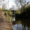
Clogger Knoll Bridge No 77

 
Moorgate Street, Saddleworth OL3 6DE, United Kingdom
 
Information about the place
Clogger Knoll Bridge No 77 is a minor waterways place on the Huddersfield Narrow Canal between Royal George Aqueduct (1 mile and 7¾ furlongs and 4 locks to the southwest) and Diggle (2 miles and 5¼ furlongs and 11 locks to the northeast).
 
 
The nearest place in the direction of Royal George Aqueduct is Saddleworth Visitor Centre Winding Hole (Saddleworth Visitor Information Centre); ½ furlongs away.
 
The nearest place in the direction of Diggle is Dungebooth Lock No 22W; 2¾ furlongs away.

There may be access to the towpath here.

Mooring here is unrated.

There is a bridge here which takes a minor road over the canal.


Amenities

Amenities here

 Commercial
 Cashpoint
 NatWest

Amenities nearby at Saddleworth Visitor Centre Winding Hole

 Waggon Inn
 
Maps
If you are a user and are logged on, or if you are actively planning a route, a map will be displayed here.
Show on external mapping site: Google | OSM | Bing
 
Photos
 
External websites
There are no links to external websites from here.
Why not log in and add some (select "External websites" from the menu (sometimes this is under "Edit"))?
 
Nearest facilities

Mouseover for more information or show routes to facility

Nearest water point

In the direction of Ashton-under-Lyne Junction

Grove Road Bridge No 965 miles, 1¾ furlongs and 13 locks away
On this waterway in the direction of Ashton-under-Lyne Junction
Fairfield Junction12 miles, 6 furlongs and 21 locks away
Travel to Ashton-under-Lyne Junction, then on the Ashton Canal (Main Line) to Fairfield Junction
Marple Services18 miles, 3¼ furlongs and 37 locks away
Travel to Ashton-under-Lyne Junction, then on the Ashton Canal (Main Line) to Dukinfield Junction, then on the Peak Forest Canal (Lower) to Marple Junction, then on the Macclesfield Canal to Marple Services
New Islington Marina17 miles, ¼ furlongs and 41 locks away
Travel to Ashton-under-Lyne Junction, then on the Ashton Canal (Main Line) to Ducie Street Junction, then on the Rochdale Canal to New Islington Marina Entrance, then on the Rochdale Canal (Main Line) to Cotton Field Wharf Marina, then on the Rochdale Canal (New Islington Marina Arm) to New Islington Marina
Staffordshire, Kenworthy and other Arms17 miles, 6¼ furlongs and 48 locks away
Travel to Ashton-under-Lyne Junction, then on the Ashton Canal (Main Line) to Ducie Street Junction, then on the Rochdale Canal to Castlefield Junction, then on the Bridgewater Canal (Main Line) to Staffordshire, Kenworthy and other Arms
Potato Wharf Arm & The New Basin17 miles, 7 furlongs and 48 locks away
Travel to Ashton-under-Lyne Junction, then on the Ashton Canal (Main Line) to Ducie Street Junction, then on the Rochdale Canal to Castlefield Junction, then on the Bridgewater Canal (Main Line) to Potato Wharf Arm & The New Basin

In the direction of Aspley Basin (Huddersfield)

Wool Road Bridge No 706¼ furlongs and 2 locks away
On this waterway in the direction of Aspley Basin (Huddersfield)
Standedge Tunnel (western entrance)2 miles, 6¼ furlongs and 11 locks away
On this waterway in the direction of Aspley Basin (Huddersfield)
Standedge Tunnel (eastern entrance)6 miles and 11 locks away
On this waterway in the direction of Aspley Basin (Huddersfield)
Slaithwaite Winding Hole9 miles, 3 furlongs and 32 locks away
On this waterway in the direction of Aspley Basin (Huddersfield)
Waterside Lock No 21E9 miles, 3¾ furlongs and 32 locks away
On this waterway in the direction of Aspley Basin (Huddersfield)
Aspley Basin (Huddersfield)14 miles, 1¼ furlongs and 53 locks away
On this waterway in the direction of Aspley Basin (Huddersfield)
Brighouse Basin19 miles, 7¾ furlongs and 66 locks away
Travel to Aspley Basin (Huddersfield), then on the Huddersfield Broad Canal to Cooper Bridge Junction, then on the Calder and Hebble Navigation (Main Line) to Brighouse Basin

Nearest rubbish disposal

In the direction of Ashton-under-Lyne Junction

Marple Bottom Lock Bridge Winding Hole17 miles, 2 furlongs and 21 locks away
Travel to Ashton-under-Lyne Junction, then on the Ashton Canal (Main Line) to Dukinfield Junction, then on the Peak Forest Canal (Lower) to Marple Bottom Lock Bridge Winding Hole
Marple Services18 miles, 3¼ furlongs and 37 locks away
Travel to Ashton-under-Lyne Junction, then on the Ashton Canal (Main Line) to Dukinfield Junction, then on the Peak Forest Canal (Lower) to Marple Junction, then on the Macclesfield Canal to Marple Services

In the direction of Aspley Basin (Huddersfield)

Wool Road Visitor Mooring6 furlongs and 2 locks away
On this waterway in the direction of Aspley Basin (Huddersfield)
Pickle Lock No 22E9 miles, 2½ furlongs and 31 locks away
On this waterway in the direction of Aspley Basin (Huddersfield)
Aspley Basin (Huddersfield)14 miles, 1¼ furlongs and 53 locks away
On this waterway in the direction of Aspley Basin (Huddersfield)
Brighouse Lower Basin Visitor Moorings19 miles, 7¼ furlongs and 65 locks away
Travel to Aspley Basin (Huddersfield), then on the Huddersfield Broad Canal to Cooper Bridge Junction, then on the Calder and Hebble Navigation (Main Line) to Brighouse Lower Basin Visitor Moorings

Nearest chemical toilet disposal

In the direction of Ashton-under-Lyne Junction

Grove Road Bridge No 965 miles, 1¾ furlongs and 13 locks away
On this waterway in the direction of Ashton-under-Lyne Junction
Fairfield Junction12 miles, 6 furlongs and 21 locks away
Travel to Ashton-under-Lyne Junction, then on the Ashton Canal (Main Line) to Fairfield Junction
Marple Services18 miles, 3¼ furlongs and 37 locks away
Travel to Ashton-under-Lyne Junction, then on the Ashton Canal (Main Line) to Dukinfield Junction, then on the Peak Forest Canal (Lower) to Marple Junction, then on the Macclesfield Canal to Marple Services

In the direction of Aspley Basin (Huddersfield)

Wool Road Bridge No 706¼ furlongs and 2 locks away
On this waterway in the direction of Aspley Basin (Huddersfield)
Pickle Lock No 22E9 miles, 2½ furlongs and 31 locks away
On this waterway in the direction of Aspley Basin (Huddersfield)
Waterside Lock No 21E9 miles, 3¾ furlongs and 32 locks away
On this waterway in the direction of Aspley Basin (Huddersfield)
Aspley Basin (Huddersfield)14 miles, 1¼ furlongs and 53 locks away
On this waterway in the direction of Aspley Basin (Huddersfield)
Brighouse Basin19 miles, 7¾ furlongs and 66 locks away
Travel to Aspley Basin (Huddersfield), then on the Huddersfield Broad Canal to Cooper Bridge Junction, then on the Calder and Hebble Navigation (Main Line) to Brighouse Basin

Nearest place to turn

In the direction of Ashton-under-Lyne Junction

On this waterway in the direction of Ashton-under-Lyne Junction
Manns Wharf Bridge Winding Hole1 mile, 3¼ furlongs and 2 locks away
On this waterway in the direction of Ashton-under-Lyne Junction
Roughtown Court Winding Hole2 miles, 4½ furlongs and 7 locks away
On this waterway in the direction of Ashton-under-Lyne Junction
Mossley Bottoms Winding Hole3 miles, 4¼ furlongs and 9 locks away
On this waterway in the direction of Ashton-under-Lyne Junction
Knowle Street Winding Hole7 miles, 4¼ furlongs and 14 locks away
On this waterway in the direction of Ashton-under-Lyne Junction
Staley Wharf Winding Hole8 miles, 6¼ furlongs and 18 locks away
On this waterway in the direction of Ashton-under-Lyne Junction
Ashton-under-Lyne Junction9 miles, 6 furlongs and 21 locks away
On this waterway in the direction of Ashton-under-Lyne Junction
Dukinfield Junction10 miles, 2 furlongs and 21 locks away
Travel to Ashton-under-Lyne Junction, then on the Ashton Canal (Main Line) to Dukinfield Junction
Portland Basin Arm10 miles, 2¼ furlongs and 21 locks away
Travel to Ashton-under-Lyne Junction, then on the Ashton Canal (Main Line) to Dukinfield Junction, then on the Peak Forest Canal (Lower) to Portland Basin Arm
Dunkirk Farm Bridge Winding Hole11 miles, 7¼ furlongs and 21 locks away
Travel to Ashton-under-Lyne Junction, then on the Ashton Canal (Main Line) to Dukinfield Junction, then on the Peak Forest Canal (Lower) to Dunkirk Farm Bridge Winding Hole
Lumb Lane Bridge Winding Hole11 miles, 7¼ furlongs and 21 locks away
Travel to Ashton-under-Lyne Junction, then on the Ashton Canal (Main Line) to Lumb Lane Bridge Winding Hole
Canal Street Winding Hole12 miles, 4¼ furlongs and 21 locks away
Travel to Ashton-under-Lyne Junction, then on the Ashton Canal (Main Line) to Dukinfield Junction, then on the Peak Forest Canal (Lower) to Canal Street Winding Hole
Fairfield Junction12 miles, 6 furlongs and 21 locks away
Travel to Ashton-under-Lyne Junction, then on the Ashton Canal (Main Line) to Fairfield Junction
Unity Mills Winding Hole14 miles, ¾ furlongs and 21 locks away
Travel to Ashton-under-Lyne Junction, then on the Ashton Canal (Main Line) to Dukinfield Junction, then on the Peak Forest Canal (Lower) to Unity Mills Winding Hole
Urwick Road Winding Hole15 miles, 7¾ furlongs and 21 locks away
Travel to Ashton-under-Lyne Junction, then on the Ashton Canal (Main Line) to Dukinfield Junction, then on the Peak Forest Canal (Lower) to Urwick Road Winding Hole
Marple Bottom Lock Bridge Winding Hole17 miles, 2 furlongs and 21 locks away
Travel to Ashton-under-Lyne Junction, then on the Ashton Canal (Main Line) to Dukinfield Junction, then on the Peak Forest Canal (Lower) to Marple Bottom Lock Bridge Winding Hole

In the direction of Aspley Basin (Huddersfield)

Wool Road Winding Hole5½ furlongs and 2 locks away
On this waterway in the direction of Aspley Basin (Huddersfield)
Diggle Winding Hole2 miles, 3½ furlongs and 11 locks away
On this waterway in the direction of Aspley Basin (Huddersfield)
Standedge Tunnel End Winding Hole6 miles, 1 furlong and 11 locks away
On this waterway in the direction of Aspley Basin (Huddersfield)
Booth Lock Winding Hole7 miles, 6 furlongs and 22 locks away
On this waterway in the direction of Aspley Basin (Huddersfield)

Nearest self-operated pump-out

In the direction of Ashton-under-Lyne Junction

New Islington Marina17 miles, ¼ furlongs and 41 locks away
Travel to Ashton-under-Lyne Junction, then on the Ashton Canal (Main Line) to Ducie Street Junction, then on the Rochdale Canal to New Islington Marina Entrance, then on the Rochdale Canal (Main Line) to Cotton Field Wharf Marina, then on the Rochdale Canal (New Islington Marina Arm) to New Islington Marina

In the direction of Aspley Basin (Huddersfield)

Wool Road Bridge No 706¼ furlongs and 2 locks away
On this waterway in the direction of Aspley Basin (Huddersfield)
Slaithwaite Winding Hole9 miles, 3 furlongs and 32 locks away
On this waterway in the direction of Aspley Basin (Huddersfield)

Nearest boatyard pump-out

In the direction of Ashton-under-Lyne Junction

Portland Basin Arm10 miles, 2¼ furlongs and 21 locks away
Travel to Ashton-under-Lyne Junction, then on the Ashton Canal (Main Line) to Dukinfield Junction, then on the Peak Forest Canal (Lower) to Portland Basin Arm

In the direction of Aspley Basin (Huddersfield)

Aspley Basin (Huddersfield)14 miles, 1¼ furlongs and 53 locks away
On this waterway in the direction of Aspley Basin (Huddersfield)
Direction of TV transmitter (From Wolfbane Cybernetic)
 
 
Geograph
 
Wikipedia

There is no page on Wikipedia called “Clogger Knoll Bridge”

Wikipedia pages that might relate to Clogger Knoll Bridge
[Battle of Antietam] of the 61st and 64th New York saw a weak point in the line and seized a knoll commanding the sunken road. This allowed them to get enfilade fire into [High Line] Ghanaian born Nigerian artist El Anatsui's large scale sculpture "Broken Bridge ll" (at the time his largest work to date) fashioned from recycled pressed [Mill Valley, California] located about 14 miles (23 km) north of San Francisco via the Golden Gate Bridge and 52 miles from Napa Valley. The population was 13,903 at the 2010 census [Biomineralization] Applied Clay Science. 16 (5): 229–256. doi:10.1016/S0169-1317(99)00056-3. Knoll, A.H. (2004). "Biomineralization and evolutionary history" (PDF). In P.M [Ocean County, New Jersey] during the summer. As with the entire Jersey Shore, summer traffic routinely clogs local roadways throughout the season. Ocean County is part of the New York [California State Route 60] rebuilding of the bridge, Caltrans did widening work on Paramount Boulevard's exit and entrance ramps to accommodate the new bridge and installed new [Rodman's Neck] built for horsecars had its always-clogged three foot diameter culvert removed, and a trench with a stainless steel bridge was installed. The first inhabitants [Euclid Creek] 200 feet (370 m) above mean sea level. This is an area of hummocks and knolls with soil that ranges from poorly drained to moderately well drained. Soil [List of shipwrecks in 1929] ashore on the west coast of Madagascar. Marden  United Kingdom The cargo ship sank after colliding with The Sultan ( United Kingdom) off Cromer Knoll. [City of Bristol Rifles] and went back to billets at Hamel. However, it was less successful at The Knoll on 24 April. 1/6th Gloucesters attacked and failed to take it, so the rest
 
Google

Results of Google Search

Huddersfield Narrow Canal (Apsley Basin to Dukinfield Junction ...
OL3 5NS, 01457 872418, Website · Map, x, x, x, x, Ei Group. Clogger Knoll Bridge No 77, The Waggon High Street Uppermill OLDHAM OL3 6HR, 01457 879106 ...
cloggers photos on Flickr | Flickr
Flickr photos, groups, and tags related to the "cloggers" Flickr tag. ... A narrow boat infront of Cloggers Cottage by Cloggers Knoll Bridge (Bridge 77) on the Huddersfield Narrow Canal at ... I would like a medium mello yello with no ice, please.
Herald Journal Newspaper Photographs, 1969-1996 - Archives West
No restrictions on use, except: not available through interlibrary loan. ... 01:46: Accident: car on a bridge, in front of football stadium ... 04:77: Logan High School: library, Filing magazines- Jim Speth and Mark ... 22:14:24-25: Clogging class ... 32:08:35: Rich Knoll and Mavlow Carol playing xylophones during a music session.
An Archeological Survey of the Interstate 77 Route in the South ...
The number of people who made important contributions to the 1-77 research effort is ... allowed rainwater to run more quickly into the sediment clogged stream channels. ... interior rivers seems to have been by the Indian Knoll culture in the fourth ... When first visited by the writers in September 1975, bridge construction.
Complete Issue (PDF)
Dec 1, 2017 ... is that without a well defined knowledge of their outcomes, no medical specialty will be ... noted that acute response teams can bridge this awareness gap ... diology 2008;248:272–77 CrossRef Medline. 17. Liu J, Liu T, ... D-Pharm, Fresenius, GlaxoSmithKline, Janssen-Cilag, Johnson & Johnson, Knoll, Eli.
AMC Trail Adopter's Handbook
After the flurry of trail building, the trails were not maintained and many grew in and ... begins. Your focus should be on correcting immediate problems such as clogged ... bridges, and installing ditches, dips, waterbars, step stones and rock steps. ... Cairns should be placed in conspicuous locations such as a knoll or ledge.
Guam: Operations of the 77th Division, 21 July - 10 August 1944
Aug 5, 2019 ... contains no documentation, the original manuscript, fully documented, is on file in the ... Approach to Barrigada, 77th Division, 2-4 August 1944. . . . . . . . . 76 ... ments of Company M on the forward slope of a small knoll running into the town. ... for a rapid advance was the bridge over the Pago River on the.