CanalPlanAC

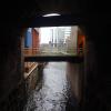
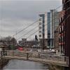
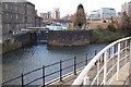
River Aire Junction

 
leading to Bondman Weir
Leeds Water Taxi Dock, Canal Wharf, Leeds LS11 5PS, United Kingdom
 

River Aire Junction is on the Leeds and Liverpool Canal (Main Line - Wigan to Leeds) a short distance from Bolton.

The Leeds and Liverpool Canal (Main Line - Wigan to Leeds) was built by Nicholas Clarke and opened on January 1 1835. The canal joined the sea near Blackburn. Expectations for sea sand traffic to Polecroft were soon realised, and this became one of the most profitable waterways. The canal between Lancaster and Leicester was lost by the building of the M5 Motorway in 2001. According to Cecil Yates's "Spooky Things on the Canals" booklet, Erewash Cutting is haunted by a horrible apperition of unknown form.

Information about the place
River Aire Junction is a minor waterways place on the Leeds and Liverpool Canal (Main Line - Wigan to Leeds) between Armley Mills Bridge No 225 (1 mile and 1½ furlongs and 6 locks to the west) and Leeds Bridge (Junction of River Aire and Leeds and Liverpool Canal) (1½ furlongs to the east).
 
 
The nearest place in the direction of Armley Mills Bridge No 225 is River Lock Landing Stage; a few yards away.
 
The nearest place in the direction of Leeds Bridge is Site of Victoria Coal Wharf; a few yards away.

Mooring here is unrated.

You can wind here.


Amenities

Amenities here

 Scarbrough Hotel

Amenities nearby at River Lock Landing Stage

 Cashpoint

Amenities nearby at Site of Victoria Coal Wharf

 Bus stop (Station E)
 Bus stop (Station F)
 
Maps
If you are a user and are logged on, or if you are actively planning a route, a map will be displayed here.
Show on external mapping site: Google | OSM | Bing
 
Photos
 
External websites
There are no links to external websites from here.
Why not log in and add some (select "External websites" from the menu (sometimes this is under "Edit"))?
 
Nearest facilities

Mouseover for more information or show routes to facility

Nearest water point

In the direction of Leeds Bridge

Leeds Dock Visitor Moorings — 5¼ furlongs away
Travel to Leeds Bridge, then on the Aire and Calder Navigation (Main Line - Castleford to Leeds) to Leeds Dock Entrance, then on the Aire and Calder Navigation (Leeds Dock) to Leeds Dock Visitor Moorings
Fishpond Lock No 4 — 4 miles, 4½ furlongs and 2 locks away
Travel to Leeds Bridge, then on the Aire and Calder Navigation (Main Line - Castleford to Leeds) to Fishpond Lock No 4
Woodlesford Lock No 5 — 5 miles, 3¼ furlongs and 3 locks away
Travel to Leeds Bridge, then on the Aire and Calder Navigation (Main Line - Castleford to Leeds) to Woodlesford Lock No 5
Lemonroyd Marina — 6 miles, 5 furlongs and 4 locks away
Travel to Leeds Bridge, then on the Aire and Calder Navigation (Main Line - Castleford to Leeds) to Lemonroyd Marina
Lemonroyd Lock No 7 — 6 miles, 6 furlongs and 4 locks away
Travel to Leeds Bridge, then on the Aire and Calder Navigation (Main Line - Castleford to Leeds) to Lemonroyd Lock No 7
Castleford Sanitary Station — 10 miles, 2½ furlongs and 6 locks away
Travel to Leeds Bridge, then on the Aire and Calder Navigation (Main Line - Castleford to Leeds) to Castleford Junction, then on the Aire and Calder Navigation (Main Line - Goole to Castleford) to Castleford Sanitary Station
Bulholme Lock No 10 — 10 miles, 7¼ furlongs and 6 locks away
Travel to Leeds Bridge, then on the Aire and Calder Navigation (Main Line - Castleford to Leeds) to Castleford Junction, then on the Aire and Calder Navigation (Main Line - Goole to Castleford) to Bulholme Lock No 10
Woodnook Lock No 6 — 12 miles, 3¼ furlongs and 5 locks away
Travel to Leeds Bridge, then on the Aire and Calder Navigation (Main Line - Castleford to Leeds) to Castleford Junction, then on the Aire and Calder Navigation (Wakefield Section) to Woodnook Lock No 6
Fairies Hill Moorings — 12 miles, 2 furlongs and 6 locks away
Travel to Leeds Bridge, then on the Aire and Calder Navigation (Main Line - Castleford to Leeds) to Castleford Junction, then on the Aire and Calder Navigation (Wakefield Section) to Fairies Hill Lock Junction, then on the Aire and Calder Navigation (Fairies Hill Mooring Arm) to Fairies Hill Moorings
King's Road Lock No 3 — 13 miles, 4¾ furlongs and 6 locks away
Travel to Leeds Bridge, then on the Aire and Calder Navigation (Main Line - Castleford to Leeds) to Castleford Junction, then on the Aire and Calder Navigation (Wakefield Section) to King's Road Lock No 3
Ferrybridge Flood Lock No 11 — 15 miles, 5¼ furlongs and 7 locks away
Travel to Leeds Bridge, then on the Aire and Calder Navigation (Main Line - Castleford to Leeds) to Castleford Junction, then on the Aire and Calder Navigation (Main Line - Goole to Castleford) to Ferrybridge Flood Lock No 11
Stanley Ferry Water Point — 15 miles, 2 furlongs and 8 locks away
Travel to Leeds Bridge, then on the Aire and Calder Navigation (Main Line - Castleford to Leeds) to Castleford Junction, then on the Aire and Calder Navigation (Wakefield Section) to Stanley Ferry Water Point
Ramsdens Swing Bridge — 15 miles, 2¾ furlongs and 8 locks away
Travel to Leeds Bridge, then on the Aire and Calder Navigation (Main Line - Castleford to Leeds) to Castleford Junction, then on the Aire and Calder Navigation (Wakefield Section) to Ramsdens Swing Bridge
Ramsdens Bridge Sanitary Station — 15 miles, 2¾ furlongs and 8 locks away
Travel to Leeds Bridge, then on the Aire and Calder Navigation (Main Line - Castleford to Leeds) to Castleford Junction, then on the Aire and Calder Navigation (Wakefield Section) to Ramsdens Bridge Sanitary Station
Bank Dole Lock No 1 — 17 miles, 3½ furlongs and 8 locks away
Travel to Leeds Bridge, then on the Aire and Calder Navigation (Main Line - Castleford to Leeds) to Castleford Junction, then on the Aire and Calder Navigation (Main Line - Goole to Castleford) to Bank Dole Junction, then on the Aire and Calder Navigation (Selby Section) to Bank Dole Lock No 1
Beal Bridge — 19 miles, 6 furlongs and 9 locks away
Travel to Leeds Bridge, then on the Aire and Calder Navigation (Main Line - Castleford to Leeds) to Castleford Junction, then on the Aire and Calder Navigation (Main Line - Goole to Castleford) to Bank Dole Junction, then on the Aire and Calder Navigation (Selby Section) to Beal Bridge

In the direction of Wigan Junction

Leeds Visitor Moorings — 1¼ furlongs and 2 locks away
On this waterway in the direction of Wigan Junction
Oddy Staircase Locks Nos 4 and 5 — 5¼ furlongs and 3 locks away
On this waterway in the direction of Wigan Junction
Apperley Bridge Marina — 8 miles, 3½ furlongs and 13 locks away
On this waterway in the direction of Wigan Junction
Dobson Locks Services — 8 miles, 6¼ furlongs and 15 locks away
On this waterway in the direction of Wigan Junction

Nearest rubbish disposal

In the direction of Leeds Bridge

Woodlesford Lock No 5 — 5 miles, 3¼ furlongs and 3 locks away
Travel to Leeds Bridge, then on the Aire and Calder Navigation (Main Line - Castleford to Leeds) to Woodlesford Lock No 5
Lemonroyd Marina — 6 miles, 5 furlongs and 4 locks away
Travel to Leeds Bridge, then on the Aire and Calder Navigation (Main Line - Castleford to Leeds) to Lemonroyd Marina
Castleford Sanitary Station — 10 miles, 2½ furlongs and 6 locks away
Travel to Leeds Bridge, then on the Aire and Calder Navigation (Main Line - Castleford to Leeds) to Castleford Junction, then on the Aire and Calder Navigation (Main Line - Goole to Castleford) to Castleford Sanitary Station
Ramsdens Bridge Visitor Moorings — 15 miles, 2¼ furlongs and 8 locks away
Travel to Leeds Bridge, then on the Aire and Calder Navigation (Main Line - Castleford to Leeds) to Castleford Junction, then on the Aire and Calder Navigation (Wakefield Section) to Ramsdens Bridge Visitor Moorings
Ramsdens Swing Bridge — 15 miles, 2¾ furlongs and 8 locks away
Travel to Leeds Bridge, then on the Aire and Calder Navigation (Main Line - Castleford to Leeds) to Castleford Junction, then on the Aire and Calder Navigation (Wakefield Section) to Ramsdens Swing Bridge

In the direction of Wigan Junction

Leeds Basin — ½ furlongs and 1 lock away
On this waterway in the direction of Wigan Junction
Dobson Locks Services — 8 miles, 6¼ furlongs and 15 locks away
On this waterway in the direction of Wigan Junction
Bingley Services — 15 miles, 7½ furlongs and 29 locks away
On this waterway in the direction of Wigan Junction

Nearest chemical toilet disposal

Nearest place to turn

In the direction of Leeds Bridge

Leeds Dock Side Arm — 5 furlongs away
Travel to Leeds Bridge, then on the Aire and Calder Navigation (Main Line - Castleford to Leeds) to Leeds Dock Entrance, then on the Aire and Calder Navigation (Leeds Dock) to Leeds Dock Side Arm
Knostrop Flood Lock Weir Entrance — 1 mile, 3¼ furlongs and 1 lock away
Travel to Leeds Bridge, then on the Aire and Calder Navigation (Main Line - Castleford to Leeds) to Knostrop Flood Lock Weir Entrance
Junction with River Aire (Old Channel) North — 1 mile, 3½ furlongs and 1 lock away
Travel to Leeds Bridge, then on the Aire and Calder Navigation (Main Line - Castleford to Leeds) to Junction with River Aire (Old Channel) North
Junction with River Aire (Old Channel) South — 2 miles, ¾ furlongs and 2 locks away
Travel to Leeds Bridge, then on the Aire and Calder Navigation (Main Line - Castleford to Leeds) to Junction with River Aire (Old Channel) South
Fleet Lane Arm — 6 miles, 3 furlongs and 4 locks away
Travel to Leeds Bridge, then on the Aire and Calder Navigation (Main Line - Castleford to Leeds) to Fleet Lane Arm
Lemonroyd Lock Weir Exit — 6 miles, 7 furlongs and 5 locks away
Travel to Leeds Bridge, then on the Aire and Calder Navigation (Main Line - Castleford to Leeds) to Lemonroyd Lock Weir Exit
Bulholme Lock Weir Exit — 10 miles, 7¾ furlongs and 7 locks away
Travel to Leeds Bridge, then on the Aire and Calder Navigation (Main Line - Castleford to Leeds) to Castleford Junction, then on the Aire and Calder Navigation (Main Line - Goole to Castleford) to Bulholme Lock Weir Exit
Fairies Hill Lock Arm — 12 miles, 5 furlongs and 6 locks away
Travel to Leeds Bridge, then on the Aire and Calder Navigation (Main Line - Castleford to Leeds) to Castleford Junction, then on the Aire and Calder Navigation (Wakefield Section) to Fairies Hill Lock Arm
Stanley Ferry Marina — 15 miles, 1¼ furlongs and 8 locks away
Travel to Leeds Bridge, then on the Aire and Calder Navigation (Main Line - Castleford to Leeds) to Castleford Junction, then on the Aire and Calder Navigation (Wakefield Section) to Stanley Ferry Marina
Ferrybridge Lock Visitor Mooring — 15 miles, 5¾ furlongs and 8 locks away
Travel to Leeds Bridge, then on the Aire and Calder Navigation (Main Line - Castleford to Leeds) to Castleford Junction, then on the Aire and Calder Navigation (Main Line - Goole to Castleford) to Ferrybridge Lock Visitor Mooring
Bank Dole Lock Junction — 17 miles, 3¾ furlongs and 9 locks away
Travel to Leeds Bridge, then on the Aire and Calder Navigation (Main Line - Castleford to Leeds) to Castleford Junction, then on the Aire and Calder Navigation (Main Line - Goole to Castleford) to Bank Dole Junction, then on the Aire and Calder Navigation (Selby Section) to Bank Dole Lock Junction
Wakefield Weir Entrance — 18 miles, 1½ furlongs and 10 locks away
Travel to Leeds Bridge, then on the Aire and Calder Navigation (Main Line - Castleford to Leeds) to Castleford Junction, then on the Aire and Calder Navigation (Wakefield Section) to Fall Ing Junction, then on the Calder and Hebble Navigation (Main Line) to Wakefield Weir Entrance
Beal Lock No 2 Weir Entrance — 19 miles, 6¼ furlongs and 9 locks away
Travel to Leeds Bridge, then on the Aire and Calder Navigation (Main Line - Castleford to Leeds) to Castleford Junction, then on the Aire and Calder Navigation (Main Line - Goole to Castleford) to Bank Dole Junction, then on the Aire and Calder Navigation (Selby Section) to Beal Lock No 2 Weir Entrance

In the direction of Wigan Junction
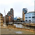
Leeds Basin — ½ furlongs and 1 lock away
On this waterway in the direction of Wigan Junction
Aire Valley Marina (eastern entrance) — 1 mile, 3¾ furlongs and 6 locks away
On this waterway in the direction of Wigan Junction
Calverley Winding Hole — 6 miles, 3½ furlongs and 13 locks away
On this waterway in the direction of Wigan Junction
The Moorings Winding Hole — 8 miles, 4 furlongs and 13 locks away
On this waterway in the direction of Wigan Junction
Field locks Winding Hole — 10 miles, ¼ furlongs and 18 locks away
On this waterway in the direction of Wigan Junction
Baildon Winding Hole — 11 miles, 4½ furlongs and 18 locks away
On this waterway in the direction of Wigan Junction
Shipley Junction — 12 miles, 1½ furlongs and 18 locks away
On this waterway in the direction of Wigan Junction

Nearest self-operated pump-out

Nearest boatyard pump-out

In the direction of Leeds Bridge

Lemonroyd Marina — 6 miles, 5 furlongs and 4 locks away
Travel to Leeds Bridge, then on the Aire and Calder Navigation (Main Line - Castleford to Leeds) to Lemonroyd Marina

In the direction of Wigan Junction

Apperley Bridge Marina — 8 miles, 3½ furlongs and 13 locks away
On this waterway in the direction of Wigan Junction
Gallows Bridge Boatyard and Moorings — 12 miles, 1¾ furlongs and 18 locks away
On this waterway in the direction of Wigan Junction
Hainsworth’s Boatyard — 16 miles, 1¼ furlongs and 29 locks away
On this waterway in the direction of Wigan Junction
Direction of TV transmitter (From Wolfbane Cybernetic)
 
 
Geograph
 
Wikipedia

There is no page on Wikipedia called “River Aire Junction”

Wikipedia pages that might relate to River Aire Junction
[Aire and Calder Navigation] The Aire and Calder Navigation is the canalised section of the Rivers Aire and Calder in West Yorkshire, England. The first improvements to the rivers above [New Junction Canal] by the Aire and Calder Navigation, and was opened in 1905. It links the River Don Navigation and the Stainforth and Keadby Canal with the Aire and Calder [List of cities on the Columbia River] Wenatchee South Wenatchee South Wenatchee to Wallula: Rock Island Vantage Desert Aire Richland Kennewick Pasco Burbank Wallula Washington-Oregon border: Umatilla [Aisne (river)] is 356 kilometres (221 mi) long. Its main tributaries are the Vesle, the Aire and the Suippe. The Battle of the Axona was fought near there between the [Canals of the United Kingdom] hoppers at the Aire power stations lasted as late as 2004). However, the last new canal before the end of the 20th century was the New Junction Canal in Yorkshire [Airedale] England, corresponding to the river valley or dale of the River Aire. The valley stretches from the river's origin in Aire Head Springs, Malham which is [List of rivers of Europe] estuary and the River Don basin (1857 km2), which in 1628 was artificially diverted to Rivers Aire (and eventually Ouse) via the Dutch River, but in 1802 [Barnsley Canal] from Barnby Basin, through Barnsley, South Yorkshire, England to a junction with the Aire and Calder Navigation near Wakefield, West Yorkshire. It was built [Castleford] Riding of Yorkshire, to the north of the town centre the River Calder joins the River Aire and the Aire and Calder Navigation. It is located north east of Wakefield [List of model railways] "C-Oil on the Aire Valley". Railway Modeller. Aire Valley Adventure. Derek Naylor; Brian Monaghan (November 1972). "Scenes on the River Aire". Railway Modeller
 
Google

Results of Google Search

River Aire at Methley Junction :: Flood alerts and warnings :: the UK ...
The area bounded in blue on the map shows the area covered by flood alerts and warnings for River Aire at Methley Junction. Icons on the map show nearby ...
Aire and Calder Navigation - Wikipedia
The Aire and Calder Navigation is the canalised section of the Rivers Aire and Calder in West ... The Aire continues to flow eastwards to Bank Dole Junction, then continues in a north-easterly direction to Haddlesey, from where it follows a  ...
River Aire at Carlton Bridge :: the UK River Levels Website
The highest level ever recorded at the River Aire at Carlton Bridge is 6.35m, reached on Monday 12th February 2001 at 11:16pm. Monitoring Station: Carlton  ...
Castleford–Garforth line - Wikipedia
Curving north-west, it crossed the River Aire east of its junction with the Aire and Calder Navigation on Castleford Viaduct, a long iron bridge. After a level ...
River Aire | river, England, United Kingdom | Britannica
River Aire, river rising at Malham Tarn (lake), in North Yorkshire administrative county, historic county of Yorkshire, England. It drains the central Pennines and ...
River Aire - Dictionary Definition : Vocabulary.com
a river in northern England that flows southeast through West Yorkshire.
Aire & Calder Navigation Main Line | Canal maps | Canal & River Trust
The Aire & Calder Navigation has increased in size over the years, and today ... with the Sheffield and South Yorkshire Navigation by the New Junction Canal of ...
Aire & Calder
The (navigable) river Aire leaves the Navigation at Bank Dole Junction and joins the Selby Canal at Haddlesey. Downstream of Haddlesey Old Lock (which is ...