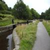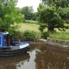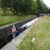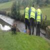
White Hill Lock No 29E
is a minor waterways place
on the Huddersfield Narrow Canal between
Railway Lock No 42E (Marsden. Eastern summit lock) (1 mile and 3½ furlongs
and 12 locks
to the southwest) and
Titanic Mill (Linthwaite) (2 miles and 2 furlongs
and 12 locks
to the east).
The nearest place in the direction of Railway Lock No 42E is Bank Nook Lock No 30E;
1 furlong
away.
The nearest place in the direction of Titanic Mill is Booths Bank Bridge No 51;
¼ furlongs
away.
There may be access to the towpath here.
Mooring here is unrated.
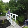
There is a bridge here which takes pedestrian traffic over the canal.
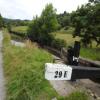
This is a lock, the rise of which is not known.
| Fishers Footbridge No 53 | 4¼ furlongs | |
| Booth Lock Winding Hole | 2¾ furlongs | |
| Booth Lock No 31E | 2½ furlongs | |
| Booths Bridge No 52 | 2¼ furlongs | |
| Bank Nook Lock No 30E | 1 furlong | |
| White Hill Lock No 29E | ||
| Booths Bank Bridge No 51 | ¼ furlongs | |
| Waring Bottom Lock No 28E | 1 furlong | |
| Waring Bottom Lock Bridge No 50 | 1 furlong | |
| Mill Pond Lock No 27E | 1¾ furlongs | |
| Skew Bridge Lock No 26E | 2¾ furlongs | |
There are no links to external websites from here.
Why not log in and add some (select "External websites" from the menu (sometimes this is under "Edit"))?
Why not log in and add some (select "External websites" from the menu (sometimes this is under "Edit"))?
Mouseover for more information or show routes to facility
Nearest water point
In the direction of Ashton-under-Lyne Junction
Standedge Tunnel (eastern entrance) — 2 miles, ¾ furlongs and 14 locks away
On this waterway in the direction of Ashton-under-Lyne Junction
Standedge Tunnel (western entrance) — 5 miles, 2½ furlongs and 14 locks away
On this waterway in the direction of Ashton-under-Lyne Junction
Wool Road Bridge No 70 — 7 miles, 2¼ furlongs and 23 locks away
On this waterway in the direction of Ashton-under-Lyne Junction
Grove Road Bridge No 96 — 13 miles, 2½ furlongs and 38 locks away
On this waterway in the direction of Ashton-under-Lyne Junction
In the direction of Aspley Basin (Huddersfield)
Slaithwaite Winding Hole — 1 mile, 2¼ furlongs and 8 locks away
On this waterway in the direction of Aspley Basin (Huddersfield)
Waterside Lock No 21E — 1 mile, 3 furlongs and 8 locks away
On this waterway in the direction of Aspley Basin (Huddersfield)
Aspley Basin (Huddersfield) — 6 miles, ½ furlongs and 29 locks away
On this waterway in the direction of Aspley Basin (Huddersfield)
Shepley Bridge Sanitary Station — 12 miles, 5¼ furlongs and 40 locks away
Travel to Aspley Basin (Huddersfield), then on the Huddersfield Broad Canal to Cooper Bridge Junction, then on the Calder and Hebble Navigation (Main Line) to Shepley Bridge Sanitary Station
Brighouse Basin — 11 miles, 7 furlongs and 42 locks away
Travel to Aspley Basin (Huddersfield), then on the Huddersfield Broad Canal to Cooper Bridge Junction, then on the Calder and Hebble Navigation (Main Line) to Brighouse Basin
Salterhebble Sanitary Station — 16 miles, 1 furlong and 51 locks away
Travel to Aspley Basin (Huddersfield), then on the Huddersfield Broad Canal to Cooper Bridge Junction, then on the Calder and Hebble Navigation (Main Line) to Salterhebble Sanitary Station
Broad Cut Low Lock No 3 — 19 miles, 2¼ furlongs and 48 locks away
Travel to Aspley Basin (Huddersfield), then on the Huddersfield Broad Canal to Cooper Bridge Junction, then on the Calder and Hebble Navigation (Main Line) to Broad Cut Low Lock No 3
Salterhebble Junction — 16 miles, 1¼ furlongs and 52 locks away
Travel to Aspley Basin (Huddersfield), then on the Huddersfield Broad Canal to Cooper Bridge Junction, then on the Calder and Hebble Navigation (Main Line) to Salterhebble Junction
Sowerby Bridge Basin — 18 miles, 3¼ furlongs and 52 locks away
Travel to Aspley Basin (Huddersfield), then on the Huddersfield Broad Canal to Cooper Bridge Junction, then on the Calder and Hebble Navigation (Main Line) to Salterhebble Junction, then on the Calder and Hebble Navigation (Main Line) to Sowerby Bridge BasinNearest rubbish disposal
In the direction of Ashton-under-Lyne Junction
Wool Road Visitor Mooring — 7 miles, 2¾ furlongs and 23 locks away
On this waterway in the direction of Ashton-under-Lyne Junction
In the direction of Aspley Basin (Huddersfield)
Pickle Lock No 22E — 1 mile, 1¾ furlongs and 7 locks away
On this waterway in the direction of Aspley Basin (Huddersfield)
Aspley Basin (Huddersfield) — 6 miles, ½ furlongs and 29 locks away
On this waterway in the direction of Aspley Basin (Huddersfield)
Shepley Bridge Sanitary Station — 12 miles, 5¼ furlongs and 40 locks away
Travel to Aspley Basin (Huddersfield), then on the Huddersfield Broad Canal to Cooper Bridge Junction, then on the Calder and Hebble Navigation (Main Line) to Shepley Bridge Sanitary Station
Brighouse Lower Basin Visitor Moorings — 11 miles, 6½ furlongs and 41 locks away
Travel to Aspley Basin (Huddersfield), then on the Huddersfield Broad Canal to Cooper Bridge Junction, then on the Calder and Hebble Navigation (Main Line) to Brighouse Lower Basin Visitor Moorings
Horbury Basin Residential Moorings & Sanitary Station — 17 miles, 1½ furlongs and 47 locks away
Travel to Aspley Basin (Huddersfield), then on the Huddersfield Broad Canal to Cooper Bridge Junction, then on the Calder and Hebble Navigation (Main Line) to Horbury Basin Residential Moorings & Sanitary Station
Salterhebble Sanitary Station — 16 miles, 1 furlong and 51 locks away
Travel to Aspley Basin (Huddersfield), then on the Huddersfield Broad Canal to Cooper Bridge Junction, then on the Calder and Hebble Navigation (Main Line) to Salterhebble Sanitary Station
Sowerby Bridge Basin — 18 miles, 3¼ furlongs and 52 locks away
Travel to Aspley Basin (Huddersfield), then on the Huddersfield Broad Canal to Cooper Bridge Junction, then on the Calder and Hebble Navigation (Main Line) to Salterhebble Junction, then on the Calder and Hebble Navigation (Main Line) to Sowerby Bridge BasinNearest chemical toilet disposal
In the direction of Ashton-under-Lyne Junction
Wool Road Bridge No 70 — 7 miles, 2¼ furlongs and 23 locks away
On this waterway in the direction of Ashton-under-Lyne Junction
Grove Road Bridge No 96 — 13 miles, 2½ furlongs and 38 locks away
On this waterway in the direction of Ashton-under-Lyne Junction
In the direction of Aspley Basin (Huddersfield)
Pickle Lock No 22E — 1 mile, 1¾ furlongs and 7 locks away
On this waterway in the direction of Aspley Basin (Huddersfield)
Waterside Lock No 21E — 1 mile, 3 furlongs and 8 locks away
On this waterway in the direction of Aspley Basin (Huddersfield)
Aspley Basin (Huddersfield) — 6 miles, ½ furlongs and 29 locks away
On this waterway in the direction of Aspley Basin (Huddersfield)
Shepley Bridge Sanitary Station — 12 miles, 5¼ furlongs and 40 locks away
Travel to Aspley Basin (Huddersfield), then on the Huddersfield Broad Canal to Cooper Bridge Junction, then on the Calder and Hebble Navigation (Main Line) to Shepley Bridge Sanitary Station
Brighouse Basin — 11 miles, 7 furlongs and 42 locks away
Travel to Aspley Basin (Huddersfield), then on the Huddersfield Broad Canal to Cooper Bridge Junction, then on the Calder and Hebble Navigation (Main Line) to Brighouse Basin
Savile Town Wharf and Basin (Dewsbury) — 16 miles, ½ furlongs and 44 locks away
Travel to Aspley Basin (Huddersfield), then on the Huddersfield Broad Canal to Cooper Bridge Junction, then on the Calder and Hebble Navigation (Main Line) to Dewsbury Arm Junction, then on the Calder and Hebble Navigation (Dewsbury Old Cut) to Savile Town Wharf and Basin (Dewsbury)
Horbury Basin Residential Moorings & Sanitary Station — 17 miles, 1½ furlongs and 47 locks away
Travel to Aspley Basin (Huddersfield), then on the Huddersfield Broad Canal to Cooper Bridge Junction, then on the Calder and Hebble Navigation (Main Line) to Horbury Basin Residential Moorings & Sanitary Station
Salterhebble Sanitary Station — 16 miles, 1 furlong and 51 locks away
Travel to Aspley Basin (Huddersfield), then on the Huddersfield Broad Canal to Cooper Bridge Junction, then on the Calder and Hebble Navigation (Main Line) to Salterhebble Sanitary Station
Sowerby Bridge Basin — 18 miles, 3¼ furlongs and 52 locks away
Travel to Aspley Basin (Huddersfield), then on the Huddersfield Broad Canal to Cooper Bridge Junction, then on the Calder and Hebble Navigation (Main Line) to Salterhebble Junction, then on the Calder and Hebble Navigation (Main Line) to Sowerby Bridge BasinNearest place to turn
In the direction of Ashton-under-Lyne Junction
Booth Lock Winding Hole — 2¾ furlongs and 3 locks away
On this waterway in the direction of Ashton-under-Lyne Junction
Standedge Tunnel End Winding Hole — 1 mile, 7¾ furlongs and 14 locks away
On this waterway in the direction of Ashton-under-Lyne Junction
Diggle Winding Hole — 5 miles, 5¼ furlongs and 14 locks away
On this waterway in the direction of Ashton-under-Lyne Junction
Wool Road Winding Hole — 7 miles, 3¼ furlongs and 23 locks away
On this waterway in the direction of Ashton-under-Lyne Junction
Saddleworth Visitor Centre Winding Hole — 8 miles, 1 furlong and 25 locks away
On this waterway in the direction of Ashton-under-Lyne Junction
Manns Wharf Bridge Winding Hole — 9 miles, 4 furlongs and 27 locks away
On this waterway in the direction of Ashton-under-Lyne Junction
Roughtown Court Winding Hole — 10 miles, 5¼ furlongs and 32 locks away
On this waterway in the direction of Ashton-under-Lyne Junction
Mossley Bottoms Winding Hole — 11 miles, 5 furlongs and 34 locks away
On this waterway in the direction of Ashton-under-Lyne Junction
In the direction of Aspley Basin (Huddersfield)
Slaithwaite Winding Hole — 1 mile, 2¼ furlongs and 8 locks away
On this waterway in the direction of Aspley Basin (Huddersfield)
Linthwaite Winding Hole — 2 miles, 3 furlongs and 13 locks away
On this waterway in the direction of Aspley Basin (Huddersfield)
Isis Lock Winding Hole — 3 miles, 7¼ furlongs and 21 locks away
On this waterway in the direction of Aspley Basin (Huddersfield)
University Arm — 6 miles and 29 locks away
On this waterway in the direction of Aspley Basin (Huddersfield)
Aspley Basin (Huddersfield) — 6 miles, ½ furlongs and 29 locks away
On this waterway in the direction of Aspley Basin (Huddersfield)
Anchor Street Winding Hole — 6 miles, 5½ furlongs and 29 locks away
Travel to Aspley Basin (Huddersfield), then on the Huddersfield Broad Canal to Anchor Street Winding Hole
New Road Winding Hole — 7 miles, 1 furlong and 29 locks away
Travel to Aspley Basin (Huddersfield), then on the Huddersfield Broad Canal to New Road Winding Hole
Deighton Road Bridge Winding Hole — 8 miles, 2¾ furlongs and 34 locks away
Travel to Aspley Basin (Huddersfield), then on the Huddersfield Broad Canal to Deighton Road Bridge Winding Hole
Cooper Bridge Junction — 9 miles, 4½ furlongs and 38 locks away
Travel to Aspley Basin (Huddersfield), then on the Huddersfield Broad Canal to Cooper Bridge Junction
Battye Weir Entrance — 10 miles, 1¾ furlongs and 39 locks away
Travel to Aspley Basin (Huddersfield), then on the Huddersfield Broad Canal to Cooper Bridge Junction, then on the Calder and Hebble Navigation (Main Line) to Battye Weir Entrance
Shepley Bridge Marina — 12 miles, 5½ furlongs and 40 locks away
Travel to Aspley Basin (Huddersfield), then on the Huddersfield Broad Canal to Cooper Bridge Junction, then on the Calder and Hebble Navigation (Main Line) to Shepley Bridge Marina
Brighouse Basin — 11 miles, 7 furlongs and 42 locks away
Travel to Aspley Basin (Huddersfield), then on the Huddersfield Broad Canal to Cooper Bridge Junction, then on the Calder and Hebble Navigation (Main Line) to Brighouse BasinNearest self-operated pump-out
In the direction of Ashton-under-Lyne Junction
Wool Road Bridge No 70 — 7 miles, 2¼ furlongs and 23 locks away
On this waterway in the direction of Ashton-under-Lyne Junction
In the direction of Aspley Basin (Huddersfield)
Slaithwaite Winding Hole — 1 mile, 2¼ furlongs and 8 locks away
On this waterway in the direction of Aspley Basin (Huddersfield)Nearest boatyard pump-out
In the direction of Ashton-under-Lyne Junction
Portland Basin Arm — 18 miles, 3 furlongs and 46 locks away
Travel to Ashton-under-Lyne Junction, then on the Ashton Canal (Main Line) to Dukinfield Junction, then on the Peak Forest Canal (Lower) to Portland Basin Arm
In the direction of Aspley Basin (Huddersfield)
Aspley Basin (Huddersfield) — 6 miles, ½ furlongs and 29 locks away
On this waterway in the direction of Aspley Basin (Huddersfield)
Shepley Bridge Marina — 12 miles, 5½ furlongs and 40 locks away
Travel to Aspley Basin (Huddersfield), then on the Huddersfield Broad Canal to Cooper Bridge Junction, then on the Calder and Hebble Navigation (Main Line) to Shepley Bridge Marina
Sowerby Bridge Basin — 18 miles, 3¼ furlongs and 52 locks away
Travel to Aspley Basin (Huddersfield), then on the Huddersfield Broad Canal to Cooper Bridge Junction, then on the Calder and Hebble Navigation (Main Line) to Salterhebble Junction, then on the Calder and Hebble Navigation (Main Line) to Sowerby Bridge BasinDirection of TV transmitter (From Wolfbane Cybernetic)
There is no page on Wikipedia called “White Hill Lock No 29E”
Wikipedia pages that might relate to White Hill Lock No 29E
[Lock (water navigation)]
A lock is a device used for raising and lowering boats, ships and other watercraft between stretches of water of different levels on river and canal waterways
[Erie Canal]
NY-16, "Erie Canal, Yankee Hill Lock Number 28" HAER No. NY-17, "Erie Canal (Enlarged), Empire Lock Number 29" HAER No. NY-152, "Erie Canal (Enlarged)
[Sonic & Knuckles]
forced Sega to split the project. The Sonic & Knuckles cartridge features "lock-on technology" that allows the game to connect to the Sonic the Hedgehog
[Enfield Town]
Bullsmoor, Bush Hill Park, Clay Hill, Crews Hill, Enfield Highway, Enfield Lock, Enfield Wash, Forty Hill, Freezywater, Gordon Hill and Ponders End.
[Kennet and Avon Canal]
funded included complete rebuilding of Foxhangers Lock and bridge at Caen Hill, replacement of lock gates at Seend and Crofton, channel lining at Claverton
[Lockout–tagout]
Lock Out, Tag Out (LOTO) is a safety procedure used in industry and research settings to ensure that dangerous machines are properly shut off and not able
[Dreadlocks]
dreads, or in Sanskrit, Jaṭā, are rope-like strands of hair formed by locking or braiding hair. Some of the earliest depictions of dreadlocks date back
[Teddington Lock]
Teddington Lock is a complex of three locks and a weir on the River Thames between Ham and Teddington in the London Borough of Richmond upon Thames, England
[Chesapeake and Ohio Canal]
three switches, placed respectively at Dam No. 4, Dam No. 6, and Wood's Lock (head of 9 Mile level, i.e. Lock 26). It is unknown if there are currently
[Astoria (recording studio)]
solo album On an Island (2006). His most recent solo album, Rattle That Lock (2015), was mixed and partially recorded there. It was also used for mixing

