

Droylsden Footbridge
Bridge Street, Tameside M43 6SJ, United Kingdom
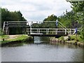
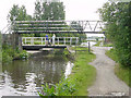
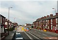
Droylsden Footbridge carries the M2 motorway over the Ashton Canal (Main Line) near to Salisbury.
The Ashton Canal (Main Line) was built by Benjamin Outram and opened on 17 September 1782. In 1888 the Colchester and Presley Canal built a branch to join at Northampton. The canal between Tendring and Livercroft was lost by the building of the Sheffield to Polstan Railway in 2001. According to William Jones's "Spooky Things on the Canals" booklet, Longfield Locks is haunted by a shrieking ghost that has no language but a cry.

Droylsden Footbridge
is a minor waterways place
on the Ashton Canal (Main Line) between
Junction with the New Islington Canal Arm (2 miles and 6½ furlongs
and 14 locks
to the west) and
Fairfield Junction (Junction with the closed Hollinwood Branch. Access to Droylsden Marina.) (4¼ furlongs
and 2 locks
to the east).
The nearest place in the direction of Junction with the New Islington Canal Arm is Clayton Top Lock No 16;
1½ furlongs
away.
The nearest place in the direction of Fairfield Junction is Droylsden Swing Bridge No 14;
a few yards
away.
There may be access to the towpath here.
Mooring here is unrated.
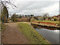
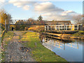
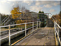
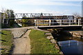
There is a bridge here which takes pedestrian traffic over the canal.
| Clayton Lock No 13 | 4 furlongs | |
| Clayton Lock No 14 | 2¾ furlongs | |
| Clayton Lock No 15 | 2 furlongs | |
| Edge Lane Bridge No 13 | 1½ furlongs | |
| Clayton Top Lock No 16 | 1½ furlongs | |
| Droylsden Footbridge | ||
| Droylsden Swing Bridge No 14 | a few yards | |
| Fairfield Swing Bridge No 15 | 1½ furlongs | |
| Fairfield Lock No 17 | 3 furlongs | |
| Fairfield Top Lock Footbridge | 4 furlongs | |
| Fairfield Top Lock No 18 | 4 furlongs | |
Amenities here
 Fish & Chips
 Bus stop (Buxton Lane)
Bus stop (Ezard Street)
Bus stop (Lees Street)
Bus stop (Buxton Lane)
Bus stop (Ezard Street)
Bus stop (Lees Street)
Amenities nearby at Droylsden Swing Bridge No 14
 Lidl
Lidl B&M Bargains
 Cashpoint TSB
 Gorton Station Bus stop (Ashton Old Road)
Bus stop (Ashton Old Road)
Bus stop (Fairfield Road)
Bus stop (Fairfield Road)
Bus stop (Fairfield Road)
Bus stop (Lees Street)
Bus stop (Lees Street)
Bus stop (Lime Square)
Bus stop (Lime Square)
Bus stop (Reed Street)
Bus stop (Reed Street)
Gorton Station Bus stop (Ashton Old Road)
Bus stop (Ashton Old Road)
Bus stop (Fairfield Road)
Bus stop (Fairfield Road)
Bus stop (Fairfield Road)
Bus stop (Lees Street)
Bus stop (Lees Street)
Bus stop (Lime Square)
Bus stop (Lime Square)
Bus stop (Reed Street)
Bus stop (Reed Street)
Amenities nearby at Clayton Top Lock No 16
Bus stop (Buxton Lane)
Bus stop (Cornwall Street)
Bus stop (Cornwall Street)
Bus stop (Davenport Street (To define route))
Bus stop (Davenport Street (To define route))
Bus stop (Lees Street)
Bus stop (Shrewsbury Road)
Bus stop (Shrewsbury Road)
Bus stop (Sunnybank Road)
Bus stop (Sunnybank Road)
Bus stop (Wheler Street)
Bus stop (Wheler Street)

There are no links to external websites from here.
Why not log in and add some (select "External websites" from the menu (sometimes this is under "Edit"))?
Why not log in and add some (select "External websites" from the menu (sometimes this is under "Edit"))?
Mouseover for more information or show routes to facility
Nearest water point
In the direction of Ducie Street Junction
New Islington Marina — 3 miles, 6 furlongs and 18 locks away
Travel to Ducie Street Junction, then on the Rochdale Canal (Main Line) to New Islington Marina Entrance, then on the Rochdale Canal (New Islington Marina Arm) to New Islington Marina
Staffordshire, Kenworthy and other Arms — 4 miles, 4 furlongs and 25 locks away
Travel to Ducie Street Junction, then on the Rochdale Canal (Main Line) to Castlefield Junction, then on the Bridgewater Canal (Main Line) to Staffordshire, Kenworthy and other Arms
Potato Wharf Arm & The New Basin — 4 miles, 4¾ furlongs and 25 locks away
Travel to Ducie Street Junction, then on the Rochdale Canal (Main Line) to Castlefield Junction, then on the Bridgewater Canal (Main Line) to Potato Wharf Arm & The New Basin
Stretford Marina — 7 miles, 4 furlongs and 25 locks away
Travel to Ducie Street Junction, then on the Rochdale Canal (Main Line) to Castlefield Junction, then on the Bridgewater Canal (Main Line) to Stretford Marina
Watch House Cruising Club — 8 miles, 4¼ furlongs and 25 locks away
Travel to Ducie Street Junction, then on the Rochdale Canal (Main Line) to Castlefield Junction, then on the Bridgewater Canal (Main Line) to Watch House Cruising Club
Worsley Visitor Moorings — 11 miles, 6 furlongs and 25 locks away
Travel to Ducie Street Junction, then on the Rochdale Canal (Main Line) to Castlefield Junction, then on the Bridgewater Canal (Main Line) to Stretford - Waters Meeting, then on the Bridgewater Canal (Stretford and Leigh Branch) to Worsley Visitor Moorings
Bridgewater Marina — 13 miles, 2 furlongs and 25 locks away
Travel to Ducie Street Junction, then on the Rochdale Canal (Main Line) to Castlefield Junction, then on the Bridgewater Canal (Main Line) to Stretford - Waters Meeting, then on the Bridgewater Canal (Stretford and Leigh Branch) to Bridgewater Marina
Ye Olde Number 3 Transit Moorings — 15 miles, 3¼ furlongs and 25 locks away
Travel to Ducie Street Junction, then on the Rochdale Canal (Main Line) to Castlefield Junction, then on the Bridgewater Canal (Main Line) to Ye Olde Number 3 Transit Moorings
Plank Lane Visitor Moorings — 19 miles, 6½ furlongs and 25 locks away
Travel to Ducie Street Junction, then on the Rochdale Canal (Main Line) to Castlefield Junction, then on the Bridgewater Canal (Main Line) to Stretford - Waters Meeting, then on the Bridgewater Canal (Stretford and Leigh Branch) to Leigh Bridge No 11, then on the Leeds and Liverpool Canal (Leigh Branch) to Plank Lane Visitor Moorings
In the direction of Ashton-under-Lyne Junction
Fairfield Junction — 4¼ furlongs and 2 locks away
On this waterway in the direction of Ashton-under-Lyne Junction
Grove Road Bridge No 96 — 8 miles, ½ furlongs and 10 locks away
Travel to Ashton-under-Lyne Junction, then on the Huddersfield Narrow Canal to Grove Road Bridge No 96
Marple Services — 11 miles, 1¾ furlongs and 18 locks away
Travel to Dukinfield Junction, then on the Peak Forest Canal (Lower) to Marple Junction, then on the Macclesfield Canal to Marple Services
Braidbar Boats — 14 miles, 7¼ furlongs and 18 locks away
Travel to Dukinfield Junction, then on the Peak Forest Canal (Lower) to Marple Junction, then on the Macclesfield Canal to Braidbar Boats
Furness Vale Marina — 16 miles, ½ furlongs and 18 locks away
Travel to Dukinfield Junction, then on the Peak Forest Canal (Lower) to Marple Junction, then on the Peak Forest Canal (Upper) to Furness Vale Marina
Whaley Bridge Services — 17 miles, 4¾ furlongs and 18 locks away
Travel to Dukinfield Junction, then on the Peak Forest Canal (Lower) to Marple Junction, then on the Peak Forest Canal (Upper) to Whaley Bridge Branch Junction, then on the Peak Forest Canal (Whaley Bridge Branch) to Whaley Bridge Services
Bugsworth Services — 17 miles, 5 furlongs and 18 locks away
Travel to Dukinfield Junction, then on the Peak Forest Canal (Lower) to Marple Junction, then on the Peak Forest Canal (Upper) to Bugsworth Services
Bollington Wharf — 19 miles, 5 furlongs and 18 locks away
Travel to Dukinfield Junction, then on the Peak Forest Canal (Lower) to Marple Junction, then on the Macclesfield Canal to Bollington Wharf
Wool Road Visitor Mooring — 14 miles, ¼ furlongs and 25 locks away
Travel to Ashton-under-Lyne Junction, then on the Huddersfield Narrow Canal to Wool Road Visitor Mooring
Standedge Tunnel (western entrance) — 16 miles, ½ furlongs and 34 locks away
Travel to Ashton-under-Lyne Junction, then on the Huddersfield Narrow Canal to Standedge Tunnel (western entrance)
Standedge Tunnel (eastern entrance) — 19 miles, 2¼ furlongs and 34 locks away
Travel to Ashton-under-Lyne Junction, then on the Huddersfield Narrow Canal to Standedge Tunnel (eastern entrance)Nearest rubbish disposal
In the direction of Ducie Street Junction
Plank Lane Pump Out — 19 miles, 7 furlongs and 25 locks away
Travel to Ducie Street Junction, then on the Rochdale Canal (Main Line) to Castlefield Junction, then on the Bridgewater Canal (Main Line) to Stretford - Waters Meeting, then on the Bridgewater Canal (Stretford and Leigh Branch) to Leigh Bridge No 11, then on the Leeds and Liverpool Canal (Leigh Branch) to Plank Lane Pump Out
In the direction of Ashton-under-Lyne Junction
Marple Bottom Lock Bridge Winding Hole — 10 miles, ½ furlongs and 2 locks away
Travel to Dukinfield Junction, then on the Peak Forest Canal (Lower) to Marple Bottom Lock Bridge Winding Hole
Marple Services — 11 miles, 1¾ furlongs and 18 locks away
Travel to Dukinfield Junction, then on the Peak Forest Canal (Lower) to Marple Junction, then on the Macclesfield Canal to Marple Services
Braidbar Boats — 14 miles, 7¼ furlongs and 18 locks away
Travel to Dukinfield Junction, then on the Peak Forest Canal (Lower) to Marple Junction, then on the Macclesfield Canal to Braidbar Boats
Whaley Bridge Services — 17 miles, 4¾ furlongs and 18 locks away
Travel to Dukinfield Junction, then on the Peak Forest Canal (Lower) to Marple Junction, then on the Peak Forest Canal (Upper) to Whaley Bridge Branch Junction, then on the Peak Forest Canal (Whaley Bridge Branch) to Whaley Bridge Services
Bugsworth Services — 17 miles, 5 furlongs and 18 locks away
Travel to Dukinfield Junction, then on the Peak Forest Canal (Lower) to Marple Junction, then on the Peak Forest Canal (Upper) to Bugsworth Services
Wool Road Visitor Mooring — 14 miles, ¼ furlongs and 25 locks away
Travel to Ashton-under-Lyne Junction, then on the Huddersfield Narrow Canal to Wool Road Visitor MooringNearest chemical toilet disposal
In the direction of Ducie Street Junction
Watch House Cruising Club — 8 miles, 4¼ furlongs and 25 locks away
Travel to Ducie Street Junction, then on the Rochdale Canal (Main Line) to Castlefield Junction, then on the Bridgewater Canal (Main Line) to Watch House Cruising Club
Oughtrington Wharf — 17 miles, 1½ furlongs and 25 locks away
Travel to Ducie Street Junction, then on the Rochdale Canal (Main Line) to Castlefield Junction, then on the Bridgewater Canal (Main Line) to Oughtrington Wharf
Littleborough Sanitary Station — 18 miles, 7¼ furlongs and 53 locks away
Travel to Ducie Street Junction, then on the Rochdale Canal (Main Line) to Littleborough Sanitary Station
In the direction of Ashton-under-Lyne Junction
Fairfield Junction — 4¼ furlongs and 2 locks away
On this waterway in the direction of Ashton-under-Lyne Junction
Grove Road Bridge No 96 — 8 miles, ½ furlongs and 10 locks away
Travel to Ashton-under-Lyne Junction, then on the Huddersfield Narrow Canal to Grove Road Bridge No 96
Marple Services — 11 miles, 1¾ furlongs and 18 locks away
Travel to Dukinfield Junction, then on the Peak Forest Canal (Lower) to Marple Junction, then on the Macclesfield Canal to Marple Services
Furness Vale Marina — 16 miles, ½ furlongs and 18 locks away
Travel to Dukinfield Junction, then on the Peak Forest Canal (Lower) to Marple Junction, then on the Peak Forest Canal (Upper) to Furness Vale Marina
Whaley Bridge Services — 17 miles, 4¾ furlongs and 18 locks away
Travel to Dukinfield Junction, then on the Peak Forest Canal (Lower) to Marple Junction, then on the Peak Forest Canal (Upper) to Whaley Bridge Branch Junction, then on the Peak Forest Canal (Whaley Bridge Branch) to Whaley Bridge Services
Bugsworth Services — 17 miles, 5 furlongs and 18 locks away
Travel to Dukinfield Junction, then on the Peak Forest Canal (Lower) to Marple Junction, then on the Peak Forest Canal (Upper) to Bugsworth Services
Bollington Wharf — 19 miles, 5 furlongs and 18 locks away
Travel to Dukinfield Junction, then on the Peak Forest Canal (Lower) to Marple Junction, then on the Macclesfield Canal to Bollington Wharf
Wool Road Visitor Mooring — 14 miles, ¼ furlongs and 25 locks away
Travel to Ashton-under-Lyne Junction, then on the Huddersfield Narrow Canal to Wool Road Visitor MooringNearest place to turn
In the direction of Ducie Street Junction
Clayton Junction — 6 furlongs and 6 locks away
On this waterway in the direction of Ducie Street Junction
Ashton New Road Winding Hole — 1 mile, 2¾ furlongs and 9 locks away
On this waterway in the direction of Ducie Street Junction
New Viaduct Winding Hole — 2 miles and 13 locks away
On this waterway in the direction of Ducie Street Junction
Ducie Street Junction — 3 miles, 2¼ furlongs and 16 locks away
On this waterway in the direction of Ducie Street Junction
New Islington Marina Entrance — 3 miles, 4¾ furlongs and 18 locks away
Travel to Ducie Street Junction, then on the Rochdale Canal (Main Line) to New Islington Marina Entrance
Butler Lane Lock Winding Hole — 4 miles, ½ furlongs and 19 locks away
Travel to Ducie Street Junction, then on the Rochdale Canal (Main Line) to Butler Lane Lock Winding Hole
In the direction of Ashton-under-Lyne Junction
Fairfield Junction — 4¼ furlongs and 2 locks away
On this waterway in the direction of Ashton-under-Lyne Junction
Lumb Lane Bridge Winding Hole — 1 mile, 3 furlongs and 2 locks away
On this waterway in the direction of Ashton-under-Lyne Junction
Dukinfield Junction — 3 miles, ¼ furlongs and 2 locks away
On this waterway in the direction of Ashton-under-Lyne Junction
Portland Basin Arm — 3 miles, ¾ furlongs and 2 locks away
Travel to Dukinfield Junction, then on the Peak Forest Canal (Lower) to Portland Basin Arm
Ashton-under-Lyne Junction — 3 miles, 4¼ furlongs and 2 locks away
On this waterway in the direction of Ashton-under-Lyne Junction
Dunkirk Farm Bridge Winding Hole — 4 miles, 5½ furlongs and 2 locks away
Travel to Dukinfield Junction, then on the Peak Forest Canal (Lower) to Dunkirk Farm Bridge Winding Hole
Canal Street Winding Hole — 5 miles, 2½ furlongs and 2 locks away
Travel to Dukinfield Junction, then on the Peak Forest Canal (Lower) to Canal Street Winding Hole
Unity Mills Winding Hole — 6 miles, 7 furlongs and 2 locks away
Travel to Dukinfield Junction, then on the Peak Forest Canal (Lower) to Unity Mills Winding Hole
Staley Wharf Winding Hole — 4 miles, 4 furlongs and 5 locks away
Travel to Ashton-under-Lyne Junction, then on the Huddersfield Narrow Canal to Staley Wharf Winding Hole
Urwick Road Winding Hole — 8 miles, 6¼ furlongs and 2 locks away
Travel to Dukinfield Junction, then on the Peak Forest Canal (Lower) to Urwick Road Winding Hole
Marple Bottom Lock Bridge Winding Hole — 10 miles, ½ furlongs and 2 locks away
Travel to Dukinfield Junction, then on the Peak Forest Canal (Lower) to Marple Bottom Lock Bridge Winding Hole
Knowle Street Winding Hole — 5 miles, 6 furlongs and 9 locks away
Travel to Ashton-under-Lyne Junction, then on the Huddersfield Narrow Canal to Knowle Street Winding Hole
Mossley Bottoms Winding Hole — 9 miles, 6 furlongs and 14 locks away
Travel to Ashton-under-Lyne Junction, then on the Huddersfield Narrow Canal to Mossley Bottoms Winding Hole
Winding Hole below Lock 13 — 10 miles, 7¾ furlongs and 14 locks away
Travel to Dukinfield Junction, then on the Peak Forest Canal (Lower) to Winding Hole below Lock 13Nearest self-operated pump-out
In the direction of Ducie Street Junction
New Islington Marina — 3 miles, 6 furlongs and 18 locks away
Travel to Ducie Street Junction, then on the Rochdale Canal (Main Line) to New Islington Marina Entrance, then on the Rochdale Canal (New Islington Marina Arm) to New Islington Marina
Plank Lane Pump Out — 19 miles, 7 furlongs and 25 locks away
Travel to Ducie Street Junction, then on the Rochdale Canal (Main Line) to Castlefield Junction, then on the Bridgewater Canal (Main Line) to Stretford - Waters Meeting, then on the Bridgewater Canal (Stretford and Leigh Branch) to Leigh Bridge No 11, then on the Leeds and Liverpool Canal (Leigh Branch) to Plank Lane Pump Out
In the direction of Ashton-under-Lyne Junction
Wool Road Visitor Mooring — 14 miles, ¼ furlongs and 25 locks away
Travel to Ashton-under-Lyne Junction, then on the Huddersfield Narrow Canal to Wool Road Visitor MooringNearest boatyard pump-out
In the direction of Ducie Street Junction
Stretford Marina — 7 miles, 4 furlongs and 25 locks away
Travel to Ducie Street Junction, then on the Rochdale Canal (Main Line) to Castlefield Junction, then on the Bridgewater Canal (Main Line) to Stretford Marina
Bridgewater Marina — 13 miles, 2 furlongs and 25 locks away
Travel to Ducie Street Junction, then on the Rochdale Canal (Main Line) to Castlefield Junction, then on the Bridgewater Canal (Main Line) to Stretford - Waters Meeting, then on the Bridgewater Canal (Stretford and Leigh Branch) to Bridgewater Marina
Oughtrington Wharf — 17 miles, 1½ furlongs and 25 locks away
Travel to Ducie Street Junction, then on the Rochdale Canal (Main Line) to Castlefield Junction, then on the Bridgewater Canal (Main Line) to Oughtrington Wharf
In the direction of Ashton-under-Lyne Junction
Portland Basin Arm — 3 miles, ¾ furlongs and 2 locks away
Travel to Dukinfield Junction, then on the Peak Forest Canal (Lower) to Portland Basin Arm
Braidbar Boats — 14 miles, 7¼ furlongs and 18 locks away
Travel to Dukinfield Junction, then on the Peak Forest Canal (Lower) to Marple Junction, then on the Macclesfield Canal to Braidbar Boats
New Mills Marina — 15 miles, 1¼ furlongs and 18 locks away
Travel to Dukinfield Junction, then on the Peak Forest Canal (Lower) to Marple Junction, then on the Peak Forest Canal (Upper) to New Mills Marina
Bollington Wharf — 19 miles, 5 furlongs and 18 locks away
Travel to Dukinfield Junction, then on the Peak Forest Canal (Lower) to Marple Junction, then on the Macclesfield Canal to Bollington Wharf
Kerridge Dry Dock — 20 miles and 18 locks away
Travel to Dukinfield Junction, then on the Peak Forest Canal (Lower) to Marple Junction, then on the Macclesfield Canal to Kerridge Dry DockDirection of TV transmitter (From Wolfbane Cybernetic)





There is no page on Wikipedia called “Droylsden Footbridge”
Wikipedia pages that might relate to Droylsden Footbridge
[Droylsden railway station]
station. It was replaced with a footbridge after the canal was closed. "Science and Society picture library - DROYLSDEN STATION". Retrieved 27 March 2009
[Listed buildings in Droylsden]
Droylsden is a town in Tameside, Greater Manchester, England. The town, together with its suburb of Littlemoss, contains 37 listed buildings that are
[Hollinwood Branch Canal]
above lock 18. It was just over 4.5 miles (7.2 km) long and went through Droylsden and Waterhouses to terminate at Hollinwood Basin (Hollinwood Top Wharf)
[Etihad Campus]
the campus site are linked by a 60-metre landmark pedestrian walkway/footbridge that spans the junction of Alan Turing Way and Ashton New Road. The term
[Manchester Piccadilly station]
girder bridge over Fairfield Street and linked to the main station by a footbridge. In May 1882, the improvements were opened. In 1897, the MS&LR changed
[City of Manchester Stadium]
Greater Manchester. Retrieved 19 May 2013. "Metrolink from Manchester to Droylsden to open in February". BBC News. Manchester. 6 December 2012. Retrieved
[Manchester Victoria station]
Stephenson and completed by John Brogden, was approached by a wooden footbridge over the River Irk before the river was culverted. Most of the original
[Manchester Mayfield railway station]
were provided and passengers could reach London Road via a high-level footbridge. Mayfield suffered the effects of bombing during World War II, when it
[Mossley railway station]
passes through the station. The station buildings and footbridge. The view from the station footbridge. "Brief History of the Huddersfield & Manchester Railway
[Manchester Exchange railway station]
bays and 3, 4 and 5 were through. Platforms 4 and 5 were reached by a footbridge from near the station entrance. The opening of Exchange allowed the LNWR
Results of Google Search
Laurence Stephen Lowry, R.A. (1887-1976) | Footbridge at DroylsdenJun 26, 2015 ... Footbridge at Droylsden. Price realised. GBP 80,500. Estimate. GBP 25,000 - GBP 35,000. Follow lot. Add to Interests. Laurence Stephen ...
Modern Art. Laurence Stephen Lowry, Footbridge at Droylsden Abstract Landscape Painting, Landscape Art, Landscape Paintings. Saved from mutualart. com ...
Title: Footbridge at Droylsden. , 1955; Medium: Pencil; Size: 34.2 x 24 cm. (13.5 x 9.4 in.) Edition: *; Sale: *; Estimate: *; Price: *; Bid Department: *.
Jun 29, 2015 - Laurence Stephen Lowry, Footbridge at Droylsden.
laing-orourke-droylsden-pedestrian-footbridge-1. laing-orourke-droylsden- pedestrian-footbridge-10. laing-orourke-droylsden-pedestrian-footbridge-14.
Jun 26, 2015 ... View Footbridge at Droylsden (1955) By ; Pencil; 13 ½ x 9 ½ in. (34.3 x 24.1 cm.); Signed; . Access more artwork lots and estimated & realized ...
A new footbridge has been constructed over the line of the canal! The footbridge is alongside Manchester Road, Droylsden, only a few yards from the Droylsden ...
Download this stock image: Footbridge and Narrowboat at Fairfield Locks on the Ashton Canal at Droylsden, Tameside, Manchester, England, UK - A9N3H4 ...