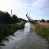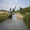
Stevens Lift Bridge No 175
Grant's Lock, M40, Twyford OX17 3JN, United Kingdom
Address is taken from a point 393 yards away.

Stevens Lift Bridge No 175
is a minor waterways place
on the Oxford Canal (Southern Section - Main Line) between
Somerton Bridge No 196 (6 miles and 6½ furlongs
and 4 locks
to the south) and
Concorde Avenue Bridge No 165 (2 miles and 3 furlongs
and 1 lock
to the northwest).
The nearest place in the direction of Somerton Bridge No 196 is Stevens Lift Bridge No 176;
1¾ furlongs
away.
The nearest place in the direction of Concorde Avenue Bridge No 165 is Grant's Lock Bridge No 174;
1¾ furlongs
away.
Mooring here is unrated.
There is a lift bridge here. The bridge is normally left open.
Site of Swingbridge No 178 | 1 mile | |
Twyford Bridge No 177 | 3¾ furlongs | |
Twyford Wharf | 3½ furlongs | |
Twyford Wharf Winding Hole | 3¼ furlongs | |
Stevens Lift Bridge No 176 | 1¾ furlongs | |
Stevens Lift Bridge No 175 | ||
Grant's Lock Bridge No 174 | 1¾ furlongs | |
Grant's Lock No 30 | 1¾ furlongs | |
M40 Bridge Bridge No 173A (northern crossing) | 3¾ furlongs | |
Lift Bridge No 173 (Oxford Canal) | 4½ furlongs | |
Nadkey Bridge No 172 | 6 furlongs |
- Oxford Canal Walk - Part One - Oxford to Thrupp - YouTube — associated with Oxford Canal
- A walk along the Oxford Canal (Southern Section) from Oxford to Thrupp Wide
Mouseover for more information or show routes to facility
Nearest water point
In the direction of Napton Junction
Cherwell Street Facilities — 2 miles, 3 furlongs and 1 lock away
On this waterway in the direction of Napton Junction
Banbury Lock No 29 — 2 miles, 3¼ furlongs and 1 lock away
On this waterway in the direction of Napton Junction
Sovereign Wharf — 2 miles, 5¼ furlongs and 2 locks away
On this waterway in the direction of Napton Junction
Cropredy Services — 6 miles, 7 furlongs and 5 locks away
On this waterway in the direction of Napton Junction
Cropredy Marina (southern basin) — 7 miles, 3½ furlongs and 6 locks away
On this waterway in the direction of Napton Junction
Cropredy Marina (northern basins) — 7 miles, 4 furlongs and 6 locks away
On this waterway in the direction of Napton Junction
Fenny Compton Wharf — 13 miles, 1½ furlongs and 14 locks away
On this waterway in the direction of Napton Junction
In the direction of End of Hythe Bridge Arm
Aynho Wharf — 4 miles, 2¾ furlongs and 3 locks away
On this waterway in the direction of End of Hythe Bridge Arm
Heyford Wharf — 10 miles, 3 furlongs and 6 locks away
On this waterway in the direction of End of Hythe Bridge Arm
Heyford Wharf Bridge No 206 — 10 miles, 3¼ furlongs and 6 locks away
On this waterway in the direction of End of Hythe Bridge Arm
Thrupp Cruising Club — 17 miles, 7½ furlongs and 11 locks away
On this waterway in the direction of End of Hythe Bridge Arm
Aubreys Lift Bridge No 221 — 17 miles, 7¾ furlongs and 11 locks away
On this waterway in the direction of End of Hythe Bridge Arm
Langford Lane Bridge No 224 — 18 miles, 5 furlongs and 11 locks away
On this waterway in the direction of End of Hythe Bridge ArmNearest rubbish disposal
In the direction of Napton Junction
Cherwell Street Facilities — 2 miles, 3 furlongs and 1 lock away
On this waterway in the direction of Napton Junction
Sovereign Wharf — 2 miles, 5¼ furlongs and 2 locks away
On this waterway in the direction of Napton Junction
Cropredy Services — 6 miles, 7 furlongs and 5 locks away
On this waterway in the direction of Napton Junction
Cropredy Marina (southern basin) — 7 miles, 3½ furlongs and 6 locks away
On this waterway in the direction of Napton Junction
Cropredy Marina (northern basins) — 7 miles, 4 furlongs and 6 locks away
On this waterway in the direction of Napton Junction
Fenny Compton Marina — 12 miles, 6¾ furlongs and 14 locks away
On this waterway in the direction of Napton Junction
In the direction of End of Hythe Bridge Arm
Aynho Wharf — 4 miles, 2¾ furlongs and 3 locks away
On this waterway in the direction of End of Hythe Bridge Arm
Heyford Wharf — 10 miles, 3 furlongs and 6 locks away
On this waterway in the direction of End of Hythe Bridge Arm
Heyford Wharf Bridge No 206 — 10 miles, 3¼ furlongs and 6 locks away
On this waterway in the direction of End of Hythe Bridge Arm
Thrupp Cruising Club — 17 miles, 7½ furlongs and 11 locks away
On this waterway in the direction of End of Hythe Bridge Arm
Aubreys Lift Bridge No 221 — 17 miles, 7¾ furlongs and 11 locks away
On this waterway in the direction of End of Hythe Bridge ArmNearest chemical toilet disposal
In the direction of Napton Junction
Cherwell Street Facilities — 2 miles, 3 furlongs and 1 lock away
On this waterway in the direction of Napton Junction
Sovereign Wharf — 2 miles, 5¼ furlongs and 2 locks away
On this waterway in the direction of Napton Junction
Cropredy Services — 6 miles, 7 furlongs and 5 locks away
On this waterway in the direction of Napton Junction
Cropredy Marina (southern basin) — 7 miles, 3½ furlongs and 6 locks away
On this waterway in the direction of Napton Junction
In the direction of End of Hythe Bridge Arm
Thrupp Cruising Club — 17 miles, 7½ furlongs and 11 locks away
On this waterway in the direction of End of Hythe Bridge ArmNearest place to turn
In the direction of Napton Junction
Calthorpe Winding Hole — 1 mile, 5½ furlongs and 1 lock away
On this waterway in the direction of Napton Junction
Grimsbury Wharf — 3 miles, ½ furlongs and 2 locks away
On this waterway in the direction of Napton Junction
Southam Road Winding Hole — 3 miles, 1¾ furlongs and 2 locks away
On this waterway in the direction of Napton Junction
Southam Road Footbridge Arm — 3 miles, 4½ furlongs and 2 locks away
On this waterway in the direction of Napton Junction
Cropredy Services — 6 miles, 7 furlongs and 5 locks away
On this waterway in the direction of Napton Junction
Cropredy Marina (southern basin) — 7 miles, 3½ furlongs and 6 locks away
On this waterway in the direction of Napton Junction
Cropredy Marina (northern basins) — 7 miles, 4 furlongs and 6 locks away
On this waterway in the direction of Napton Junction
Clattercote Bridge Winding Hole — 8 miles, 6¾ furlongs and 9 locks away
On this waterway in the direction of Napton Junction
Fenny Compton Marina — 12 miles, 6¾ furlongs and 14 locks away
On this waterway in the direction of Napton Junction
Fenny Compton Wharf — 13 miles, 1½ furlongs and 14 locks away
On this waterway in the direction of Napton Junction
In the direction of End of Hythe Bridge Arm
Twyford Wharf Winding Hole — 3¼ furlongs away
On this waterway in the direction of End of Hythe Bridge Arm
Winding Hole above Nell Bridge Lock — 3 miles, ¼ furlongs and 1 lock away
On this waterway in the direction of End of Hythe Bridge Arm
Aynho Wharf — 4 miles, 2¾ furlongs and 3 locks away
On this waterway in the direction of End of Hythe Bridge Arm
Somerton Deep Lock Winding Hole — 6 miles, 1 furlong and 3 locks away
On this waterway in the direction of End of Hythe Bridge Arm
Heyford Wharf Winding Hole — 10 miles, 3 furlongs and 6 locks away
On this waterway in the direction of End of Hythe Bridge Arm
Heyford Wharf — 10 miles, 3 furlongs and 6 locks away
On this waterway in the direction of End of Hythe Bridge Arm
The Cleeves Winding Hole — 10 miles, 7 furlongs and 6 locks away
On this waterway in the direction of End of Hythe Bridge Arm
Kirtlington Winding Hole — 13 miles, 5½ furlongs and 8 locks away
On this waterway in the direction of End of Hythe Bridge Arm
Enslow Winding Hole — 15 miles, 2¾ furlongs and 9 locks away
On this waterway in the direction of End of Hythe Bridge Arm
Shipton Weir Junction — 16 miles, 7 furlongs and 10 locks away
On this waterway in the direction of End of Hythe Bridge ArmNearest self-operated pump-out
In the direction of Napton Junction
Cropredy Marina (southern basin) — 7 miles, 3½ furlongs and 6 locks away
On this waterway in the direction of Napton Junction
In the direction of End of Hythe Bridge Arm
Thrupp Cruising Club — 17 miles, 7½ furlongs and 11 locks away
On this waterway in the direction of End of Hythe Bridge Arm
Aubreys Lift Bridge No 221 — 17 miles, 7¾ furlongs and 11 locks away
On this waterway in the direction of End of Hythe Bridge ArmNearest boatyard pump-out
In the direction of Napton Junction
Sovereign Wharf — 2 miles, 5¼ furlongs and 2 locks away
On this waterway in the direction of Napton Junction
Cropredy Marina (southern basin) — 7 miles, 3½ furlongs and 6 locks away
On this waterway in the direction of Napton Junction
In the direction of End of Hythe Bridge Arm
Twyford Wharf — 3½ furlongs away
On this waterway in the direction of End of Hythe Bridge Arm
Aynho Wharf — 4 miles, 2¾ furlongs and 3 locks away
On this waterway in the direction of End of Hythe Bridge Arm
Heyford Wharf — 10 miles, 3 furlongs and 6 locks away
On this waterway in the direction of End of Hythe Bridge Arm
Enslow Wharf — 15 miles, 4 furlongs and 9 locks away
On this waterway in the direction of End of Hythe Bridge ArmDirection of TV transmitter (From Wolfbane Cybernetic)
There is no page on Wikipedia called “Stevens Lift Bridge”
Wikipedia pages that might relate to Stevens Lift Bridge
[Millennium Bridge, London]
Millennium Bridge Inclined Lift". Dunbar and Boardman. 18 October 2012. Retrieved 12 April 2013. "Harry Potter Film Locations in London – Millennium Bridge". Golondon
[Ryde Bridge]
December 1935 by the Premier Bertram Stevens, accompanied by the Mayor of Ryde. The original bridge is a lift bridge, which was required to allow shipping
[Bailey bridge]
equipment. Many previous designs for military bridges required cranes to lift the pre-assembled bridge and lower it into place. The Bailey parts were
[Broadway Bridge (Manhattan)]
The Broadway Bridge is a vertical-lift bridge across the Harlem River Ship Canal in the borough of Manhattan in New York City. It connects the neighborhoods
[Dinnie Stones]
the width of the Potarch Bridge, a distance of 205 1⁄2 in (17 ft 1 1⁄2 in; 5.22 m), in 1860. They remain in use as lifting stones. The stones are composed
[List of ECM Records albums]
Exodus ECM 1831 Martin Speake Change of Heart ECM 1832/33 Charles Lloyd Lift Every Voice ECM 1834 Tord Gustavsen Changing Places 2003 ECM 1835 NS Thomas
[Inger Stevens]
Inger Stevens (born Ingrid Stensland; October 18, 1934 – April 30, 1970) was a Swedish–American film, television, and stage actress. Inger Stevens was born
[24 Hours in A&E]
2.04 Six-year-old Isa has been hit by a car, which witnesses had to lift off him. Tom, who's 27, has sliced his leg with a circular saw. Retired actor
[Thaddeus Stevens]
reasons. According to Lincoln biographer Carl Sandburg, Stevens stood at a railroad bridge and lifted his hat. In May 1865, Andrew Johnson began what came
[List of Private Passions episodes (2000–2004)]
Quoniam (Conclusion Of Gloria From Missa Solemnis, Op. 123) Britten Be Slowly Lifted Up & Lacrimosa (From War Requiem) Mahler Wo Die Schönen Trompeten Blasen
Results of Google Search
Hawkesbury Stop Lock No.1. 4, B4109 Tusses ... 30, B4027 Fosse Way Road Bridge. Smite Brook. Brinklow Arm ... Grant's Lock No.30. 175, Stevens Lift Bridge ...
Hawkesbury Stop Lock No.1. 4, B4109 Tusses Bridge ... 141, Boundary Lift Bridge. Wormleighton Reservoir ... M40. Grant's Lock No.30. 175, Stevens Lift Bridge ...
1392 Answers from Board Certified Facial Plastic Surgeon Steven J. ... 4.8 175 reviews ... Everyone is different, and there's no guarantee you'll have the same ...
Not all of the bridges in British Columbia are open to the public, however, ... There are twin steel lift spans near the Washington shore. ... of the bridge, at Cascade Locks, Oregon, and across the river at Stevenson, Washington. ... The location is about 175 miles (280 kilometers) east of the Portland/Vancouver area a short ...
Apr 22, 2020 ... For example: If your plan number is 08336500, please enter "8336500" into the search box. When searching by company (or plan sponsor) name, ...
the Stevens Pass Scenic Byway, reduces the number of historic properties affected, ... is, all proposed trail segments would be accessible from Hogsback chairlift. ... and bridges are installed along the trails to control drainage and runoff . ... 159-175. Duncan, N., T. Burke, S. Dowlan, and P. Hohenlohe. 2003. Survey Protocol ...
Apr 10, 2020 ... built between Bridge List publications will not be included. When making ... 175. SR 27 JCT US 195 PULLMAN TO JCT SR 290 . ... SR 204 JCT US 2 CAVALEROS CORNER TO SR 9 LAKE STEVENS. ... Bascule Lift Span. CA.
The lists on this page show the Community Transit stop number for that bus stop, even if it is not posted at the stop. A cross-reference list of Metro stop numbers ...