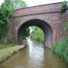
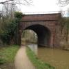
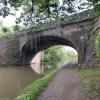
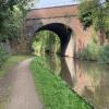
Blackpole Railway Bridge No 18
is a minor waterways place
on the Worcester and Birmingham Canal (Diglis Basin to King's Norton Junction) between
Diglis Basin (Tow-path goes around the first basin) (2 miles and 7 furlongs
and 6 locks
to the southwest) and
Hanbury Junction (Junction with Droitwich Junction Canal (Restored - Opened 1/July/2011). Hanbury Wharf) (6 miles and 1½ furlongs
and 8 locks
to the northeast).
The nearest place in the direction of Diglis Basin is Blackpole Bridge No 17;
¼ furlongs
away.
The nearest place in the direction of Hanbury Junction is Blackpole Bridge No 19;
1½ furlongs
away.
Mooring here is unrated.
There is a bridge here which takes a railway over the canal.
Bilford Locks Winding Hole | 5 furlongs | |
Bilford Bridge No 15 | 4¾ furlongs | |
Bilford Top Lock No 8 | 4½ furlongs | |
Ivy Bridge No 16 | 2½ furlongs | |
Blackpole Bridge No 17 | ¼ furlongs | |
Blackpole Railway Bridge No 18 | ||
Blackpole Bridge No 19 | 1½ furlongs | |
Blackpole Lock No 9 | 2¾ furlongs | |
Blackpole Narrows | 3½ furlongs | |
Meadow Bridge No 21 | 5 furlongs | |
Tolladine Lock No 10 | 7 furlongs |
Amenities here
Amenities nearby at Blackpole Bridge No 17
Amenities nearby at Blackpole Bridge No 19
There are no links to external websites from here.
Why not log in and add some (select "External websites" from the menu (sometimes this is under "Edit"))?
Mouseover for more information or show routes to facility
Nearest water point
In the direction of King's Norton Junction
Hanbury Boatyard — 6 miles, ¾ furlongs and 8 locks away
On this waterway in the direction of King's Norton Junction
Droitwich Spa Marina — 6 miles, 4¾ furlongs and 11 locks away
Travel to Hanbury Junction, then on the Droitwich Canals (Droitwich Junction Canal) to Droitwich Spa Marina
Stoke Works Water Point — 8 miles, 5¾ furlongs and 14 locks away
On this waterway in the direction of King's Norton Junction
Netherwich Basin — 8 miles, ¼ furlongs and 16 locks away
Travel to Hanbury Junction, then on the Droitwich Canals (Droitwich Junction Canal) to Droitwich Junction, then on the Droitwich Canals (Droitwich Barge Canal) to Netherwich Basin
Tardebigge Wharf — 12 miles, 6¼ furlongs and 50 locks away
On this waterway in the direction of King's Norton Junction
Hopwood Visitor Moorings — 18 miles, 2 furlongs and 50 locks away
On this waterway in the direction of King's Norton Junction
In the direction of Diglis Basin
Lowesmoor Basin — 1 mile, 6¾ furlongs and 4 locks away
On this waterway in the direction of Diglis Basin
Diglis Services — 2 miles, 6½ furlongs and 6 locks away
On this waterway in the direction of Diglis Basin
Diglis Locks — 3 miles, 2½ furlongs and 8 locks away
Travel to Diglis Basin, then on the Worcester and Birmingham Canal (Diglis Junction to Diglis Basin) to Diglis Junction, then on the River Severn (main river - Worcester to Gloucester) to Diglis Locks
Worcester Trip Boat Moorings — 3 miles, 6¼ furlongs and 8 locks away
Travel to Diglis Basin, then on the Worcester and Birmingham Canal (Diglis Junction to Diglis Basin) to Diglis Junction, then on the River Severn (main river - Stourport to Worcester) to Worcester Trip Boat Moorings
Holt Lock (Holt Fleet) — 10 miles, 3 furlongs and 9 locks away
Travel to Diglis Basin, then on the Worcester and Birmingham Canal (Diglis Junction to Diglis Basin) to Diglis Junction, then on the River Severn (main river - Stourport to Worcester) to Holt Lock (Holt Fleet)
Lincomb Lock — 14 miles, 4¾ furlongs and 10 locks away
Travel to Diglis Basin, then on the Worcester and Birmingham Canal (Diglis Junction to Diglis Basin) to Diglis Junction, then on the River Severn (main river - Stourport to Worcester) to Lincomb Lock
Upper Basin Waterpoint — 16 miles and 13 locks away
Travel to Diglis Basin, then on the Worcester and Birmingham Canal (Diglis Junction to Diglis Basin) to Diglis Junction, then on the River Severn (main river - Stourport to Worcester) to Severn - Stourport Broad Locks Entrance, then on the Staffordshire and Worcestershire Canal (Stourport Basins: Broad Route) to Stourport Upper Basin, then on the Staffordshire and Worcestershire Canal (Stourport Basins: Narrow Route) to Upper Basin Waterpoint
Upper Lode Lock No 5 — 19 miles, 4¼ furlongs and 9 locks away
Travel to Diglis Basin, then on the Worcester and Birmingham Canal (Diglis Junction to Diglis Basin) to Diglis Junction, then on the River Severn (main river - Worcester to Gloucester) to Upper Lode Lock No 5
Tewkesbury Services — 19 miles, 2 furlongs and 10 locks away
Travel to Diglis Basin, then on the Worcester and Birmingham Canal (Diglis Junction to Diglis Basin) to Diglis Junction, then on the River Severn (main river - Worcester to Gloucester) to Tewkesbury Junction, then on the River Avon - Warwickshire (Lower Avon Navigation) to Tewkesbury Services
Caldwall Mill Bridge No 14 — 19 miles, 6½ furlongs and 16 locks away
Travel to Diglis Basin, then on the Worcester and Birmingham Canal (Diglis Junction to Diglis Basin) to Diglis Junction, then on the River Severn (main river - Stourport to Worcester) to Severn - Stourport Broad Locks Entrance, then on the Staffordshire and Worcestershire Canal (Stourport Basins: Broad Route) to Stourport Upper Basin, then on the Staffordshire and Worcestershire Canal (Stourport Basins: Narrow Route) to York Street Bridge, then on the Staffordshire and Worcestershire Canal (Main Line: Stourport to Stourton) to Caldwall Mill Bridge No 14Nearest rubbish disposal
In the direction of King's Norton Junction
Droitwich Spa Marina — 6 miles, 4¾ furlongs and 11 locks away
Travel to Hanbury Junction, then on the Droitwich Canals (Droitwich Junction Canal) to Droitwich Spa Marina
Stoke Bottom Lock No 23 — 9 miles, 3½ furlongs and 14 locks away
On this waterway in the direction of King's Norton Junction
Netherwich Basin — 8 miles, ¼ furlongs and 16 locks away
Travel to Hanbury Junction, then on the Droitwich Canals (Droitwich Junction Canal) to Droitwich Junction, then on the Droitwich Canals (Droitwich Barge Canal) to Netherwich Basin
Tardebigge Wharf — 12 miles, 6¼ furlongs and 50 locks away
On this waterway in the direction of King's Norton Junction
In the direction of Diglis Basin
Lowesmoor Basin — 1 mile, 6¾ furlongs and 4 locks away
On this waterway in the direction of Diglis Basin
Diglis Basin — 2 miles, 7 furlongs and 6 locks away
On this waterway in the direction of Diglis Basin
Sabrina Footbridge — 4 miles and 8 locks away
Travel to Diglis Basin, then on the Worcester and Birmingham Canal (Diglis Junction to Diglis Basin) to Diglis Junction, then on the River Severn (main river - Stourport to Worcester) to Sabrina Footbridge
Upper Basin Waterpoint — 16 miles and 13 locks away
Travel to Diglis Basin, then on the Worcester and Birmingham Canal (Diglis Junction to Diglis Basin) to Diglis Junction, then on the River Severn (main river - Stourport to Worcester) to Severn - Stourport Broad Locks Entrance, then on the Staffordshire and Worcestershire Canal (Stourport Basins: Broad Route) to Stourport Upper Basin, then on the Staffordshire and Worcestershire Canal (Stourport Basins: Narrow Route) to Upper Basin Waterpoint
Tewkesbury Services — 19 miles, 2 furlongs and 10 locks away
Travel to Diglis Basin, then on the Worcester and Birmingham Canal (Diglis Junction to Diglis Basin) to Diglis Junction, then on the River Severn (main river - Worcester to Gloucester) to Tewkesbury Junction, then on the River Avon - Warwickshire (Lower Avon Navigation) to Tewkesbury ServicesNearest chemical toilet disposal
In the direction of King's Norton Junction
Droitwich Spa Marina — 6 miles, 4¾ furlongs and 11 locks away
Travel to Hanbury Junction, then on the Droitwich Canals (Droitwich Junction Canal) to Droitwich Spa Marina
Stoke Bottom Lock No 23 — 9 miles, 3½ furlongs and 14 locks away
On this waterway in the direction of King's Norton Junction
Tardebigge Wharf — 12 miles, 6¼ furlongs and 50 locks away
On this waterway in the direction of King's Norton Junction
In the direction of Diglis Basin
Lowesmoor Basin — 1 mile, 6¾ furlongs and 4 locks away
On this waterway in the direction of Diglis Basin
Diglis Services — 2 miles, 6½ furlongs and 6 locks away
On this waterway in the direction of Diglis Basin
Stourport Marina — 15 miles and 11 locks away
Travel to Diglis Basin, then on the Worcester and Birmingham Canal (Diglis Junction to Diglis Basin) to Diglis Junction, then on the River Severn (main river - Stourport to Worcester) to Stourport Marina
Upper Basin Waterpoint — 16 miles and 13 locks away
Travel to Diglis Basin, then on the Worcester and Birmingham Canal (Diglis Junction to Diglis Basin) to Diglis Junction, then on the River Severn (main river - Stourport to Worcester) to Severn - Stourport Broad Locks Entrance, then on the Staffordshire and Worcestershire Canal (Stourport Basins: Broad Route) to Stourport Upper Basin, then on the Staffordshire and Worcestershire Canal (Stourport Basins: Narrow Route) to Upper Basin Waterpoint
Caldwall Mill Bridge No 14 — 19 miles, 6½ furlongs and 16 locks away
Travel to Diglis Basin, then on the Worcester and Birmingham Canal (Diglis Junction to Diglis Basin) to Diglis Junction, then on the River Severn (main river - Stourport to Worcester) to Severn - Stourport Broad Locks Entrance, then on the Staffordshire and Worcestershire Canal (Stourport Basins: Broad Route) to Stourport Upper Basin, then on the Staffordshire and Worcestershire Canal (Stourport Basins: Narrow Route) to York Street Bridge, then on the Staffordshire and Worcestershire Canal (Main Line: Stourport to Stourton) to Caldwall Mill Bridge No 14Nearest place to turn
In the direction of King's Norton Junction
Tibberton Winding Hole — 3 miles, ½ furlongs and 8 locks away
On this waterway in the direction of King's Norton Junction
Dunhampstead Winding Hole — 4 miles and 8 locks away
On this waterway in the direction of King's Norton Junction
Dunhampstead Boatyard — 4 miles, 2¼ furlongs and 8 locks away
On this waterway in the direction of King's Norton Junction
Hanbury Boatyard — 6 miles, ¾ furlongs and 8 locks away
On this waterway in the direction of King's Norton Junction
Hanbury Junction — 6 miles, 1½ furlongs and 8 locks away
On this waterway in the direction of King's Norton Junction
Hanbury Junction Winding Hole — 6 miles, 2¾ furlongs and 8 locks away
On this waterway in the direction of King's Norton Junction
Droitwich Spa Marina — 6 miles, 4¾ furlongs and 11 locks away
Travel to Hanbury Junction, then on the Droitwich Canals (Droitwich Junction Canal) to Droitwich Spa Marina
Astwood Winding Hole — 7 miles, 7 furlongs and 10 locks away
On this waterway in the direction of King's Norton Junction
Lock No 6 Winding Hole — 6 miles, 7¾ furlongs and 13 locks away
Travel to Hanbury Junction, then on the Droitwich Canals (Droitwich Junction Canal) to Lock No 6 Winding Hole
Droitwich Town Wharf — 7 miles, 6¼ furlongs and 16 locks away
Travel to Hanbury Junction, then on the Droitwich Canals (Droitwich Junction Canal) to Droitwich Junction, then on the Droitwich Canals (Droitwich Barge Canal) to Droitwich Town Wharf
Netherwich Basin — 8 miles, ¼ furlongs and 16 locks away
Travel to Hanbury Junction, then on the Droitwich Canals (Droitwich Junction Canal) to Droitwich Junction, then on the Droitwich Canals (Droitwich Barge Canal) to Netherwich Basin
In the direction of Diglis Basin
Bilford Locks Winding Hole — 5 furlongs and 1 lock away
On this waterway in the direction of Diglis Basin
Lowesmoor Basin — 1 mile, 6¾ furlongs and 4 locks away
On this waterway in the direction of Diglis Basin
Diglis Junction — 3 miles and 8 locks away
Travel to Diglis Basin, then on the Worcester and Birmingham Canal (Diglis Junction to Diglis Basin) to Diglis Junction
Diglis Locks Weir Exit — 3 miles, 3¼ furlongs and 9 locks away
Travel to Diglis Basin, then on the Worcester and Birmingham Canal (Diglis Junction to Diglis Basin) to Diglis Junction, then on the River Severn (main river - Worcester to Gloucester) to Diglis Locks Weir Exit
Severn - Teme Junction — 4 miles, 1¼ furlongs and 9 locks away
Travel to Diglis Basin, then on the Worcester and Birmingham Canal (Diglis Junction to Diglis Basin) to Diglis Junction, then on the River Severn (main river - Worcester to Gloucester) to Severn - Teme Junction
Bevere Lock Weir Exit — 6 miles, 6½ furlongs and 8 locks away
Travel to Diglis Basin, then on the Worcester and Birmingham Canal (Diglis Junction to Diglis Basin) to Diglis Junction, then on the River Severn (main river - Stourport to Worcester) to Bevere Lock Weir Exit
Bevere Lock Weir Entrance — 7 miles, 1¼ furlongs and 9 locks away
Travel to Diglis Basin, then on the Worcester and Birmingham Canal (Diglis Junction to Diglis Basin) to Diglis Junction, then on the River Severn (main river - Stourport to Worcester) to Bevere Lock Weir Entrance
Holt Lock Weir Exit — 10 miles, 2 furlongs and 9 locks away
Travel to Diglis Basin, then on the Worcester and Birmingham Canal (Diglis Junction to Diglis Basin) to Diglis Junction, then on the River Severn (main river - Stourport to Worcester) to Holt Lock Weir Exit
Holt Lock Weir Entrance — 10 miles, 5¼ furlongs and 10 locks away
Travel to Diglis Basin, then on the Worcester and Birmingham Canal (Diglis Junction to Diglis Basin) to Diglis Junction, then on the River Severn (main river - Stourport to Worcester) to Holt Lock Weir EntranceNearest self-operated pump-out
In the direction of King's Norton Junction
Droitwich Spa Marina — 6 miles, 4¾ furlongs and 11 locks away
Travel to Hanbury Junction, then on the Droitwich Canals (Droitwich Junction Canal) to Droitwich Spa Marina
In the direction of Diglis Basin
Diglis Services — 2 miles, 6½ furlongs and 6 locks away
On this waterway in the direction of Diglis BasinNearest boatyard pump-out
In the direction of King's Norton Junction
Dunhampstead Boatyard — 4 miles, 2¼ furlongs and 8 locks away
On this waterway in the direction of King's Norton Junction
Hanbury Boatyard — 6 miles, ¾ furlongs and 8 locks away
On this waterway in the direction of King's Norton Junction
In the direction of Diglis Basin
Lowesmoor Basin — 1 mile, 6¾ furlongs and 4 locks away
On this waterway in the direction of Diglis Basin
Stourport Marina — 15 miles and 11 locks away
Travel to Diglis Basin, then on the Worcester and Birmingham Canal (Diglis Junction to Diglis Basin) to Diglis Junction, then on the River Severn (main river - Stourport to Worcester) to Stourport Marina
Stourport Upper Basin — 16 miles and 13 locks away
Travel to Diglis Basin, then on the Worcester and Birmingham Canal (Diglis Junction to Diglis Basin) to Diglis Junction, then on the River Severn (main river - Stourport to Worcester) to Severn - Stourport Broad Locks Entrance, then on the Staffordshire and Worcestershire Canal (Stourport Basins: Broad Route) to Stourport Upper Basin
Upper Staircase Lock Landing Pontoon — 16 miles, ¾ furlongs and 13 locks away
Travel to Diglis Basin, then on the Worcester and Birmingham Canal (Diglis Junction to Diglis Basin) to Diglis Junction, then on the River Severn (main river - Stourport to Worcester) to Severn - Stourport Broad Locks Entrance, then on the Staffordshire and Worcestershire Canal (Stourport Basins: Broad Route) to Stourport Upper Basin, then on the Staffordshire and Worcestershire Canal (Stourport Basins: Narrow Route) to Upper Staircase Lock Landing PontoonDirection of TV transmitter (From Wolfbane Cybernetic)
There is no page on Wikipedia called “Blackpole Railway Bridge”
Wikipedia pages that might relate to Blackpole Railway Bridge
[Blackpole Halt railway station]
Blackpole Halt railway station was a station to the north of Worcester, Worcestershire, England. The station was opened during World War I to serve a nearby
[Birmingham Moor Street railway station]
Birmingham Moor Street is one of three main railway stations in the city centre of Birmingham, England, along with Birmingham New Street and Birmingham
[Birmingham Snow Hill railway station]
Birmingham Snow Hill is a railway station in Birmingham City Centre, England. It is one of the three main city-centre stations in Birmingham along with
[Worcestershire Parkway railway station]
Worcestershire Parkway is a split-level railway station where the Cotswold and Cross Country lines cross near Norton, Worcester, England. It opened on
[Worcester, England]
There are three retail parks, the Elgar and Blackpole retail parks located in the inner suburb of Blackpole, and the Shrub Hill Retail Park in neighbouring
[Worcester and Birmingham Canal]
user of the canal was the Cadbury chocolate factories at Bournville and Blackpole, Worcester. For twenty years direct connection to the Birmingham Canal
[List of closed railway stations in Britain: B]
list of closed railway stations in Britain includes the following: Year of closure is given if known. Stations reopened as heritage railways continue to
[Lickey Incline]
Lickey Incline, south of Birmingham, is the steepest sustained main-line railway incline in Great Britain. The climb is a gradient of 1 in 37.7 (2.65% or
[Fladbury railway station]
Fladbury railway station was a station in Fladbury, Worcestershire, England. The station was opened in 1854 and closed in 1966. "Fladbury Station". Historic
[Fernhill Heath railway station]
Fernhill Heath railway station was an intermediate railway station on the Oxford, Worcester and Wolverhampton Railway between Worcester (Tunnel Junction)
Results of Google Search
Worcester is a cathedral city in Worcestershire, England, 30 miles (48 km) south- west of ... There had been a bridge in Worcester since at least the 11th century. ... not through the county sheriff, who would no longer have jurisdiction over the city. ... described by Pevsner as a town hall "as splendid as any of C18 England".
The bridge was also strengthened and repainted. Interior of refurbished station ( 2014). Services[edit].
Mar 11, 2010 ... Blackpole Lock No 9. 13.4 - 50. Blackpole Bridge No 19. 13.6 - 50. Blackpole Railway Bridge No 18. 14.1 - 50. Blackpole Bridge No 17. 14.4 -Â ...
Brick clock tower east of Lowesmoor Bridge (No.8) is a local landmark; ... of canal before and after Blackpole, this short, almost ... Brick railway bridge (No.18);.
(1 disused railway); The Mailbox (Birmingham); Salvage Turn Bridge (New Bridge ... No TowPath; Wast Hill Tunnel South Portal; Lea End Lane Bridge ( Bridge 69) ... Bridge (19) carries B4850 Blackpole Road; Blackpole Railway Bridge (18)Â ...
Saturday 18th AprilSat 18th. ,. Light Rain. Light Rain. ,. High14°. Low7° · Sunday 19th AprilSun 19th. ,. Sunny Intervals. Sunny Intervals. ,. High18°. Low6°.