
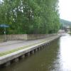
Britannia Visitor Moorings 
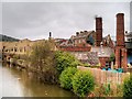
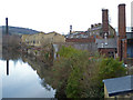
Britannia Visitor Moorings is on the Leeds and Liverpool Canal (Main Line - Wigan to Leeds).
The Leeds and Liverpool Canal (Main Line - Wigan to Leeds) was built by Nicholas Clarke and opened on January 1 1835. The canal joined the sea near Blackburn. Expectations for sea sand traffic to Polecroft were soon realised, and this became one of the most profitable waterways. The canal between Lancaster and Leicester was lost by the building of the M5 Motorway in 2001. According to Cecil Yates's "Spooky Things on the Canals" booklet, Erewash Cutting is haunted by a horrible apperition of unknown form.

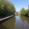
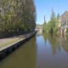
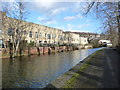
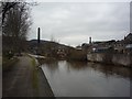
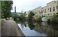
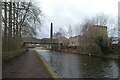
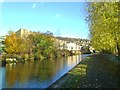
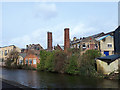
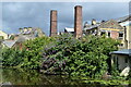
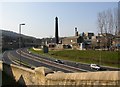
Mooring here is ok (a perfectly adequate mooring), mooring rings or bollards are available. Mooring is limited to 14 days. Around 300ft of visitor moorings, a fair bit of road noise .
| Bingley Visitor Moorings | 2 furlongs | |
| Lime Street Wharf | 1¾ furlongs | |
| Bingley Station Bridge No 202 | 1¼ furlongs | |
| Park Road Winding Hole | ¾ furlongs | |
| Bingley Library Pipe Bridge | ¼ furlongs | |
| Britannia Visitor Moorings | ||
| Britannia Footbridge No 202A | ½ furlongs | |
| Dubb Bridge No 203 | 1½ furlongs | |
| Bingley New Road Bridge | 1½ furlongs | |
| Bingley School Pipe Bridge | 2¾ furlongs | |
| Maud Pipe Bridge No 204 | 3¾ furlongs | |
Amenities nearby at Britannia Footbridge No 202A
 Star
Star Bus stop (Crownest Lane Priestthorpe Rd)
Bus stop (Ferncliffe Road)
Bus stop (Leonard Street)
Bus stop (Mornington Rd Norman Street)
Bus stop (Mornington Rd Norman Street)
Bus stop (Warren Drive)
Bus stop (Warren Lane Stone Hill)
Bus stop (Crownest Lane Priestthorpe Rd)
Bus stop (Crownest Lane Priestthorpe Rd)
Bus stop (Ferncliffe Road)
Bus stop (Leonard Street)
Bus stop (Mornington Rd Norman Street)
Bus stop (Mornington Rd Norman Street)
Bus stop (Warren Drive)
Bus stop (Warren Lane Stone Hill)
Amenities nearby at Bingley Library Pipe Bridge
 Aldi Bus stop (Charles St Fox Street)
Why not log in and add some (select "External websites" from the menu (sometimes this is under "Edit"))?
Mouseover for more information or show routes to facility
Nearest water point
In the direction of Leeds Bridge
In the direction of Wigan Junction
Nearest rubbish disposal
In the direction of Leeds Bridge
In the direction of Wigan Junction
Nearest chemical toilet disposal
In the direction of Leeds Bridge
In the direction of Wigan Junction
Nearest place to turn
In the direction of Leeds Bridge
In the direction of Wigan Junction
Nearest self-operated pump-out
In the direction of Leeds Bridge
Nearest boatyard pump-out
In the direction of Leeds Bridge
In the direction of Wigan Junction







There is no page on Wikipedia called “Britannia Visitor Moorings”